Holy Well: OS Grid Reference – NT 2636 7177
Also Known as:
- Canmore ID 52492
- Pennywell
Getting Here

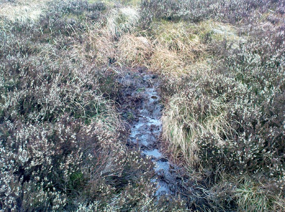
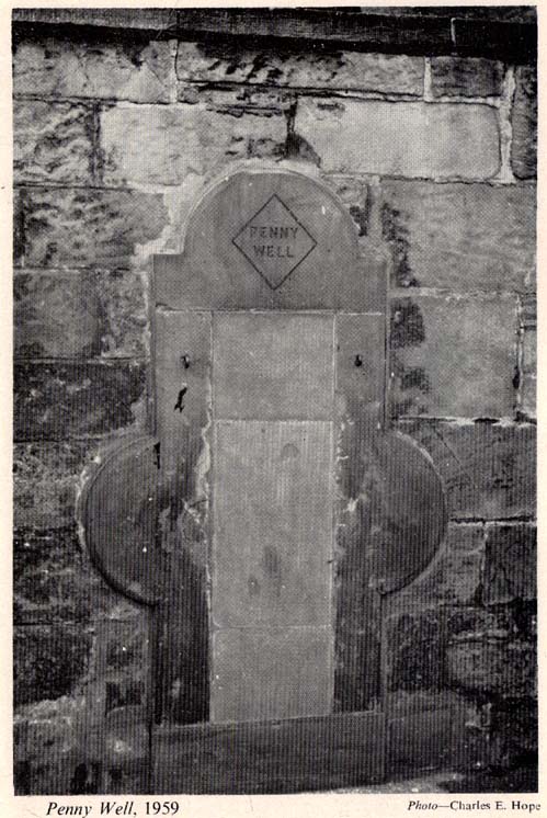
The stone marking the position of the well is situated on the north side of the road at the east end of Grange Loan, a few yards west of the junction with Findhorn Place, at Newington on the south side of Edinburgh. Unfortunately, all that now remains of the well is a red sandstone front with two pieces of metal on each side.
Archaeology & History
Set back a little into the wall alongside the road, we today see only the architectural memory of this once famous and much-reputed holy well, whose waters sadly no longer flow. Curiously omitted from the primary Scottish surveys on holy wells, it was long known as an important water source by the people of Edinburgh in ages past. The best article on the site was written by W.F. Gray (1962) some fifty years ago, in which he told:
“Built against a garden wall, the Penny Well looks rather forlorn. Now that a plentiful supply of water is in every dwelling, its public usefulness is definitely at an end, though it may slake the thirst of a passer-by. But however that may be, the Penny Well has a long if not distinguished history, though fact and fiction, it is to be feared, are inextricably linked.
“And first, as to its age. There is documentary evidence of the existence of the Penny Well as far back as 1716. In that year Sir William Johnston of Westerhall, Dumfriesshire, disposed to William Dick of Grange three acres of his lands of Sciennes, which are described as bounded on the west by the lands belonging to “said William Dick and the Penny Well.” The well really marked the south-east boundary of the lands of Grange.
“The actual age of the Penny Well is unknown. All that can be positively stated is that it has existed for at least two hundred years… How the Penny Well came by its name is another unsolved mystery. There is a story to the effect that in the earlier half of the nineteenth century an old woman who lived in the cottage opposite the well had charge of the spring and sold the water to wayfarers at a penny a glass. A very plausible story by which to account for the name! Unfortunately its credibility is shaken by the fact that…the spring was known as the Penny Well fully a century before…
“Sir Thomas Dick Lauder, when he took up residence at Grange House in 1832, was deeply interested in the well at the east end of his property. He had it restored and above it placed a tablet with the words, ‘Penny Well’ inscribed on it.
“About 1870, when feuing operations were in progress and there was much digging in the vicinity of the well, the water suddenly ceased to flow. After an interval, however, it again became copious, so much so that it formed a tiny pond in front of an adjoining house. In the hope of drawing off the water, a pit was dug. This led to an interesting discovery. Five feet below the surface, workmen came upon what there seems no reason for doubting was the original trough of the Penny Well. This “interesting and unexpected find” (to quote from The Scotsman) was covered by a large block of hard sandstone. The trough, which was circular, measured 32 inches across and had a depth of fully 1o inches in the centre.
“The Society of Antiquaries made investigations and the opinion was hazarded that “the basin into which the water ran was without doubt a baptismal font,” possibly the one which once stood beside St. Roque’s Chapel, situated at the southwest end of Grange Loan, but long since removed.
“In the (1890s) the Penny Well underwent a second restoration, the Town Council providing £30 for the purpose. By this time however, the spring was found to be impure, but the trouble was got over by substituting the town water.”
Folklore
Although there are no documents proving with certainty, local tradition reputed this to be one of Edinburgh’s numerous holy wells. It probably was. And whilst W. Forbes Gray seemed at a loss to explain the name of this old water source, it probably comes from the old practice of local people dropping pennies and other offerings into the well in the hope that the spirit of the waters would confer good health or other benefits upon the hopeful pilgrim. Such rites, of course, are very ancient indeed and relate specifically to the animistic spirit-nature of the site. In Mr Gray ‘s (1962) essay on the Penny Well he also had this to say:
“According to one statement, it was a holy well attached to the Convent of St. Catherine of Sienna (which stood at the foot of St. Catherine’s Place), a well whose waters were possessed of miraculous powers of healing those afflicted with blindness, in which case it would be in the same category as the well of St. Triduana at Restalrig, and the Balm Well at Liberton.”
Reputed in times gone by to be one of the never-failing springs, this clear and sparkling water supply would keep bubbling away long after all others in the area had dried-up during summer droughts.
“It is also said that the ubiquitous Mary Queen of Scots, when she visited the religious sisterhood at Sciennes, partook of the waters of the Penny Well. “
References:
- Bennett, Paul, Ancient and Holy Wells of Edinburgh, TNA: Alva 2017.
- Gray, John G. (ed.), The South Side Story, W.F. Knox: Glasgow 1962.
- Gray, W. Forbes, “The Penny Well,” in South Side Story, Glasgow 1962.
- Smith, J. Stewart, The Grange of St Giles, T. & A. Constable: Edinburgh 1898.
© Paul Bennett, The Northern Antiquarian