Take the A822 road to the northeast of Crieff and head 4-5 miles along until you enter the Sma’ Glen. You go past Ossian’s Stone and after crossing the river past the Newton Bridge enclosure, the road starts to go uphill. Nearly 2 miles up, the road levels out and at the left-side of the road is a small thin car-parking spot. Keep your eyes peeled out for it! From here, walk back down the road for nearly 250 yards until your reach a gate into the fields on your right. By now you should already be able to see the stone in the field, barely 100 yards away to the southwest.
Archaeology & History
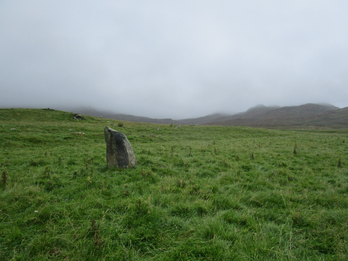
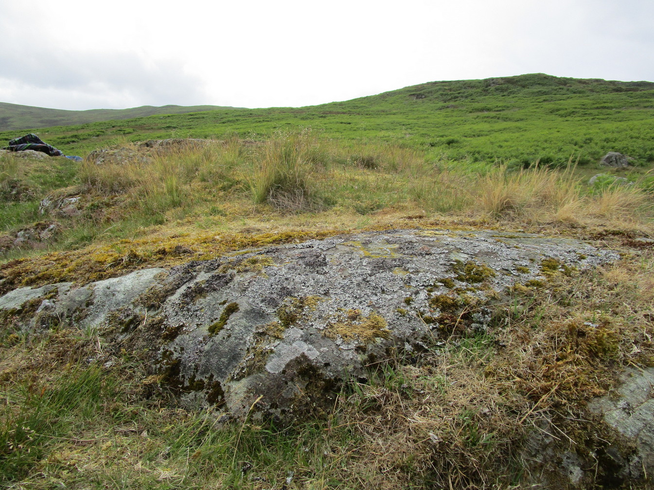
The old stone, looking N
Standing within the impressive landscape of the Perthshire mountains, this 4-foot-tall monolith is a seemingly solitary fella, sliced almost straight down one side—like so many of its regional compatriots—not far from the edge of General Wade’s military road. Not much more can be said of the old thing. The petroglyphic cluster of Corrymuckloch begins less than half-a-mile to the north; and, in all likelihood, other prehistoric sites will exist close by that aren’t yet in the archaeological registers…
Acknowledgments: Thanks to my long-suffering daughter Naomi, for taking me up for a quick break to see this old stone…
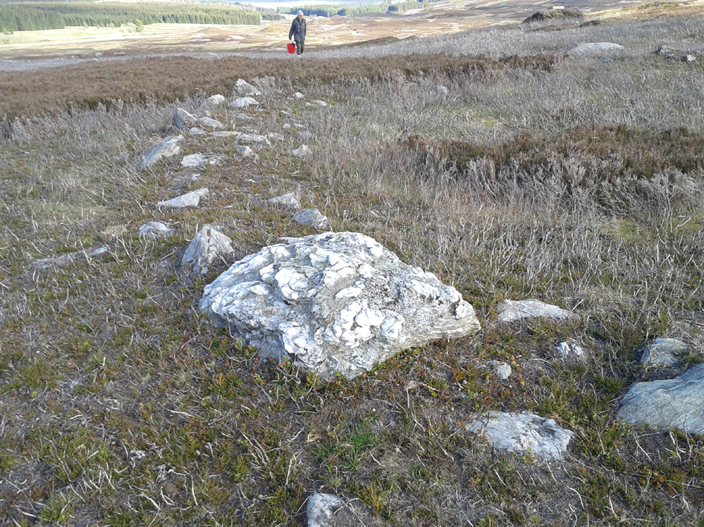
Take the A822 road to the northeast of Crieff and head 4-5 miles along until you enter the Sma’ Glen. You go past Ossian’s Stone and after crossing the river the road starts to go uphill. Nearly 2 miles up, the road levels out and at the left-side of the road is a small thin car-parking spot. Keep your eyes truly peeled for that! Go through the gate and turn right (north), up the grassy slope. Follow this footpath (known as General Wade’s road) straight past Corrymuckloch Farm until, about 250 yards on, the track splits. Take the left track and nearly 500 yards along walk up the embankment on your left and look around (if you reach the gate you’ve gone too far).
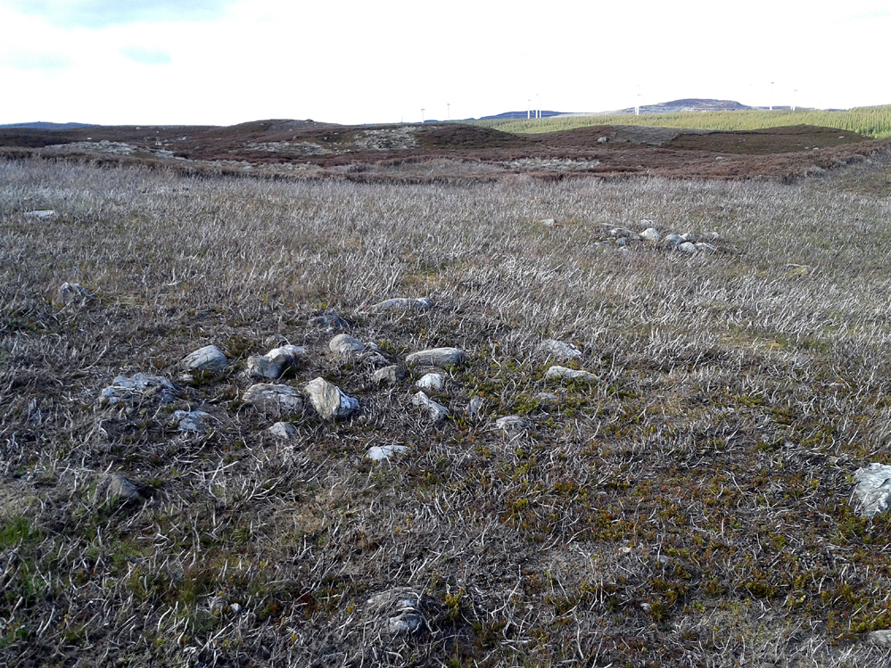
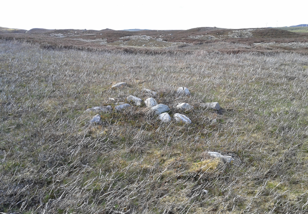
Archaeology & History
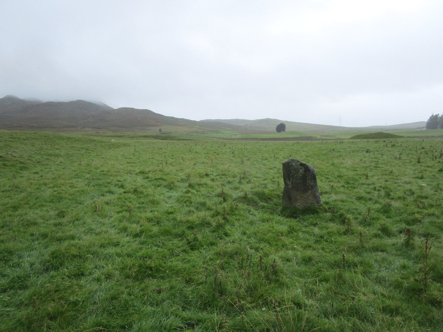
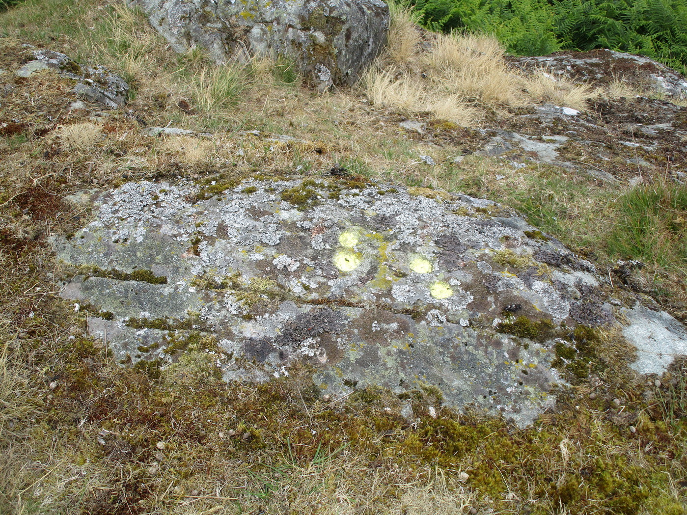
Corrymuckloch (14) stone
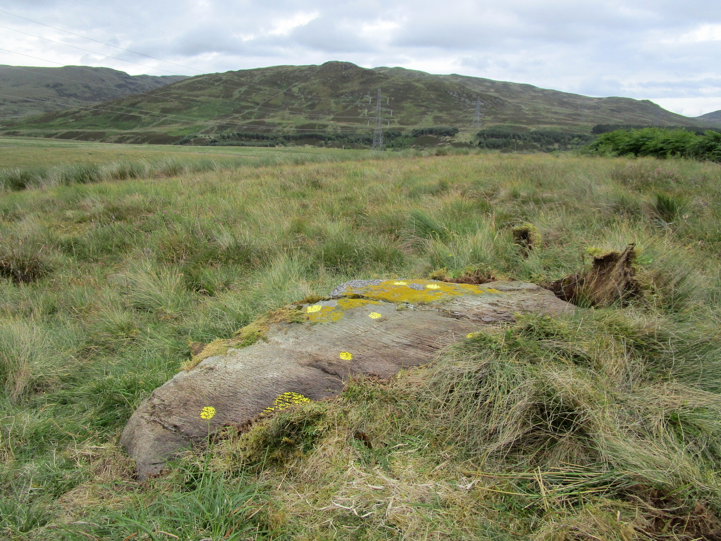
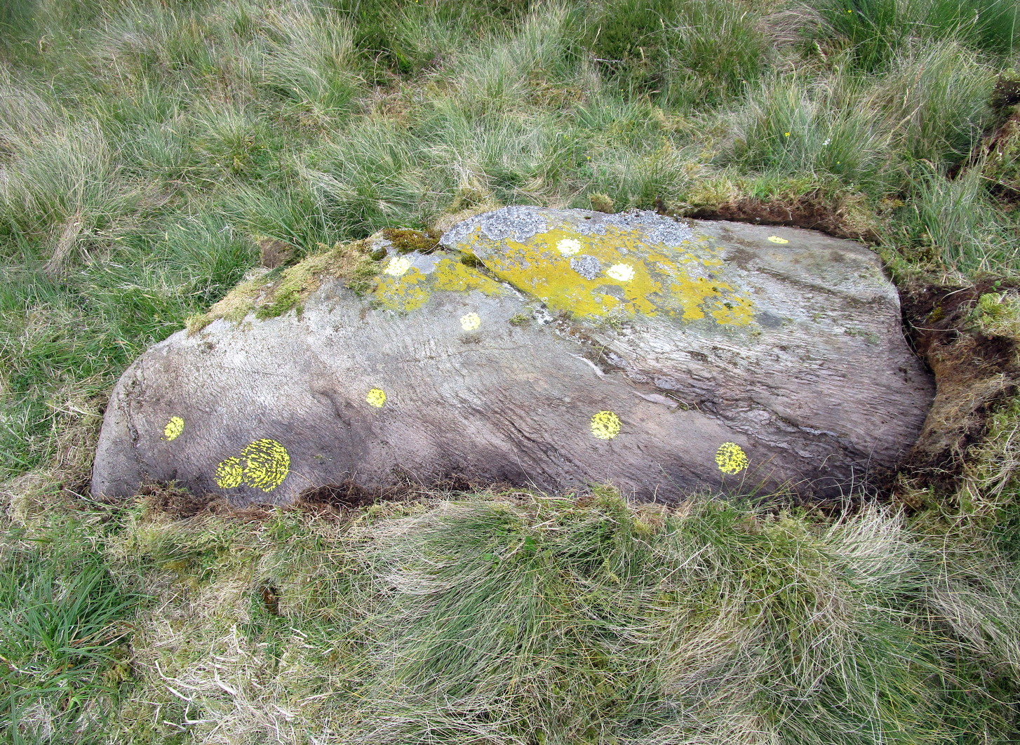
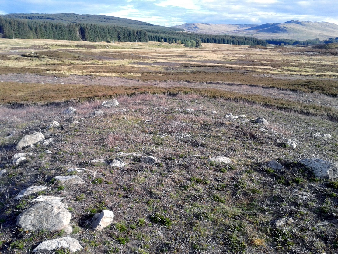
This stone was rediscovered in July 2023 during a cursory survey of other carvings in the Corrymuckloch cluster (17 and counting!). Most of the stone was covered in vegetation when first found, with just a single cupmark near its crown ensuring it got more attention. Altogether there are 10 or 11 cup-marks of varying levels of erosion across the length and breadth of the rock. The most notable one is on the northwest side of the stone, it being twice the size of the others and of much greater depth. It may originally have been a natural depression that was enhanced when the stone was carved. This larger cup has a smaller one attached just above it.
An intriguing find was noted all along the western edge of the rock, where upwards of a hundred small pieces of quartz—the majority of it crystal clear—were scattered between the stone edge and the soil. This is an ingredient that’s been noted at a number of petroglyphs in Scotland.
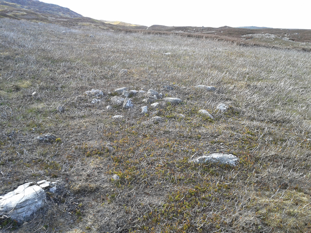
Take the A822 road to the north-east of Crieff and head 4-5 miles along until you enter the Sma’ Glen. You go past Ossian’s Stone and after crossing the river the road starts to go uphill. Nearly 2 miles up, the road levels out and at the left-side of the road is a small thin car-parking spot. Keep your eyes truly peeled for that! Walk through the gate and along the track (west) for 300 yards until you reach the fence. Once here, walk right (north) and go through the gate less than 50 yards away. Less than 300 yards ahead of you you’ll see a small rock outcrop. Get to it!
Archaeology & History
Rediscovered in July 2023, on this small rock outcrop it seems that only the lower east section has been carved, and it can be pretty difficult to see beneath the old layers of lichen that’s been painted across its surface. Comprising of just four cup-marks close to each other on the top of the stone, there’s a possible fifth cup to be seen on its northeast length. It’s nowt special to look at to be honest, but it’s worth checking out when you’re looking at the others in this cluster. In truth, this is another that’s only gonna be of interest to the real geeks amongst you!
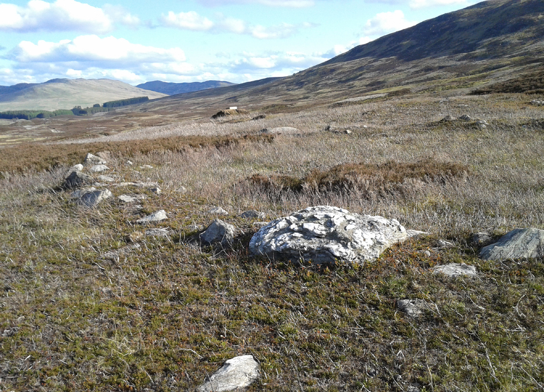
Take the same directions to reach the impressive Carn Ban prehistoric tomb. From here, walk along the winding track past the giant cairn onto the moors for about 350 yards, until the track goes dead straight and heads NNW uphill. Walk up here for another 350 yards keeping your eyes peeled on the rounded pyramidal hill with the large rock on top. The circle is 20 yards off the track as you head up to the pyramidal hill stone.
Archaeology & History
Although this site is mentioned in notes by the Scottish Royal Commission and highlighted by Ordnance Survey, information thereafter is pretty scarce. Which is surprising when you check this place out first-hand. It’s bloody impressive! David Cowley (1997) describes the area, but not in much detail.
Northern arc of walling
Eastern arc of walling
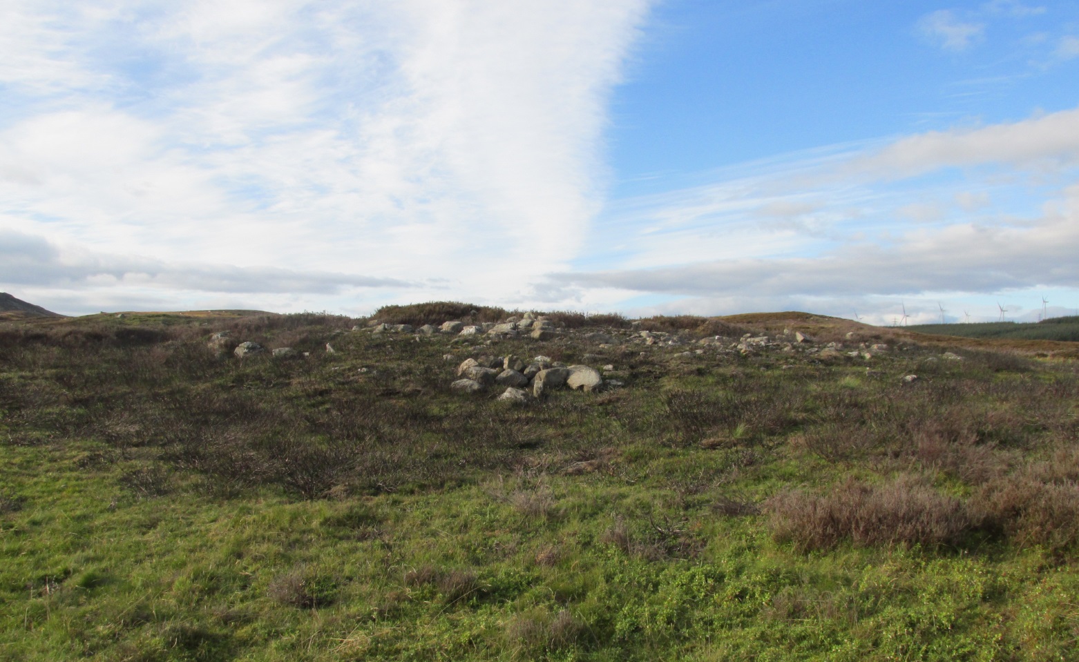
The circle seems to have been rediscovered first of all by the dowser J. Scott Elliott (1964), who thought it was a cairn circle – which is understandable. However, it has been classified by the Royal Commission lads as a “hut circle”, so we’ll stick with that for the time being.
An entrance to the circle doesn’t stand out. There may be one on the southeastern side, but this isn’t clear; and what looked like a possible entrance on its northern edge was discounted, as a larger stone blocked this on the outside. There was no immediate evidence of any internal structure, no hearth, no tomb – merely a small stone at its centre, deeply embedded in the peat. This may, however, cover a central cist – which would make this a cairn circle and not a large hut circle. But that’s guesswork on my behalf!
Arc of ring from east to southWNW arc of walling
Never excavated, what we’ve got here is a very well-preserved, large ring of stones, more typical of Pennine and Derbyshire ring cairns than any standard hut circles. But this is Scotland we’re talking about! This impressive ring measures outer-edge to outer-edge 12 yards in diameter (north-south), by 11 yards (east-west), with the stone walling that defines the ring being between 3 and 4 feet across all round, and between 1-2 feet high. And it’s in damn good nick! More similar in structure to the likes of Roms Law, a number of notably large stones define the edges, but many hundreds of smaller packing stones build up the ring walls. Of the larger rocks in the ring, the most notable one is a large white quartz crystal stone on its NNE side.
Quartz rock reflects the sun, looking W
It’s an impressive site whatever it may be! – in very good condition for its age (Bronze Age by the look of it) and, whilst still visible above the heather, well worth checking out if you like your stone circles and prehistoric rings. The small prehistoric graveyard 30-40 yards south and east, plus the extensive settlement systems all over these moors are all worth exploring if you visit this place.
References:
Cowley, David C., “Archaeological Landscapes in Strathbraan,” in Tayside & Fife Archaeological Journal, volume 3, 1997.
Scott-Elliot, J., “Kinloch House, Amulree,” in Discovery & Excavation in Scotland, 1964.
Scott-Elliot, J., Dowsing – One Man’s Way, Neville Spearman: London 1977.
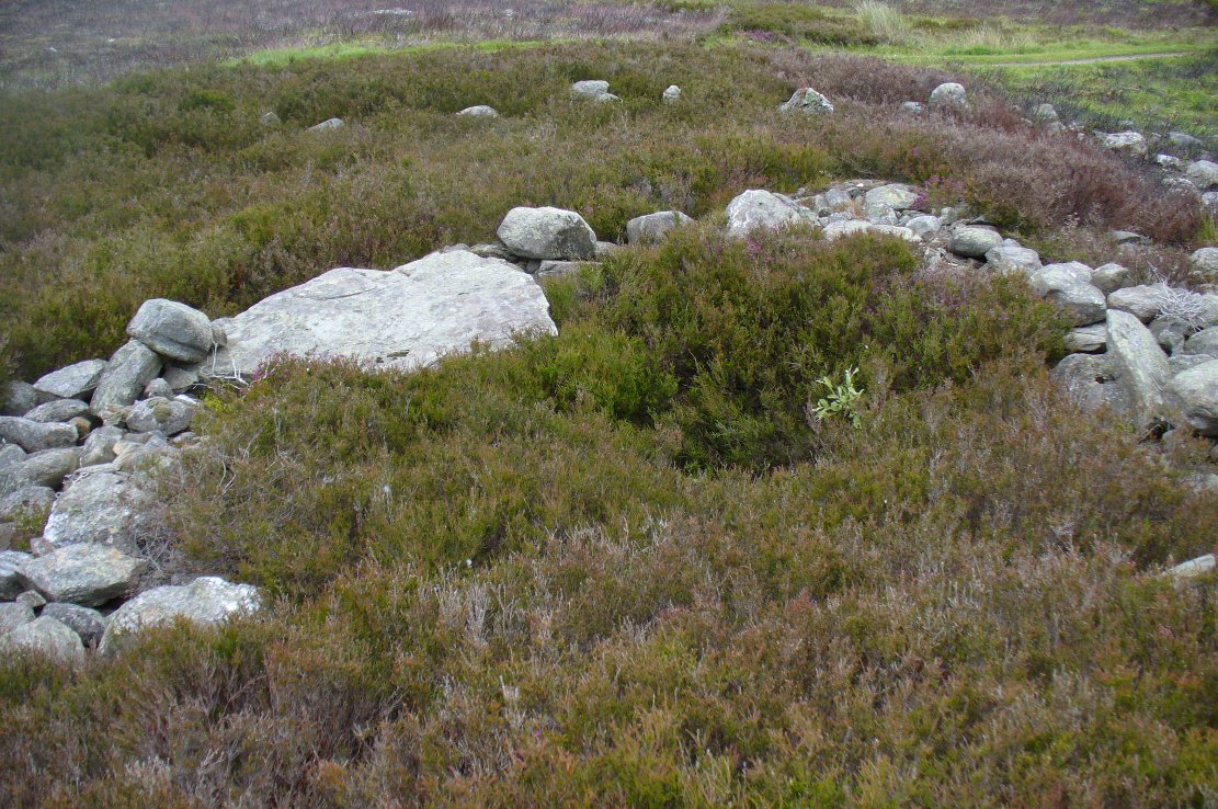
Take the A826 road south out of Aberfeldy, uphill, till you reach the White Cairn or Carn Ban, then follow the dirt-track for 700 yards onto the moors until you reach the Glen Cochill Circle 1. From here, look at the large stone atop of the very notable rounded hillock barely 50 yards east (at NN 90367 41478) and meander on the slopes immediately below it on the south and west. If the heather’s grown back, you don’t stand a chance!
Archaeology & History
As far as I’m aware, despite there being some brief notes of cairnfields in and around the rich prehistoric arena of Glen Cochill, I can find no data indicating that the five small single cairns a short distance south and southeast of the Glen Cochill Ring (01), have been described before.
Cairn 1 – looking north
Cairn 2 – looking north
Deeply embedded into the peat, they are only visible when the heather has been burnt away, as highlighted in the accompanying photos. Each cairn is of roughly the same size and structure: 2-3 yards across and only a couple of feet above ground-level, consisting of the traditional small rounded stones, each probably constituting a single burial or cremation.
Cairn 4, below the hilltop rock
Of at least five cairns that we found here (there may be others beneath the covering heather), it was very notable that they’re on edges of a rounded pyramidal hillock, whose top is surmounted by a large pointed stone – probably a glacial erratic. We looked at this rock in the hope of finding some cup-markings, but there were none. However, it seemed as if the cairns and this crowning stone were related to each other, as if rites for the dead were proclaimed here for those in the tombs. It may sound silly, but go there and take a look at it yourselves – before the heather grows back. Just as a priests today, and shamans throughout history, have used an altar or plinth to make commemorations to the dead, so this crowning stone may equally have been used. It makes sense. And, as if to add validating ingredients: if we look east, past the crowning stone and across the River Cochill, we see the great rocks in the forest known as Creag a Bhaird, or the Crag of the Bard, from whence orations and tales were known to be told… But that’s another site with its very own story…
Acknowledgements: Once again, thanks must be given to Mr Paul Hornby for his help in finding these sites.
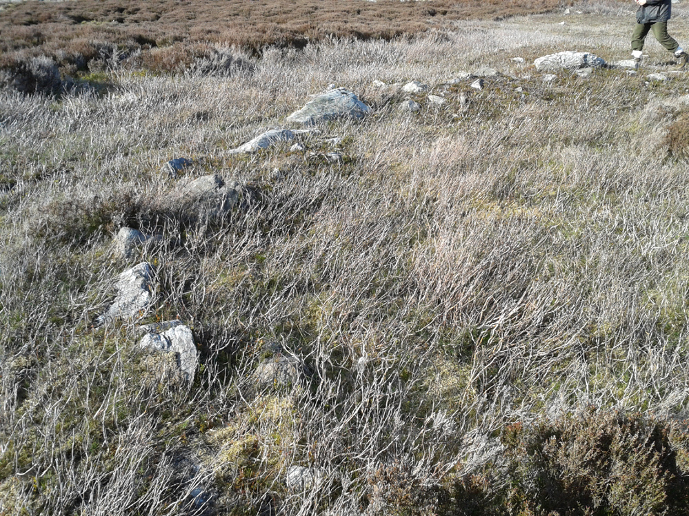
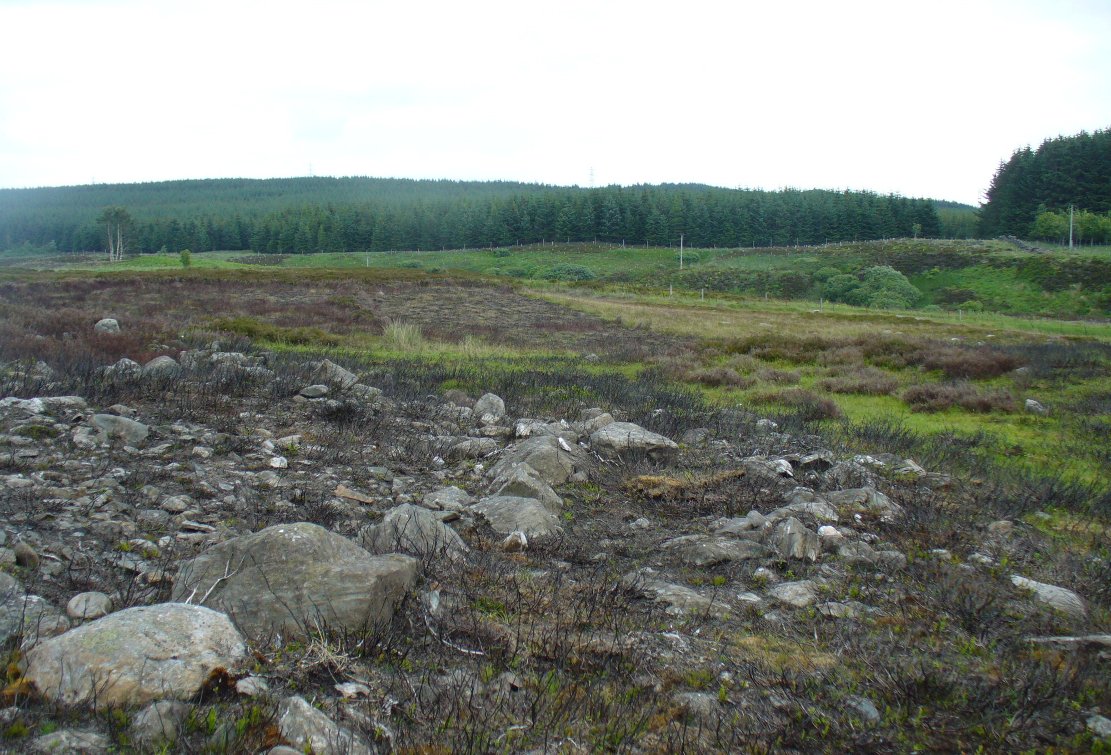
Along the A826 road south out of Aberfeldy, make your way towards the impressive giant Carn Ban of Glen Cochill. Nearly a mile past the cairn further down the road, keep yer eyes peeled for the straight line of walling reaching up onto the moors. About 100 yards before the wall, go over a ruined metal gate by the roadside up and onto the moor. Walk straight uphill for barely 50 yards until you’re on the level, then walk left for 50 yards or so again. Yer damn close!
Archaeology & History
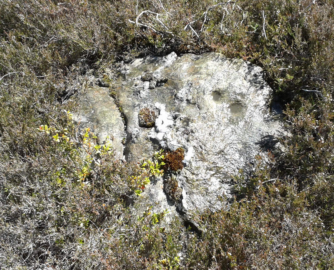
3rd cupmark visible at bottom
Although this is a seemingly isolated carving, difficult to find and nowt much to look at, it is located in a region with massive amounts of prehistoric remains – much of it inadequately surveyed or not surveyed at all. Amidst a collection of more than a dozen unexcavated Bronze Age cairns, this small flat earthfast stone bears two standard cup-markings, with a possible third at its edge. It is not immediately connected with any of the nearby cairns.
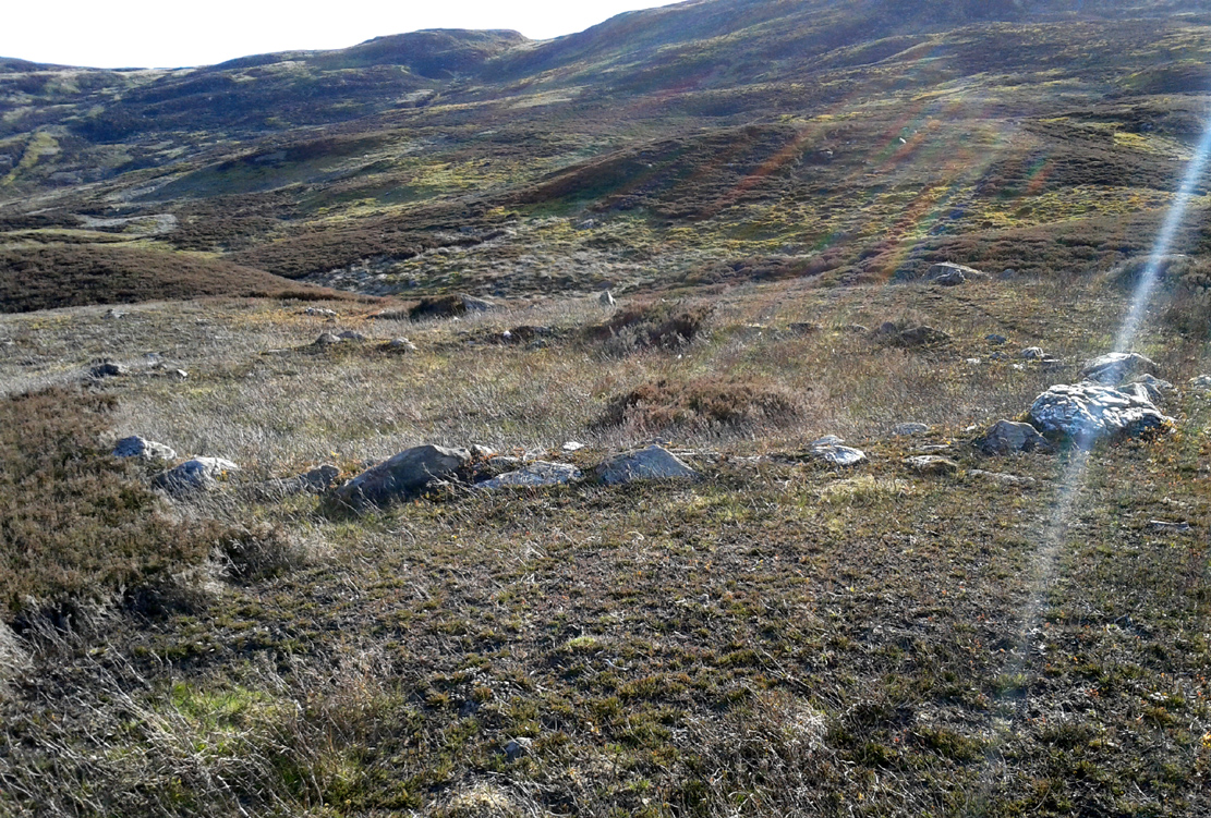
Take the same directions to reach the giant Carn Ban prehistoric tomb. Follow the track past the tomb further onto the moorland until you reach a small wooden bridge over the small burn. From here, walk straight north off-path onto the moor for 100 yards and a small rise in the land, with several cairns just below it, is the site in question.
Archaeology & History
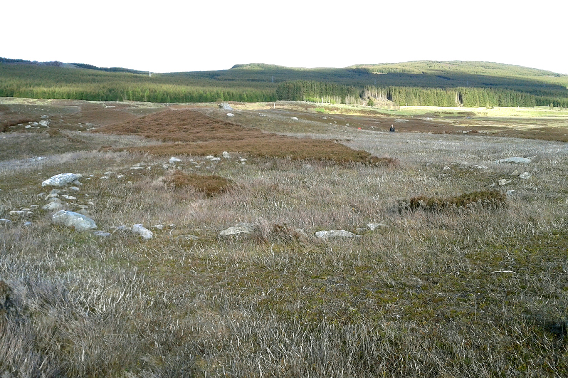
Hut circle are hut circles – right? Well, usually that’s the case. We find them attached to, or within, or outlying prehistoric enclosures and can date from anywhere between the neolithic and Iron Age periods. With the site we’re looking at here, on the outer western side of Glen Cochill’s southernmost giant enclosure, there’s something amiss….or maybe that should be, “something rather peculiar.”
Mr Hornby, hut-sideShamans Lodge walling
Paul Hornby found it a few weeks ago during an exploration of the region’s prehistory. We went in search of, and found, the giant Carn Ban close by, but noticed curious archaeological undulations ebbing in and out of the heathlands: cairns, walls, hut circles, settlements, more cairns—and then this!
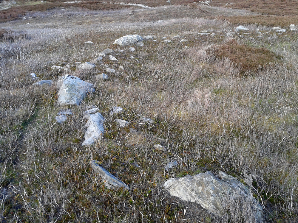
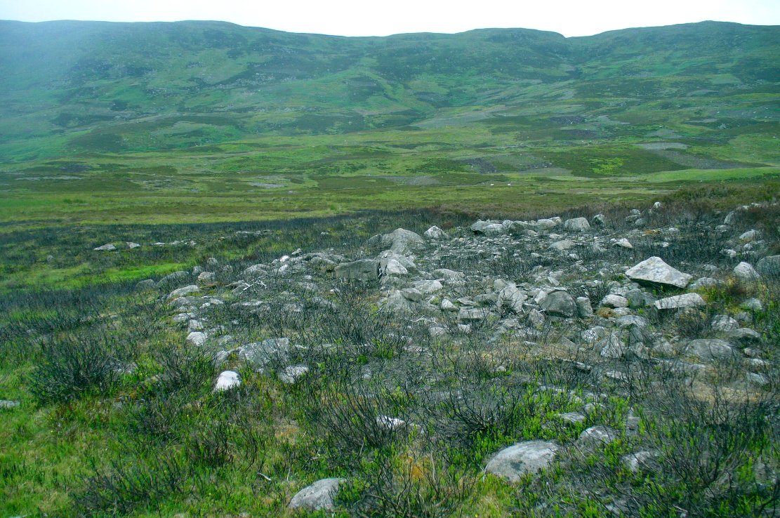
Consisting of two slightly larger-than-average ovals of walled stone, probably Bronze Age in date, the first impression was of a remarkably well-preserved site (and that it is!), seemingly of an elongated stretch of walling, with a central wall that split it into two halves. Each ‘hut circle’ was found to be between six and seven yards across, with the two conjoined architectural features giving an overall NW-SE length of 14 yards. But the more we looked at this, the more obvious it became that this was originally one single hut circle—the lower southeastern one—with an additional one that was added and attached onto the northwestern side at a later date, probably several centuries later.
Lower earlier hut circle, with upper later hut circle attached
Walking around the structure we found that the very well-preserved walls—about 2 feet wide in places and rising a foot or so above the compacted peat—had been built onto a raised platform of earth. This was no ordinary hut circle! The ground beneath it seems to have been raised and supported and on the southern side in particular it is notable that other building stones are compacted into the peat. There may even be the remains of a secondary outer wall on this southern edge, where it seems that the entrance was made.
Small group of cairns 15 yards away
Here’s the curious bit: immediately outside the northwestern and southern walls are small prehistoric tombs, or cairns. Not just one or two, but more than a dozen of them, all constructed within 20 yards of this curiously raised double hut circle. Literally, a small prehistoric house of some form was raised in the centre of a prehistoric graveyard—and it doesn’t end here.
Of at least three giant enclosures in this region, and what looks like a very well-preserved prehistoric tribal hall or meeting place, there are upwards of a hundred tombs scattered nearby. Two cairn circles were also found about 100 yards to the north, one of which was damaged by a military road a few centuries ago.
Close-up of walling
I give this double-roomed abode the somewhat provocative title of the Shaman’s Lodge because of its setting: surrounded by tombs, the ‘house’ would seem to have been a deliberate setting erected in the Land of the Dead here. I hope you can forgive my imaginative mind seeing this as a structure where, perhaps, a medicine woman would give rites to the dead, either for those being buried in the small graves, or rites relating to the giant White Cairn of the ancestors close by. Shamans of one form or another occur in every culture on Earth and have been traced throughout all early cultures. If no such individuals ever existed within the British Isles, someone needs to paint one helluva good reason as to why they believe such a thing….
When the heather grows back here, the site will disappear again beneath the vegetation. It is unlikely to re-appear for quite sometime, so I recommend that anyone wanting to have a look at this does so pretty quick before our Earth covers it once again….
References:
Stewart, Margaret E.C., “Strath Tay in the Second Millenium BC – A Field Survey”, in Proceedings Society Antiquaries Scotland, volume 92, 1961
Acknowledgements: Huge thanks again to Paul Hornby for his assistance with site inspection, and additional use of his photos.
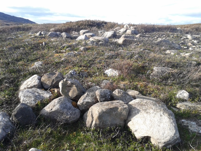
Take the A826 road south out of Aberfeldy, uphill – and uphill. Several miles up, past the roadside Loch na Craige, and past the solitary farmhouse of Scotston, you’re getting close. A few hundred yards past here watch out for the small bridge over the small burn; and literally another half-mile past this, keep your eyes peeled for the small track on your right, onto the moors. Walk 70 yards on the track and there, on your left, it rises from the heather!
Archaeology & History
Carn Ban, Glen Cochill (photo credit, Paul Hornby)
This giant neolithic tomb in the middle of a beautiful nowhere is perhaps the tomb of an ancestral King or Queen, later idolised into creation myths by our heathen ancestors who, we know, lived across this huge moorland plain for countless centuries. One account tells that “a circle of free-standing boulders set at irregular intervals” used to surround the cairn, but this seems to have gone.
Southeastern quadrant
Measuring 21 yards (19.2m) across east-west, and just over 21 yards (19.3m) north-south, this is quite a large construction made up of thousands of small stones in a near-perfect ring that measures 68 yards (62m) in circumference. The cairn seems to have been built in three layers, with its outer defining ring of medium-sized rocks, upon which a layer of typical cairn-spoil stones were laid. A couple of yards within this, a second internal ring has been set consisting of much larger stones, more typical of those found in small stone circles or average ring-cairns. Within this, the cairn seems to have been raised again and another large deposit of countless stones were scattered, with many pieces of white quartz (very common in this area) incorporated in the construction.
Capstone and outer ringSection of internal ring
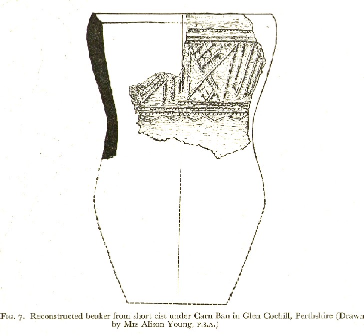
At the very centre of the cairn, at least one large central ‘tomb’ or cist is clearly evident. Within this cist were found the severely damaged ruins of a small decorated beaker, in which, perhaps, the ashes of the dead might have once been found. A very large and heavy capstone that covered the central tomb, has been rolled over and lays just off-centre. No rock art seems visible on this capstone, but we were unable to check its underside. When standing here at the middle of the tomb, you are four feet above the average ground-level of the surrounding moorland.
Section of cairn edgeImaginative reconstruction of beaker in central tomb
Curiously and erroneously reported by Margaret Stewart (1961) to have “been completely removed”, this large and very visible monument lives near the middle of a very large and extensive prehistoric enclosure, whose walled remains extend for some distance all round this section of the moors. Within this arena we find large numbers of other architectural features, including many smaller cairns, some hut circles and additional lines of internal prehistoric walling. Just a few yards south of the tomb itself, we can clearly see a length of walling running east-west and another seemingly reaching up to the White Cairn. Whether these were built at the same time, or later, is difficult to say.
In the event that you visit this site, take your time! All round here, mainly to the north and west, you will find masses of prehistoric remains, none of which has been adequately excavated. A few hundred yards north is an extended necropolis that doesn’t appear to have been surveyed.
References:
Stewart, Margaret E.C., “Strath Tay in the Second Millenium BC – A Field Survey”, in Proceedings Society Antiquaries Scotland, volume 92, 1961
Acknowledgements: Huge thanks again to Paul Hornby for his assistance with site inspection, and additional use of his photos.