Take the A675 road to Bolton from Abbey Village, going up the track opposite Piccadily farmhouse until you reach the ruins in the woods. The site can also be reached by going south down the Tockholes Road car park following the sign for Hollinshead Hall on your right.
Archaeology & History
Hollinshead Hall
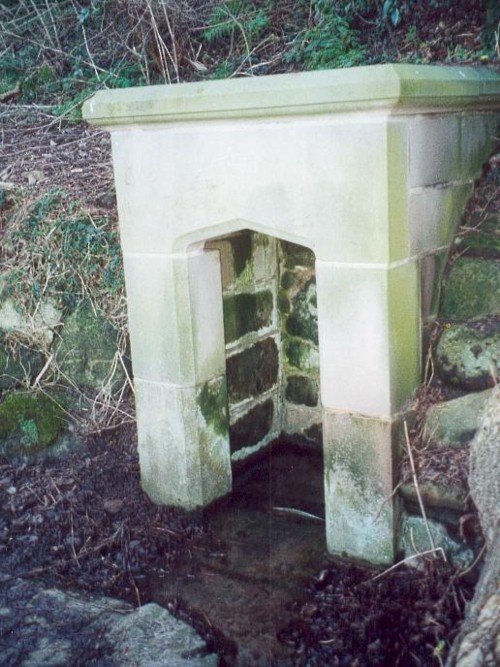
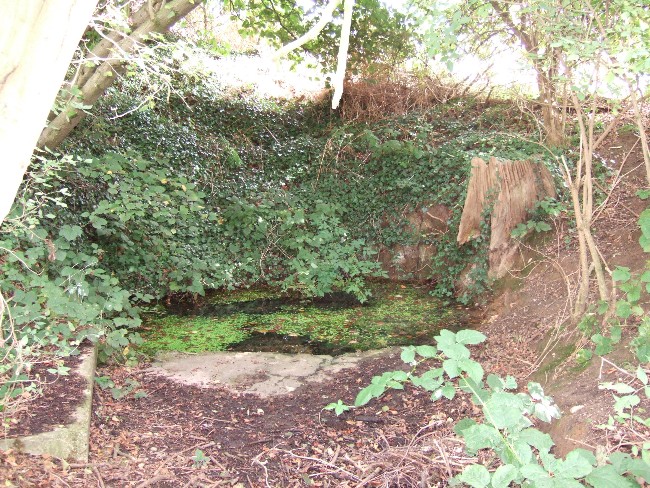
Associated with Hollinshead Hall, which is now a ruin, the well is made of the same sandstone rubble as the hall with a stone slate roof. The building a single cell is built into a slope from which the spring arises and is encapsulated by it. Either side a high walls creating a sort of forecourt with side benches with inward-facing chamfered piers with ball finials at the ends. The well house itself is quite an attractive building and is certainly not thrown up, having a symmetrical facade with chamfered unglazed widows which are fitted with spear-headed iron bars and clearly the building has never been glazed. The gable end has a large oval opening with a matching one at the rear. In the centre is a heavy board door with a chamfered doorway. This doorway unfortunately is locked baring any entrance to the well house.
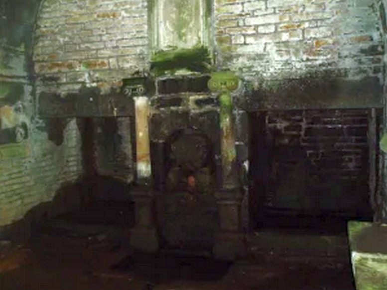
Peering in through the windows one can see how strong the vaulted roof is, adorned by a pendent ball in its centre. The spring’s water flows from a crudely carved lion’s head, either side of a reredo of Ionic colonnettes, with a sunken stone tank beneath or each side a rectangular recess which enclose rectangular pools. There is a diamond-paved floor with a central gutter draining from this well or trough at centre of rear wall.
Local tradition accounts that there was a site here from Medieval times and indeed, that the name Hollinshead was derived from a version of holy well although O.E hol, for hollow is more likely although there is a Halliwell Fold Farm nearby being derived from O.E halig for healing. The pool with steps down above the well house may be the original well of course. The discovery of a hoard of medieval coins in 1970s would support the date and perhaps they were an offering.
Folklore
Abram’s Blackburn (1877) is perhaps the first to state that the water was curative. However, anonymous quote in Nightingales History of Tockholes describes the well as:
“Here no less than five different springs of water, after uniting together and passing through a very old carved stone representing a lion’s head, flow into a well. To this Well pilgrimages were formerly made and the water which is of a peculiar quality, is remarkable as an efficacious remedy for ophthalmic complaints.”
Another tradition is that the site was a resting place for pilgrims to Whalley Abbey and that the trough was used as baptistery, however, this would be more likely to be the spring above the well house. It is probably a spring house, a structure built over a natural source of water for the storage of dairy products and other foods that needed to be kept fresh.
Reculsancy was very prevalent in Lancashire and the well house does the bear the coat of arms of the Radcliffes. It would suggest why the structure is so ornate and suggest a 1600s date—although many authorities suggest an 18th century origin. The site would be a secret baptistery and its design as a dairy would also help as well as being still function, certainly the presence of benches suggest this functionality. It appears to be too close to the house to be a garden folly such as a grotto! The suggestion of stained glass in the windows suggests something more significant discovered during the present stone roof’s construction. Indeed, the choice of the lion’s head is possibly that of the ‘Lion of Judah’, meaning Jesus providing rich and valuable water, although this is a common motif on many drinking fountains of course! Interesting, Cramshaw (1994) tells us that the site was in the 1980s the site of a well dressing, although what type is unclear and no other author has mentioned it as far as I am aware. Perhaps we shall never know the real origin of this delightful building.
A stone’s throw from Ikea and found off the B600 main road. Travelling to Greasley from Watnall, take first turning on the left after Royal Oak Wood. Travel up Trough Road, past the woods where it is best to park, then walk up Trough Lane and the well can be found on the right hand side, opposite a house called The Springs.
Archaeology & History
I am of the opinion that the ‘holy’ element of this well is a romanticism of the 1800s, but there is a possible record in the ‘The Manor of Bevall in the County of Nottingham’ document, commissioned by the Honourable Dame Elizabeth Capell in 1653. Amongst the records it appears a number of times as:
‘Holy Well Furlong 2 lands bounded with John Richards west and William Hickton east’.
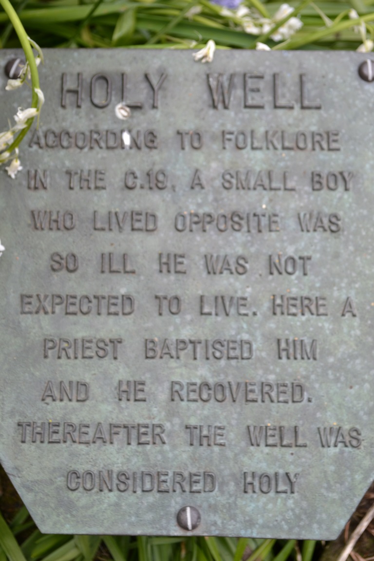
Plaque at the wellFront of the well
A 1724 Capps Survey of Watnall Cantelupe notes that Joseph Richards had some lands lying in a close called the Flatts or Holliwell, which understandably relates to ‘Holy Well’. There is also note of a Holwell Croft field name in the 1500s at Greasley, which again may describe this site or another and such suggests that it derives from O.E. hol, meaning ‘hollow’, a common misconception when identifying prospective holy wells. Jeremy Harte (2008) in his English Holy Wells suggests that those sites called ‘Holy Well’ are pre-Medieval in origin so perhaps this site is one of the most ancient in the county.
The sacred waters
On my first visit to this site I was told by an elderly man that he was baptised there (or water used from it used for his baptism), before attempting inexplicably in trying to discourage me from finding it (due to his wariness of me I failed to discover the nature of his baptism or of what denomination). According to locals in the lane the plaque and present state of the well dates from the 1980s and was done in partnership with the local council.
The house opposite is called ‘The Springs’ was this name of the well before the ‘present’ name and so it is ‘modern’ holy well per se, although I think the 18th century survey is significant.
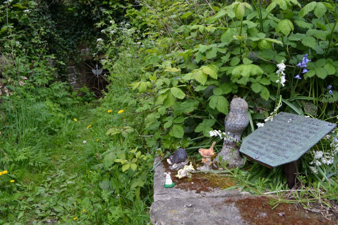
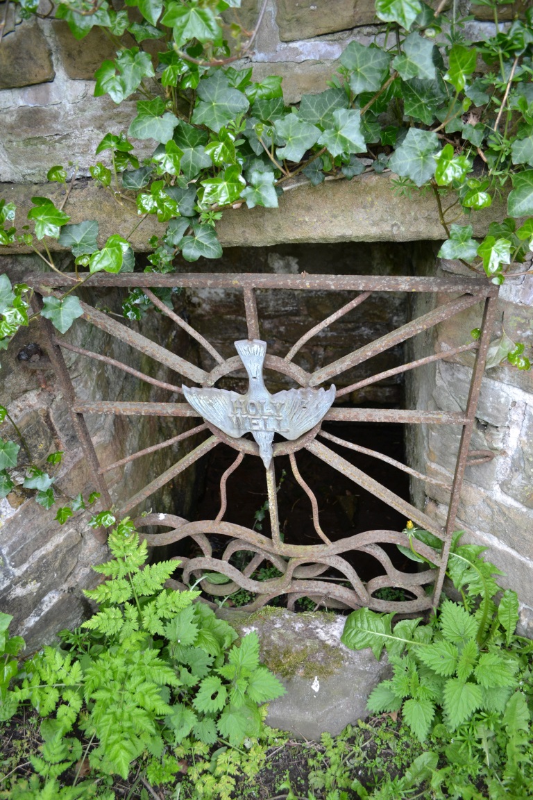
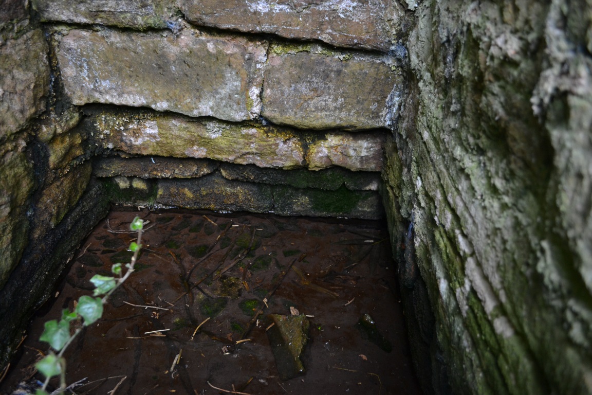
The well itself, is enclosed in a stone recess with a rusty iron gate with a dove affixed on it bearing the legend Holy Well. It is approached by a path walled along both sides which are adorned by a wide range of gnomes and garden ornaments..almost so you could be pixy led!
Folklore
A plaque near the well’s entrance has a local piece of folklore recorded. This relates that a local boy who lived opposite was very ill and bedridden. A local priest called for water to be drawn for the boy from the well. This was done and the boy became well.
Interestingly it’s the only legend of this type—one which records a cure—in all the Nottinghamshire holy wells. It is a shame one cannot find a date or check its provenance, a fact supported by local history author Mr. John Lee. The use of priest is significant. Does the story may indicate the Catholic revival in holy wells in the 19th century? However, the only Catholic associations locally are that of Hilltop at Greasley for there was, and is, only a Methodist chapel in Watnall.
Extracted from Parish, R.B (2008) Holy Wells and healing springs of Nottinghamshire
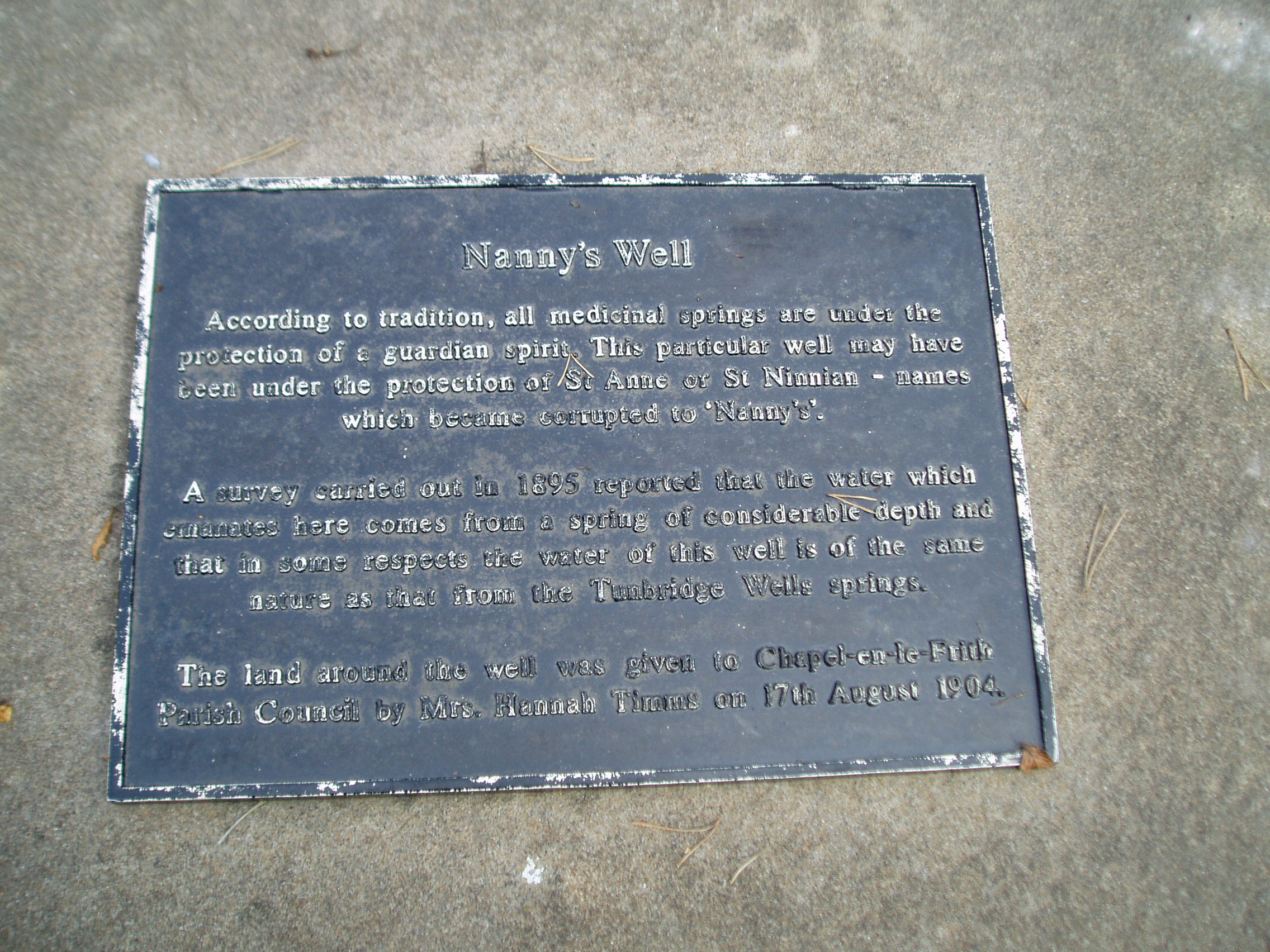
To find Nanny’s Well, take B5474 out of Chapel and take the right hand turning called Crossings road (which goes to Chinley) which is before Frith view on the left. Continue until the small wall surrounding the site can be seen on the right.
Archaeology & History
The name it is said to be either from St Ninian (less likely) or St Anne (more likely as she is also considered the mother of Mary and thus Grandmother of Jesus).
The Nanny well pump
It is described in M.J.B Baddeley’s Peak district of Derbyshire (1913) and the neighbourhood as:
“a valuable but neglected spring of chalybeate water.”
Yet in 1895, a Manchester firm of Grace, Calvert and Thompson analysed it and found it:
“not polluted to any extent with organic matter of animal or vegetable origin and comes from a spring of considerable depth and that no surface water has become mixed with it’…in same respects the water of this well is of the same nature as that from the Tunbridge Wells springs.”
The site is now an iron pump by the side of Crossings Road, known as Nanny Well Road, enclosed in a low wall along which. The pump no longer works and the well capped but it can be heard and just about seen through a crack beneath.
A peer through the crack shows running water!
Folklore
Nanny well plaque
It was visited on Easter Morning, with sugar or licorice to make Spanish Water, and then the bottles were hung around their necks. The site is one of four wells dressed annually since the 1980s in July and the site is blessed.
Extracted from Parish, R. B., (2008) Holy Wells and Healing springs of Derbyshire
The genuine St. Bertram’s well is not easy to find and I recommend using the OS map carefully. It is reached by taking the footpath that leads off at the left passing the cross out of the village. Follow this until the end of the dry stone walling on the right and then divert from the footpath to the right where the well can be seen. The second well is easily found in the field between the church and the Hall.
Archaeology and History
Bertram is an interesting local saint, dating from around the 7th-8th century. Briefly, he is said to be of Royal Irish lineage but after making a princess pregnant, escaped to England where he sheltered in the woods around Ilam. The story is told by Alexander, a monk, in the 13th century who notes:
“They were in hiding in a dense forest when lo ! the time of her childbirth came upon them suddenly ; born of pain and river of sorrow! A pitiful child bed indeed! While Bertellinus went out to get the necessary help of a midwife the woman and her child breathed their last amid the fangs of wolves. Bertellinus on his return imagined that this calamity had befallen because of his own sin, and spent three days in mourning rites”.
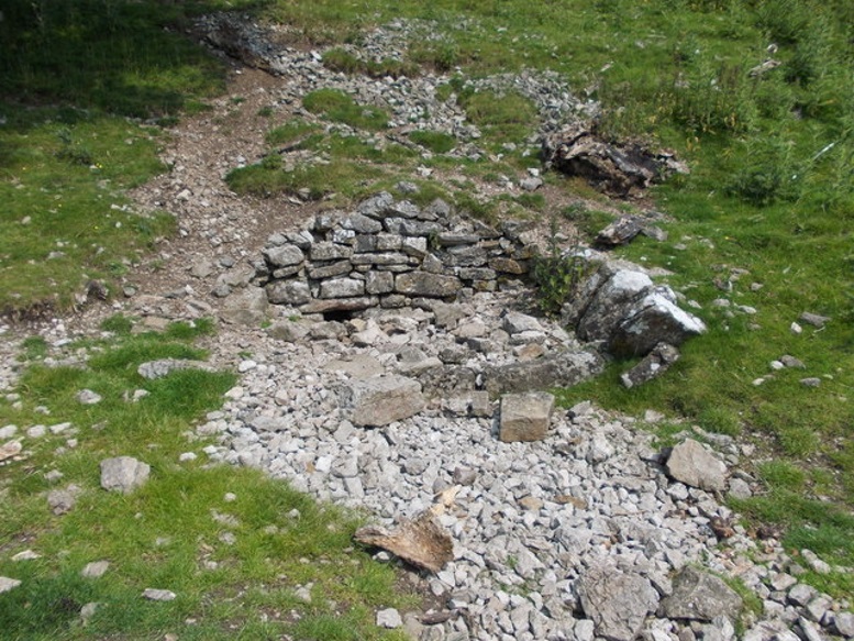
As a result he became a hermit living in a cave in the valley near Ilam. Despite the earliest mention being Plot, the local geography is suggestive that this is the site of an early Christian hermitage site, although no mention of a well is noted in his legends it can be noted. Currently, the well is surrounded on four sides by varying low stone walling, about two feet or so at its highest (although it appears to have been built up and down over the time I have visited the well). The spring flows from a small, less than a foot square chamber, enclosed in stone and set into the bank through a channel in the rubble flow and out along the path towards it.
Since the 1990s, on the first Saturday in August, the Orthodox Church makes a pilgrimage to the site and blesses the well. Interestingly, literature available from the National Trust shop fails to mention this well, but notes a more substantial second St Bertram’s Well close by the church and surrounded by a rectangular stone wall with steps down, the water arises here at greater speed and flows into the nearby River Manifold. Visually it is more impressive and more accessible but whether there is any long tradition of this second well is unclear, but authors such as the Thompsons’s (2004) The Water of Life: Springs and Wells of Mainland Britain and Bord (2008) Holy Wells of Britain appear to have fostered its reputation.
Incidentally, the church boasts the remains of St Bertram’s shrine with foramina and the church yard has two Saxon crosses, making a visit to the village a must for those interested in early medieval history.
Folklore
“St Bertram’s Ash… grows over a spring which bears the name of the same Saint… The common people superstitiously believe, that tis very dangerous to break a bough from it: so great a care has St Bertram of his Ash to this very day. And yet they have not so much as a Legend amongst them, either of this Saint’s miracles, or what he was; onely that he was Founder of their Church”
Such notes Plot (1686) The Natural History of Stafford-Shire, the earliest reference of this fascinating site. By Browne (1888) in his An Account of the Three Ancient Cross Shafts, the Font, and St Bertram’s Shrine, at Ilam, noted that the ash had gone, but the water was still being used. He states that:
“The late Mrs Watts Russell always had her drinking water from it.”
Extracted and amended from the forthcoming Holy wells and healing springs of Staffordshire by R. B. Parish (2008)
The well now lies on private land and feds a trout farm (Beckets Well Trout Farm at The Castle House, Sevenoaks Rd, Otford in Sevenoaks). To find Becket’s Well go along the A225 to the centre of Otford, park in the car park ( in front of the row of terraced shops ) near the Bishop’s Palace. Take a small private road to Castle farm, now as said, a trout farm. Inquire here, if you are able to visit the well, which lies within a complex of fish pools to the east of the farm house.
Archaeology & History
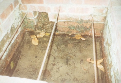
The site has been well recorded in recent centuries, for example an account of 1876, describes the site as, “endorsed within a wall, forming a chamber 15 ft across and 10 ft deep.” Both the chamber’s appearance and shape suggests that is would be ideal for immersions, of which Harper and Kershaw (1923) notes that bath and steps are defied annually by the hop pickers. It is interesting to note that Thorne (1876), with no apparent reference, gives another connection with the saint, suggesting that, “to have used by the saint as a bath.” No subsequent or previous work draws notice to this, so it is likely to be antiquarian fancy. Another more plausible possibility is that it was used by the leper hospital found on this site around 1228. They would have clearly made use of the pure water for medicinal purposes and perhaps indeed used it as a bath.
Kirkham (1948) notes it was suffering from neglect being “now said to be choked up and half full of tins.” This decline would appear to have started a long time ago, as a folly tower, now demolished, was built on Otford Mount (a nearby earthwork), from the well’s stone work. Consequently, this degraded condition prompted excavation in the 1950s by the Otford and District Historical Society; of which the following details of their findings are briefly described.
The report noted that the well consisted of two chambers, with water emerging from two arched outlets into the first of these. This chamber is surrounded on three sides by walls, thirty-five feet by thirteen feet (east end), the walls are eight feet high, and at the same level of the ground. Six steps at the south-east end give access to the well chamber. The sluice wall is five feet high, eight feet wide, and is substantially buttressed on the western front. Water runs through this sluice wall, between steep banks westward, through a lower chamber, twenty-seven feet (north sides), and thirty-five feet (west side). The water then flowed through watercress and finally through an underground, probably Tudor conduit. This conduit then passes through the site of the Palace. This stream once fed a moat, but now discharges into the Bubblestone Brook, a Darenth tributary.
Local common thought was that the well is the remains of a Roman bath house, a belief echoed by its present owner; and a view endorsed by both Ward (1932) and Harper and Kershaw (1923), who note that it “is really a Roman Bath.” This view is further supported by the two surrounding Roman villas, and hence one aim of the excavation was to evaluate this long held claim. Yet, although they showed that the well had gone through considerable renovation and rebuilding over the centuries, no remains could be positively be dated to this period. This renovation, of course, resulted in a rarity of deposits, and hence with a lack of artefacts, the subsequent interpretation was thus difficult.
The excavation was further handicapped by the waterlogged conditions. Both may have influenced the results. Consequently, there are still doubts, and the concept of a Roman origin has not been satisfactorily disproved. The earliest written record is from Otford Ministers accounts of 1440-1, indicating that by then a stone structure existed here, but how old that was again is not clear. It states:
“To a carpenter for two days to make 2 gutters to bring water from the pool of the garden to the moat and for working on and laying another gutter beyond the water course and coming from the fountain of St. Thomas to old garden, 12d; and to a carpenter for one day covering a gutter with timber and cresting it, 6d. And for two masons for 2 days for placing and laying and making a new stone wall of the fountain of St. Thomas, broken for the pipe of the water conduit, 3s, taking between them daily 12d. To five labourers 10 days digging the soil between the said fountain and moat to lay in the leaden pipe of said conduit16s 8d taking each daily 4d.”
The present floor may be ascribed to that period; although it would seem to cover an earlier lower flint floor (again possibly Roman). Between 1520-1520, Archbishop Warkham, pulled down the then existing Manor house and built the Palace, covering four acres. This consequently required a better water supply, and hence the well was improved: the original lower chamber is said to originate from this period. The full purpose of the lower chamber is not clear, but it is believed that it may have housed cisterns giving a greater flow of water. When Henry VIII acquired the Palace from Archbishop Crammer in 1537, he spent money on improvements to the estate, and probably the well. The sluice gate, strengthened by Warham, was now supported by buttresses. These may have supported a conduit house. This was recorded in 1573:
“The condiyte house or well conteyning in length XXXVI foote and in breadth XIX fote to be taken downe and newe sett upp will coste XXX pounds. The pypes conveyinge the water from hence to the offyces and small sesterns to be amended will coste Xiii.”
By the 1600s, the Palace was in disrepair and the well was only used for private consumption by Castle farm. Despite this, restoration still continued and the north, east and south wall saw upper improvements by the 1700s. In the lower chamber a stone west wall was erected on Warham’s brick foundations. By this time, the south wall was beginning to collapse and was rebuilt in the 1800s.
By 1954 repairs were again needed, as the north wall was collapsing. Goodsall (1968) reported that even after its excavation in the late 1950s, the site then enclosed in railings was forlorn and overgrown with weeds. Forty years on, the present condition is similar to that illustrated in the contemporary photo, taken during the excavation: the intervening decades have seen the inevitable degradation, through time, of its infrastructure. Fortunately, the hideous railings have been removed, obviously to erect the trout farm infrastructure, whose water is supplied by the well. The walls appear now comparably greatly overgrown, which has probably preserved them, and the sluice wall, north, south and west walls appear the most ruinous, with the walling falling away towards the sluice wall. The walling was best preserved at the east end.
The clear spring appears to flow rapidly from its source, and has the appearance of being deeper. As stated, it now has now a commercial function, providing good quality water for the raising of trout flowing through a series of fish ponds replacing the cress beds. The owner in the 1990s, a Mrs. Burrows, believed that the well was originally roofed. The results of the excavation did not indicate this although it may be a mix-up with the possibility of a conduit house over the well. She also stated the water stayed the same temperature through the winter and summer, a constant 500 C, certainly beneficial to bathers.
Folklore
One of the best known holy wells among Kent antiquarians no doubt due to the colourful legend associated with it. This tells that whilst living here in the old manor—the ruins of which called the Bishop’s Palace still stand—St. Thomas bemoaned the lack of good water. As a remedy he struck his staff into the ground and clear water gushed forth. This is a familiar folklore motif and we shall see it again referred to at other Kent sites. Perhaps it recalls the saint ordering well digging to provide fresh water and marked the position with his staff! The legends earliest reference is made by Lambard (1571):
“..stake his staffe into the drie ground ( in a place thereof now called Sainte Thomas Well) and immediately the same water appeared, which running plentifully, serveth the offices of the new house to the present day.”
The well was said to be curative, but the exact nature of its curative powers are unknown, and although belief in them was waning by 1800s, rumours of its use continued to the last world war. The Gentlemen’s Magazine of June 1820 gives the only recorded account of a cure and states that:
“an old man, who, crippled by rheumatism, was completely renovated by this bath to health and action of circumstance witnessed by the late Lord Stanhope and several of the neighbouring gentry.”
(Extracted and amended from original blog page, which includes and addition holy well – Colet’s Well –
http://insearchofholywellsandhealingsprings.wordpress.com/2012/01/12/the-holy-wells-of-otford-kent/ – and from the forthcoming Holy Wells and Healing Springs of Kent – references quoted in the piece can be found therein.)
To find Adam’s Well take the footpath from near the High Rocks Inn, leading up under the railway, continuing along the edge of a copse and into open area. Where the path turns sharp right one can see, looking ahead at this junction, a large pond and above this the black and white cottage. Beside this an arch where the spring arises. To gain access, go through the gate ahead and turn into the drive of the house called Adam’s Well and ask permission to see the well as it lives on private land.
Archaeology & History
The earliest reference to the site is found in Thomas Burr’s (1766) History of Tunbridge Wells:
“on forest a little beyond the Rocks, a spring of water was discovered, which was palled in and called Adam’s well. For what particular reason this spring was taken such notice of, it is not now very easy to determine.”
Burr (1766) perhaps implies that the well was discovered within living memory, and its fame being established before that of Tunbridge.
MacKinnon (1934) in his History of Speldhurst, perhaps drawing upon an earlier source as well as describing it in greater detail, clearly indicates it origins as a holy well, in the use of the words holy water below:
“Adam’s Well is situated in this Manor, it was famous long before the Tunbridge Wells waters were discovered, and issue from high ground at Langton. In much repute in ancient times, it is impregnated with no mineral, saline, nitrous or earthy matter, whatever, it is quite free of sediment, and was called in old times a ‘holy water.’ In 1765, the owner of this well, on digging into the rock to enlarge the pool or bath came upon an ancient stone arch, whose date could but mere matter of conjecture. This arch can be seen at the present day.”
Combined with the traces of medieval stonework, the medieval origin is supported by its name: Adam, being taken from a local fourteenth century landowner, John Adam. Fortunately, Adam’s Well still exists, much as MacKinnon (1934) describes, now enclosed in the private grounds of Adam’s Well House: a bungalow, built in the nineteenth century, after a bout of vandalism, to house a caretaker for the well. The well itself arises in a shallow, square brick-lined chamber. Enclosing this is a large stone alcove, built to allow a sheltered access to the well during inclement weather. The back wall of this shelter is of a crude nature, indicating that it may indeed be of considerable age. A stone set in its arch notes: ‘ADAMS WELL 1868.’
The waters of the Well
This date presumably refers to when the well was repaired, and the house built. In front of this is a much larger and deeper rectangular stone chamber. I was informed by the then owner in the mid-1990s, Mrs Wolf, that dogs and horses were washed within this. Over this chamber is an iron grill with the letters ‘AW’ in its centre. Mrs Wolf also told me that the quality of the water was so good that it was bottled and stored on ships for long periods. Much of the popularity of the water came from the fact that it lay along the busy old road from Peacehaven to London.
Folklore
Burr (1766) implies that its powers, to cure human ailments, were largely forgotten and:
“…at present it is only famous for the cure of mangy dogs, in which case it is esteemed an infallible remedy.”
Yet, John Britton (1836) in the Descriptive sketches of Tunbridge Wells and the Calverley estate; with brief notices of the picturesque scenery, seats, and antiquities in the vicinity describes it as being noted for:
“its transparency of its waters, and for its efficacy in some cutaneous disorders.”
Recent analysis showed that the water contains copper, which perhaps explains its lower popularity compared to Tunbridge, as copper salts were not as efficacious as iron salts. This is supported by Mrs. Wolf who noted that it had not cured her rheumatism!
Extracted from the forthcoming Holy wells and healing springs of Kent
The well depicted in Hope’s (1893) Legendary lore of holy wells, sadly he says nothing about it!
The Holy Well is signposted off the road to Castle Donington on the left hand side as you near a small brook, past new bridge and it will be seen down the track. It can be muddy, so bring some boots!
Archaeology & History
It is first noted in 1366 as ‘Halywalsiche.’ The purchase of the lands of St Catherine’s Chantry, lately dissolved, in 1564, refers to lands here at ‘Holy well hedge’ and ‘Hollywell siche.’ A carved inscription over the well read:
“Fons sacer hic strvitvr Roberto Nominus Hardinge 16xx“
translating as:
“this Holy well was built by Robert named Hardinge 16xx“.
Briggs suggested the date of 1660, which is quite likely, as it coincides with the Restoration of Charles II as the family at the nearby hall. The aforementioned Hardinge, were staunch Royalists, and of course puritans disliked holy wells as many other so called ‘popish’ things. However, its restoration may have been for little more than to maintain a good water supply. Later depictions such as pre-war postcards show the date to be quite clearly 1662.
The restored holy well today, original stonework to rear with newer stone at the front
The present condition of the well is tribute to its local community. The arch survived for nearly 300 years but a combination of vandals and the roots of the nearby ash tree caused the arch fall down and it lay in pieces in the 1950s. Sadly the original inscription appears to have been stolen or entirely broken to pieces. However, unlike many similar sites, this was not the final fate of the well. In the 1980s it was restored using as many of the old stones as possible. The landowner was happy to sell the land and Melbourne Civic Society donated money for its restoration. No artifacts were found, apart from 17th century Ticknall ware pottery, later tiles, and drainpipes fragments. Most of the original stones were recovered, but the job of reconstructing them appeared to be a large task and new stone was required. The arch over the well was left blank as it was thought misleading to re-inscribe it. Usher (1985) notes that on the first Sunday after Ascension Day, May 19th 1985, over a hundred people gathered for the opening ceremony when the plaque was unveiled by the Society’s President, the Marquees of Lothian, of Melbourne Hall. It is delightful to see it restored and celebrated by the community.
Folklore
There appears to be no records regarding its properties baring its ‘superior excellence of its waters‘, and being noted as a mineral spring. Interestingly, its waters are said to flow towards the rising sun.
The well is found on the south-east corner edge of Grovesnor Park, which is the south-east of the city beside the River Dee.
Archaeology & History
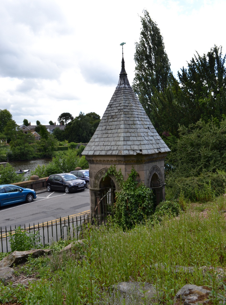
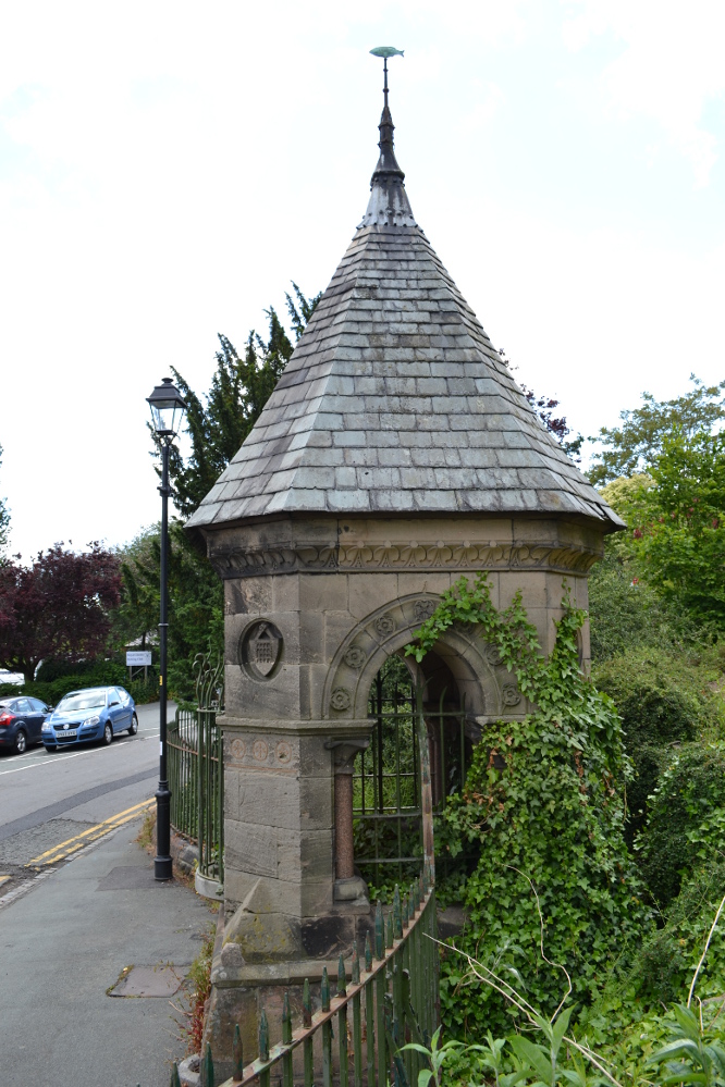
Billy Hobbys Well, Chester
An early reference to this site is in the place-name of Billy Obbies Field, marked in 1745, with an accompanying spring marked at 1791. This would appear to suggest that the spring gained its name from the field and not vice versa, with the name possibly representing a local person. Yet the name may hide a much earlier origin. The name ‘Hobby’ derives from hobb, a name for a devil or demon – and where the name hobgoblin derives from. It may be possible that the area was a marshy waste and to warn people away a legend of a demon was introduced. More interesting is the idea that as the name ‘Hobb’ is synonymous with Puck, and Puck possibly having a Roman origin, that the site could be a much earlier Pagan site. This might explain the fertility ritual found here (see Folklore, below) if it has a greater age. It may be significant that when the park was developed, a long line of Roman earthenware water pipes were found. Did they draw water from the spring?
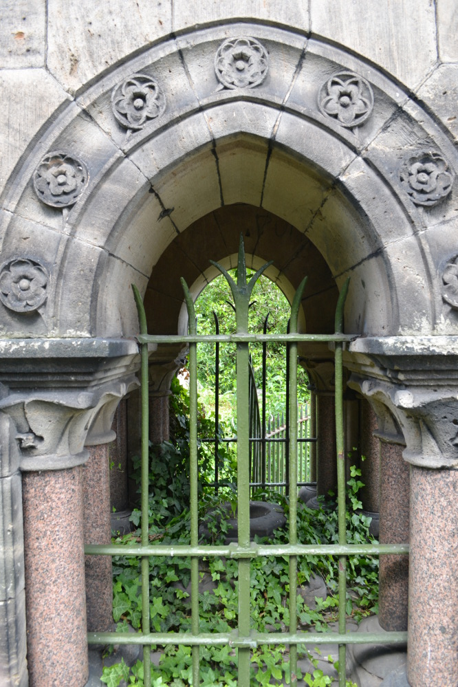
Internal Structure
Whatever the origin, when the garden was developed in the 1860s by the 2nd Earl of Westminster, Richard Grosvenor, a rather grand and impressive red and buff sandstone ashlar well house was erected. This was designed by John Douglas, a local Chester architect, who was not forthcoming in making this well grand with canted corners, pointed arches flanked by a granite columns with wrought iron bars. At each corner is a small carved circle containing carved sheafs and portcullis and the voussoirs contain carved roses. A tiled spired roof sits upon the structure with an apex surmounted by a copper fish weathervane. All in all, rather ostentatious for a well – especially as access to the well chamber has not been made very easy by the enclosure. Whether the improvements were done to develop some sort of spa well is unclear, but it is known that the when Canniff Haight (1904) visited for his United Empire, the spring was still flowing and noted, for he records:
“Billy Hobby’s Well,” a spring of excellent water, where we have a drink.”
Folklore
This was a local wishing well. A local anonymous rhyme records:
“I lov’d the tales that idle maids do tell,
Of wonders wrought at Billy Hobby’s Well,
Where love-sick girls with leg immured would stand,
The right leg ’twas – the other on dry land,
With face so simple – stocking in the hand –
Wishing for husbands half a winter’s day.
With ninety times the zeal they used to pray”
This old rhyme despite some pedigree suggested I have been able to date only to 1823. It appears to record a ritual undertaken at the well, a similar ‘one part of the body in, one out’ was done at Walsingham by lovelorn maidens, but it does look to be Victorian in origin there (or at least post Reformation). The only problem with the practice being undertaken then is that the present structure dates from that period.
From the forthcoming work on Holy wells and healing springs of Cheshire
References:
Dodgson, J.M., The Place-Names of Cheshire – Part 5, English Place-Name Society: Cambridge 1981.
Park by the church, which has a Sheela Na Gig and some roman stones. Walk back to the A153 (Ancaster Cross roads), turn left and cross the road. Take the footpath which is on the south side of the A153 and bear right into the nature reserve. The well – a large pool – is on private land, but it can be seen to the right of the entrance to the reserve.
Archaeology & History
This spring was possibly known in Roman and pre-Roman times, as there is a Roman station settlement hereby. Roman credentials have been strengthened since Time Team’s research which found that the site was the focus of a cult. There was an inscribed stone, found in the church and originally part of an archway, which says:
DEO VIRIDIO TRENICO ARCVM FECIT DE SVO DON
Translated to:
‘For the god Viridius, Trenico made this arch, donated from his own funds.”
The Time team archaeologists found a late Roman or early Dark Age burial with a similar inscription ‘DEO VRIDI SANCTO – ‘To the holy god Viridius.” The show thought that the God was associated with agriculture, but with the proximity of the spring nearby, perhaps they missed an obvious connection. It seems very likely that the Romans would have known of the spring as the valley beside it is thought to be a Roman raceway and the town was only a few yards away.
The spring is not mentioned historically; for example Leland (1535-43) notes a chapel and hermitage, but no well:
“The area wher the castelle stoode is large, and the dikes. In the highest ground of the area is now an old chapel dedicate to S. Marie, and there a her(em)ite.”
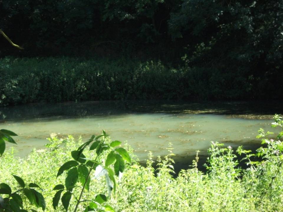
Lady Well on 1858 map
In Victorian times the water was tapped as a source of water for the village and a large cistern and pipe system established. According to Thompson (1999) in his work on Lincolnshire springs and wells, this was later removed and the well had become a boggy area, before finally being restored and clay-lined to be stocked with fish and prevent water loss. Its water now appears to be a light greeny-blue as a result. One cannot directly reach the edge of the water as it is enclosed in fencing but it can clearly be seen from the footpath.
Folklore
No tradition appears recorded regarding it properties. However, it appears likely that this is the spring Rudkin (1936) notes as St. Helen’s Well or Mucky Pool in the legend of Byard’s Leap, the famed story associated with a local witch as the story has association with Ancaster – although this could record another site.
References:
Parish, R. B., (2012) Holy wells and healing springs of Lincolnshire
The Runwell (copyright with permission http://www.spiritrealms.co.uk/gallery.htm )
It can be found by taking a road off the A132 (Wickford Road) which leads to Stock (directly opposite the Parish Church), continuing until you reach another minor road to Rettendon. A short way up this road it forks. Take the road to the right & continue until one reaches a minor drive to Poplars Farm (distinctive with its trees each side of the drive). Continue up here until one passes the house to a small piece of tarmac. Here a footpath continues directly in front, continue until one reaches on the left a gate. Enter through here, and head across the field towards a notable tree, and a gap in the hedge. To the left, follow the edge of the field, until one sees another opening into the well. The approach from the south is the only route worth considering as northerly access is blocked by a fence. It can be extremely muddy, so good footwear is advisable.
Archaeology & History
Philip Morant (1763-8) is the first to mention it, suggesting that the settlement is named:
“..from a considerable Running well in the Parish.”
Again, Chandler (1896)—noted in Collins (1986)—emphasises:
“a remarkable spring of water on Poplars Farm, which is always running and has never been known to fail.”
Despite this obvious assumption, Ekwall (1936) suggested that the prefix originates from O.E rune for ‘mystery’ or implying a well possessing a secret of some religious observance. This is suggestive of the strange legends and traditions involved with the site. Alternatively it could derive from hruna referring to the tree trunk—and it does arise in a copse. A roman road runs by here.
The only reference to a religious site appears to be in 1602 when the parish register records ‘Shrine of the Bl. Virgin of RunnyngeWelle’. However, stone remains found over the years around the well may support the idea of a well chapel; these remains were two pieces of limestone window mullion and a piece which appears to be part of a step as well as pieces of Kentish ragstone.
Folklore
According to Bazille-Corbin (1940), Runwell is steeped in lore and legend. One must take these stories as possible antiquarian fancy as there does not appear to be any concrete evidence for them. Doubtless some of it is true, other bits not. He states that in the Sixth Century AD, Christian missionaries Lucus and Lucilus visited Essex and found a scene of paganism here, built a chapel, and rededicated the well to “Our Lady St Mary.” The floor of this chapel had a unique designed cross, with black flint and red strawberry stone, to show the teachings of the tenets of the Christian Faith.
To protect this and collect subsequent devotional gifts, a nunnery, of six members, was developed around the site. They tended to the shrine, well head and the statue of Our Lady, to which many miracles were attributed. Little evidence exists concerning this foundation, but it is believed to have been dissolved in the 16th Century. Locally it is said parts of the nunnery were incorporated into the nearby farm-house ‘The Poplars’. In the 1980s, Andrew Collins, searched for records of this local priory, but found none.
Another legend connected with the well accords that a young nun, Sister Lucy, after renouncing her vows, found the outside world not to her liking and returned in repentance, one snowy night, to the chapel for forgiveness. Yet, upon reaching the chapel steps, she slipped and fell into the icy waters of the well. (cf. The Single or St. Thomas’ Well at Ifield, Kent)
Her ghost is said to haunt the area, preserving perhaps the memories of these past water deities. This is enforced by the belief by some authorities that the well’s dedication indicates a Christianisation of the Iceni goddess Epona. This is supported by these horseshoe-shaped motifs, and that the approach to the well being haunted by a horse.
Andy Collins (1986) was informed that a concrete water tank was installed over the spring. This proved to be inaccurate, but the well was defined by a concrete chamber. Collins thought that this may be the remains of some adaptation for a spa bath, but no hard evidence was forthcoming regarding this.
It certainly had passed through considerable years of neglect, as noted by the Runwell Rector John Edward Bazille-Corbin (1942), who said it was “in much need of dredging and cleaning out.”
The photo shown in Collins’s (1986) work shows a concrete lined rectangular pond, defined by corrugated iron. He was thus responsible for its repair and clearing away the years of neglect, also revealing the concrete rectangular pond, which was reached by a series of steps from its north side. A flight of steps appear to enter the well itself from the front. The body of water is of considerable size and depth and one could easily immerse oneself in it. When I last visited here, the water appeared murky but a sample revealed (apart from the pond fauna) a remarkable clarity.
Within recent years the well appears to have attracted a ‘cult following’, clearly manifesting itself in two ways. One is a seasonal Boxing Day walk to the well started in 1975, which is still undertaken (see link, below). The other more traditionally is the attachment of rags or cloutties to the surrounding shrubbery. Such activity, although probably done by those ‘in the know’ rather than any continuation of any local tradition, is the only such example I have come across in East Anglia—although recent photographs fail to show this and it appears that the tree has been cut down where these have been placed and the area opened up.
References:
Bazille-Corbin, J. E., Runwell St. Mary: A farrago of History, Archaeology, Legend and Folk-lore, 1940.
Collins, Andrew, “Devilish Mysteries at Runwell,” in Essex Countryside Vol. 33 no.431, p38-39, 1985.
Collins, Andrew, The Running Well Mystery, 1986.
Ekwall, Eilert, Studies in English Place and Personal Names, Lund 1931.
Ekwall, Eilert, The Concise Oxford Dictionary of English Place-Names, Oxford 1936.
Morant, Philip, The History and Antiquities of the County of Essex – 3 volumes, London 1763-8 (reprinted by EP: Wakefield 1978).

 Peering in through the windows one can see how strong the vaulted roof is, adorned by a pendent ball in its centre. The spring’s water flows from a crudely carved lion’s head, either side of a reredo of Ionic colonnettes, with a sunken stone tank beneath or each side a rectangular recess which enclose rectangular pools. There is a diamond-paved floor with a central gutter draining from this well or trough at centre of rear wall.