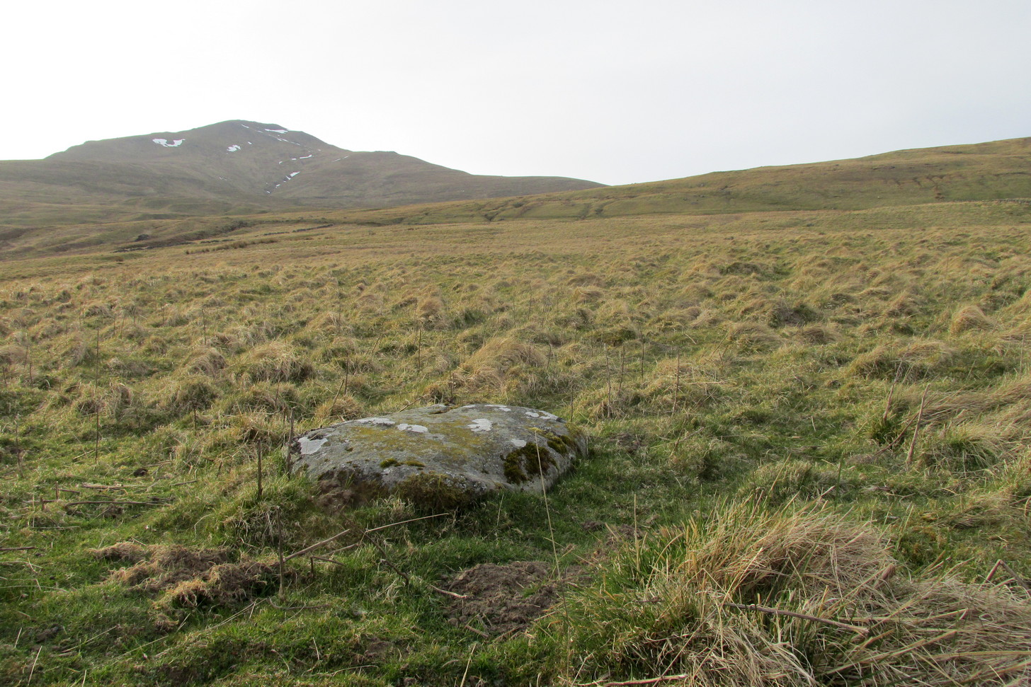
Take the directions to the Balnasuim (1) carving, then up and across to Balnasuim (2). From here, walk diagonally uphill to your right (NE) for about 150 yards and head to the the very top-corner of this field. You’ll see the large embedded rock emerging out of the ground, just ten yards away from a small stream. You’re there!
Archaeology & History
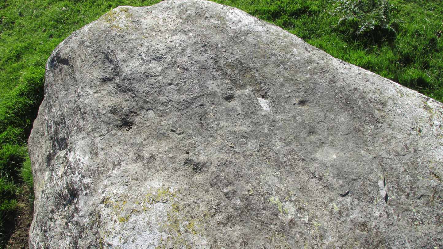
As Officer Barbrady likes to put it, “move along people, there’s nothing to see here!“—and that’s really the case with this, another of Balnasuim’s petroglyphs. This lichen-encrusted rock has just two simple cup-marks, barely visible when the daylight’s poor – and it’s almost as disappointing when the day is good! In all honesty, in wilfully visiting this site and its geographical compatriots, I can sincerely understand how people can tell us petroglyph-nuts that we “really have nothing better to do” with our time!
From Killin, take the A827 road to Kenmore. 6 miles along, on your right, is the track down to the Big Shed at Tombreck. Keep on the A827 for exactly ⅓-mile (0.53km), and opposite the driveway to Craggantoul is a small parking spot. A few yards on the road, over the burn, go thru the gate on your left. From here, follow the straight line of walling uphill and 20 yards before reaching Cragganester (9) carving, follow the line of fencing right (ENE) until you hit the wall more than 350 yards away. From here, follow the walling uphlil 350 yards where it turns a right-angle west. About 50 yards east of the right-angled wall, look around…
Archaeology & History
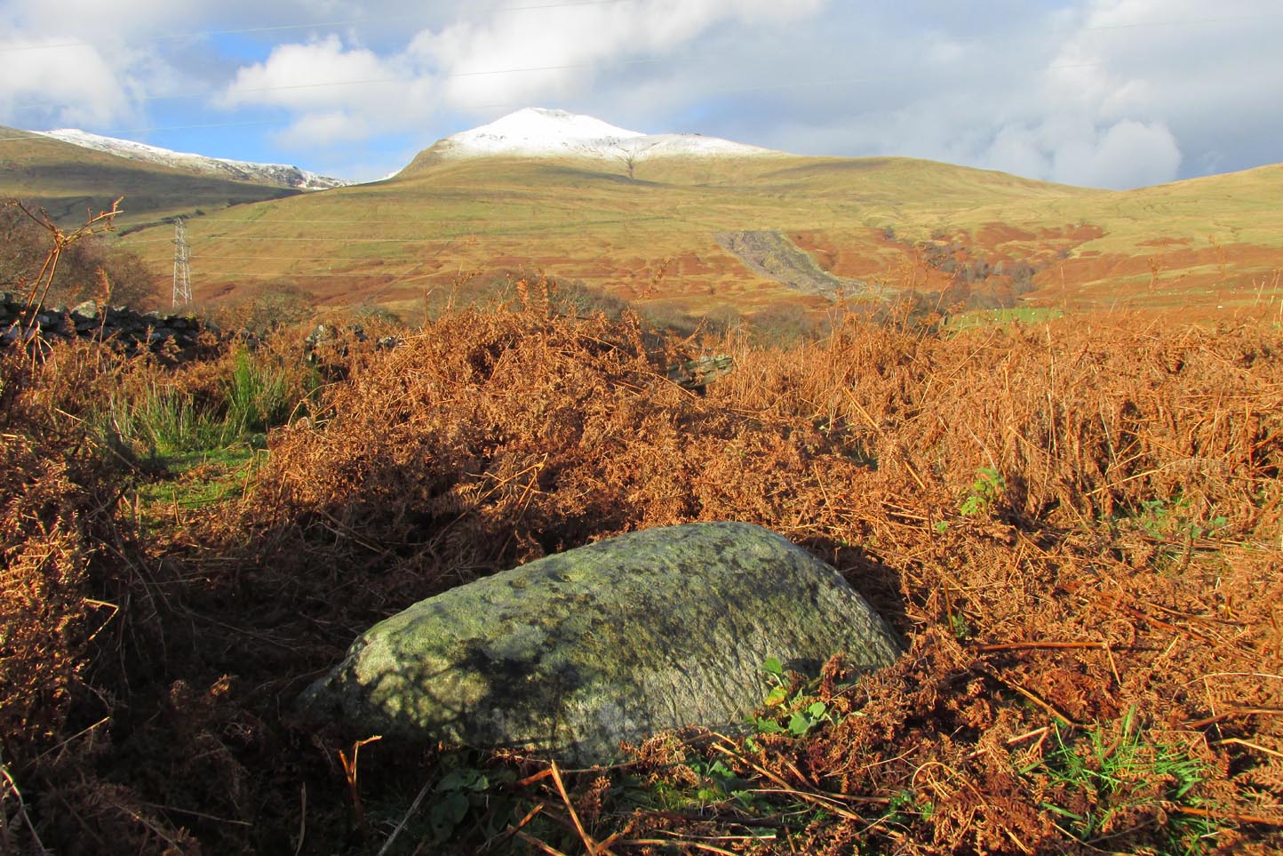
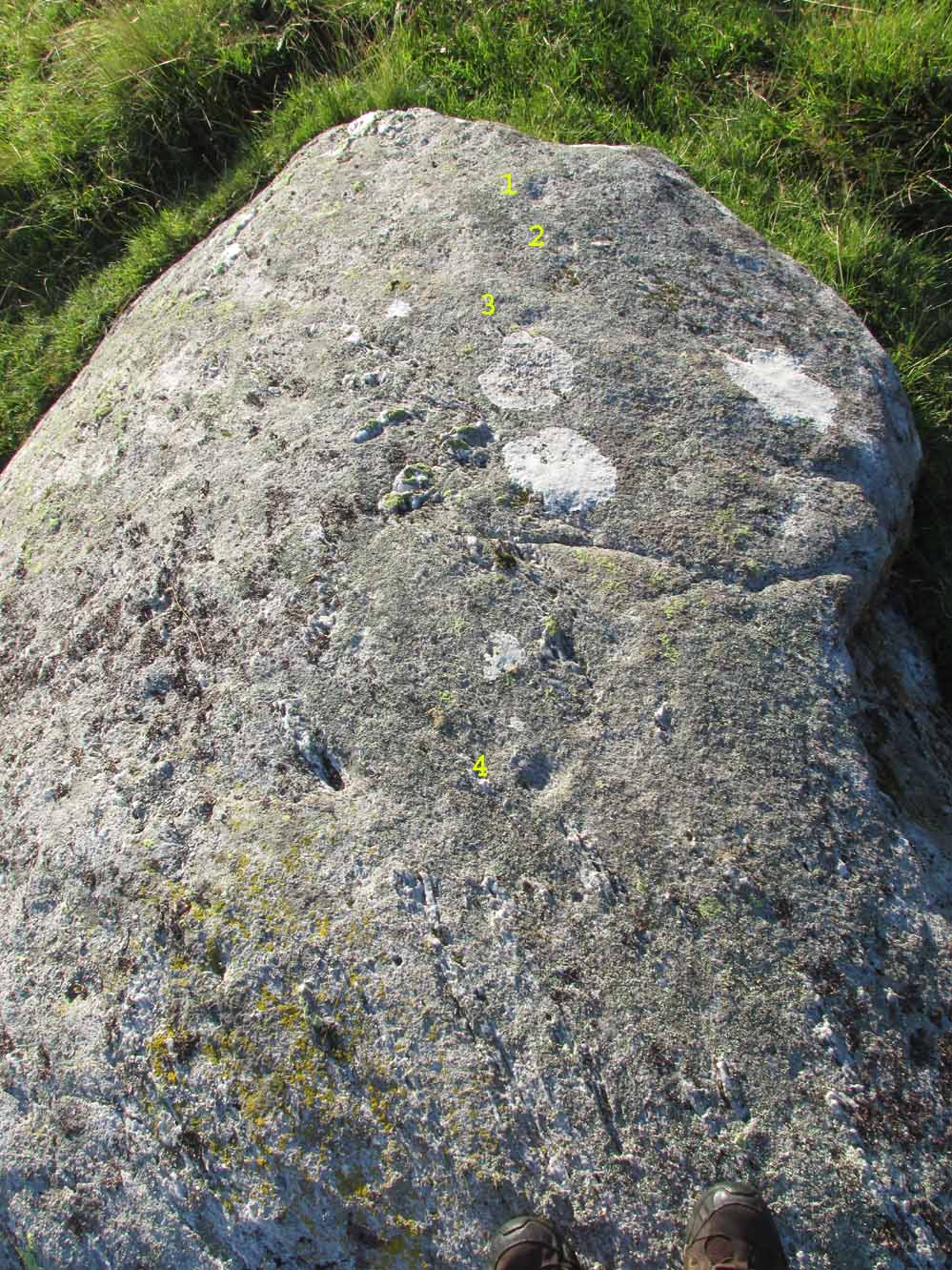
3 faint cups in an arc
As with the other carvings up here at Balnasuim, there is little to look at unless you’re one of the ardent petroglyphic crazies! On this small rounded stone, cushioned beneath the skylines of Ben Lawers and Meall Odhar, are at least three cupmarks in a rough arc running from the northern part of the stone, with the most pronounced of them being close to the northern edge of the rock. The others are very shallow and can be difficult to make out in poor sunlight. A possible fourth cupmark with a short protruding line may exist close to the SE part of the stone. The Balnasuim (2) carving is 305 yards (279m) to the NE.
From Killin, take the A827 road to Kenmore. 6 miles along, on your right, is the track down to the Big Shed at Tombreck. Keep on the A827 for exactly ⅓-mile (0.53km), and opposite the driveway to Craggantoul is a small parking spot. A few yards on the road, over the burn, go thru the gate on your left. From here, follow the straight line of walling up past Cragganester (9) carving, following the burn uphill parallel to the copse of trees until, after about 800 yards, you reach the wall. From here, walk towards the rounded hill of Meall Odhar and, after about 450 yards, you’ll notice it meets a line of walling that runs downhill. Keep walking along, past this, but after 150 yards, go into the field on your right and walk downhill for about 100 yards. Look around!
Archaeology & History
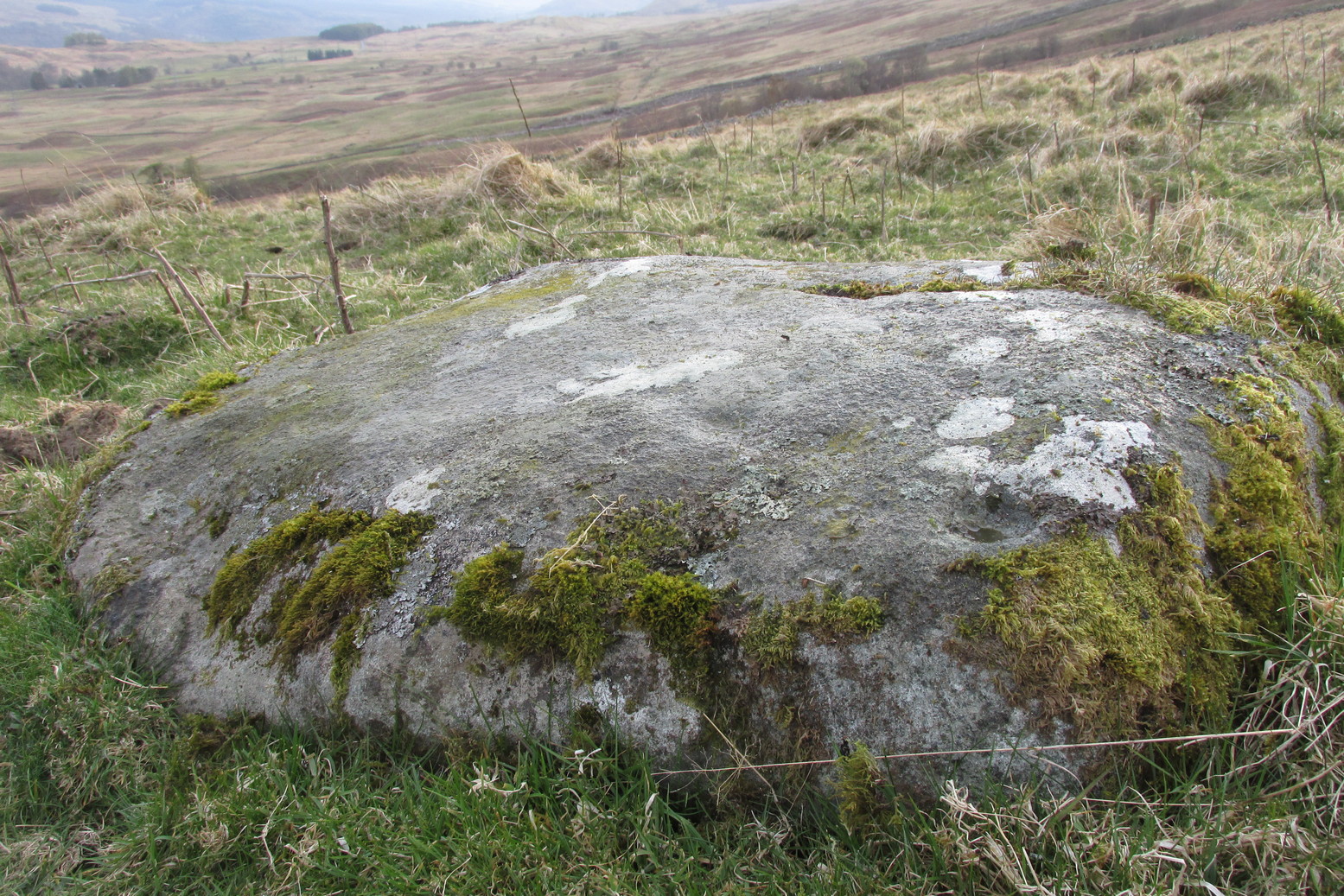
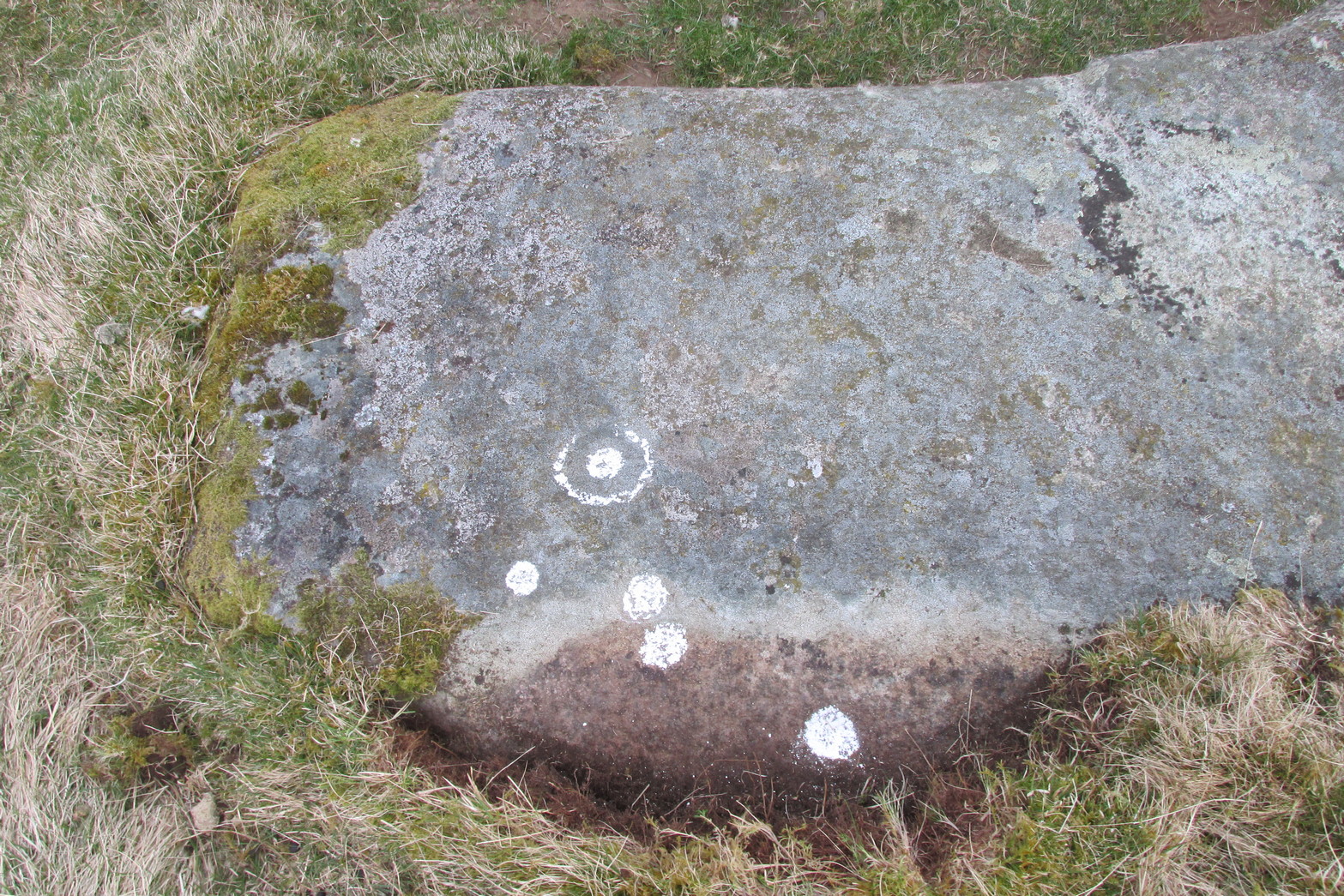
Despite the climb, plus its description as a ‘cup-and-ring’ stone, this petroglyph is somewhat of a disappointment. An elongated stone, half-covered in earth faces south towards Loch Tay and the mountains across, with a series of very eroded cup-marks.
Cup-marks on SW sideCup-and-ring on NE side
They are separated into two small groups. At the southwest side of the rock we can see three or four faded cup-marks. The middle of the rock seems devoid of anything, but on its more northeastern side we find four more cups in close attendance to a standard cup-and-ring motif. That’s about it! The Balnasuim (1) carving can be found 305 yards (279m) to the southwest.
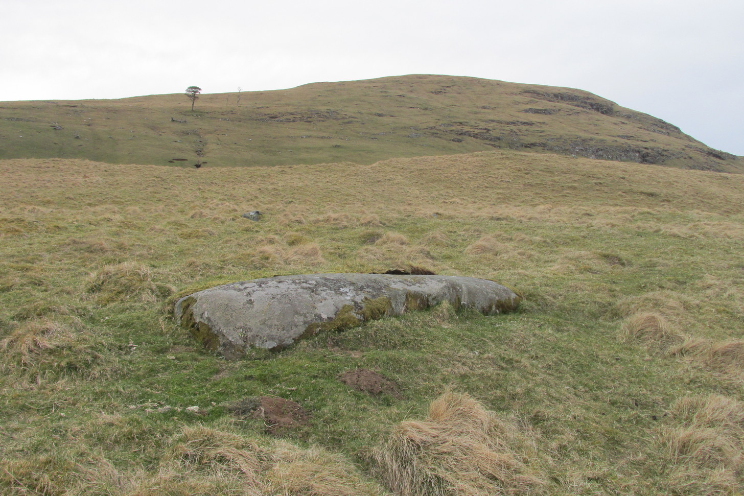
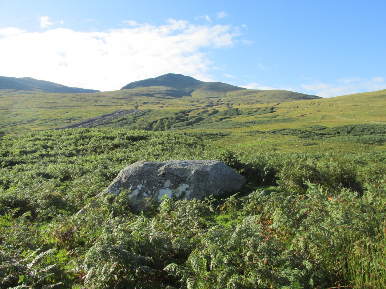
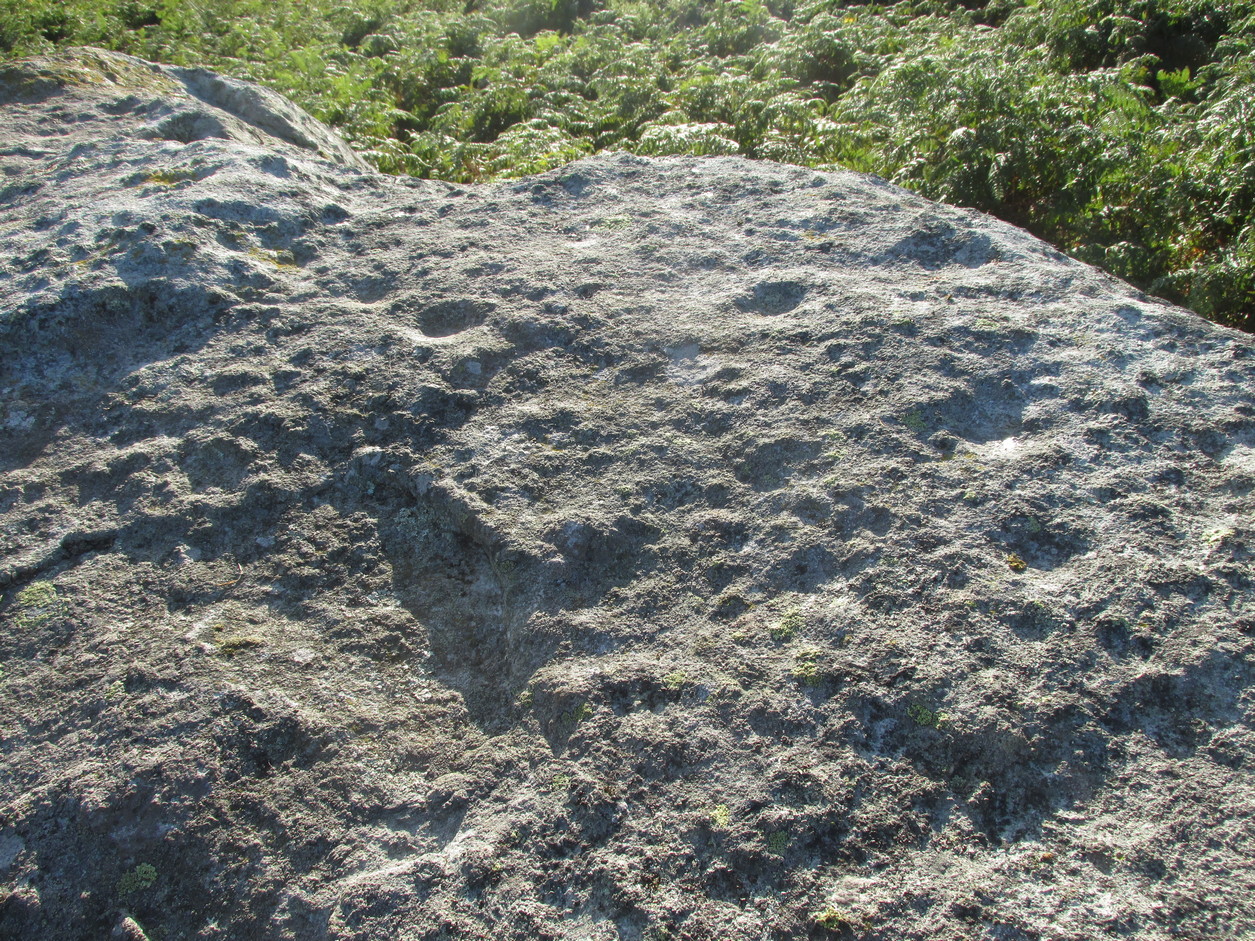
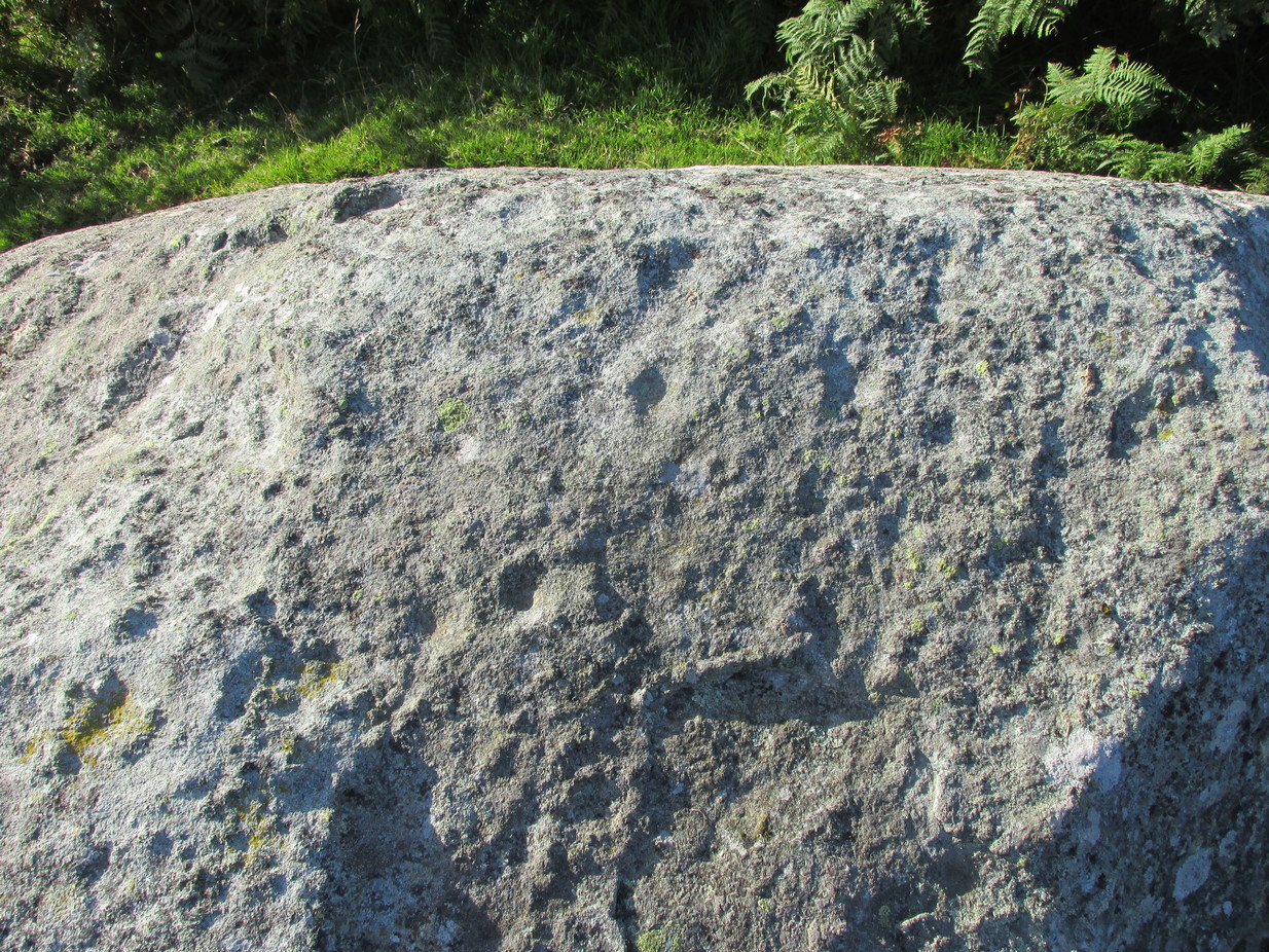
From Killin, take the A827 road to Kenmore. 6 miles along, on your right, is the track down to the Big Shed at Tombreck. Keep on the A827 for exactly ⅓-mile (0.53km), and opposite the driveway to Craggantoul is a small parking spot. A few yards on the road, over the burn, go thru the gate on your left. Follow the straight line of walling up for 400 yards it meets where another line of walling running right (E), into the boggy pasture-lands. Walk along here for roughly another 400 yards then go up the slope as if walking up Ben Lawers (N). You’ll come to 2 large boulders next to each other where the slope levels out. It’s the one on your left!
Archaeology & History
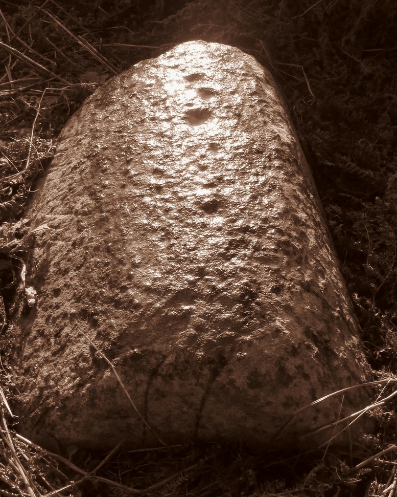
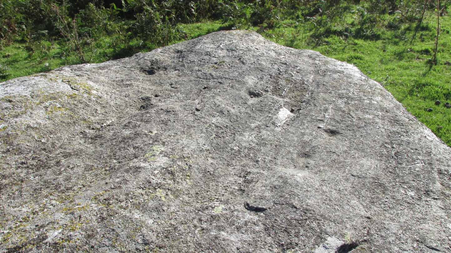
This carving is really for the purists amongst you. It’s like most of the carvings along this contour line in that the design is simplistic. Consisting of at least nine cups all on top of the stone, they can be difficult to see amidst the rough garnet and lichen-encrusted rock.
Cupmarks on its west faceLooking down on the cups
On one of our visits here, when the light cut across the surface at a lower angle, it seemed as if one of the cups had a faint ring around it; but it looked as if the outline of it had been started, but then for some reason the ring was never actually carved. This outline is very faint. We’ve found examples of this at two of the Duncroisk carvings, several miles to the west, where the faintest trace of a ring was outlined, but never carved. Of the cup-marks: five of them are carved on the east-side of the rock and are pretty easy to see (with the ring around one of them), whilst the other four—slightly more difficult to make out—are on its west side. A couple of hundred yards north you can see the Cragganester 10 carving.
From Killin, take the A827 road to Kenmore. 6 miles along, on your right, is the track down to the Big Shed at Tombreck. Keep on the A827 for exactly ⅓-mile (0.53km), and opposite the driveway to Craggantoul is a small parking spot. A few yards on the road, over the burn, go thru the gate on your left and walk up the path for less than 100 yards. The stone is just a coupla yards on your right (if you reach the derelict tractor, you’ve gone about 10 yards past the stone).
Archaeology & History
Cupmarks along the top
This is another one of the many simple cup-marked petroglyphs scattering the Cragganester and Tombreck regions beneath the slope of Ben Lawers. It’s an elongated, smoothly-shaped ‘female’ stone, aligned north-south, possessing four distinct cups along its crown: three in a small line at the south-end of the stone and a single one close to the north end. However between these is what may be another, shallow fifth cupmark—but this is uncertain.
One notable feature here is that the rock is encrusted with small garnets. This geological ingredient isn’t uncommon in this area, and we’ve found that quite a proportion of the petroglyphs hereby possess this feature. It was probably of some importance to the people who carved them.
Acknowledgements: Thanks to Paul Hornby for use of his photograph.
From Killin, take the A827 road to Kenmore. 6 miles along, on your right, is the track down to the Big Shed at Tombreck. Keep on the A827 for exactly ⅓-mile (0.53km), and opposite the driveway to Craggantoul is a small parking spot. Go through the gate here and walk up the little hill right in front of you until you can see an electricity pylon 200 yards away. Head for, go up the slope behind and along until you drop into a tiny little valley where a long line of very distinct old walling runs east-west. Walk back and forth along it till you see a reasonably large earthfast stone on its own.
Archaeology & History
Close to a long line of what I think is pre-medieval walling—possibly Iron Age—is what can only be described as a truly crap-looking petroglyph which, to be honest, I’d walk past and give not a jot of notice if it wasn’t for the fact that it’s been recorded. When we visited here, three very worn large cup-marks were visible on its sloping west face, with what looked like two more on top of the stone—but these seemed questionable in terms of them being man-made. Apparently there’s another one on it, but in the searing heat and overhead midday sun when we visited, this couldn’t be seen.
From Killin, take the A827 road to Kenmore. 6 miles along, on your right, is the track down to the Big Shed at Tombreck. Keep on the A827 for exactly ⅓-mile (0.53km), and opposite the driveway to Craggantoul is a small parking spot. A few yards on the road, over the burn, go thru the gate on your left. Follow the straight line of walling up for 800 yards where the walling hits the burn, then follow the water up until you cross a fence. Once over this, 50- yards to your right you’ll see a large rounded rock and companion. It’s the rounded rock.
Archaeology & History
As with most the carvings along here, it is the setting that captivates more than the petroglyph. This is another one mainly for the purists amongst you, but there’s a distinct feel of other carvings hiding very close by that remain hidden. Anyhoo…
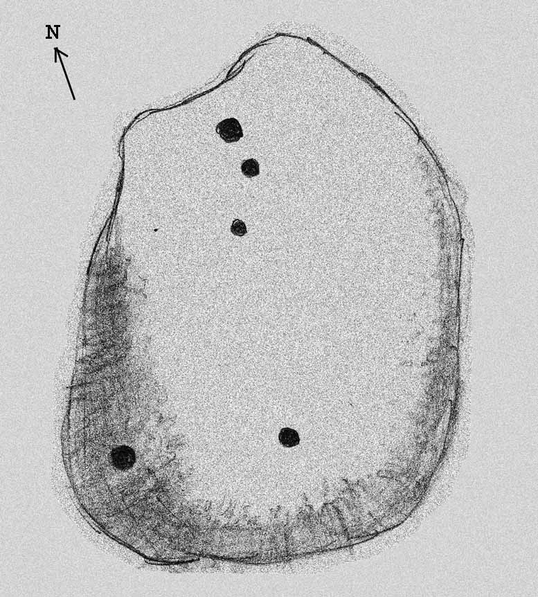
4 of the cups numeratedRough sketch of design
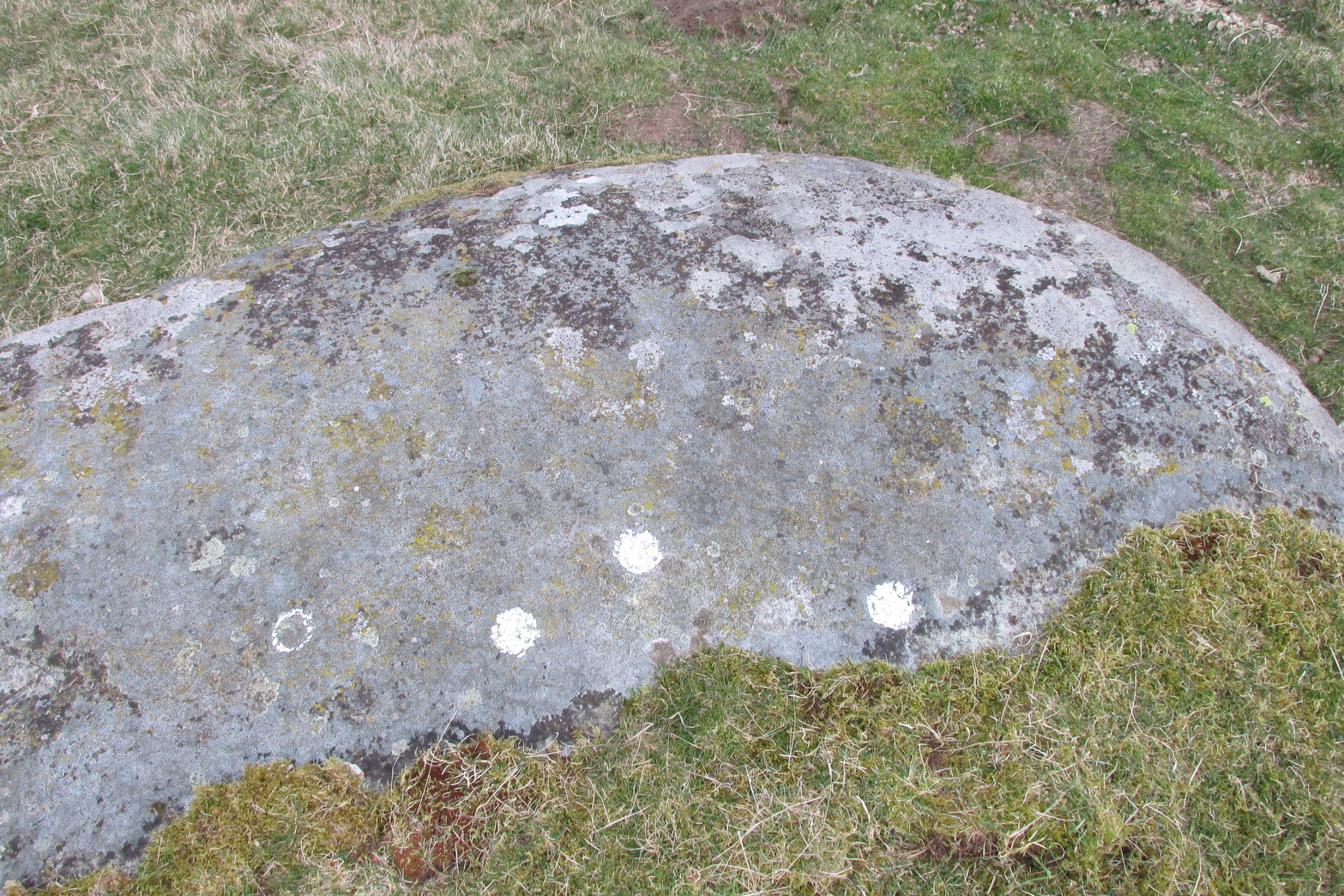
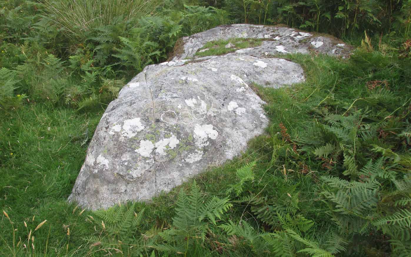
This reasonably large, rounded, female stone has the usual scatter of quartz in its veins, along with at least four cup-marks on its upper sloping surface. Three of them are seen in a slight arc on the more northern slope of the stone with one of them particularly faint; but the most notable of the lot on the very crown of the stone. (see the numerated image, right) A fifth cup-mark is clearly visible on the western face of the boulder, shortly below where the rock begins to level out. You’ll see it. Some 200 yards west of this carving, the prominent rock hosting the Cragganester 10 carving is visible on top of its rounded knoll.
From Killin, take the A827 road to Kenmore. 6 miles along, on your right, is the track down to the Big Shed at Tombreck. Keep on the A827 for exactly ⅓-mile (0.53km), and opposite the driveway to Craggantoul is a small parking spot. A few yards on the road, over the burn, go thru the gate on your left. Follow the straight line of walling up for 7-800 yards and then walk to your right, into the field. About 300 yards into the overgrown meadowland you’ll see a rounded knoll with a very notable boulder on its crown. Y’ can’t really miss it!
Archaeology & History
It’s the setting of this carving that captures you way more than the carving itself—which is probably somewhat of a disappointment to most folk, unless you’re a petroglyph fanatic like myself.
The five cup-marks…and from another angle
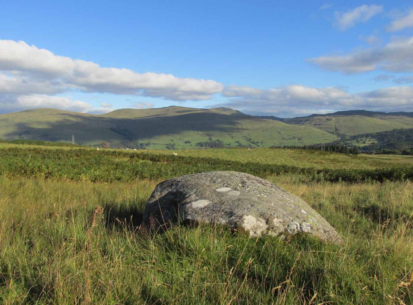
Found relatively close to other carvings, this reasonably large boulder has, upon its roughly smooth top, just five simple cup-marks with varying degrees of weathering, from the very noticeable to the somewhat faint—hinting at the unlikely possibility that it might have been carved at different times. A possible sixth cup can be seen in certain daylight conditions on the southwest section of the stone. That’s it!
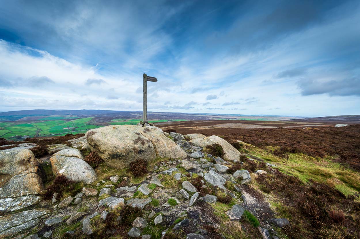
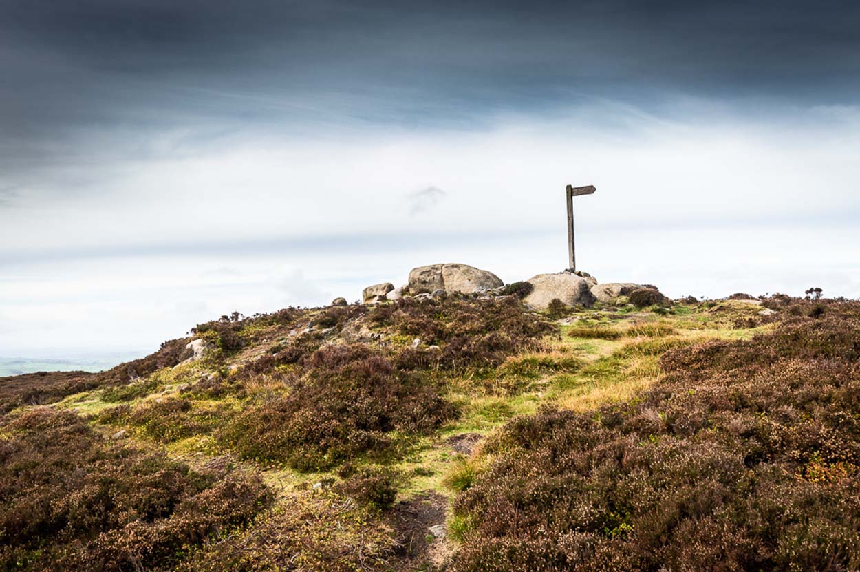
I prefer the much longer walk to this site, from Askwith Moor carpark some 5 miles to the west, but this wouldn’t be most folks cuppa tea. So for the lazy buggers amongst you: whether you’re coming via Ilkley (cross the bridge to Middleton and turn left, following the long winding road for several miles) or Bolton Bridge (hit Beamsley village and turn left up Lanshaw Bank), you need to get up to Langbar village. On the north side of the village is a distinct small rough carpark. From here, cross the road where the footpath sign is and walk straight up the steep hill to Beamsley Beacon at the top. Keep walking for exactly ¼-mile where you’ll find a large heap with boulders round its edge. You’re there.
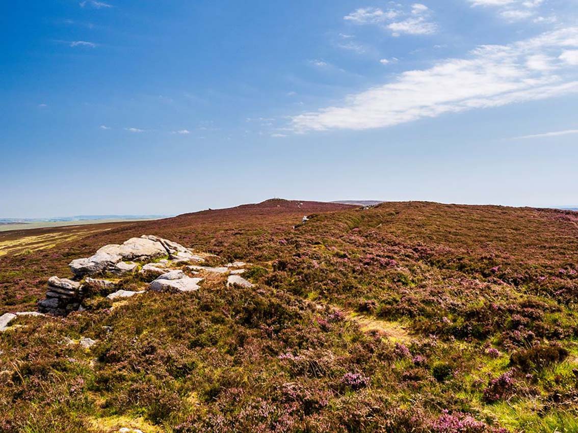
At the highest point of these hills where the moorlands of Langbar and Beamsley meet, is this prominent rocky pile on the same skyline as Beamsley Beacon. The two are ancient cairns, both robbed of most of their stones, but still a good site to sit and behold the vast landscape which reaches out for miles in all directions. And, from this highest point, looking south to the highest point across the Wharfe valley on Ilkley Moor, the remnants of another giant prehistoric cairn is visible: looking across at each other, eye to eye.
Of the two great cairns on Beamsley moor, The Old Pike is the more peculiar of the two because—unlike its partner along the ridge—several large boulders near its top give the impression of being Nature’s handiwork. This may be the case, but Nature isn’t the lass who laid down the mass of smaller rounded stones that are mainly visible on the west and southern sides. These have been placed there by people. But it’s not until you step back 40 or 50 yards that you get a more distinct impression of the place. The Old Pike rises up like a rocky nipple out of the heath, showing a very embedded overgrown man-made heap, typical of the overgrown prehistoric cairns that scatter our northern uplands.
The site is included on the archaeologist’s Pastscape website, albeit citing it as a ‘possible’ cairn. But the more we look at it, the greater the impression becomes that this old heap is man-made – certainly on its eastern and southern sides. The rise of boulders on its west may be natural, and then ancient man placed the cairn material up and around them. Only an excavation would tell us for sure. But its old name of Howber Pike tells a tale before we even visit the place. When the great Yorkshire historian Harry Speight (1900) came here he picked up on this element, telling us,
“Howber literally is the ‘Hill of Tombs’, from the Teutonic haugr and Anglian how, a burial mound, and berg also her, a hill, often fortified.”
The great place-name authority A.H. Smith (1956) not only echoes this but goes into greater etymological detail, noting that as well as haugr or how being “an artificial mound, a burial mound,” it’s a word that is particularly used in the northern counties. He does note however, that this may not always be the case and can sometime just relate to a “a hill or hilltop resembling an artificial mound.” However, we also find in Smith’s tome on place-name elements that the latter part of ‘Howber’ deriving from beorg, can also mean a tumulus or burial mound. But there are cases where this has been corrupted and means, as Speight states, a fortified hill. So at Howber Pike we seem to have the ancient name of some probable burial site. As for its neighbour a quarter-mile west, the giant cairn of Beamsley Beacon is also known as the Howber Hill….
References:
Smith, A.H., English Place-Name Elements – volume 1, Cambridge University Press 1956.
Smith, A.H., The Place-Names of the West Riding of Yorkshire – volume 5, Cambridge University Press 1963.
Speight, Harry, Upper Wharfedale, Elliott Stock: London 1900.
Acknowledgements: Huge thanks to James Elkington for use of his fine photos on this site.
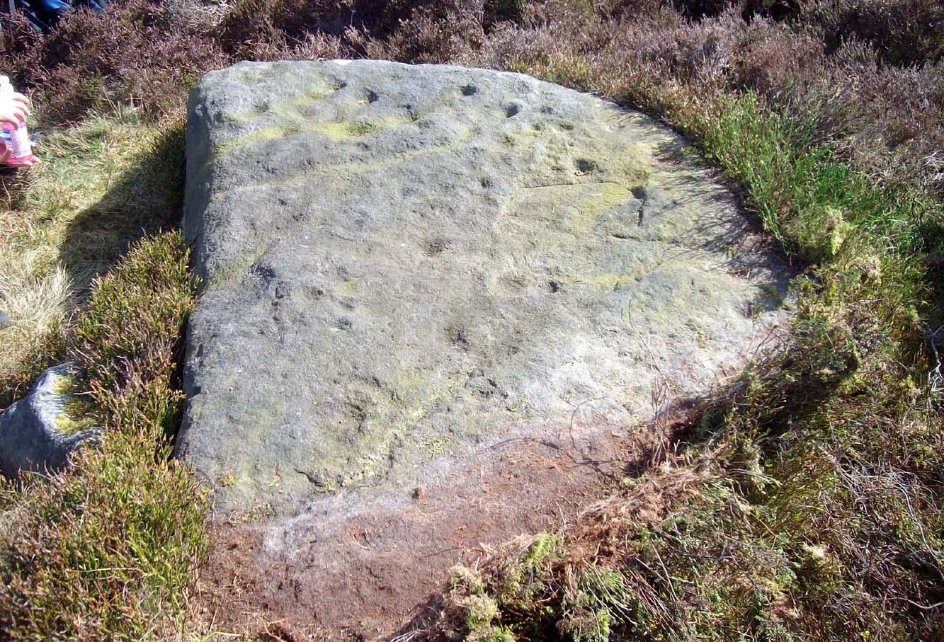
Various ways to get here, but probably the easiest is to start from Cow & Calf Rocks, walking up the steep slope onto the moor-edge. Paths veer left and right once you’re on the level, but you wanna head straight forward, west(-ish), for about 350 yards till you reach the stream. Cross over and then take the path that runs parallel with the stream, uphill. Nearly 200 yards up, where the moor begins to level out, you cross a path running east-west; keep going past this for about another 50 yards (as if you’re heading to the Backstone Circle) and you’ll notice some small sheep-paths leading you into the heather to your right and, some 40-50 yards into the heath you’ll see this large flat stone!
Archaeology & History
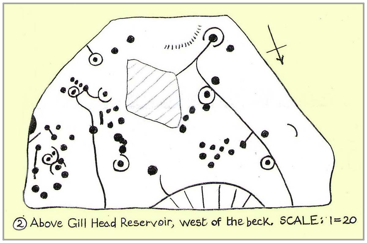
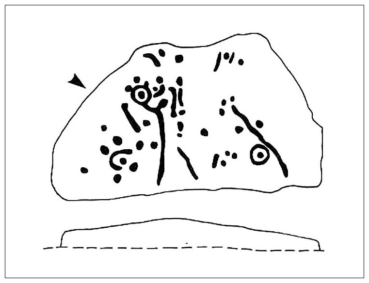
This carving seems to have been rediscovered in the 1950s by Michael Walker and Stuart Feather. They were amongst a small group of people who visited this and some other carvings in June 1956, when the first (known) sketch of the carving was done by Mr Walker. His sketch of the stone is somewhat more elaborate than the one in John Hedges’ (1986) later archaeological survey. Indeed, in some ways the two drawings seem to show little resemblance to each other. (not uncommon with these things!)
Walker’s 1956 sketchHedges’ 1986 sketch
Walker shows nine cup-and-rings in various states of completion, with several clusters of singular cups at different places on the rock—more than forty in all, some of which are connected to each other by short lines. This is in contrast with the later archaeological description, which saw far fewer of the primary symbols. When John Hedges (1986) described the carving in his inventory, he informed the reader:
“Fairly smooth, medium sized grit rock standing up in heather, crowberry and grass, sloping SW to NE with the hill, its almost triangular flat top covered with carvings, some very clear, interesting patterns. About thirty-five cups, seven surrounding a small ring with cups on the circumference and at centre. Two long grooves with a cup at one end, running down to the edge of the rock. ‘Peck’ marks noticeable in one groove and in one ring round a cup. Three other grooves going half round cups, or leading from a cup. Slice of rock apparently removed.”
Boughey & Vickerman (2003) added nothing new in their later survey.
Although we have an uninterrupted open view of the landscape to the north and west from here, it might not have been like this when the carving was done 4-5000 years ago. The scattered woodland covering these heaths may have impeded the views. However, immediately west of this carving are the broken remains of a small Bronze Age settlement, some of whose walling is traceable some 100-150 yards away and any tree cover that may have been here may have been cut back. We may never know for sure…
References:
Boughey, K.J.S. & Vickerman, E.A., Prehistoric Rock Art of the West Riding, WYAS: Leeds 2003.
Hedges, John (ed.), The Carved Rocks of Rombald’s Moor, WYMCC: Wakefield 1986.
Jackson, S. & Walker, Michael J., “Ilkley Boulders Tour,” in Cartwright Hall Archaeology Group Bulletin, 2:1, 1956.