Tomb Stone (110), Stanbury Hill, Bingley Moor, West Yorkshire

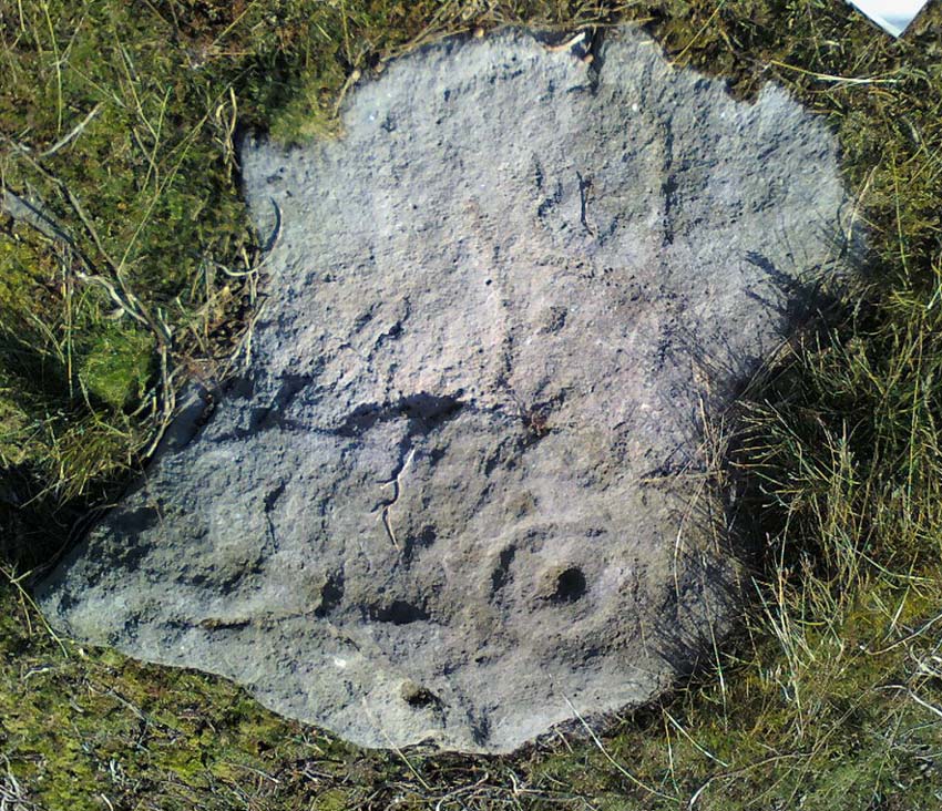
Cup-Marked Stone:  OS Grid Reference – SE 11229 43143

Also Known as:

  1. Carving no.93 (Hedges)
  2. Carving no.110 (Boughey & Vickerman)

Getting Here

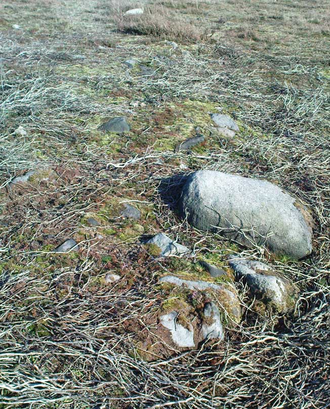
The larger stone in this cairn is the carved rock

From East Morton village, take the moorland road, east, and up the steep hill.  Where the road levels out there’s a right turn, plus (more importantly!) a trackway on your left which leads onto the moor.  Go up this track and keep walking till you hit a moorland ‘footpath’ signpost.  Just before this walk due west (your left) into the heather for about 10 yards.  Look around! (if the heather’s long and overgrown, you might have trouble finding it)  If you find carved stone 109, you’re less than 10 yards off this one!

Archaeology & History

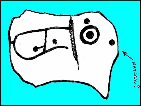
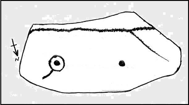
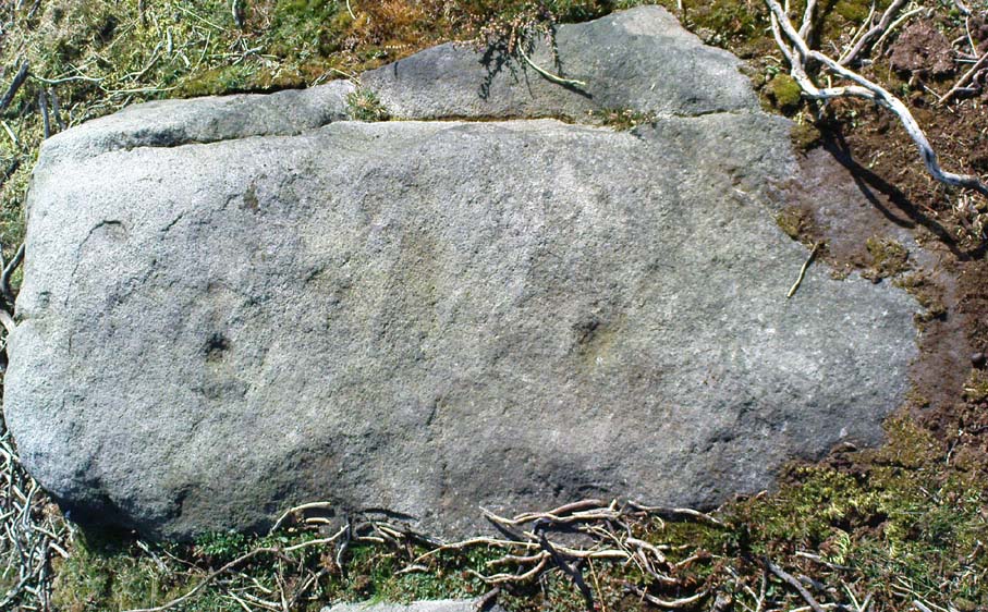
First reported by Stuart Feather and described in a short note of the Yorkshire Archaeological Register* of 1977.  This was one of two small carved stones next to each other amidst the “denuded remains of a cairn 3m in diameter and 0.35m high.”  The stone we can still see here is a small one, seemingly near the very centre of the cairn, with its carved face looking northwards.  The carving is a simple double-ring surrounding a central cup: an almost archetypal cup-and-ring stone.
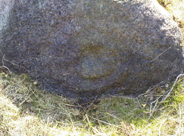
Crap photo of the double-ring

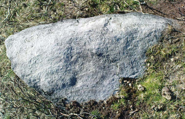
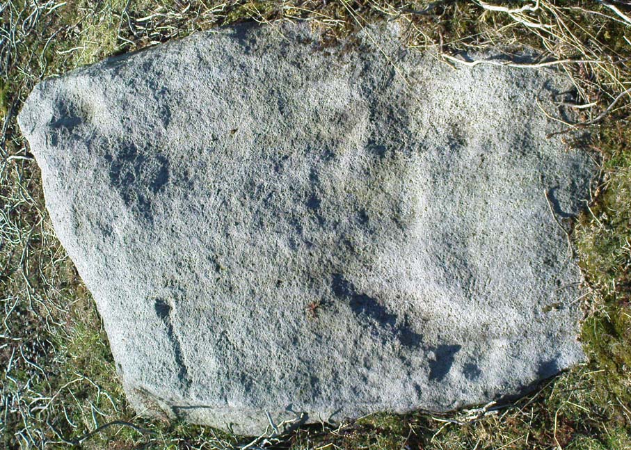
The other ancient carved stone that was once seen next to this (catalogued as carving 111) has in recent years been stolen by an archaeological thief no less!  Any information that anyone might have telling us who’s stolen this heritage piece, or where it might presently reside, can be emailed to me in confidence.  Or…the thief who’s taken it can return the carving to the site and put it back where it belongs before we find out where you live.  Simple as!

(Soz about the poor photo of this carving.  For decent ones of this stone you need to get here when the sun’s in a better position.  I’ll hopefully get some better images next time we’re up there when the light’s better.)

References:

  1. Boughey, Keith & Vickerman, E.A., Prehistoric Rock Art of the West Riding, WYAS 2003.
  2. Hedges, John (ed.), The Carved Rocks on Rombalds Moor, WYMCC: Wakefield 1986.
  3. Moorhouse, S. (ed.), “Yorkshire Archaeological Register: 1977,” in Yorkshire Archaeology Journal, volume 50, 1978.

* Does anyone have any idea who you report such new discoveries to so that they can be reported in Yorkshire Archaeology Society’s ‘Register’?  I’ve asked ‘em several times about a number of previously unrecorded sites that we’ve located, so that they can make a record of them, but I never get a reply.

©Paul Bennett, The Northern Antiquarian

Low Black Knoll, Morton Moor, West Yorkshire

Cup-Marked Stone:  OS Grid Reference – SE 104 445

Getting Here

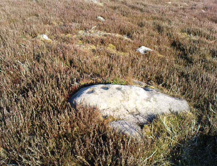
Morton Moor carving

Takes a bitta finding this one.  From the Twin Towers at the top of the moors (Whetstone Gate), walk east along the footpath, past the towers for about another 100 yards, looking out on the other side of the wall until you meet with some walling running downhill onto Morton Moor.  Follow this walling for a few hundred yards till it drops down a small valley; then follow the valley down, keeping to its left-hand side, swerving a little round Black Knoll above you.  Cross the dried-up stream and about 100 yards ahead of you (southeast), heading towards the Sweet Well, zigzag about (once the heather’s grown back here, this’ll take some finding!).  Good luck!

Archaeology & History

Cup-markings, looking north

There’s no previous history to this site and archaeological records indicate no prehistoric remains in this region.  However, we (that is Dave, Mikki and me) found this and a number of other sites yesterday in a bimbling wander, to and fro, through boggy-heaths and deep heather.  It’s a previously unrecorded cup-marked stone, with what seems like an attached burial cairn right by its side (yet again!).  The cairn is 3 yards by 2 yards across.  Two very distinct cup-marks can clearly be seen near the top of the small stone, with a possible third just below.  A curious though natural yoni-like erosion can be seen on the lower side of the stone which may have some significance to people into that sorta thing!  Whether it had owt to do with the cup-markings is another thing altogether!

© Paul Bennett, The Northern Antiquarian

Stanbury Hill (109), Bingley Moor, West Yorkshire

Cup-Marked Stone:  OS Grid Reference – SE 11224 43139

Also Known as:

  1. Carving no.91 (Hedges)

Getting Here

From East Morton village, take the moorland road, east, and up the steep hill.  Where the road levels out there’s a right turn, plus (more importantly!) a trackway on your left which leads onto the moor.  Go up this track and keep walking till you hit a moorland ‘footpath’ signpost.  Just before this walk due west (your left) into the heather for about 10 yards.  Look around! (if the heather’s long and overgrown, you might have trouble finding it)

Archaeology & History

Thought to be one of several carvings that were first reported by Stuart Feather and described in the Yorkshire Archaeological Register* of 1977: near the “denuded remains of a cairn” (there are in fact two here) is “a further cup-marked rock adjacent.”  This is thought to be the one registered in John Hedges’ (1986) survey as ‘stone 91’.  It’s a cute little thing, about 10 yards south of carving 110 (itself sited near the centre of a much-denuded burial cairn).

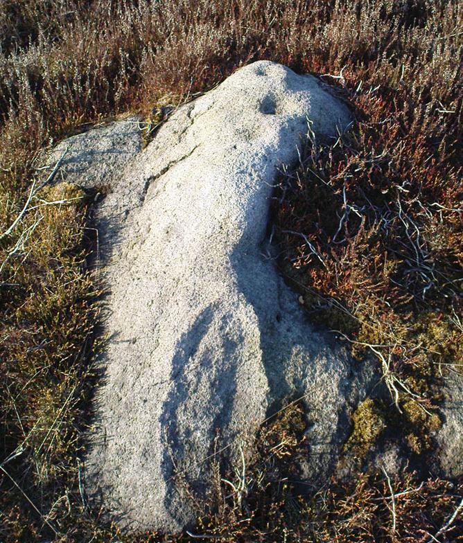
Carving 109, when wet!
and when dry!

Similar in design to some of the Baildon Moor cup-marked stones (see carving no.126), the primary design here is a simple one: five cup-markings run along the edge of the small stone, with a small carved “line” running between two of the cups, as if denoting separation; whilst on the lower middle part of the stone is another, single cup, a little more worn than the others.  It seems likely that this carving, like its double-ringed companion a few yards away (and others on this part of the moors) was in some way associated with the nearby prehistoric cairns.


References:

  1. Boughey, Keith & Vickerman, E.A., Prehistoric Rock Art of the West Riding, WYAS 2003.
  2. Hedges, John (ed.), The Carved Rocks on Rombalds Moor, WYMCC: Wakefield 1986.
  3. Moorhouse, S. (ed.), “Yorkshire Archaeological Register: 1977,” in Yorkshire Archaeology Journal, volume 50, 1978.

* Does anyone have any idea who you report such new discoveries to so that they can be reported in Yorkshire Archaeology Society’s ‘Register’?  I’ve asked ’em several times about a number of previously unrecorded sites that we’ve located, so that they can make a record of them, but I never get a reply.

© Paul Bennett, The Northern Antiquarian


Todmoor Carving, Bingley Moor, West Yorkshire

Cup-and-Ring Stone:  OS Grid Reference – SE 10992 42594

Also Known as:

  1. Carving no.86 (Hedges)
  2. Carving no.103 (Boughey & Vickerman)

Getting Here

From Bingley, head up to Eldwick (either road, it doesn’t matter) until you hit the crossroads at the top where you go up Heights Lane onto the moors (ask someone if you’re struggling).  Right at the top where the lane meets the moorland road, straight across is a dirt-track onto the moor.  You’re going up there!  Walk up for about 350 yards, then go into the heather on your left.  About 20-30 yards in, keep your eyes peeled for the stone in the photo.  It’s low down, a few feet across either way, but easily missed when it gets covered in heather.

Archaeology & History

Todmoor carving’s cup & lines

Up here again today — Mikki Potts, Dave and me — this was first carving we came to.  It was first discovered by the late great Stuart Feather (1961) on one of his many forays onto these moors.  It’s a bittovan odd carving: deep wide grooves, seemingly carved out by humans, in which some other cups have then been carved; plus an odd scatter of other singular cup-markings, what looks like a double-cup, and a long winding line running from near the middle to the stone’s western edge.  All the carved elements have been etched onto the southern half of the stone.  The lovely little Todmor standing stone is about 50 yards northwest of here.

References:

  1. Boughey, Keith & Vickerman, E.A., Prehistoric Rock Art of the West Riding, WYAS 2003.
  2. Feather, Stuart, “Mid-Wharfedale Cup-and-Ring Markings. Nos. 5 & 6,” in Cartwright Hall Archaeology Group Bulletin, 6:7, 1961.
  3. Hedges, John (ed.), The Carved Rocks on Rombalds Moor, WYMCC: Wakefield 1986.

© Paul Bennett, The Northern Antiquarian

Fenny Shaw Cup-Mark, Bingley Moor, West Yorkshire

Cup-Marked Stone:  OS Grid Reference – SE 11271 43565

Also Known as:

  1. Carving no.112 (Boughey & Vickerman)

Getting Here

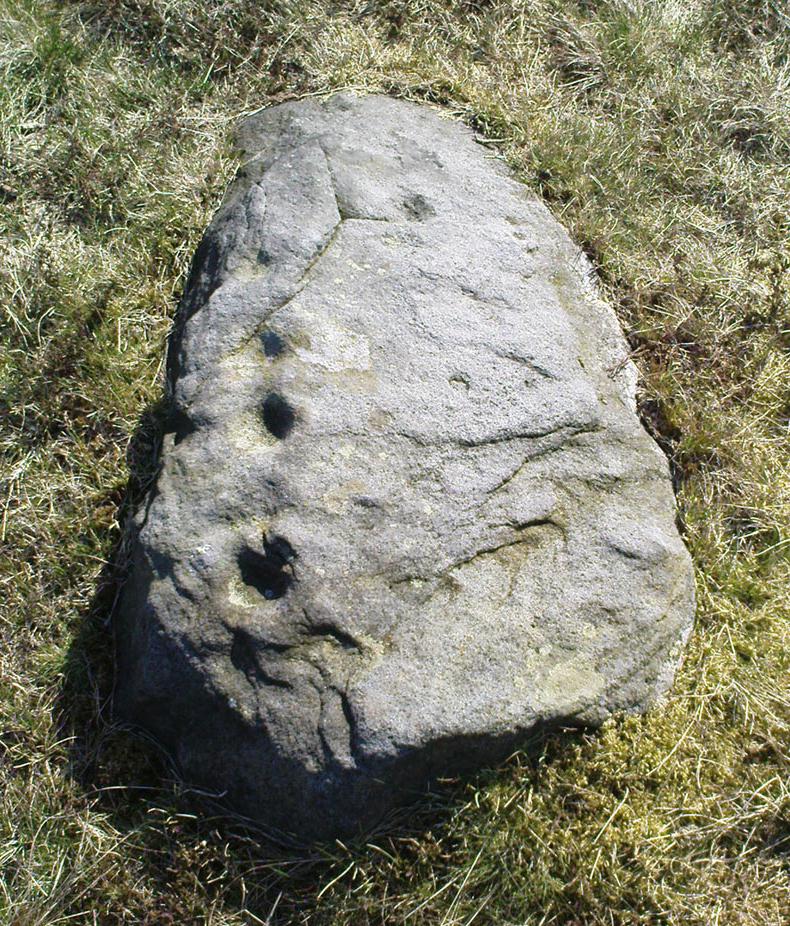
Close-up of 'cup-mark'
Close-up of ‘cup-mark’
Fenny Shaw Cup-Marked Stone

Follow the same directions to reach the Big Rock carving.  From here walk less than 100 yards up the slope, veering to your left and where you reach the rushes (Juncus grasses), walk up and keep your eyes peeled for the singular upright rock.  Or as ‘Redkiteyorks’ said, go “up the slope 82.4 metres, 54.5 degrees(True) from IAG108 (Big Rock).” It aint hard to find really…

Archaeology & History

Another stone mainly for the purists amongst you.  Little has been written on this possible carving.  Boughey & Vickerman (2003) said simply:

“Large rough rock. Two possible cups on top and one further possible cup on W vertical face. Doubtful”.

References:

  1. Boughey, K.J.S. & Vickerman, E.A., Prehistoric Rock Art of the West Riding, WYAS: Leeds 2003.
  2. Hedges, John (ed.), The Carved Rocks of Rombald’s Moor, WYMCC: Wakefield 1986.

© Paul Bennett, The Northern Antiquarian

Enclosure Stone, Bingley Moor, West Yorkshire

Cup-and-Ring Stone:  OS Grid Reference – SE 10983 43368

Also Known as:

  1. Carving no.99 (Boughey & Vickerman)

Getting Here

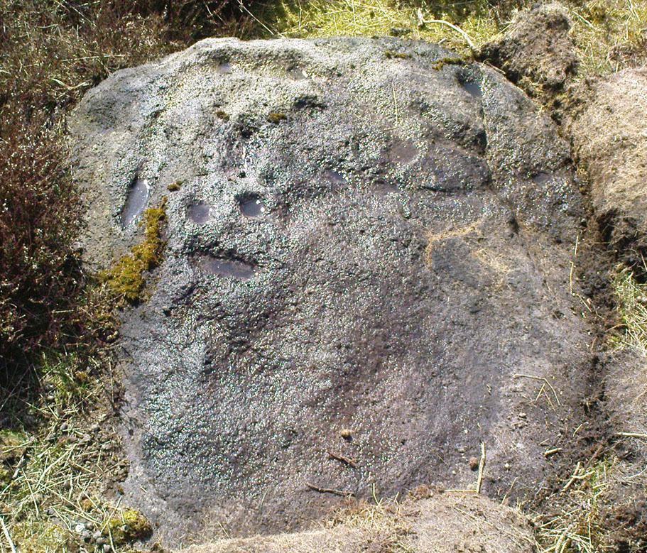
Enclosure Carving, Stanbury Hill

From East Morton village, take the moorland road, east, and up the steep hill.  Where the road levels out there’s a left turn where a trackway leads onto the moor.  Go up here & keep walking till you hit a moorland ‘footpath’ signpost.  Stop here and walk due west (your left) onto the gently sloping rise and into the mass of the Stanbury Hill enclosure system.  Keep walking for 200 yards or so, where the land begins to slope down to the end of the spur; and just 50 yards before it drops down to the stream below you’ll find a cluster of carved rocks like the Lunar Stone, the Teaspoon Rock, Spotted Stone, etc, all scattered about.  Near these, you’ll find this one!

Archaeology & History

Not to be confused with the carving of the same name on the northern side of these moors (near the Green Crag Slack enclosure), this carved rock gets its name specifically from looking like a lay-out plan of some settlement or enclosure.  It’s unlikely that this title or description has anything to do with the carving, but its the impression it gave me when I first saw it!  But then once you look at the carving from another angle it takes on a different impression.

Enclosure Carving from above

First thought to have been found by Stuart Feather in 1978, it is one of many carvings that occur in what seems to be an extensive prehistoric enclosure or settlement.  There’s a complete cup-and-ring near the western end of the rock, with another distinct cup-marking by its side, and what looks to be a natural cup at the top-end of the stone.  But it was the other section of the carving on the central and eastern side which intrigued me: a curious ‘enclosure’ of lines, with a cup-marking in each section.  Cutting between the cup-and-ring and the enclosure lines is a natural long crack or fissure running roughly north-south through the rock.  It seemed to me (though I could be wrong) that a line had been pecked running along this natural crack — although in Boughey & Vickerman’s (2003) drawing they don’t highlight this.  It also seemed that the carved lines from ‘enclosure’ linked up to the pecked line that was carved along the natural fissure in the rock (as illustrated in my crap drawing!).

Shit drawing of CR99

As with the Lunar Stone nearby: it appears that either this stone was carved at different periods; or else for a long period of time much of the stone was exposed to the elements, whilst a section of it remained covered.  For the distinct cup-and-ring on the western-end is more worn, with more eroded evidence of pecking, than the extended lines on the eastern end of the rock.  I need to go back here and get some better images — and certainly do a much better drawing!

References:

  1. Boughey, Keith & Vickerman, E.A., Prehistoric Rock Art of the West Riding, WYAS 2003.
  2. Hedges, John (ed.), The Carved Rocks on Rombalds Moor, WYMCC: Wakefield 1986.

© Paul Bennett, The Northern Antiquarian

Littlestone, Bingley Moor, West Yorkshire

Cup-Marked Stone:  OS Grid Reference – SE 11209 43488

Getting Here

Follow the directions to reach the nice Big Rock carving.  Once here, walk up the gentle slope less than 100 yards eastwards.  Get here before the heather grows back, otherwise it’s unlikely you’ll find it!

Archaeology & History

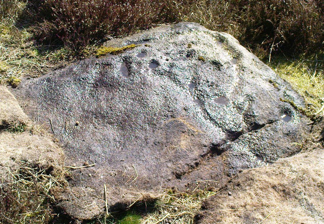
The Little Stone, Bingley Moor

Not previously catalogued, this is just a small trivial little stone with just a single cup-marking on it.  There’s a somewhat debatable line which looks more likely on the photo than when you actually see it in situ.  As we had the Big Rock just down the slope from here, I thought this could be a little rock, or Little Stone (makes sense!).  It was found by your very own Paul and those of you with the wills to seek it out, don’t be disappointed as most are with such a Littlestone. It’s certainly not as rosy as those close by, but hey – it’s another carved rock!

© Paul Bennett, The Northern Antiquarian

Teaspoon Rock, Bingley Moor, West Yorkshire

Cup-Marked Stone:  OS Grid Reference – SE 10997 43357

Also Known as:

  1. Carving no.104 (Boughey & Vickerman)*

Getting Here

Follow the same directions to reach the Lunar Stone carving.  Once here, amble about a few yards to your immediate south and you’ll find it — assuming the heather aint grown back over and covered it!

Archaeology & History

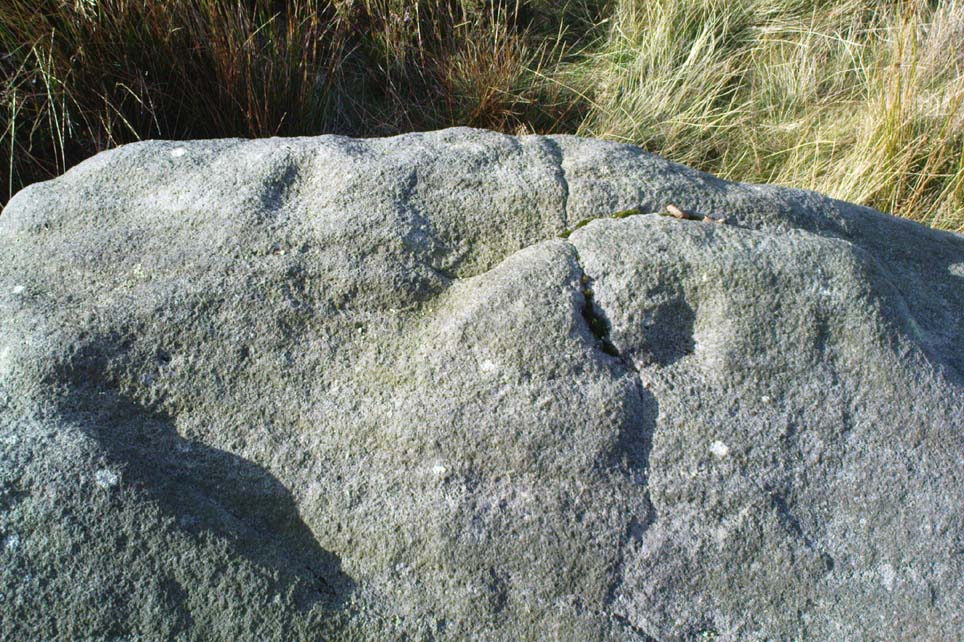
Teaspoon Rock, Stanbury Hill

This’d probably be another of those carvings first found by Stuart Feather in his amblings here in the 1970s, but we can’t say for sure.  In Boughey & Vickerman’s survey (2003), apart from attributing it as being in two separate positions (mistaking some reference from the English Heritage doods as some other carving – though that shouldn’t surprise anyone!),* they then correctly describe it as having “one cup with groove” running outwards — which we can see quite plainly (lending Michala Potts to say, “it reminds me of a teaspoon!” – hence the title!).  There may be as many as four other cups on this rock, though it’s hard to say for sure.  Two of them, perhaps, may have a very worn line linking them together (as you can slightly work out on the top-half of the carving) — but again, this is hard to say for sure.  Certainly this poor little carving aint quite as decorative as its nearby partners!

References:

  1. Boughey, Keith & Vickerman, E.A., Prehistoric Rock Art of the West Riding, WYAS 2003.

* In their survey this stone was also listed as carving no.98 by mistake, which should now be deleted from subsequent survey listings.

© Paul Bennett, The Northern Antiquarian

Ringtail Stone, Stanbury Hill, Bingley Moor, West Yorkshire

Cup-and-Ring Stone:  OS Grid Reference – SE 10970 43348

Also Known as:

  1. Carving no.96

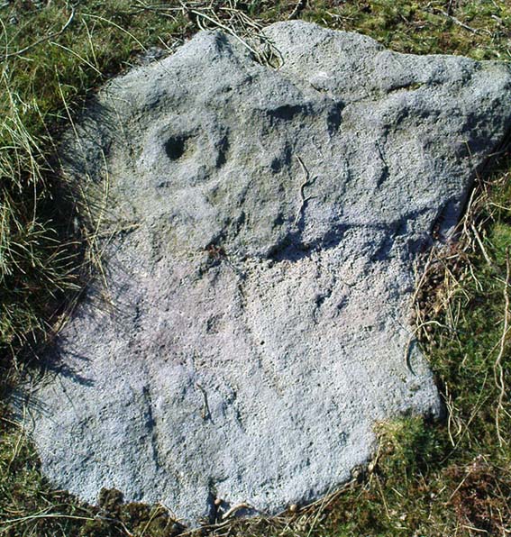
Ringtail Stone carving

Getting Here

Follow the same directions to find the Lunar Stone.  Once here, walk just 20 yards southwest and keep your eyes peeled!  This is a long flat stone which can easily get overgrown in the heather, so you might need to search around till you find it.

Archaeology & History

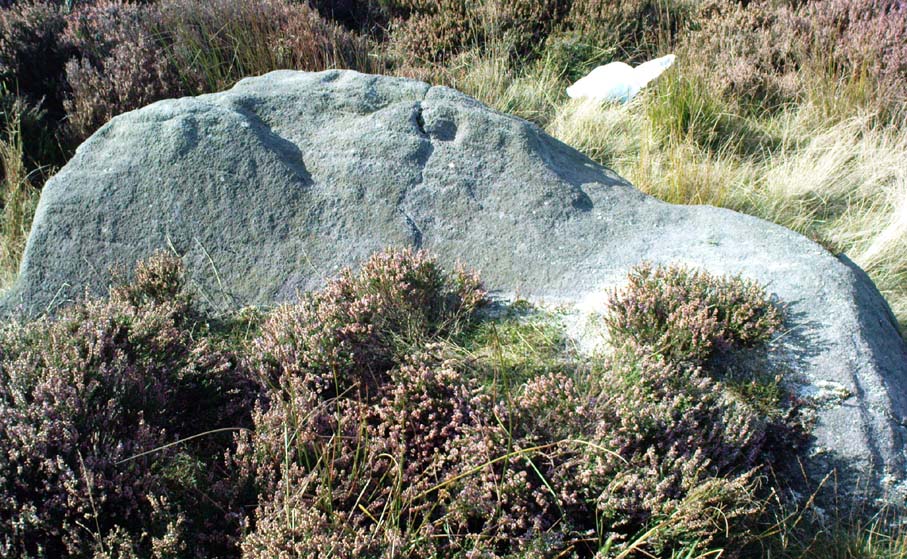
Ringtail Stone - facing south
Ringtail Stone, Stanbury Hill

Thought to be another carving first located by Stuart Feather in 1978, though we can’t bne totally sure on that.  Curiously omitted from Hedge’s (1986) survey, this old glyph comprises of a single cup-mark near the western end of the stone and a complete cup-and-ring at the eastern-end.  It was first illustrated in Boughey & Vickerman’s (2003) fine survey, but they missed seeing a quite distinct line or ‘tail’ coming out the northern side of the cup-and-ring.  Nowt special in archaeological terms, but of obvious relevance to the dood who carved it! They thought there may have been two faint cups in the ring, but it isn’t clear by any means.

As with the other carvings nearby, we find it amidst a scattering of prehistoric walling and the remnants of old cairns.

References:

  1. Boughey, Keith & Vickerman, E.A., Prehistoric Rock Art of the West Riding, WYAS 2003.

© Paul Bennett, The Northern Antiquarian

Stanbury Hill Enclosure, Bingley Moor, West Yorkshire

Enclosures:  OS Grid Reference – SE 109 433

Getting Here

Follow the same directions as to find the Lunar Stone, Spotted Stone, etc.  Go thru East Morton village up the steep moorland road, east, and where the road levels out there’s a right turn and a trackway on your left which leads onto the moor.  Go ½-mile up this track till you hit a moorland ‘footpath’ signpost.  Stop here and walk due west (left) for a coupla hundred yards.  If the heather’s grown back you aint much chance of finding owt – but if there’s only low growth, amble about zigzagging – and keep your eyes peeled!

Archaeology & History

Section of cairn rubble & walling

Although there’s been no written record of the Stanbury Hill remains until very recently, it seems quite probable that Mr Stuart Feather would have come across at least parts of these remains when he uncovered the rock-art in the same vicinity, but he never made public his finds.  He was a diligent researcher and finder of cup-and-ring stones, nose to the ground sorta chap, and it would be odd for him to miss the other remains on this hill.  For as we now know, there are undeniable evidences of considerable neolithic and/or Bronze Age walling scattered along (mainly) the southern side of Stanbury Hill, running mainly along an east-west axis, but there are also examples of the walling running roughly north-south.  In at least one position near the western end of the ridge, halfway down the south-facing slope, is what seems to be the unmistakable trace of an enclosed hearth.  At the time of writing a series of archaeological digs are, slowly, being done hereabouts, so it will be good to read their final evaluations.

Very close to some parts of the walling we find the remains of old cairns, and at least one cup-and-ring stone has been carved along the axis of one line of walling (it reminded me very much of the Bronze Age settlement remains found at Snowden Moor, over the northerly horizon, in the Washburn Valley).  Several other previously unreported cup-marked stones have also been found here (we’ll highlight them on TNA in the coming weeks).

Upon first impression the remains found upon and around Stanbury Hill seem more related to mortuary practices than what we’d call ‘domestic’ living practices, as the prevelance of carvings and cairns indicates.  But we’ve gotta be cautious here, as in many sites the dead were kept with the living; and as we find in many traditional or aboriginal cultures, the land of spirits and that of the living are much more closely allied than in our profane ‘Western’ paradigm.

More from this site in due course…

© Paul Bennett, The Northern Antiquarian