Castleton (5f), Airth, Stirlingshire

Cup-Marked Stone:  OS Grid Reference – NS 85584 88087

Archaeology & History

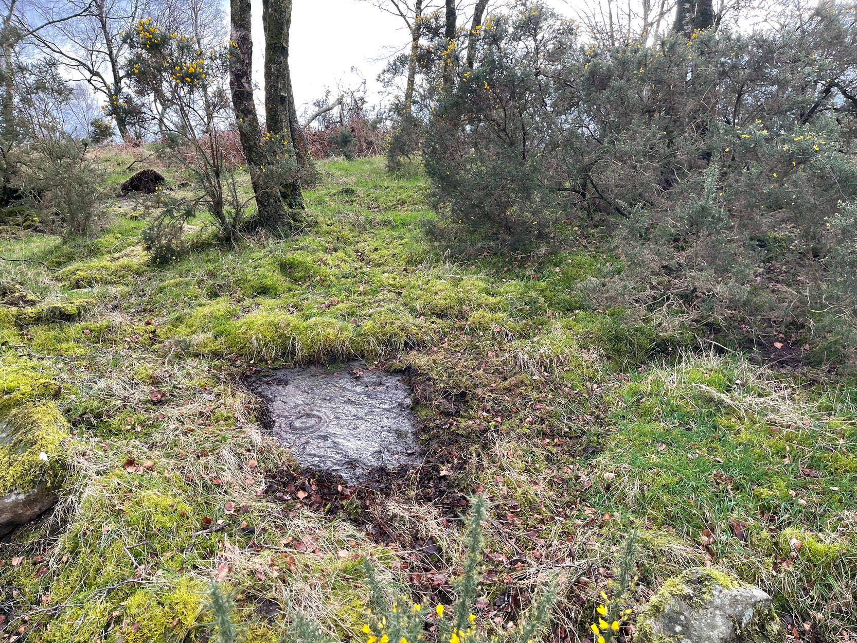
As with other carvings in this locale, the name of the stone is based on a survey done by Maarten van Hoek. (1996)  It’s a pretty simplistic design within the impressive Castleton complex, found at the southeastern end of the gorse-covered rocky ridge, about 70-80 yards west of the farmhouse.  It was uncovered on a visit here by Nina Harris, Paul Hornby, Frank Mercer and Lisa Samson on Sunday 19 November, 2018.

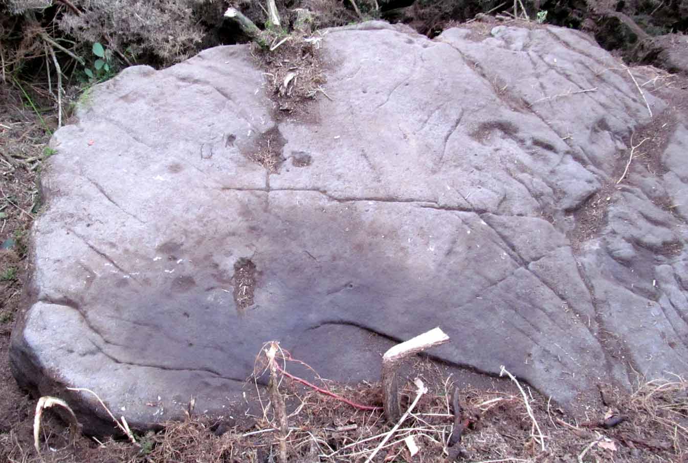
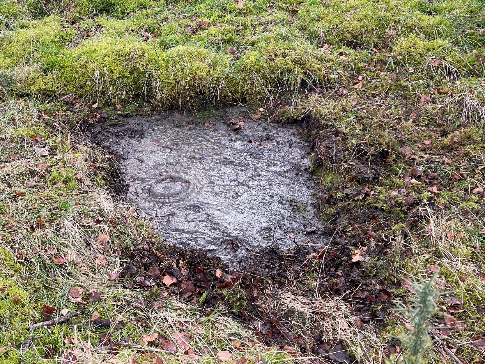
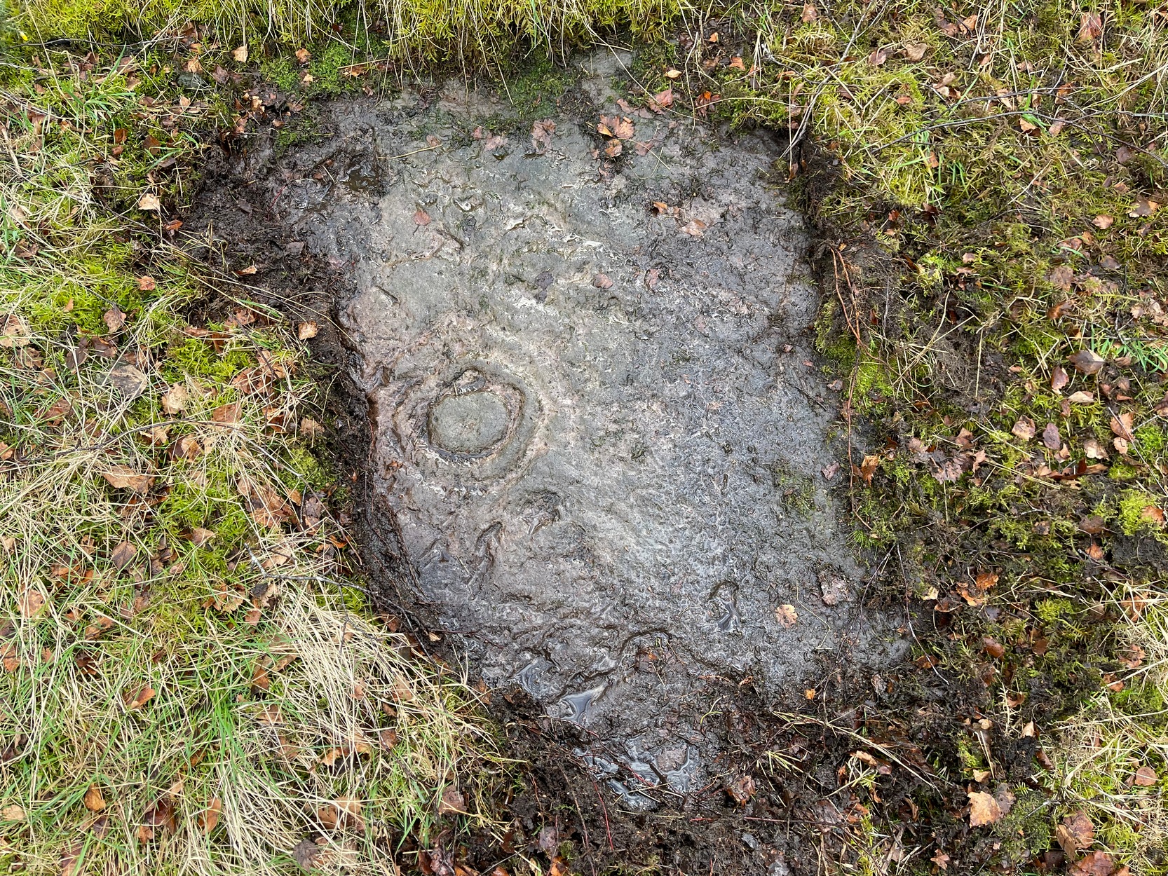
The cup-marked stone
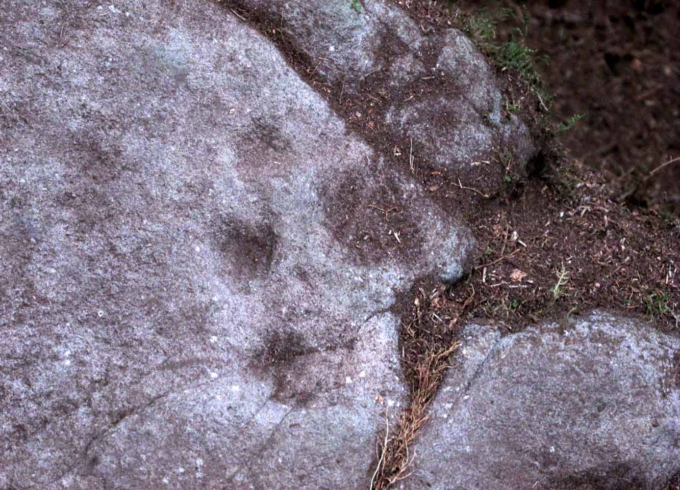
Large cup & arc of 3

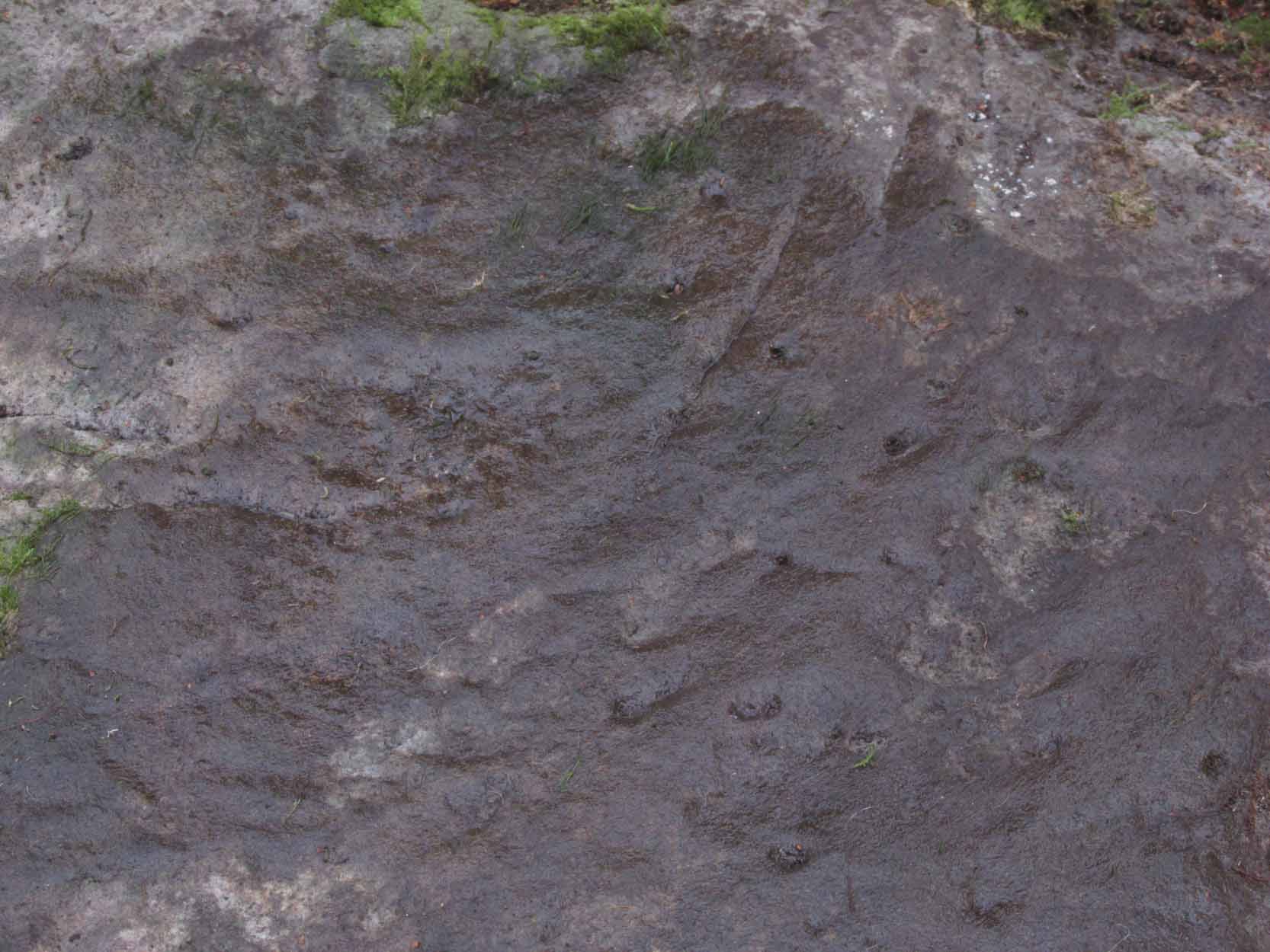
Unlike the others in the Castleton complex, this carving is probably of interest only to the hardcore petroglyph hunters.  The design consists of at least ten cup-marks on the uncovered section of the rock, one of which appears to have a broken circle with two ‘entrances’ either side of it, so to speak.  The most notable element in the design is close to the edge, where an arc of three cups almost corners a larger cup right at the edge.   There may be more carved elements to be found on the westerly side of the stone, which was covered in deep vegetation when we came here.

References:

  1. van Hoek, Martin A.M., “Prehistoric Rock Art around Castleton Farm, Airth, Central Scotland,” in Forth Naturalist & Historian, volume 19, 1996.

© Paul BennettThe Northern Antiquarian


Castleton (2), Cowie, Stirling, Stirlingshire

Cup-and-Ring Stone:  OS Grid Reference – NS 85494 88272

Also Known as:

  1. Castleton 9 (van Hoek)

Getting Here

Castleton 2 carving, Airth

If you’re travelling from Stirling or Bannockburn, take the B9124 east to Cowie (and past it) for 3¾ miles (6km), turning left at the small crossroads; or if you’re coming from Airth, the same B9124 road west for just about 3 miles, turning right at the same minor crossroads up the long straight road. Drive to the dead-end of the road and park up, then walk back up the road 350 yards to the small copse of trees on your left.  Therein, some 50 yards or so, zigzag about!

Archaeology & History

Petroglyphs can be troublesome things at the best of time: not only in their ever-elusive root meanings, but even their appearance is troublesome!  This example to the east of Cowie in the incredible Castleton complex is one such case.  It is undoubtedly a multi-period carving, probably first started in the neolithic period, added onto in the Bronze Age, and maybe even finished in the early christian period.  You’ll see why!

It’s been described several times in the past, with Maarten van Hoek (1996) telling how it was rediscovered,

“by Mrs Margaret Morris in 1986 in the birch-coppice at Castleton Wood. A fragment of outcrop rock with a distinct cup-and-three-rings, rather oval-shaped like others in the area.”

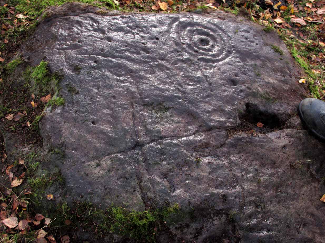
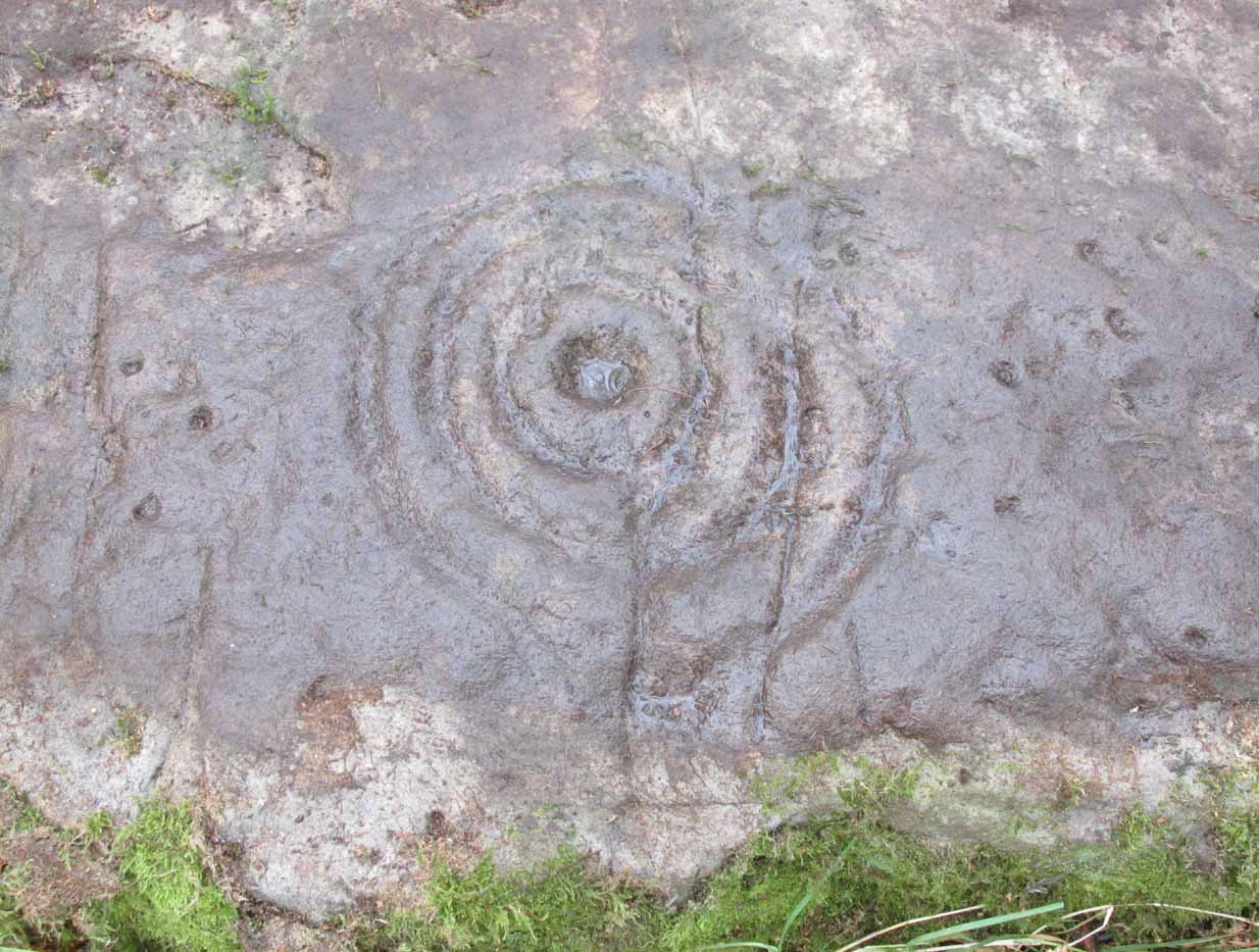
The main cup-and-3-rings (photo, Paul Hornby)

But as our own team found out, there’s more to it than that.  Like many of the Castleton carvings, vital elements have been missed in the previous archaeological assessments.  But it’s an easy thing to do.  The carved design here almost ebbs and flows with daylight, shadows, changes in weather, bringing out what aboriginal and traditional peoples have always told us about rock itself, i.e., it’s alive, with qualities and virtues that can and do befuddle even that great domain of ‘objectivity’—itself an emergent construct of an entirely subjective creature (humans).  But that’s what petroglyphs do!—whether they are part of a living tradition, or lost in our striving modernity, exhibiting once more that implicit terrain of animism.  And this carving exemplifies it very clearly.

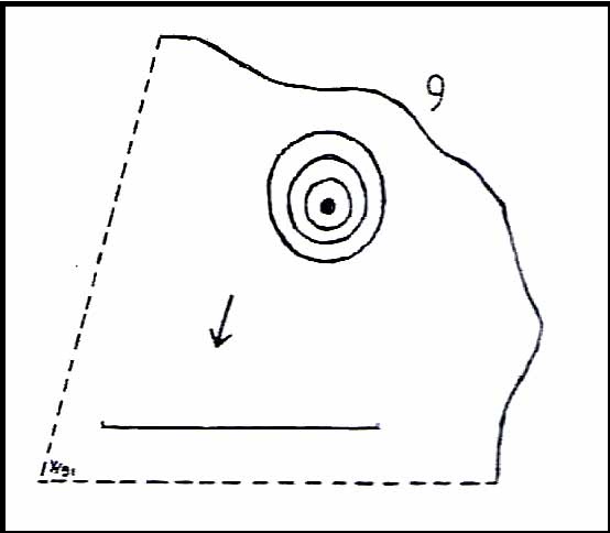
The primary visual design is the odd triple-ring, which isn’t quite as clear-cut as the earlier descriptions would have you think.  In the drawing below by van Hoek (1996), three complete elliptical ‘rings’ are shown; whereas on its northern edge where the outer ring is closest to the rock edge, we find that the ‘ring’ has carved lines that run off and down the slope of the stone towards ground-level.  It also seems that from the inner second-ring, a natural scar in the rock has been heightened by pecking, creating an artificial carved line running from near the centre and ‘out’ of the three rings.  You can make this out in the accompanying photo, above.

van Hoek’s 1996 sketch
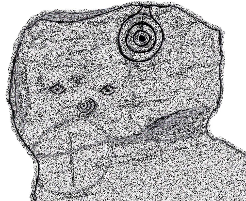
The more complete design

Additionally we found two very faint carved ‘eyes’ or trapezoids pecked onto the stone, obviously at a much earlier date than the notable triple-ring—which could almost be modern!  They would no doubt have excited the old archaeologist O.G.S. Crawford (1957), whose curious theory of petroglyphs was that they were images of some sort of Eye Goddess.  Archaeo’s can come out with some strange ideas sometimes…

Fainter still was another triple-ring—albeit incomplete—with what appears to be a very small central cup-mark, just below and between the two ‘eyes’.  It was first noticed by Paul Hornby when he was playing with the contrast settings on his camera, in the hope of getting clearer photos of any missing elements.

Very faint triple-ring, bottom-left of photo (photo by Paul Hornby)

“Can you see this?” he asked.  And although very faint indeed (on most days you can’t see it at all), it’s undoubtedly there: another multiple-ringer all but lost by the erosion of countless centuries, and older still than the ‘eyes’ above it.  In all the photos we took of this stone, from different angles in different weathers (about 100 in all), this very faint triple-ring can only be seen on a handful of images.  But it’s definitely there and you can see it faintly in the attached image (right) to the bottom-left.

A final note has to be made of a possible unfinished, large circular section with a cross carved into the natural feature of the stone, first noticed by Lisa Samson.  It’s uncertain whether this has been touched by human hands (are there any geologists reading?), but it’s something that we’re noticing increasingly at more and more petroglyph sites.  They’re not common, but it has to be said that we found two more man-made ‘crosses’ attached to multiple cup-and-rings near Killin just a few weeks ago.  Also, folklore tells us that not far from this Castleton cluster, a christian hermit once lived….

References:

  1. Crawford, O.G.S., The Eye Goddess, Phoenix House: London 1957.
  2. Morris, Ronald W.B., The Prehistoric Rock Art of Southern Scotland, BAR: Oxford 1981.
  3. van Hoek, M.A.M.,”Prehistoric Rock Art around Castleton Farm, Airth,” in Forth Naturalist & Historian, volume 19, 1996.

Acknowledgements:  Huge thanks as always to Nina Harris, Fraser & Lisa Harrick, Paul Hornby, Penny & Thea Sinclair, for their additional senses and input.

© Paul BennettThe Northern Antiquarian


Castleton (2b), Cowie, Stirlingshire

Cup-and-Ring Stone:  OS Grid Reference – NS 85520 88214

Getting Here

Castleton (2) carving

If you’re coming via Castleton Farm, at the back of the farm go through the gate on the right, by the corner of the field and walk along the line of the wall for 200 yards  northwest until you approach the small copse of trees ahead of you.  Just before the trees, instead, walk up the slope, SW, to the other small copse, and about 15 yards along the line of trees, go into them.  Keep your eyes peeled on the upwards sloping ground where a gap in the greenery shows you the stone in question!

Archaeology & History

This is an odd one.  Amidst the array of truly ancient and well-eroded multiple cup-and-ring stones in the incredible Castleton complex, this small design on the northeast slope away from the main cluster, has a distinctly different appearance about it when we compare it to the others along the ridge.  It’s not been done by the same person or people who carved the more ornate designs close by.  Indeed, it seems that it wasn’t even done at the same period but has a history that is much more recent.

The carving, as you can see in the photos, has a somewhat scruffy look about it when compared to the more usual designs.  If it’s prehistoric, it has the hallmarks of being done by someone with rock art dyslexia!  My own view is that it’s a pretty recent carving. It’s possible, perhaps, that it may have been executed by a medieval christian priest who lived a short distance to the east and whose cross markings are evident on at least one of the other cup-and-rings hereby.  But the carving might be even more recent: perhaps 19th Century in origin.  It just doesn’t have that air of authenticity about it, as any seasoned petroglyph officionado would tell you.  And we have to bear in mind that this was the site of a quarry in the 18th and 19th century, so the carving might have been done at that time by one of the workers to mimic the very ancient and faded designs close by.  Anyhow…

The design consists of two distinct and deeply carved rings around a central raised point, in which it looks as if someone started to create a cup-mark, but never finished the job!  The same can be said of an third outer-ring, whose faint outline is clearly visible in decent light, but which was started but never finished.  Make of it what you will.  When we first found this carving in 2019, someone had been up and already peeled back the turf (“there were a group o’ folk,” the farmer told me), thankfully showing the carving in its crude glory.  The Canmore website informs us that the stone was first unfurled by George Currie in 2006, who said that it was little more than “a ring surrounded by a central boss”—but there’s clearly more to it than that and I wonder if this is actually the same carving that Mr Currie found.

Note: The name of this and the other carvings in the Castleton complex need completely re-designating into an accurate order, as they’ve been defined and redefined by various authors and groups over the years, leaving them in a disorganized haphazard mess.

© Paul BennettThe Northern Antiquarian

Lady Well, Airth, Stirlingshire

Holy Well (destroyed):  OS Grid Reference – NS 89801 86524

Also Known as:

  1. Canmore ID 46862
  2. Lady’s Well
  3. Spaw Well

Archaeology & History

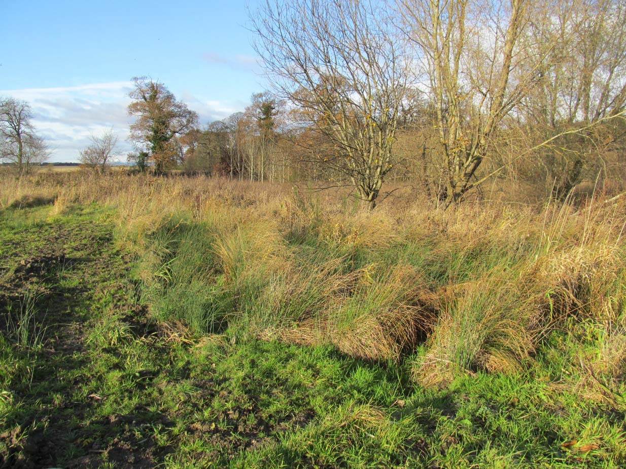
Site of the Lady Well, Airth

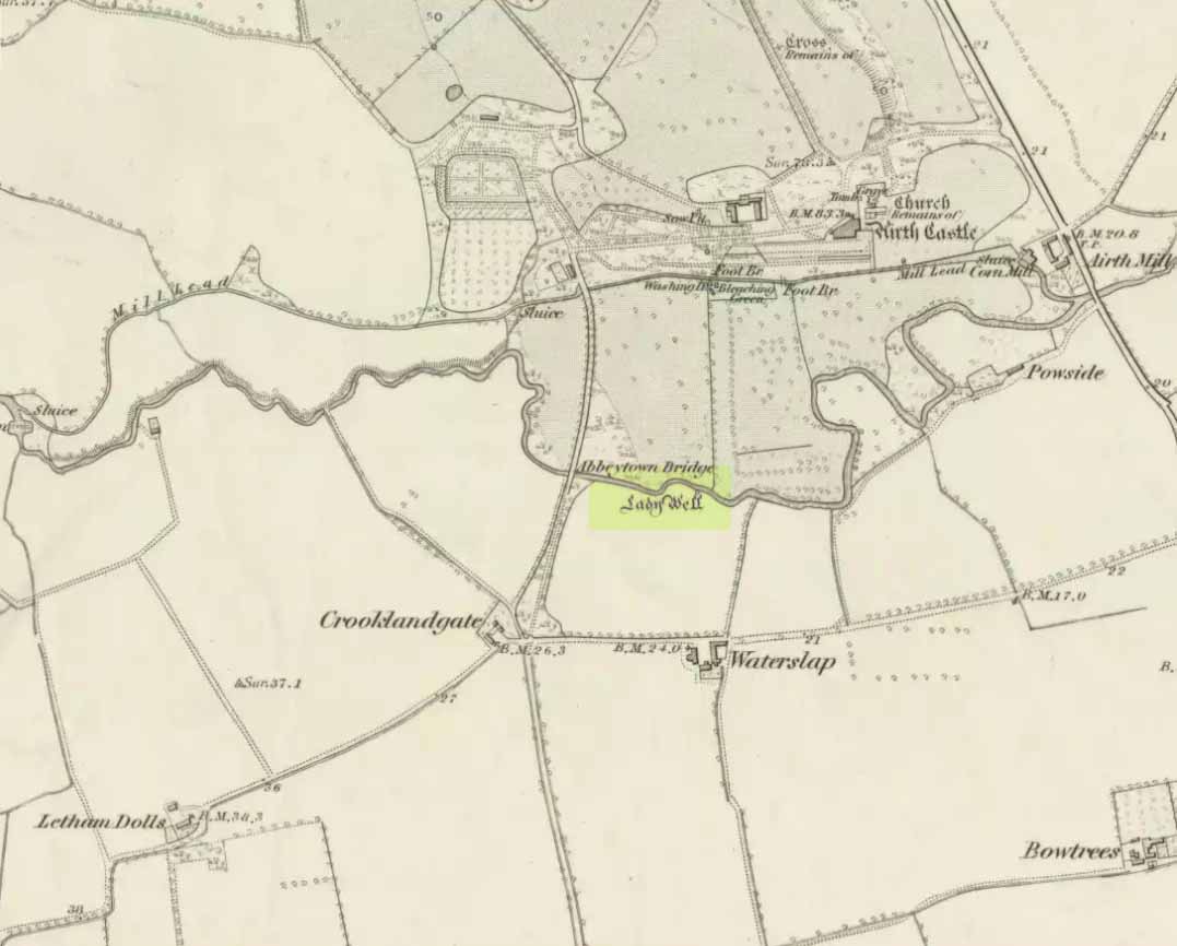
Once to be seen flowing on the south-side of the Pow Burn below Airth Castle, all traces of this once sacred site has fallen prey to the usual advance of the so-called ‘civilized’.  In literary terms, the site was first described in church records from 1657—as Ladieswell—and the accounts we have of the place from then are most revealing in describing the traditional use of the place by local people.  It was a sacred site, obviously, chastised by the madness of the christian regime of the period, in their attempt to destroy indigenous customs and societal norms.  William Hone (1837) gave an extended account of what some people were up to here in his Everyday Book:

“In 1657, a mob of parishioners were summoned to the session, for believing in the powers of the well of Airth, a village about six miles north of Falkirk, on the banks of the Forth, and the whole were sentenced to be publicly rebuked for the sin. –

“”Feb. 3, 1757, Session convenit. Compeared Bessie Thomson, who declairit scho went to the well at Airth, and that schoe left money thairat, and after the can was fillat with water, they keepit it from touching the ground till they cam horm.”

“”Ffebruary 24. — Compeired Robert Fuird who declared he went to the well of Airth, and spoke nothing als he went, and that Margrat Walker went with him, and schoe said ye beleif about the well, and left money and ane napkin at the well, and all was done at her injunction.”

“”Compeared Bessie Thomson declarit schoe fetch it horn water from the said well and luit it not touch the ground in homcoming, spoke not as sha went, said the beleif at it, left money and ane nap-kin thair; and all was done at Margrat Walker’s command.”

“”Compeired Margrat Walker who denyit yat scho was at yat well befoir and yat scho gave any directions ”

“”March 10. Compeared Margrat Forsyth being demand it if scho went to the well of Airth, to fetch water thairfrom, spok not by ye waye, luit it not touch ye ground in homcoming? if scho said ye belief? left money and ane napkin at it? Answered affirmatively in every poynt, and yat Nans Brugh directit yem, and yat they had bread at ye well, with them, and yat Nans Burg said shoe wald not be affrayit to goe to yat well at midnight hir alon.”

“”Compeired Nans Burg, denyit yat ever scho had bein at yat well befoir.”

“”Compeired Robert Squir confest he went to yat well at Airth, fetchit hom water untouching ye ground, left money and said ye beleif at it.”

“”March 17. Compeired Robert Cochran, declairit, he went to the well at Airth and ane other well, bot did neither say ye beleif, nor leave money.”

“”Compeired Grissal Hutchin, declairit scho commandit the lasses yat went to yat well, say ye beleif, but dischargit hir dochter.”

“”March 21. Compeired Robert Ffuird who declairit yat Margrat Walker went to ye well of Airth to fetch water to Robert Cowie, and when schoe com thair, scho laid down money in Gods name, and ane napkin in Robert Cowie’s name.”

“”Compeired Jonet Robison who declairit yat when scho was seik, Jean Mathieson com to hir and told hir, that the water of the well of Airth was guid for seik people, and yat the said Jean hir guid sister desyrit hir fetch sum of it to hir guid man as he was seik, bot sho durst never tell him.”

“”These people were all 44 publicly admonishit for superstitious carriage.””

The practices continued.  In 1723, a Mr Johnstoun of Kirkland, writing about the parish of Airth, also told of the reputation of the well, saying,

“Upon the south side of the Pow of Airth, upon its very edge, is a spaw well famous in old times for severall cures, and at this day severalls gets good by it, either by drinking or bathing. Its commonly called by the name of Ladies well. Its about two pair of butts below Abbytown bridge.”

The fact that he told us it was “good for bathing” suggests a pool was adjacent, or at least the tiny tributary between it and the Pow Burn gave room for bathing and had a curative reputation. (there are many pools in the Scottish mountains with this repute – some are still used to this day!)

It was then described by Robert Ure in the first Statistical Account of 1792, where he told how the people were still using the waters, despite the crazy early attempts to stop them.  “There is a Well, near Abbeytown Bridge,” he told,

“called Lady-Well, which is thought to be medicinal.  Numbers have used it, and still use it as such.  It is supposed to have obtained that name, from the holy water, in the time of Popery, being taken from it, to supply the abbacy, or Catholic Church, then at Airth.”
Lady Well on 1865 map

But we know that its origins as a celebrated well pre-date any christian overlay.  People were reported visiting the site from as far away as Edinburgh, such was its repute!

Much later when the Ordnance Survey lads came here, showing it on their first map of Airth, they made their own notes of the place, saying briefly,

“A small well close to the Pow Burn – it is supposed to have derived its name from the Custom of dedicating wells to the Virgin Mary – so Common prior to the Reformation. It is not a mineral well.”

Ugly plastic pipe is all that remains

But its demise was coming.  In the wake of the christian Industrialists and their myth, subsuming the necessary integral sacrality of the Earth, the waters of the well were eventually covered.  When the Royal Commission (1963) lads gave the site their attention in October 1954, they reported that “no structural remains” of any form could be seen here, and in recent years all trace of the well has vanished completely.  When we visited the site a few months ago, perhaps the very last remnant of it was a small plastic pipe sticking out of the muddy bankside, dripping dirty water into the equally dirty Pow Burn.

It would be good if local people could at least put a plaque hereby to remind people of the history and heritage that was once so integral to the way they lived their lives.

References:

  1. Bennett, Paul, Ancient and Holy Wells of Stirling, TNA 2018.
  2. Fraser, Alexander, Northern Folk-lore on Wells and Water, Advertiser Office: Invermess 1878.
  3. Frost, Thomas, “Saints and Holy Wells,” in Bygone Church Life in Scotland (W. Andrews: Hull 1899).
  4. Hone, William, The Every-day Book – volume 2, Thomas Tegg: London 1837.
  5. MacFarlane, Walter, Geographical Collections Relating to Scotland – volume 1, Edinburgh Universoty Press 1906.
  6. MacKinlay, James M., Folklore of Scottish Lochs and Springs, William Hodge: Glasgow 1893.
  7. Morris, Ruth & Frank, Scottish Healing Wells, Alethea: Sandy 1982.
  8. Murray, G.L., Records of Falkirk Parish – volume 1, Duncan & Murray, Falkirk 1887.
  9. Reid, John, The Place-Names of Falkirk and East Stirlingshire, Falkirk Local History Society 2009.
  10. Royal Commission on the Ancient & Historical Monuments Scotland, Stirling – volume 2, HMSO: Edinburgh 1963.

© Paul BennettThe Northern Antiquarian