Glen Cochill Cairnfield (01), Little Dunkeld, Perthshire

Cairns:  OS Grid Reference – NN 9035 4145
Getting Here

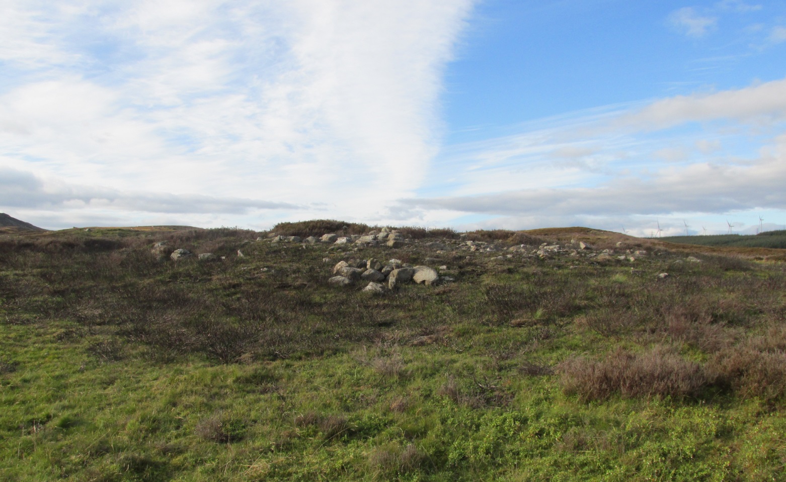
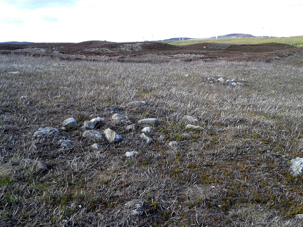
Two of at least five cairns hereby

Two of at least five cairns hereby

Take the A826 road south out of Aberfeldy, uphill, till you reach the White Cairn or Carn Ban, then follow the dirt-track for 700 yards onto the moors until you reach the Glen Cochill Circle 1.  From here, look at the large stone atop of the very notable rounded hillock barely 50 yards east (at NN 90367 41478) and meander on the slopes immediately below it on the south and west.  If the heather’s grown back, you don’t stand a chance!

Archaeology & History

As far as I’m aware, despite there being some brief notes of cairnfields in and around the rich prehistoric arena of Glen Cochill, I can find no data indicating that the five small single cairns a short distance south and southeast of the Glen Cochill Ring (01), have been described before.
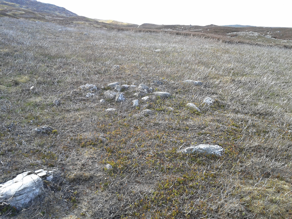
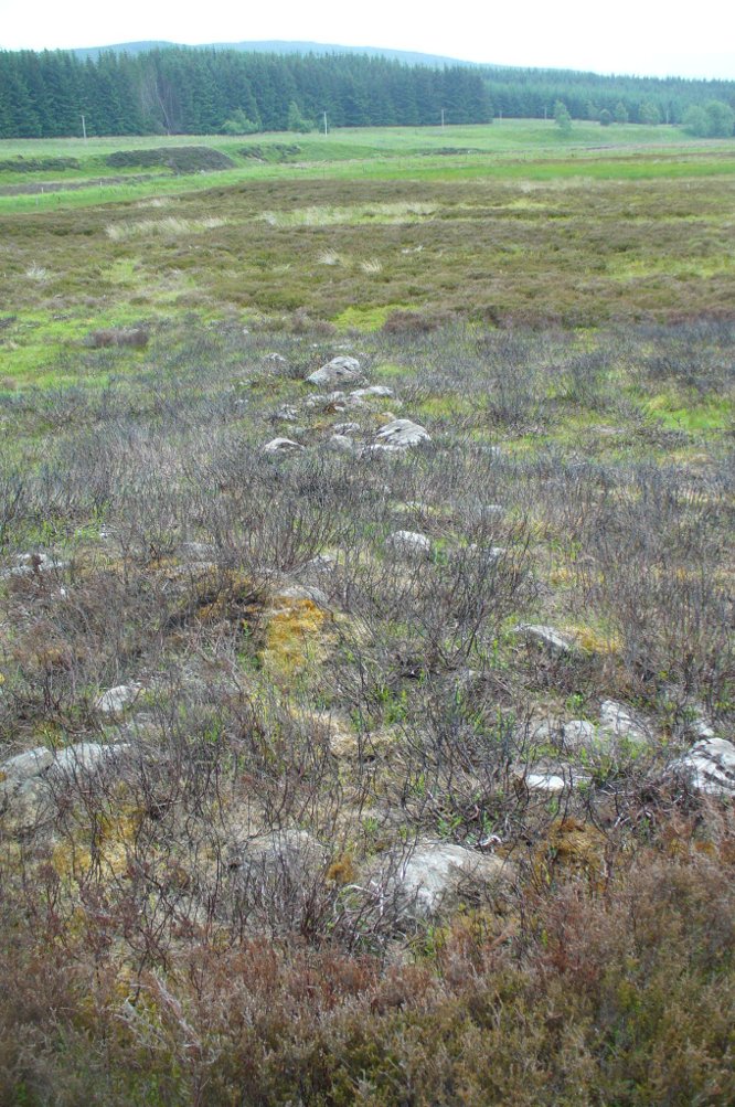
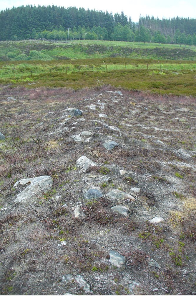
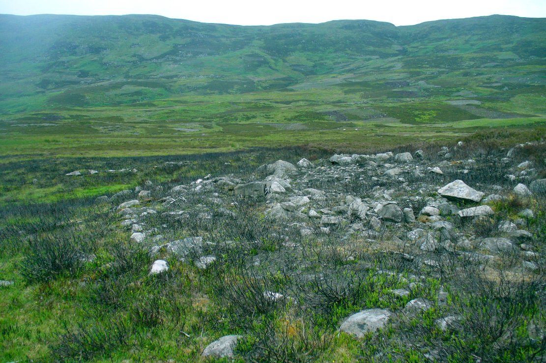
Cairn 1 - looking north

Cairn 1 – looking north

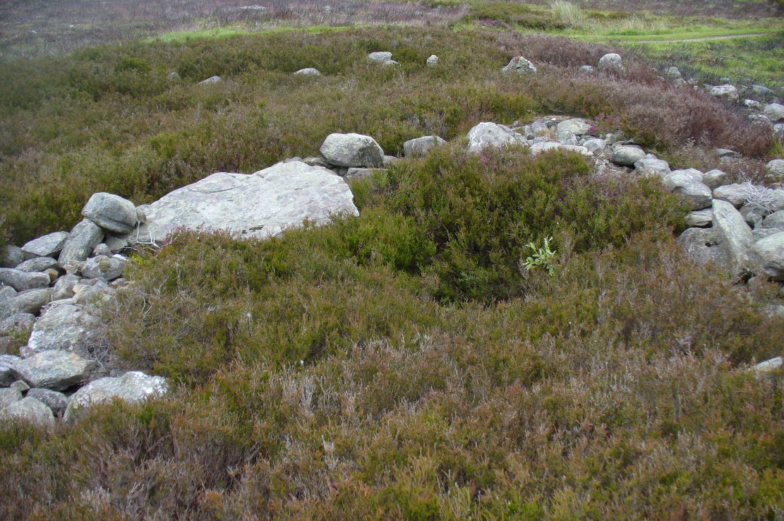
Cairn 2 - looking north

Cairn 2 – looking north

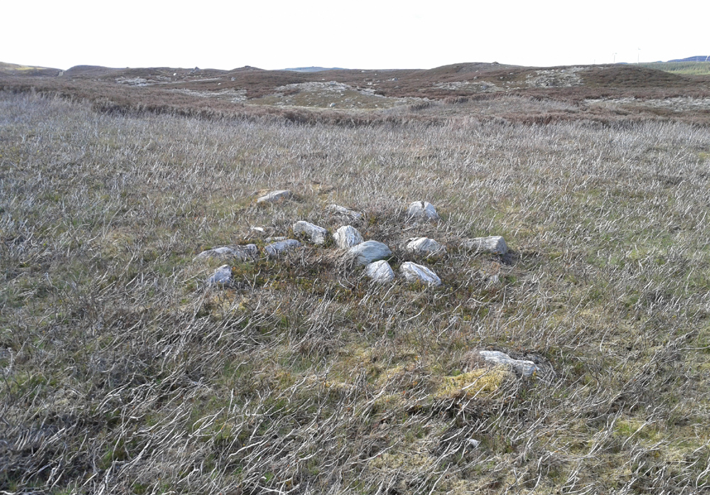
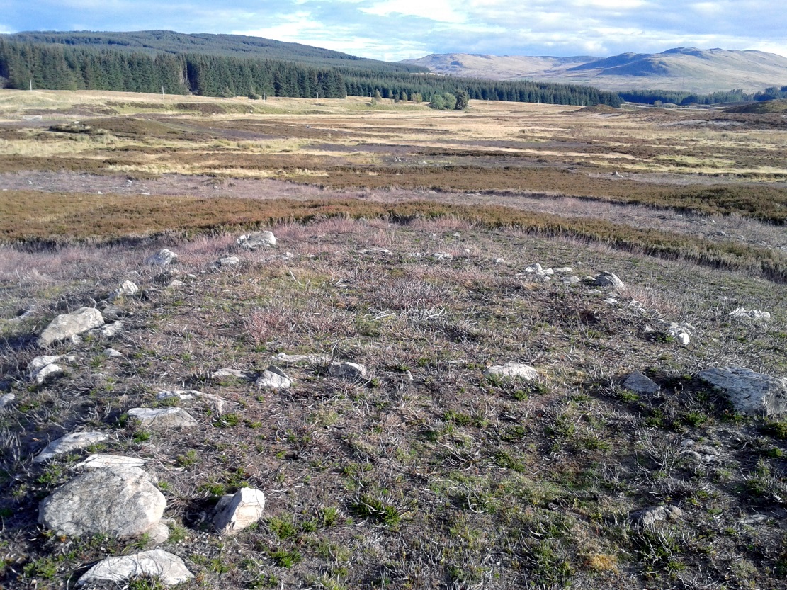
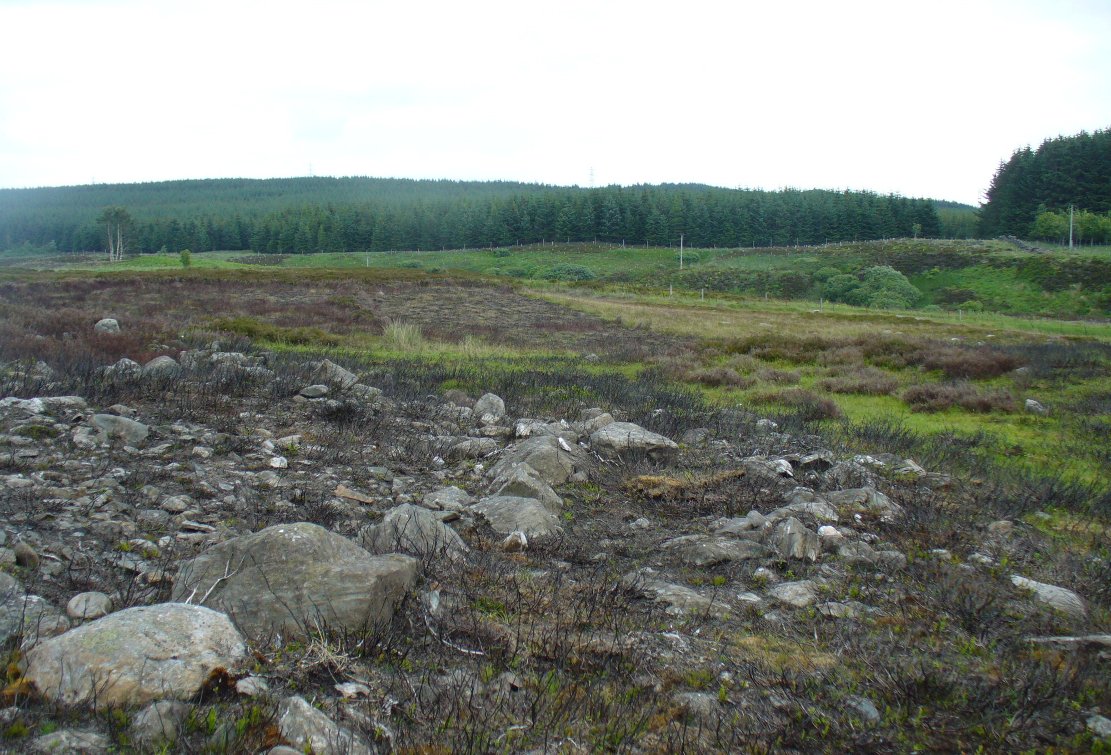
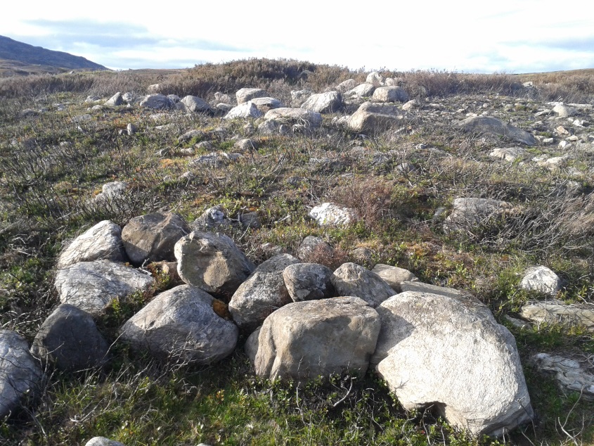
Deeply embedded into the peat, they are only visible when the heather has been burnt away, as highlighted in the accompanying photos.  Each cairn is of roughly the same size and structure: 2-3 yards across and only a couple of feet above ground-level, consisting of the traditional small rounded stones, each probably constituting a single burial or cremation.

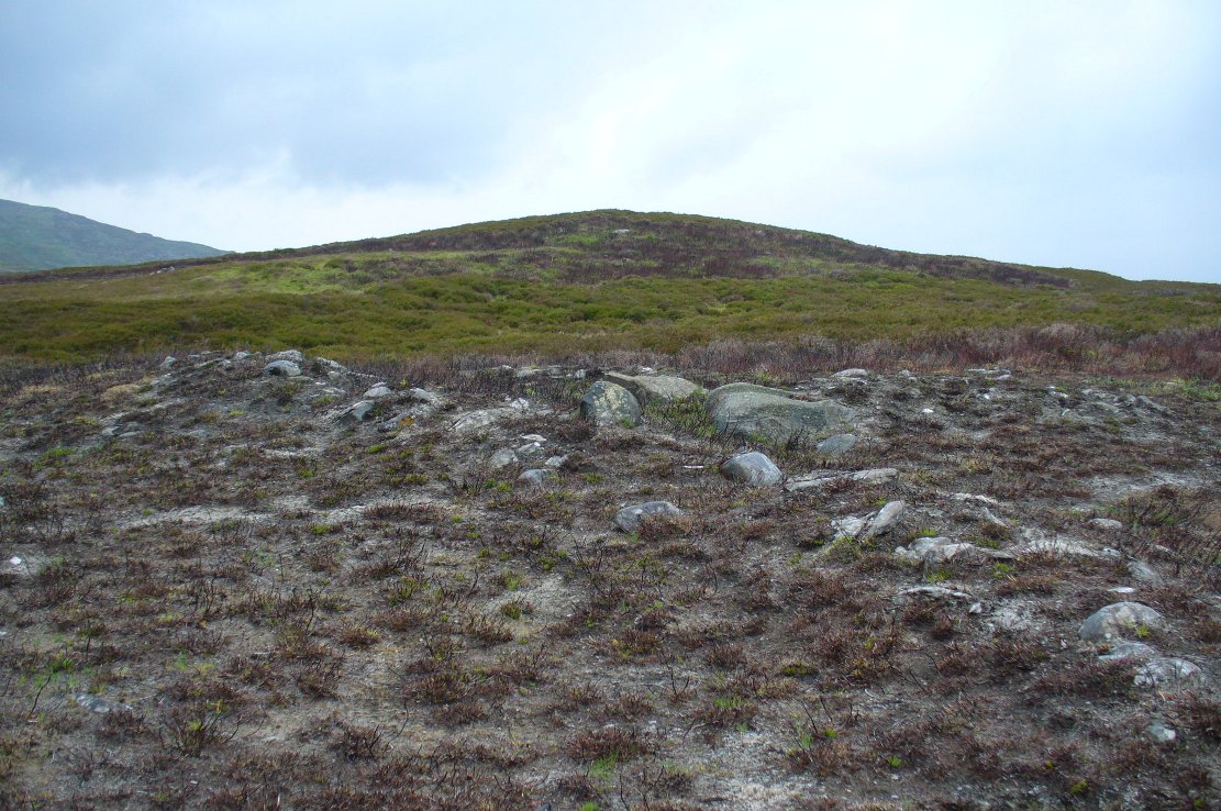
Cairn 4, below the hilltop rock

Cairn 4, below the hilltop rock

Of at least five cairns that we found here (there may be others beneath the covering heather), it was very notable that they’re on edges of a rounded pyramidal hillock, whose top is surmounted by a large pointed stone – probably a glacial erratic.  We looked at this rock in the hope of finding some cup-markings, but there were none.  However, it seemed as if the cairns and this crowning stone were related to each other, as if rites for the dead were proclaimed here for those in the tombs.  It may sound silly, but go there and take a look at it yourselves – before the heather grows back.  Just as a priests today, and shamans throughout history, have used an altar or plinth to make commemorations to the dead, so this crowning stone may equally have been used.  It makes sense.  And, as if to add validating ingredients: if we look east, past the crowning stone and across the River Cochill, we see the great rocks in the forest known as Creag a Bhaird, or the Crag of the Bard, from whence orations and tales were known to be told… But that’s another site with its very own story…

Acknowledgements:  Once again, thanks must be given to Mr Paul Hornby for his help in finding these sites.

© Paul BennettThe Northern Antiquarian


Glen Cochill (01), Little Dunkeld, Perthshire

Cup-Marked Stone:  OS Grid Reference – NN 90800 39842

Also Known as:

  1. Canmore ID 87710

Getting Here

Glen Cochill's cup-marked stone

Glen Cochill’s cup-marked stone

Along the A826 road south out of Aberfeldy, make your way towards the impressive giant Carn Ban of Glen Cochill.  Nearly a mile past the cairn further down the road, keep yer eyes peeled for the straight line of walling reaching up onto the moors.  About 100 yards before the wall, go over a ruined metal gate by the roadside up and onto the moor.  Walk straight uphill for barely 50 yards until you’re on the level, then walk left for 50 yards or so again. Yer damn close!

Archaeology & History

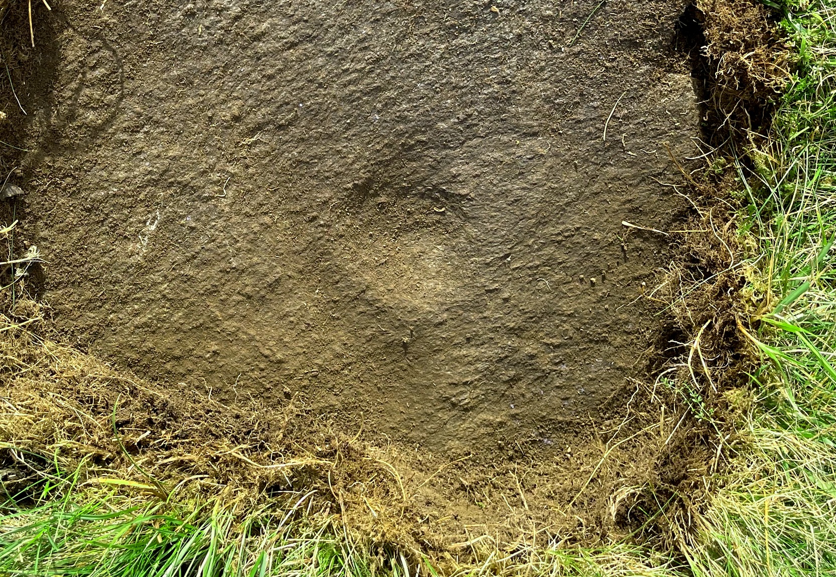
3rd cupmark visible at bottom

3rd cupmark visible at bottom

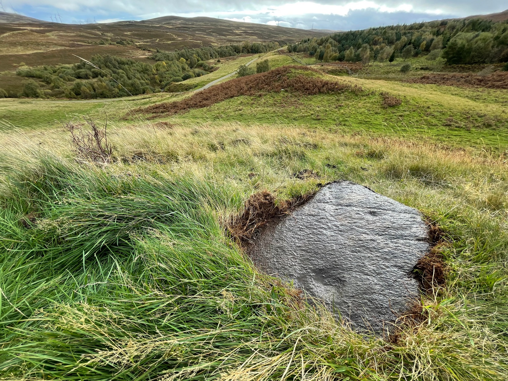
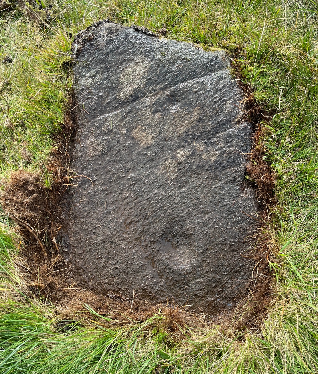
Although this is a seemingly isolated carving, difficult to find and nowt much to look at, it is located in a region with massive amounts of prehistoric remains – much of it inadequately surveyed or not surveyed at all.  Amidst a collection of more than a dozen unexcavated Bronze Age cairns, this small flat earthfast stone bears two standard cup-markings, with a possible third at its edge.  It is not immediately connected with any of the nearby cairns.

© Paul BennettThe Northern Antiquarian


Beltane Well, Kenmore, Perthshire

Sacred Well:  OS Grid Reference – NN 7867 4725

Also Known as:

  1. An Tobar
  2. Holy Well of Inchadney

Getting Here

An Tobar, or Beltane Well, on the 1867 map

An Tobar, or Beltane Well, on the 1867 map

From Kenmore village on the north-side of the river, over the bridge, take the small road on your right towards Dull.  After a very short distance the road runs alongside the woodland for nearly 1½ miles until, on your left, you’ll reach Drummond Cottage.  Across from here a dirt-track takes you into the trees.  Barely 100 yards along, watch for the overgrown path that runs down the slope on your left.  At the bottom a small stream has several feeds – one of which is surrounded by a ring of bright quartz stones.

Archaeology & History

Shown on the early Ordnance Survey maps as An Tobar (meaing simply “a well”), this somewhat nondescript title betrays a much more colourful folk history, albeit dissolved by those common culprits of Church and disrespectful incomers (which shows little sign of diminishing).

Lara by the Well

Lara by the Well

Close-up of quartz surround

Close-up of quartz surround

In the field immediately south, back up the slope above the well and through the trees, was once an ancient church whose existence has all but vanished.  Hereby was held an ancient fair known as Feill nam Bann Naohm, or the Fair of the Holy Women, named after a group of nuns whose lived here, who William Gillies (1938) and others proclaim were the legendary Nine Maidens, whose dedications at wells, trees and other sites scatter Scotland. But the fair was ended in 1575 and moved to Kenmore; then, several years later in 1579, the church also moved onto Eilean nam Ban Naomh (NN 7664 4536) on Loch Tay.

The old well however, after being left by the descendants of the Holy Women or Nine Maidens, continued to be frequented by local people.  Gillies (1938) wrote:

“The Holy Well of Inchadney is situated at the foot of the terrace, about five hundred yards to the north of the churchyard… Up to the middle of last century the well used to be visited by great numbers of people on the morning of Bealtuinn, the first day of May.”

In Ruth & Frank Morris’ survey (1981) they told how the site had become much overgrown and,

“The well was cleaned out in 1914 and among articles found was a stone 21 inches by 16 inches, with a rude St Andrew’s cross scratched on it, a George III farthing among other copper coins, a rudely made stone cup 2½ inches high and 7 inches in diameter, three metal buttons, a glass bead and six pins.”

No such offerings seemed in evidence when we visited a few weeks ago; but we were told that people are still seen visiting the well.

Looking down into the pure waters

Looking into the pure waters

A small stone-laid footpath runs towards the adjacent burn from the circular well, which is almost completely surrounded by large quartz rocks.  In the well itself was a small fish, showing how clean the waters are—or as would be deemed in times of olde: a ‘guardian’ of the waters.

We must also make note of the fact that, just two fields away to the north, according to the antiquarian Fred Coles (1910), a stone circle was once in evidence.  This old well sat neatly between the sites of megalithic ring and church.

Folklore

In the field in front of the well, Hilary Wheather (1982) told that there once lived a legendary water bull, but she lamented on his passing.  With the coming of the modern-folks and their unnatural ways,

“and having great timber lorries rumbling past your home every day is no fun for a peace-loving waterbull living in Poll Tairbh, the Bull’s Pool opposite the Holy Well.  Gone are the days when he was the revered Spirit of the Meadow, passed with trembling and fear by all the young maids of the Parish lest he should jump out and carry them off to his watery lair. Half the calves of the area were sired by him and it was always easily seen which cow had the attentions of the Great Waterbull.  Her calf was always the biggest and the best.  But he hasn’t been seen by his pool for many a year…”

The waters are cited by Geoff Holder (2006) to be good for toothache.

References:

  1. Coles, Fred, “Report on Stone Circles Surveyed in Perthshire (Aberfeldy District),” in Proceedings of the Society of Antiquaries, Scotland, volume 44, 1910.
  2. Gillies, William A., In Famed Breadalbane, Munro Press: Perth 1938.
  3. Holder, Geoff, The Guide to Mysterious Perthshire, History Press 2006.
  4. McHardy, Stuart, The Quest for the Nine Maidens, Luath Press: Edinburgh 2003.
  5. Miller, Joyce, Magic and Witchcraft in Scotland, Goblinshead: Musselburgh 2010.
  6. Morris, Ruth & Frank, Scottish Healing Wells, Alethea: Sandy 1982.
  7. Wheater, Hilary, Kenmore and Loch Tay, Appin Publications: Aberfeldy 1982.

Acknowledgements:  Big thanks to the bunch who got us here:  to Paul Hornby, Nina Harris, Aisha Domleo & Lara Domleo (ooh – and Leo too!).

© Paul BennettThe Northern Antiquarian


Croft Moraig Carving (02), Kenmore, Perthshire

Cup-Marked Stone:  OS Grid Reference – NN 79744 47263

Also Known as:

  1. Croft Moraig – Stone D

Getting Here

Follow the same directions for the Croft Moraig stone Circle.  Then check out the largest of the fallen or elongated stones on the northwest side of the ring, with a smoothed sloping surface, just at the side of the overgrown stone platform on which it rests.  Y’ can’t really miss it.

Archaeology & History

When William Gillies (1938) wrote about the carvings at the Croft Moraig stone circle, he told how, previously, Fred Coles,

“noticed that several of the upright stones…show cup-markings on their perpendicular surfaces. Some of these are quite distinct, but others are so worn through weathering that they can only be traced with the fingers.”

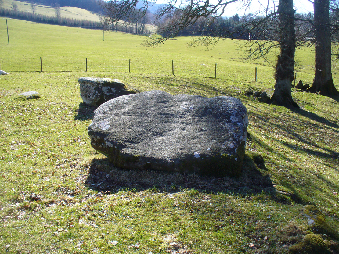
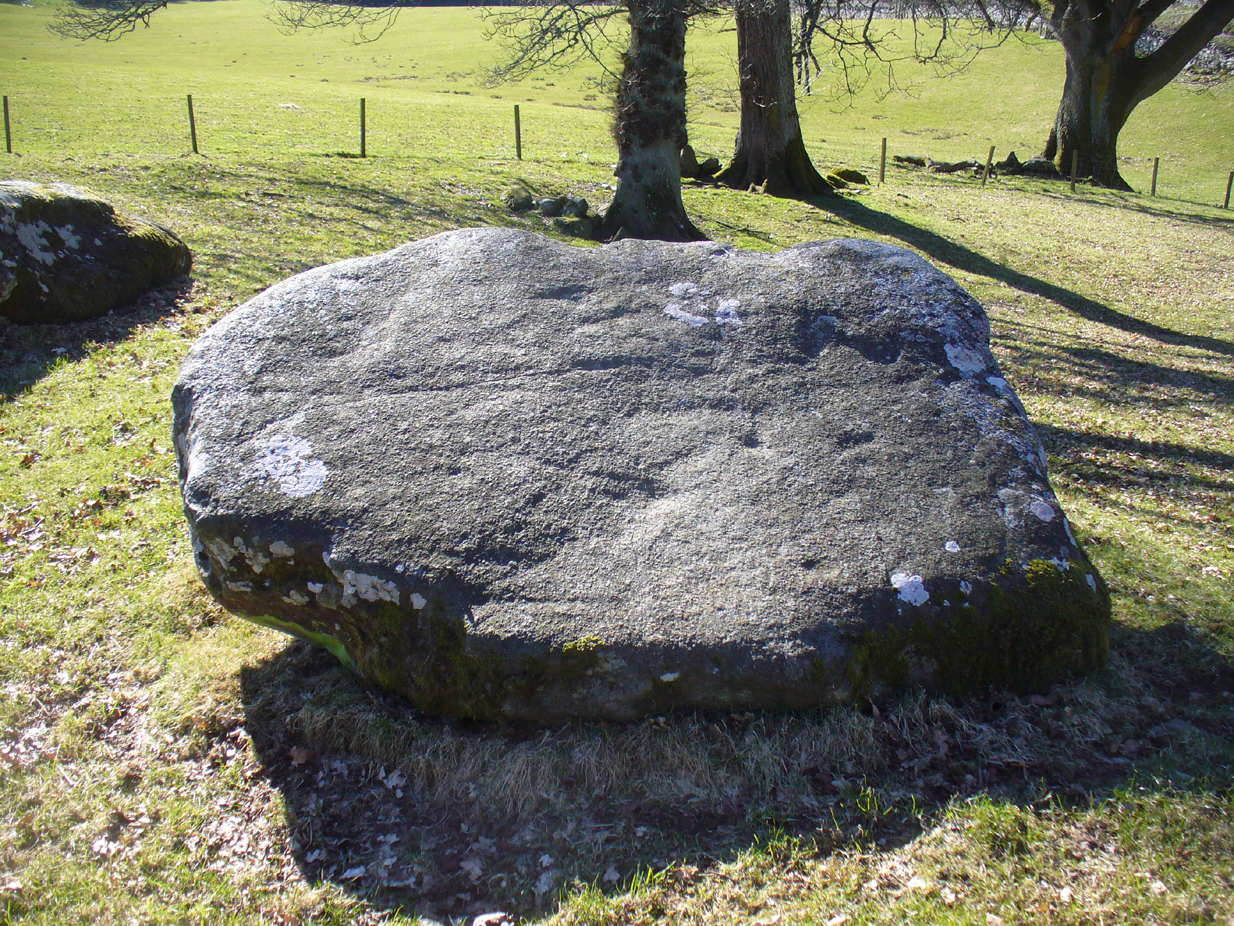
Stone D, with cupmarks
Stone D, with faint cups
Close-up of the cupmarks

This is one of them. Barely visible at the best of times, the cup-markings are faded and very hard to see unless daylight conditions are just right. As you can see in the photos, several distinct cup-like impressions are visible, but it only appears that two of them are cup-marks.  The others seem to be more geophysical in nature – but I’d love to be wrong!

At the SSW edge of the circle, 13 yards (11.75m) away, is the Croft Moraig cup-and-ring stone.

Folklore

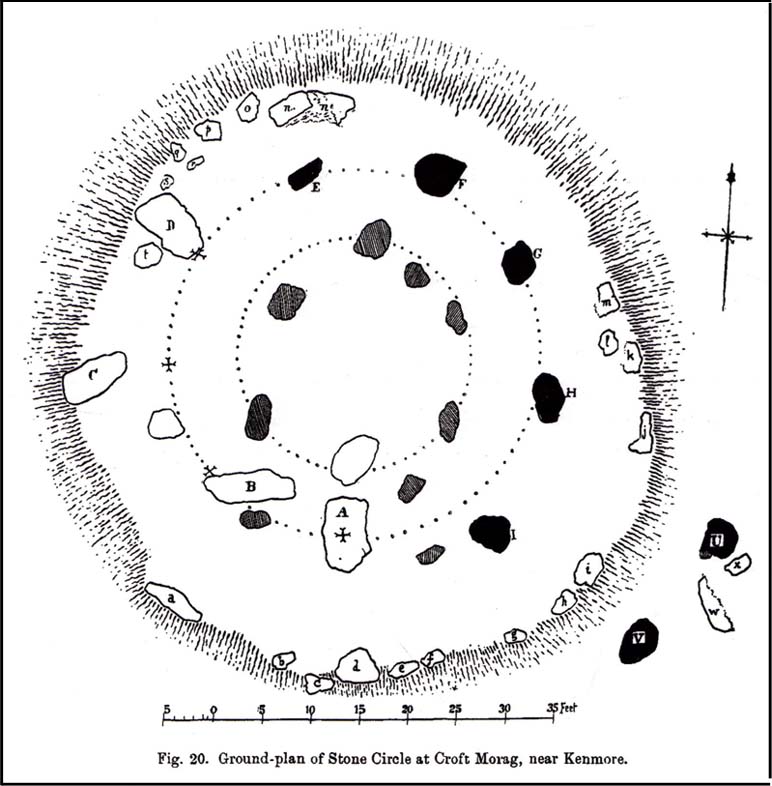
Stone D on Fred Coles' plan
Stone D on Coles’ plan

The great northern Antiquarian Fred Coles (1910) noted that this particular stone (stone D in his ground-plan of the circle) had “been polished by the sliding of generations of children”.  This playful action on stones elsewhere in the UK and around the world sometimes relates to fertility rites (i.e., the spirit of the stone could imbue increased fertility upon the practitioner), but Mr Coles made no mention of such rituals here.

References:

  1. Coles, Fred, “Report on Stone Circles Surveyed in Perthshire,” in Proceedings of the Society of Antiquaries, Scotland, volume 44, 1910.
  2. Gillies, William A., In Famed Breadalbane, Munro Press: Perth 1938.
  3. Yellowlees, Sonia, Cupmarked Stones in Strathtay, Scotland Magazine: Edinburgh 2004.

Acknowledgements:  Many thanks to hardcore crew for our various visits here: to Paul Hornby, Lisa Samson, Fraser Harrick, James Elkington, Penny & Thea Sinclair.

© Paul Bennett, The Northern Antiquarian

Black Burn (3), Aberfeldy, Perthshire

Cup-and-Ring Stone:  OS Grid Reference – NN 83318 46049

Getting Here

Black Burn (3) carving

Follow the same directions as if you’re going to the Black Burn (2) carving (which you’ll obviously be looking at if you’re checking this one out!); and from there, walk two or three steps southwards down the slope – and you’re just about stood on it!

Archaeology & History

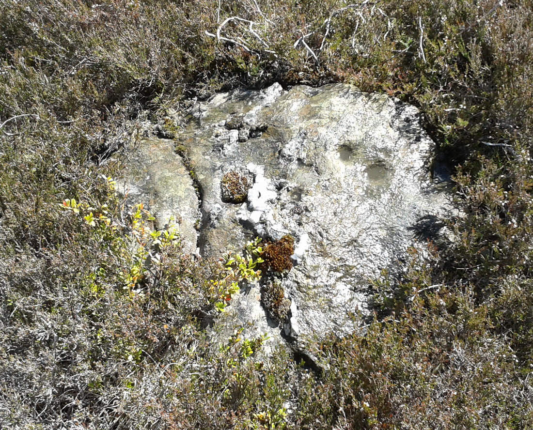
This, at first sight, seems little more than two cup-marks: one rather small, and the other somewhat larger than usual.  I walked round it, crouched down and fondled it, poured water on it and heightened the carving… and noticed what seemed to be a carved arc around the western side of the large cup.  But I couldn’t make my mind up whether this was natural or not.  And then as laid down and looked across the stone, it seemed as if a very faint triangle completely enclosed the large cup!  I crawled round it at ground level and the shape appeared and disappeared as the light altered.  So I took a few more photos and wondered whether or not the shape would become obvious in them.  And it did!

An eye in the triangle?
Cup and faint triangle, or a trick of the mind?

It’s unusual – and I’m still not sure whether it’s natural or not.  The carving needs more attention, in better daylight.  Or perhaps the computer-tech kids might have a look at it and see if this really is an eye-in-the-triangle style design we’ve got here.  It would be damn good!  Anyhow, the carving was first mentioned by George Currie (2005), who told of it being two metres south of the Black Burn (2) cup-and-ring and, plainly, that it “has two cups: 60 x 15mm and 25 x 8mm.”  It overlooks the urisk-haunted Urlar Burn, a creature known in some places for having milk and other offerings poured into cup-marks to appease it and gain good fortune.

References:

  1. Currie, George, “Perthshire: Black Burn (Dull Parish) – Cup and Ring Marked Rocks”, in Discovery & Excavation Scotland, volume 6 (new series), 2005.

© Paul BennettThe Northern Antiquarian

Black Burn (2), Aberfeldy, Perthshire

Cup-and-Ring Stone:  OS Grid Reference – NN 83318 46055

Getting Here

Black Burn (2) carving

Take the A826 Crieff Road uphill for 275 yards then turn right up the Urlar Road.  It’s a long uphill walk from here, up the private road, through and past Urlar Farm and along the track, making sure to go right where the track splits, keeping to the west-side of the burn. (don’t cross over it!)  From here, the fields open up ahead of you into the distant hills.  Keep along the track until, after a few hundred yards a small copse of trees is on your right.  Walk past the bottom of this and then walk immediately up to the top of the large rounded knoll, or Tom, on your right.  Once at the top, look for the triangular stone on its southwestern edge.

Archaeology & History

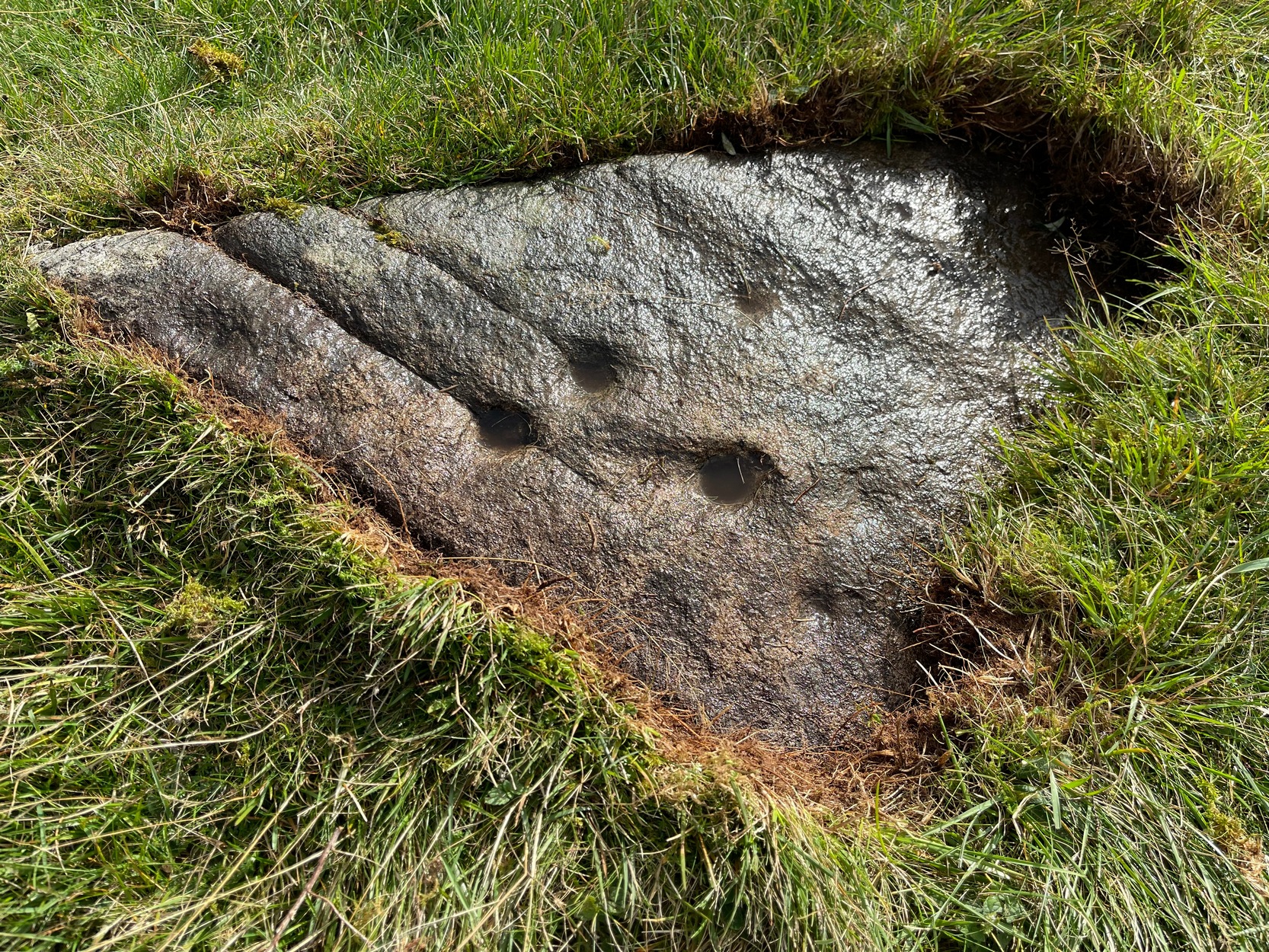
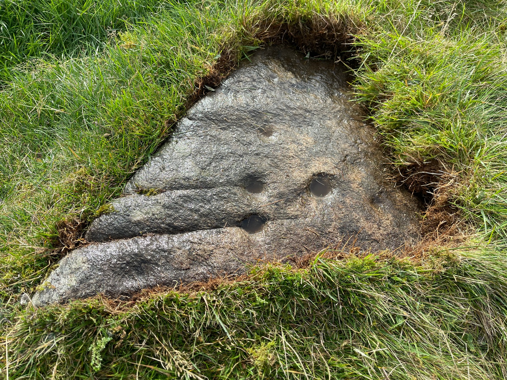
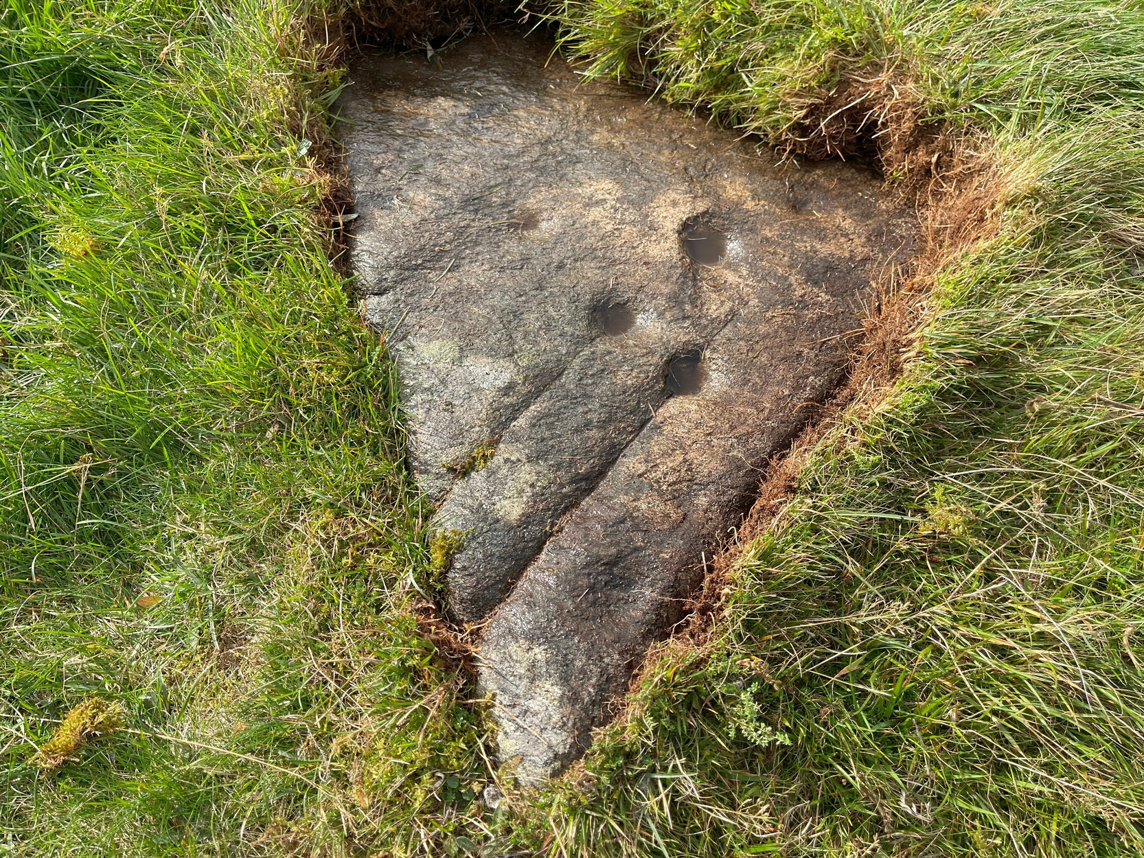
Upon this rounded tom, beloved of faerie folk and overlooking the urisk-haunted Urlar Burn, is this small flat triangular-shaped stone, embedded in the ground, possessing an unusual set of seven, possibly eight cup-markings (not five as Currie [2005] initially described) of varying depths and age, carved into straight geological fissures in the rock which, I hasten to add, were probably intended as part of the original design.  Such elements are not unusual in carvings in other parts of the world, tending to relate to some spirit or ancestral ingredient.  Whether that was important here, we might never know.

Black Burn (2) carving

But in addition to the cups on their geological cracks, a large faint wonky incomplete ring has been carved around the centre-most cup-mark, seemingly stopping where it meets the natural crack.  You can just make it out in the photos. One side of this ring may continue onto the top of the longer crack, but it was difficult to see in the cloudy daylight and another visit is necessary.

The carving was first described by George Currie (2005), who told, in his usual minimalist manner:

“On W side of large knoll, triangular-shaped rock, 0.7 x 0.7m, flush with ground; five cups, largest being 50 x 20mm and smallest, 25 x 8mm.”

Two or three yards away, just slightly down the slope to your south, is another cup-marked stone: the Black Burn (3) carving.

References:

  1. Currie, George, “Perthshire: Black Burn (Dull Parish) – Cup and Ring Marked Rocks”, in Discovery & Excavation Scotland, volume 6 (new series), 2005.

Acknowledgements:  Huge thanks for use of the Ordnance Survey map in this site profile, reproduced with the kind permission of the National Library of Scotland

© Paul BennettThe Northern Antiquarian

Glen Cochill 1, Little Dunkeld, Perthshire

Enclosure:  OS Grid Reference – NN 90732 41196

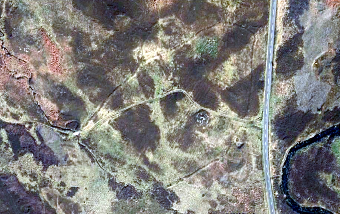
Aerial view shows outline of enclosure

Also Known as:

  1. Canmore ID 26252
  2. Southern Enclosure

Getting Here

Take the directions to find the Carn Ban giant cairn.  Once there, you’re in the middle of the enclosure—or near enough!

Archaeology & History

This is one of several very large extensive prehistoric enclosures that stretch across the undulating rocky plains of this wild moorland, high up below the mountain-tops south of Aberfeldy.   Although humans are scarce up here nowadays, in ancient times it was a very different ballgame.

Internal line of walling
Eastern edge walls
Eastern edge walls

Extensive and well constructed walling, measuring an average of 2-3 yards across and several feet high in places, encircles the giant White Cairn some distance away from it, running for a third-of-a-mile (0.5km) in a contorted oval shape.  The walling is pretty much continuous except for where the modern tracks have destroyed two sections of it (and other monuments within) and where entrances or ‘doors’ allowed access on the west, north and eastern sides.  The circuitous route of the walls  appears to start and end at a small unnamed stream at its southern end.

Outer northeastern walling

Inside the perimeter walls, there are scattered examples of simple hut circles and cairns—some singular, others for families, and others that may be clearance cairns. It’s difficult to say without excavations.  On the top northwestern side of the enclosure there is another, smaller enclosure attached to the main mass—seemingly earlier in construction than the giant creature its attached to—which overlooks the curious Shaman’s Lodge double hut-circle 75 yards to the west.  This and much of the internal area was, when we visited, covered in extensive and deep heather, so we couldn’t get a clear picture of the entire site.

We might never know exactly how many people used this site, but we can say with some certainty, due to the remains found inside and around the place, that it was used by lots of  people over many centuries, not just for what modern homo-profanus defines as ‘utilitarian’ purposes, but also important rituals were practised herein (though we are looking at an ahistorical period before the boundary of ‘sacred’ and ‘profane’ had been defined).

For antiquarians and explorers, this region is a must!  A weekend of sleeping rough up here might well be in order!

References:

  1.  Stewart, Margaret E.C., “Strath Tay in the Second Millenium BC – A Field Survey”, in Proceedings Society Antiquaries Scotland, volume 92, 1961

Acknowledgements:  Huge thanks again to Paul Hornby for his assistance with site inspection, and additional use of his photos.

© Paul Bennett, The Northern Antiquarian


Shaman’s Lodge, Glen Cochill, Perthshire

Hut Circles:  OS Grid Reference – NN 90591 41247

Getting Here

The large double hut circle, surrounded by tombs

Take the same directions to reach the giant Carn Ban prehistoric tomb. Follow the track past the tomb further onto the moorland until you reach a small wooden bridge over the small burn.  From here, walk straight north off-path onto the moor for 100 yards and a small rise in the land, with several cairns just below it, is the site in question.

Archaeology & History

Hut circle are hut circles – right?  Well, usually that’s the case.  We find them attached to, or within, or outlying prehistoric enclosures and can date from anywhere between the neolithic and Iron Age periods.  With the site we’re looking at here, on the outer western side of Glen Cochill’s southernmost giant enclosure, there’s something amiss….or maybe that should be, “something rather peculiar.”

Mr Hornby, hut-side
Mr Hornby, hut-side
Shamans Lodge walling

Paul Hornby found it a few weeks ago during an exploration of the region’s prehistory. We went in search of, and found, the giant Carn Ban close by, but noticed curious archaeological undulations ebbing in and out of the heathlands: cairns, walls, hut circles, settlements, more cairns—and then this!

Consisting of two slightly larger-than-average ovals of walled stone, probably Bronze Age in date, the first impression was of a remarkably well-preserved site (and that it is!), seemingly of an elongated stretch of walling, with a central wall that split it into two halves.  Each ‘hut circle’ was found to be between six and seven yards across, with the two conjoined architectural features giving an overall NW-SE length of 14 yards.  But the more we looked at this, the more obvious it became that this was originally one single hut circle—the lower southeastern one—with an additional one that was added and attached onto the northwestern side at a later date, probably several centuries later.

Lower earlier hut circle, with upper later hut circle attached

Walking around the structure we found that the very well-preserved walls—about 2 feet wide in places and rising a foot or so above the compacted peat—had been built onto a raised platform of earth.  This was no ordinary hut circle!  The ground beneath it seems to have been raised and supported and on the southern side in particular it is notable that other building stones are compacted into the peat.  There may even be the remains of a secondary outer wall on this southern edge, where it seems that the entrance was made.

Small group of cairns 15 yards away

Here’s the curious bit: immediately outside the northwestern and southern walls are small prehistoric tombs, or cairns.  Not just one or two, but more than a dozen of them, all constructed within 20 yards of this curiously raised double hut circle.  Literally, a small prehistoric house of some form was raised in the centre of a prehistoric graveyard—and it doesn’t end here.

Of at least three giant enclosures in this region, and what looks like a very well-preserved prehistoric tribal hall or meeting place, there are upwards of a hundred tombs scattered nearby.  Two cairn circles were also found about 100 yards to the north, one of which was damaged by a military road a few centuries ago.

Close-up of walling
Close-up of walling

I give this double-roomed abode the somewhat provocative title of the Shaman’s Lodge because of its setting: surrounded by tombs, the ‘house’ would seem to have been a deliberate setting erected in the Land of the Dead here.  I hope you can forgive my imaginative mind seeing this as a structure where, perhaps, a medicine woman would give rites to the dead, either for those being buried in the small graves, or rites relating to the giant White Cairn of the ancestors close by.  Shamans of one form or another occur in every culture on Earth and have been traced throughout all early cultures.  If no such individuals ever existed within the British Isles, someone needs to paint one helluva good reason as to why they believe such a thing….

When the heather grows back here, the site will disappear again beneath the vegetation.  It is unlikely to re-appear for quite sometime, so I recommend that anyone wanting to have a look at this does so pretty quick before our Earth covers it once again….

References:

  1.  Stewart, Margaret E.C., “Strath Tay in the Second Millenium BC – A Field Survey”, in Proceedings Society Antiquaries Scotland, volume 92, 1961

Acknowledgements:  Huge thanks again to Paul Hornby for his assistance with site inspection, and additional use of his photos.

© Paul Bennett, The Northern Antiquarian


Carn Ban, Glen Cochill, Perthshire

Cairn:  OS Grid Reference – NN 90728 41161

Also Known as:

  1. Canmore ID 26253
  2. White Cairn

Getting Here

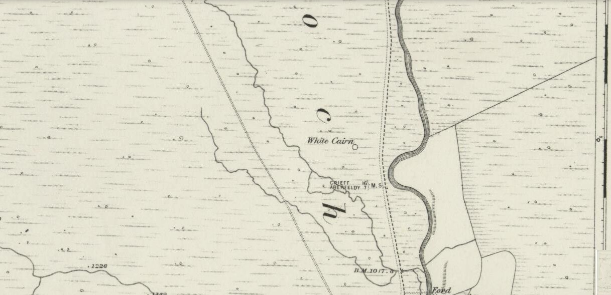
White Cairn on the 1862 map

Take the A826 road south out of Aberfeldy, uphill – and uphill.  Several miles up, past the roadside Loch na Craige, and past the solitary farmhouse of Scotston, you’re getting close.  A few hundred yards past here watch out for the small bridge over the small burn; and literally another half-mile past this, keep your eyes peeled for the small track on your right, onto the moors.  Walk 70 yards on the track and there, on your left, it rises from the heather!

Archaeology & History

Carn Ban, Glen Cochill (photo credit, Paul Hornby)

This giant neolithic tomb in the middle of a beautiful nowhere is perhaps the tomb of an ancestral King or Queen, later idolised into creation myths by our heathen ancestors who, we know, lived across this huge moorland plain for countless centuries.  One account tells that “a circle of free-standing boulders set at irregular intervals” used to surround the cairn, but this seems to have gone.

Southeastern quadrant

Measuring 21 yards (19.2m) across east-west, and just over 21 yards (19.3m) north-south, this is quite a large construction made up of thousands of small stones in a near-perfect ring that measures 68 yards (62m) in circumference. The cairn seems to have been built in three layers, with its outer defining ring of medium-sized rocks, upon which a layer of typical cairn-spoil stones were laid.  A couple of yards within this, a second internal ring has been set consisting of much larger stones, more typical of those found in small stone circles or average ring-cairns.  Within this, the cairn seems to have been raised again and another large deposit of countless stones were scattered, with many pieces of white quartz (very common in this area) incorporated in the construction.

Capstone and outer ring
Section of internal ring

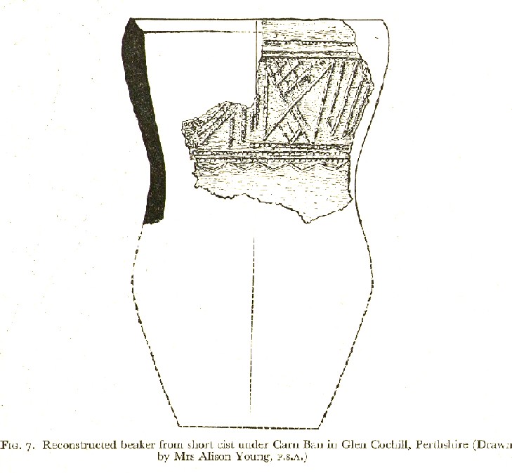
At the very centre of the cairn, at least one large central ‘tomb’ or cist is clearly evident.  Within this cist were found the severely damaged ruins of a small decorated beaker, in which, perhaps, the ashes of the dead might have once been found.  A very large and heavy capstone that covered the central tomb, has been rolled over and lays just off-centre.  No rock art seems visible on this capstone, but we were unable to check its underside.  When standing here at the middle of the tomb, you are four feet above the average ground-level of the surrounding moorland.

Section of cairn edge
Imaginative reconstruction of beaker in central tomb

Curiously and erroneously reported by Margaret Stewart (1961) to have “been completely removed”, this large and very visible monument lives near the middle of a very large and extensive prehistoric enclosure, whose walled remains extend for some distance all round this section of the moors.  Within this arena we find large numbers of other architectural features, including many smaller cairns, some hut circles and additional lines of internal prehistoric walling.  Just a few yards south of the tomb itself, we can clearly see a length of walling running east-west and another seemingly reaching up to the White Cairn.  Whether these were built at the same time, or later, is difficult to say.

In the event that you visit this site, take your time!  All round here, mainly to the north and west, you will find masses of prehistoric remains, none of which has been adequately excavated.  A few hundred yards north is an extended necropolis that doesn’t appear to have been surveyed.

References:

  1.  Stewart, Margaret E.C., “Strath Tay in the Second Millenium BC – A Field Survey”, in Proceedings Society Antiquaries Scotland, volume 92, 1961

Acknowledgements:  Huge thanks again to Paul Hornby for his assistance with site inspection, and additional use of his photos.

© Paul Bennett, The Northern Antiquarian


St. David’s Well, Weem, Aberfeldy, Perthshire

Holy Well:  OS Grid Reference – NN 8445 5002

Also Known as:

  1. Canmore ID 25672
  2. Chapel Rock Spring
  3. Fuaran Creig a’ Chaibeul
  4. St. Cuthbert’s Well

Getting Here

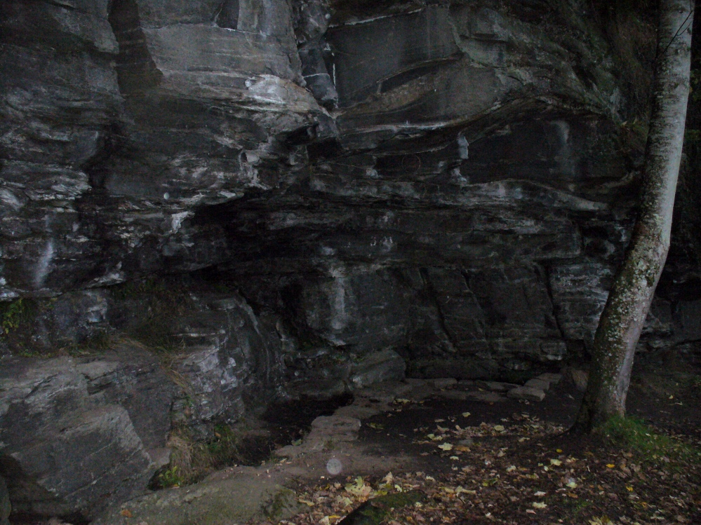
In the dark, dark wood... hides St. David's Well
In the dark, dark wood… hides St. David’s Well

The best way to find this site, in the middle of the large woods up the slopes, is to follow the circular mile-long tourist path that runs through it. Take the B846 road out of Aberfeldy over the bridge towards Dull and Weem.  As you go through Weem, watch closely for the signpost directing you into the trees of Weem Rock and Woods on the right. Follow this tiny road up until you reach the parking circle in the edge of the trees.  Follow the directed footpath up into the woods & keep to the winding track, up, zigzagging, and up again, until it levels out a bit and runs below the large long crags. Tis beneath here you need to be!

Archaeology & History

The pool of St David's Well
The pool of St David’s Well

Not far from the curious Weem Wood carvings, hidden beneath one section of the long high crags in remains of the ancient forest, is this trickle of fresh water which collects into a small stone-lined pool. (a small round plaque which reads ‘St. David’s Well’ on the cliff-face above the waters is helpful) It’s in a truly lovely setting, with a small ‘cave’ about 50 yards west along the same footpath and a modern carved ‘cross’ in front of it.

The well was formerly known as St. Cuthbert’s Well (date: 20 March) who, so legend tells, lived nearby—probably at the christian-druid college at Dull, a mile west of here. It was he who collected the waters from the rock face into the small pool we see today.  This used to be known as St. Cuthbert’s Bath.  But several centuries after the saint’s death, the local laird, Sir David Menzies, came and restored the well and gained a reputation for spending much time living hereby, sometimes in the small cave along the edge of the cliffs.  It was to him that the New Statistical Account wrongly dedicated the waters to in the 19th century—but the title has stuck!

Described in several old local history works, the site was included in the giant folklore tome on Scottish waters by MacKinlay (1893), who wrote the following:

“In the wood clothing the steep hill of Weem, in Perthshire, is St. David’s Well, said to be named after a former laird who turned hermit.  The spring has a considerable local fame, and many have been the wishes silently breathed over its water.  Part of an ancient stone cross lies at its margin, and on it the visitor kneels while framing his or her wish.”

Nothing of this ‘cross’ can now be seen, but it is said that its remnants are housed at Weem church in the village below.  Also in the 19th century, occasional christian gatherings were held here and as many as fifty people came “for religious services.” Thomas Hunter (1886) reported that “a collection of human bones” were found near the well in front of the crags. There is also what looks like a newly cut large cup-marking with two carved lines reaching out from it, heading towards the well, on a small ledge of stone close to the pool.

Folklore

Folklore tells that once, long ago, dragons lived in these old woods—overcome no doubt by the incoming christians who stole and denigrated the olde peasant ways of our ancestors.  In bygone times, locals used the waters here for their health-giving properties.  As Ruth and Frank Morris (1982) told,

“it was an ancient wishing well which was still visited in 1954, when such objects as pins and buttons and an occasional penny was thrown in.”

References:

  1. Ferguson, Malcolm, Rambles in Breadalbane, Thomas Murray: Glasgow 1891.
  2. Hunter, Thomas, Illustrated Guide to Perthshire, Robertson & Hunter: Perth 1886.
  3. MacKinlay, James M., Folklore of Scottish Lochs and Springs, William Hodge: Glasgow 1893.
  4. Morris, Ruth & Frank, Scottish Healing Wells, Alethea: Sandy 1982.

© Paul Bennett, The Northern Antiquarian