Well of the Mosses, Glen Almond, Perthshire

Healing Well:  OS Grid Reference – NN 82865 33096

Getting Here

Spring of the Mosses

Spring of the Mosses

Take the dirt-track up Glen Almond for 3½ miles until you reach the standing stone of Clach an Tiompan.  The giant long cairn of the same name is just above the track on the other side.  Walk past this and start walking uphill, diagonally, until a few hundred yards up, a ridge levels out with some unrecorded habitation sites upon it.  The clear waters of this spring are on the eastern edge of this ridge.

Archaeology & History

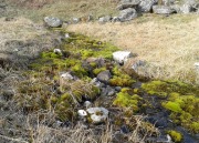
A little-known spring of water found on the slopes immediately above the giant Clach an Tiompan long cairn.  Beautifully clear water emerges from beneath a large rock that rests by an ancient pathway running across the mountain-slope, used by the local people who lived here before the genocide of The Clearances.  When we visited the place recently, the waters were low, but still running, and the mosses which reach along the length of the burn were almost iridescent in the evening sunlight.

The living glows of moss & water

The living glows of moss & water

Looking upstream to its source

Looking upstream to its source

Upon drinking here, there was that subtle sweetness to the waters, typical of many moss-clad sites, indicating it to have that typical medicinal virtue as a place to renew or revitalise your low-sugar energies after you’ve finished your meditation and rest, gazing within the enchanting mountains in which you are being held.  It’s a truly wonderful little site!

© Paul BennettThe Northern Antiquarian


Twentypenny Well, Duddingston, Edinburgh, Midlothian

Healing Well:  OS Grid Reference – NT 2815 7259

Getting Here

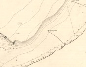
Twentypenny Well on 1852 map

1852 map showing the well

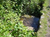
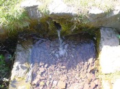
From Duddingston, head along the Old Church Lane to the Delf Well, and from then to the Horse Well and, from here, walk along the small footpath that runs along the northwest side of Duddingston Loch.  Less than 100 yards past the Horse Well you’ll notice, on the left-hand side of the path, a stone trough with a fast flow of water running into it.  That’s the spot!

Archaeology & History

Another little-known and all-but forgotten healing well, illustrated on the 1852 map of the area, but all history and traditions relating to the site are seemingly forgotten (surely not?).

The well at the path-side

The well at the path-side

The clear drinking water runs into the stone trough

The clear drinking water runs into the stone trough

The well originally appeared a little further up the slope, closer to the road in the brambles, but Time has brought the waters lower.  The name “twentypenny” is a curious one.  We know of many Penny Wells across the country: some (like the trees) are sites where coins were given to the spirits of the place as an offering for goodness or to heal a given affliction; others were so-named as the price of one penny was given for a draught of the waters.  Twenty pennies is something of an anomaly.  Somebody somewhere must surely know something?

References:

  1. Bennett, Paul, Ancient and Holy Wells of Edinburgh, TNA: Alva 2017.

© Paul BennettThe Northern Antiquarian


Tod’s Well, Comiston, Edinburgh, Midlothian

Healing Well (destroyed):  OS Grid Reference – NT 239 692

Also Known as:

  1. Three Foxes Well

Archaeology & History

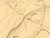
Springs at Comiston, 1632 map

Springs at Comiston, 1832 map

A renowned site of once clear running water, the Tod’s Well got its name from being the abode of foxes many centuries ago.  It was one of the five well-known ‘Comiston Springs’ as they were known—each dedicated to a certain animal—but the eternally present water in this venerable landscape was corrupted from Nature’s course by the usual Industrialists as early as 1681, so as to feed the polluting edifice of Edinburgh city.  James Colston (1890) told how,

“The Town Council entered into a contract with a Dutchman, named Peter Bruschi (aka Peter Brauss) for the sum of £2,900, “to bring the water of Tod’s Well (Anglice fox) at Comiston to Edinburgh, in a leaden-pipe of a three-inch bore, to be laid one foot deep in the ground.””

When the local council upgraded the water supplies in 1820, this piping was replaced to feed the ever-needy merchants and marketeers.  In Hope & Telford’s (1813) survey, the water from here was described as “constantly pure” and “excellent.”

References:

  1. Bennett, Paul, Ancient and Holy Wells of Edinburgh, TNA: Alva 2017.
  2. Colston, James, The Edinburgh and District Water Supply, Edinburgh 1890.
  3. Harris, Stuart, The Place-Names of Edinburgh: Their Origins and History, Gordon Wright: Edinburgh 1996.
  4. Hope, Thomas C. & Telford, Thomas, Reports on the Means of Improving the Supply of Water for the City of Edinburgh, A. Constable: Edinburgh 1813.

© Paul BennettThe Northern Antiquarian


Horse Well, Duddingston, Edinburgh, Midlothian

Healing Well:  OS Grid Reference – NT 28198 72642

Getting Here

Horse Well on 1852 map

Horse Well on 1852 map

Get to the Delf Well from Duddingston and keep walking along the lochside road for 60-70 yards, where you go through the black metal gate in the fence on your left.  Walk down the slope just a few yards and (drought dependent!) you’ll see an initial damp patch where the well used to arise 150 years ago; just a few yards further down the slope is the more notable spring water of the Horse Well below you.

Archaeology & History

The site is shown on the 1852 map of the area where it was later “capped” and used by the old local water authority.  Thankfully the water has managed to escape and is once more feeding the birds and the land, running into the loch below.  When we arrived here, a crow was drinking from the waters.

Horse Well & its herbs

Horse Well & its herbs

Although you’d expect that this was once a watering-place for horses, the name of the well may relate to the Scottish folk-name of the herb Veronica beccabunga, generally known as Brooklime or European Speedwell, but locally called Horse-well grass—some of which seemed to be growing in the watery spring amidst the other plants.  As a herb it was used in the treatment of scurvy.  The history of the well however, seems all but forgotten…

References:

  1. Bennett, Paul, Ancient and Holy Wells of Edinburgh, TNA: Alva 2017.
  2. Grant, William (ed.), Scottish National Dictionary – volume 5, SNDA: Edinburgh 1958.

© Paul BennettThe Northern Antiquarian


Fountain Well, Edinburgh, Midlothian

Healing Well:  OS Grid Reference – NT 26082 73692

Also Known as:

  1. Canmore ID 52238
  2. Netherbow
  3. Wellhead

Getting Here

Fountina Well on 1852 map

Fountain Well on 1852 map

Get onto the Royal Mile road (which comprises Lawn Market, High Street and Canongate) which runs down from the castle; and near the bottom of the High Street section (between North Bridge and St. Mary’s Street), on the left side of the road you’ll see a large upright monument which was formerly a stone drinking fountain.  You can’t really miss it!

Archaeology & History

Found just yards away from the house of the religious lunatic, John Knox, this is one of several wells that could once be found along the old High Street, or Royal Mile, near the middle of the city.  A fast-flowing spring of water was contained within this solid stone monument first built around 1675 by the King’s mason, Robert Mylne.  The fountainhead was rebuilt at a later date and it supplied water for the inhabitants of the old town.

Fountain Well, Edinburgh

Fountain Well, Edinburgh

Fountain Well, early 19th C

Fountain Well, early 19th C

It has a small semi-circular water trough at its western base and is ornamented on this and its eastern side with small mythical fauns, out of which water emerged.   The local council should ensure to make the well work again, giving people clean drinking water when they need it.

The local historian Stuart Harris (1996) puzzled over the origin of the name ‘Fountain Well’, wondering whether it related to a nearby mansion, but he wasn’t too clear in his description for those who live outside of the city, where this mansion was.  He wrote:

“It is…reasonable to suppose that the present well got its name from being in the general vicinity of the mansion, and that the mansion and the (Fountain) Close must have been named for another well, now lost, in the close or at its head.  It is suggested in Wilson (1891), but scarcely proved, that it was the Endmyleis Well…which is mentioned in…1567.”

Bereft of natural animism, the site is more likely to be of interest to architects than the usual hydromancers and their exploratory ilk…

References:

  1. Bennett, Paul, Ancient and Holy Wells of Edinburgh, TNA: Alva 2017.
  2. Colston, James, The Edinburgh and District Water Supply, Edinburgh 1890.
  3. Harris, Stuart, The Place-Names of Edinburgh, Gordon Wright: Edinburgh 1996.
  4. Wilson, Andrew P., Milestones in the Royal Mile, John McQueen: Galashiels 1947.
  5. Wilson, Daniel, Memorials of Edinburgh in the Olden Times – 2 volumes, Edinburgh 1891.

© Paul BennettThe Northern Antiquarian


Delf Well, Edinburgh, Midlothian

Healing Well:  OS Grid Reference – NT 28220 72715

Getting Here

Delf Well, SE of Arthur's Seat

Delf Well, SE of Arthur’s Seat

From the south-side of Arthur’s Seat at Duddingston, along Duddingston Road West, turn west along Old Church Lane.  Where the houses finish and the loch appears on your left and the small car-park on the right, walk above the cars and onto the small footpath.  Barely 20 yards ahead, under the edges of the trees, a sealed oblong concrete water-hole is the site in question.

Archaeology & History

Delf Well on the 1877 map

Delf Well on the 1877 map

Only for the purists amongst you, the Delf Well has fallen prey to being capped and piped away so you can no longer drink here.  It is shown on the early 19th century maps of the area and was used as a water supply for the opulent South Lodge of Holyrood Park.  An old metal chain—remains of which are still attached to the covering stone—once had an old cup attached, to enable walkers to drink here.

References:

  1. Bennett, Paul, Ancient and Holy Wells of Edinburgh, TNA: Alva 2017.
  2. Harris, Stuart, The Place-Names of Edinburgh, Gordon Wright: Edinburgh 1996.

© Paul BennettThe Northern Antiquarian


St. Anne’s Well, Strathaven, Lanarkshire

Holy Well:  OS Grid Reference – NS 7039 4438

Archaeology & History

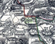
St Anne's Well on 1865 map

St Anne’s Well on 1865 map

Long since lost it would seem, in a search for this legendary site over the weekend with Gordon, Aisha and Lara, I’m still not certain of the actual status of the site.  Although we found a very fresh water supply still running not far from where the old OS-map showed the original holy well to be, it may be a completely different water source.

There are hardly any references to the spring and those that exist are scant.  In the early 1860s, St. Ane’s Well was mentioned briefly in the Object Name Book of the area:

“This is a good spring well in the southern part of the town of Strathaven.  It is commonly called Tun’s (Tan’s?) Well, but this is an abbreviation of the name.”

Lara plays at a nearby well

Lara plays at a nearby well

Looking down on the waters

Looking down on the waters

More recently, thanks to a communication from the local historian Robert Currie, more information has come to light about the well.  It was described in the local history work by Mary Gebbie (1880).  Mr Currie told me:

“In her Sketches of Avondale and Strathaven…we read: “In a lane off Tod’s Hill was the famous Tann’s Well – obviously a corruption of the celebrated water saint, St. Anne. This spring has within a few years completely dried up. Access was easily had from the castle to it, over the draw-bridge, which is said to have rested on the ledge of the ground and rock on which the fifth house is built south of the bridge. Before this aperture was built up, the inhabitants around took advantage of the pathway for drawing water from the Pomillion, at a place called the Fairy Pool. A little above this comes the Dove Castle; and a half a mile further out is the Gallow Hill.”

He continued:

“That said, the current siting of St. Anne’s Well is located on Lesmahagow Road with (the) site being almost opposite the Council houses bordering on Station Road (there is currently a mini-roundabout near the locus). In recent years the site has become obscured but in my own living memory there was once a plaque authenticating the site and with a garden seat thereby.”

In searching through their own library, Mr Currie and his wife came across more about the site in William Downie’s (1979) book on Strathaven, in which he wrote:

“A small lane off Todshill went down to a cluster of houses called St. Anne’s Well nestling on the sloping ground beside the mill dam. In 1911 these houses were acquired and demolished by the Town Improvement Committee. A row of houses backing backing on to Powmillon Burn were also demolished at the same time and a retaining wall with railings erected, so opening up a very fine view of the castle and burn etc.”

The dedication here to the mythic figure of St. Anne (mother of the Virgin Mary and grandmother of Jesus) is isolated and mysterious.  No church is dedicated to her in the area, nor other relative christian remains.  Her appearance in Strathaven is something of an oddity.  There was a Duchess ‘Ann’ Hamilton of Strathaven Castle who lived 200 yards away at Strathaven Castle on the other side of the river that might have given her name to the well, but this is very unlikely.  More probable is that St. Anne was used as the mythic figure who covered an earlier dedication to the prima mater, or Cailleach—although there are no remains that relate to Her either.  However, the existence of St Mary’s church and an associated well to the north, along with a burn dedicated to a “maiden” in the same parish to the northwest add to the cailleach’s potential…..but all tales of Her have seemingly been forgotten.

…So it seems that the spring of water that Lara, Aisha, Gordon and I came across was obviously not the same place, but exists just below the roadside where the disused railway line is.  It’s close to St Anne’s Well – but is not the same water source.

References:

  1. Downie, Fleming, A History of Avondale and Strathaven, Eric Moore: Glasgow 1979.
  2. Gebbie, Mary, Sketches of the Town of Strathavon and Parish of Avondale: Historical & Traditional, John Menzies: Edinburgh 1880.

Links:

  1. Strathaven Past & Present

Acknowledgements:  Considerable thanks must be given to Robert Currie, BA Hons, who sent us additional information enabling a more informative and accurate site profile for this holy well.  Thanks Bob! Also huge thanks again to Aisha Domleo, Lara Domleo, Unabel Gordon and their frobbling Leonidus!

© Paul BennettThe Northern Antiquarian


Holy Well, Balmossie Den, Broughty Ferry, Angus

Holy Well:  OS Grid Reference – NO 47217 32714

Also Known as:

  1. Cat Craig Well
  2. Cauld Water Wellie
  3. Wishing Well

Archaeology & History

The old Wishing Well or Holy Well of Monifieth, c.1900

This little-known site is thought to be the ‘Well’ that is still marked on modern OS-maps at the grid-reference given here, on the north side of the A92 at Balmossie Bridge, although no names are cited on any of the official maps to confirm this.  When Brotchie & Herd (1980) described the old well in their photo-history of the area, they told that it was found “at Balmossie Den,” adding that

“the area is much overgrown now, but the well still exists.  It is inscribed, ‘Whosoever drinketh of this water shall thirst again T.E. 1847.’  These initials are of Thomas Erskine of Linlathen who had the stone erected on the supposed site of a medieval holy well.”

Just below here used to be the remains of an ancient chapel, which Tom Erskine thought gave this well holy sanctity.  In the late 19th and early 20th century, the site gained repute as a wishing well, where people left offerings for the spirit of the waters in exchange for health and other good deeds.  The area of Broughty Ferry and Monifieth was a seat of the Culdees, with ancient trees and land hereby dedicated to St Bridget and Our Lady, although there remain no extant traditions indicating that this site had any direct associations with such mythic figures.

References:

  1. Brotchie, A.W. & Herd, J.J., Old Broughty Ferry and Monifieth, N.B. Traction: Keighley 1980.

© Paul BennettThe Northern Antiquarian


Lady Well, Leeds, West Yorkshire

Holy Well (destroyed):  OS Grid Reference – SE 3060 3373

Archaeology & History

Lady Lane, where the well was

Lady Lane, where the well was

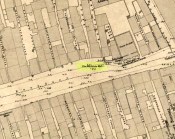
Deep in the industrial centre of Leeds, not far from the main bus station, could once be found one of Yorkshire’s many ‘Lady Wells’.  The great historian and antiquarian Ralph Thoresby (1715) was the first to write of this great spring, which is now lost beneath the concrete buildings near Quarry Hill.  He described it as,

“a noted spring…to this day called Lady Well and the adjoining way, Lady Lane.”

In 1806 Edward Baines of Leeds described this spring of “soft, pure water,” also telling it to be on Lady Lane, saying that

“At the bottom of this street is a spring of excellent water, called Lady-Well, which affords a copious supply of that necessary article to this populous part of town.”

This Lady Well was also included in Andrea Smith’s (1982) survey, who noted that less than two hundred yards northwest of was The Chantry of Our Lady. This church has medieval foundations and its dedication would be derived from the healing waters here; plus, Smith notes, in West Yorkshire, “the number of churches dedicated to Our Lady is only two and these are both classed as ancient.”

References:

  1. Baines, Edward, The Leeds Guide, E. Baines: Leeds 1806.
  2. Smith, Andrea N., “Holy Wells in and around Bradford, Leeds and Pontefract,” in Wakefield Historical Society Journal, volume 9, 1982.
  3. Thoresby, Ralph, Ducatus Leodiensis, London 1715.

© Paul BennettThe Northern Antiquarian


Bede’s Well, Hebburn, Jarrow, County Durham

Holy Well:  OS Grid-Reference – NZ 31987 64158

Getting Here
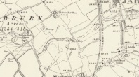
Bedes Well, Hebburn 1898

Bede’s Well on 1898 map

Gone down Adair Way and drive down as far as you can. Park and find the path back into the path this leads to the natural amphitheater down steps where the well is.

Archaeology & History

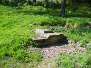
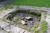
Surrounded by worn paving slabs in a small amphitheatre. It is reached by steps and surrounded by trees. The well is very dry, with broken stone work. Nearly lost under Victorian industrial growth, local people in the early 1900s became concerned with its plight and money was raised via an appeal in the Jarrow Guardian. Although some money was forthcoming, nothing appears to have happened until 1932 when it was enclosed in a railed enclosure with its name carved into the stone work either side of a gate way. When  Palmer’s shipyard slag heap was consolidated sadly spring was diverted leaving the well dry.
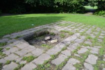
Bede's Well, Jarrow (6)St Bede has a long association with Jarrow but whether he knew of this well is unproved. The legend locally says that when living at St. Paul’s Monastery he would send the monks out to collect water from this well. However, it has been questioned why? Especially as the well is some distance away, a well was found enclosed in the site and in fact the river nearby would have been clean enough to drink. It is possible that the site derives its name from the Anglo-Saxon word baed meaning bathing place and as such perhaps the site was dug to provide a healing bath. Perhaps we shall never know, but what is clear is that the site is slowly disappearing into obscurity.

St. Bede's Well in 1908Folklore

The earliest reference to this site is Floyer in 1702 which notes that

“Nothing is more Common in this Country… for the preventing or curing of Rickets, than to send Children of a Year old and upwards, to St Bede’s… Well”
Bede's Well, Jarrow (2)

Brand (1789) says that:

“about a mile to the west of Jarrow there is a well, still called Bede’s Well, to which, as late as the year 1740, it was a prevailing custom to bring children troubled with any disease or infirmity; a crooked pin was put in, and the well laved dry between each dipping. My informant has seen twenty children brought together on a Sunday, to be dipped in this well; at which also, on Midsummer-eve, there was a great resort of neighbouring people, with bonfires, musick, &c”.

A report in the Sunderland Times quoted by Hope (1893) notes that:

“Still, when the well is occasionally cleared out, a number of crooked pins (a few years ago a pint) are always found among the mud. These have been thrown into the sacred fount for some purpose or other, either in the general way as charms for luck, or to promote and secure true love, or for the benefit of sick babies… In days when the ague was common in this country, the usual offering… was a bit of rag tied to the branch of an overhanging tree or bush”

A visitor reported an early morning journey to the well, where ‘he seated himself on a rail to enjoy the singing of the birds. Before long an Irishman came up, who had been walking very fast, and was panting for breath. He took a bottle out of his pocket, stooped down and filled it from the well, put it to his mouth, and took a copious draught. “A fine morning, sir”, said our friend. “Sure and it is”, replied the man, “and what a holy man St Bede must have been! You see, when I left Jarrow, I was as blind as a bat with the headache, but as soon as I had taken a drink just now, I was as well as ever I was in my life”. So he filled his bottle once more with the precious liquid, and walked away.