Healing Well (destroyed): OS Grid Reference – NS 5619 6654
Archaeology & History
Along the B808, between Beith Street and Byres Road, where it meets the main Dumbarton Road, the memory of Cooper’s Well is preserved in the street-name. It was one of more than a dozen springs in the area, but was one of the most renowned by local people.
Although not shown on the early OS-maps, thankfully the local historian and folklorist—and early environmentalist, it must be said!—James Napier (1873), gave a good account of it in his excellent work on the traditions of the area:
“Cooper’s Well was situated on the side of the road at the north-west end of Well Street, at the corner of where the Gas-work wall now is. It was about three feet deep, and had two steps leading down to the water from the road. Two sides and back were walled up higher than the road, and covered with a stone slab. It was celebrated in the neighbourhood as a drinking water, being strongly chalybeate, and therefore could not be used for cooking purposes. Although shallow, it was never frozen during winter (so that it must have come from a considerable depth), and it was cold in summer. On a warm summer Sunday evening we have seen people, not only from all parts of the village, but from the gentle houses in the neighbourhood, carrying water from the Cooper’s Well to drink. It is from this well the street has its name. The Gas-work dried up the well. There was a story current of some Glasgow people who were visiting at Mr. Sharp’s of Horslethill. Mrs. Sharp had been baking some oatcakes with butter or dripping in them, which caused them to be very fine and short. The Glasgow gentlemen were anxious to know how they were baked, and were told that they were baked with the Cooper’s Well water, some of which they had got a drink of. Shortly after some of the gentlemen sent out their servants to Partick for a supply of the water, but the servants could not succeed in making the cakes so nice as those got from Mrs Sharp. For long after this, butter-cakes were known in and around Partick as Cooper’s Well bread.”
I have to admit I’ve not visited this site, but presume that all trace of the site has disappeared.
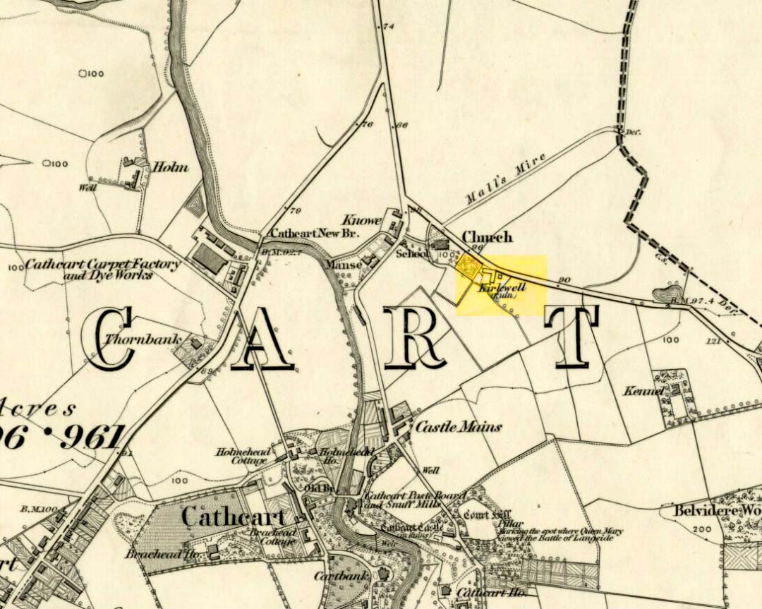
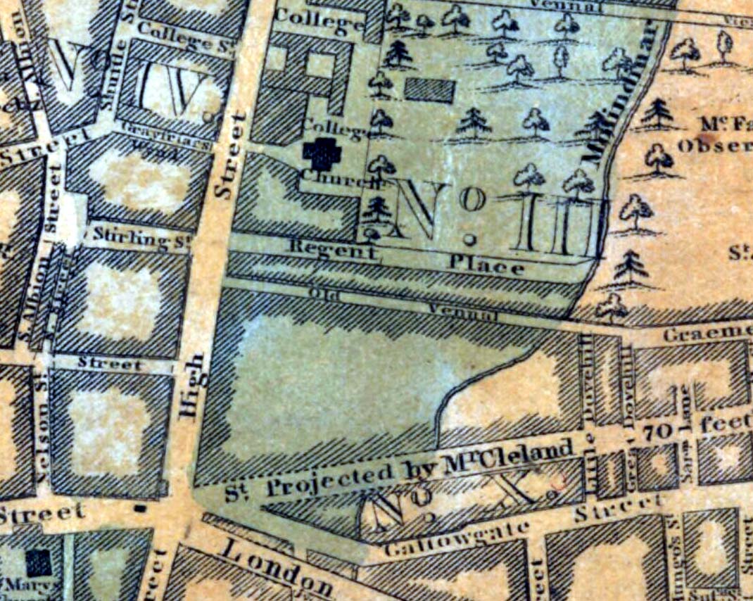
St. Oswald’s Well was described in Hew Scott’s (1920) magnum opus as being beside the parish church of the same name, but other references to it are scant. An old well-house was built besides or over the waters, which subsequently became known as the Kirk Well due to its proximity to the church, 125 yards to the northwest. All trace of it appears to have gone. The road to the west of the site also 125 yards away, called Kirkwell Road, seems to be the last piece of folk memory that remains.
St. Oswald himself was a British tribal leader of Northumbrian descent who, legend tells, went to Iona and became a christian. He had to leave the island eventually and go back into Yorkshire to bring peace back into the northern counties. Whether this Well of his was dedicated to him as a result of his journey from back south from Iona, we do not know. His saint’s day is August 5—very close indeed to that old heathen celebration time of Lughnasadh or Lammas. Most likely this is not just a coincidence, but will have related to what local folk were doing before the christian impositions.
The name of this site alone insisted that I bring it to people’s attention! If it was a healing well relating to its name, I wonder what it was used for! It’s described just once in the New Statistical Account (1845) for Lanarkshire, where Pete Brown said briefly:
“On the south side of the road from Auchinloch to Glasgow, there is still the Cockplay Well, over which many proprietors and feuars have a servitude.”
Two roads came out of the village at the time of the NSA notes: one to the immediate west and the other to the south. None of the maps cite the place-name ‘Cockplay’, but two ‘wells’ occur on the outgoing western road. One is in the village itself, behind some cottages; this is not likely to be the site in question, as the description would surely have stated that the well was in the village. However, “on the south side of the road” one mile west of the village, roughly halfway between Wallace’s Well and Cardyke there is a ‘Well’ shown on the early OS-maps. This has to be the most likely contender.
The etymology may revolve around variants on the word old english word cocc, which in this instance is likely to be ‘bird/s’ or a cock, as a in the male domestic fowl; effectively making it the ‘well where the birds played.’ More help and information on it would be good.
Get onto the A763 road several miles east of Glasgow city centre and go along Gardenside Avenue onto the Carmyle estate. A few hundred yards on, turn right down Carmyle Avenue, then left onto River Road. Follow the footpath along the edge of the River Clyde for nearly a mile—past the recently destroyed John’s Well—until you hit the remnants of Kenmuir Woods. You’ll reach some large polluted pools and when you reach the gap between the first and second pool, walk into the trees above the river and the Well is there.
Archaeology & History
The decaying remains of this old well can still be seen, incredibly, in the small copse of trees that are Kenmuir Woods, just a few yards above the River Clyde, 160 yards below the M8 and the same distance west of the Daldowie sewage treatment works, with polluted water treatment pools just yards away! Not the sort of place you’d take a partner for any sort of marriage ceremony whatsoever nowadays! But it wasn’t always like this of course. Only since the Industrialists stamped their mark…
When Hugh MacDonald (1860) wrote the finest narrative of this arena in the middle of the 19th century, his evocative words painted the entire landscape with a veil untouched since his days. Indeed, it is truly like another world compared to the sacrilege of what we see today:
“It is a wild and bosky scene, covered with a picturesque profusion of timber, and is the habitat of flowers innumerable. The weaver herbalists of Camlachie and Parkhead find it a perfect storehouse of medicinal rarities; and on Sundays they may be seen in sickly groups prying into every green recess in search of plants which old Culpepper would have loved for their rare qualities, or carrying them home in odorous bundles, confident of having obtained a mastery over “all the ills that flesh is heir to.” The botanist may also occasionally be seen lurking here, vasculum in hand, or on bended knee, examining the structure of some strange flower. But even the mere general lover of flowers will here find much to reward his attention. At present the May-flower (Caltha palustris), the wild hyacinth, the craw-flower of Tannahill, the red campion (Lychnis dioica), the odorous woodruff (Asperula oderata), the globe-flower or lucken gowan (Trollius europœus), and many others are in full bloom, and so thickly strewn that even as the poet says, “You cannot see the grass for flowers.”
“At the foot of the bank, near its upper extremity, there is a fine spring, which is known by the name of the ‘Marriage Well,’ from a couple of curiously united trees which rise at its side and fling their shadows over its breast. To this spot, in other days, came wedding parties, on the day after marriage, to drink of the crystal water, and, in a cup of the mountain-dew, to pledge long life and happiness to the loving pair whom, on the previous day, old Hymen had made one in the bands which death alone can sever. After imbibing a draught of the sacred fluid from the cup of Diogenes, we rest a brief space on the margin of the well.”
One wonders how far back in time the attribution of ‘Marriage Well’ from the animism of the trees went; and whether marriage ceremonies were performed here, quietly, away from the prying eyes of the Church and invading english in centuries much earlier under the guidance of the Moon. It’s probable…
Nature’s cloak was still intact here when, many years after Hugh MacDonald’s visit, the local writer Dan McAleer (1930) informed us that,
“Shy bridesmaids and their groomsmen used to visit after a wedding to drink the mystic waters of the Marriage Well. Certain places about the woods were well adapted for picnics, etc. After tea and refreshments the lads and lassies passed hours in amusement trying to step over the well and anyone soiling the water in any way while stepping across it would not get married that year.”
Much of the beauty of the landscape and Her waters, and the rich romance that arises from Her cyclical forms are long gone from here now… Cold ‘progress’ bereft of the necessity of Nature’s sanctity is no progress at all… Although the genius loci of the place may have long since gone, at the very least the regional council—or decent locals, if the council can’t be arsed—could erect some memorial and save the failing Marriage Well from what seems to be its close and final demise….
References:
Carpenter, Edward, Civilization: Its Cause and Cure, George Allen & Unwin: New York 1914.
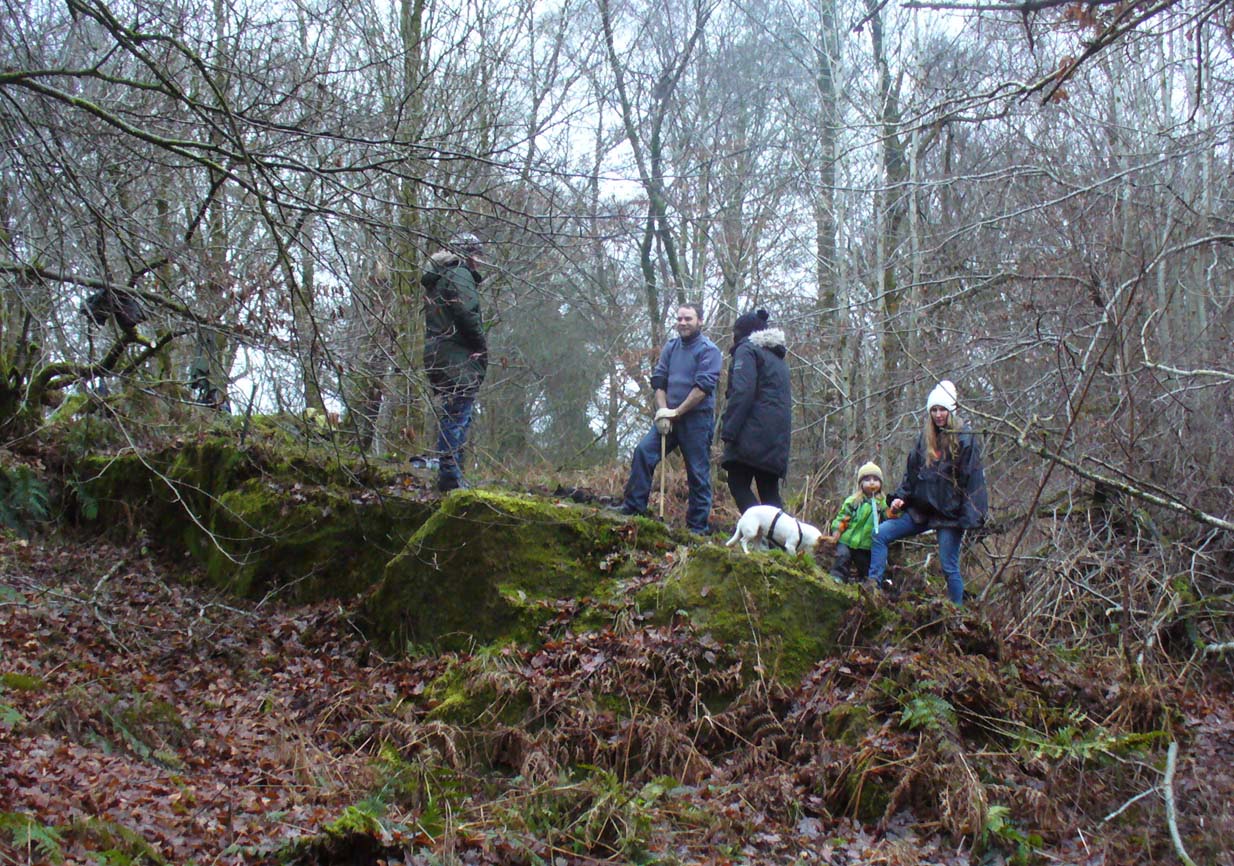
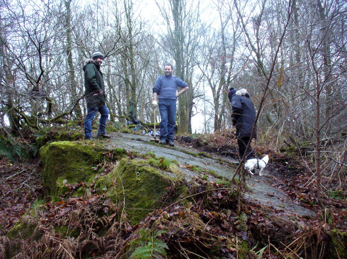
The TNA Rock Art Team on site – Fraser, Frank, Lisa, Leo & Aish
Get yourselves to Johnstone or Elderslie (which just about fuse into each other) and off the B789 road, make your way to Johnstone Castle football ground on Auchenlodment Road and go uphill, past the housing estate, until the fields open up on either side. 350 yards further, woodland appears. Go past the hair-pin kink in the road and, 50 yards or so past this, walk into the trees on your right. About 20 yards in, a large sloping rock face is what you’re looking for… (there’s a decent car-park on the left-hand side of the road 400 yards further along if you’re driving here)
Archaeology & History
4 cup-and-rings in poor light
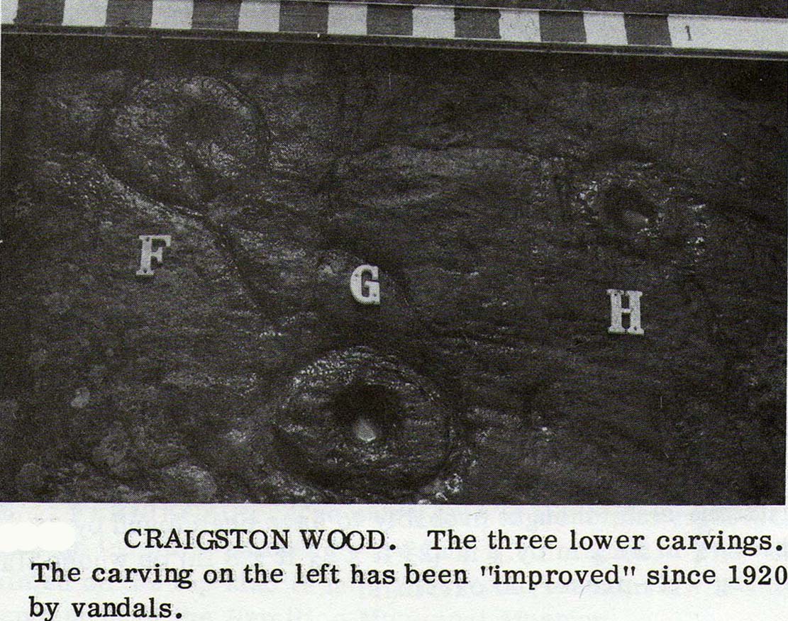
A seemingly solitary but vandalised petroglyph at the top of the Craigton Woods above Johnstone Castle estate: vandalized by the industrialists, whose quarry cut into a once larger rock, at whose edges cup-markings exist and whose design extended much further onto the now-vanished rock. The carving was also painted onto by some ignorant bastard many years ago (as the photos show); and one of the cup-and-rings here has either been damaged or isn’t prehistoric. The paint was daubed onto the stone in the 1960s and is shown in one of Ron Morris’ (1981) several descriptions of the site; and whilst it interferes with the design, it hasn’t damaged it anything like as badly as the industrialists have done.
Craigenfeoch cup-and-rings
Vandalism aside: it’s still quite an impressive carving, albeit hidden in the shadows of the surrounding trees. The design has been etched onto a large rock, some 35 feet long and perhaps up to 10 feet across, sloping at an angle of about 30-35° down (slippery when wet, as we all found out!). When we visited the site a few days ago, low cloud and mist didn’t really allow us a decent inspection of the site. But what we did find was more than our predecessors….
James Kirkwood (1938) gave the first literary account of the site—and in some detail. When he found the place it was “mostly covered with vegetation”, much like we found it on our visit. He wrote:
“The group of markings comprises five cups, each surrounded by a single encircling ring, whole lay-out being contained in an area of about 9 square feet. The setting corresponds almost exactly with the four cardinal points of the magnetic compass. The cup and ring to the north is the best preserved, the cup being 2½ inches in diameter and cut to a depth of 1 inch; the ring is somewhat elliptical, measuring 8½ and 7½ inches on its major and minor axes. A channel or gutter connects this cup with that within the eastern ring. The remaining cups vary from 2 inches to 2½ inches in diameter, and the rings from 6½ to 7 inches diameter. It is significant that the east and west cups are equidistant from the north one at about 15¼ inches; they are also equally spaced from the southeast cup at 19½ inches, and this latter dimension measures the distance from the west to the southwest cup. The four cups and rings on the main cardinal points are all moderately distinct, but the southwest sculpturing can only be very faintly discerned.”
James Kirkwood’s drawingRon Morris’ sketch
Kirkwood’s fascination with the alignments and measurements betwixt certain elements on the petroglyph was something of a fad at the time (resurfacing with some vigour in some quarters today), but is likely to have little if any authentic relevance with the animistic dynamics implicit in the function of the design.
When Ronald Morris (1981) entered the carving into his Southern Scotland survey, he made the now standard bland description of the carved elements:
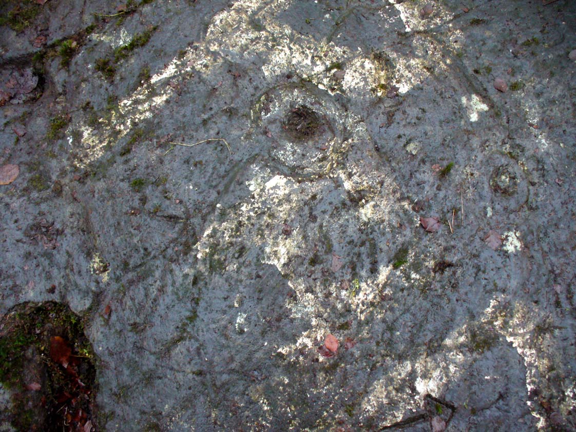
“At least 5 cups-and-one-complete-ring (some ovoid), at least one with a long wavy groove downhill from the ring, and at least 5 cups, some of which may have been ringed. The ring marked ‘F’ in the (black-and-white photo, below) has been ‘improved’ since 1934 — the author has an older photograph showing it similar to the others. The 2 upper rings can only be seen just after sunrise, when wet—they are much weathered. Greatest ring diameter – 17cm (7in) and carving depths up to 2cm (1in).”
Fraser, Frank & Lisa at work
A good drawing of the carving would be worthwhile (are there any rock art-ists out there wanna join us on our next visit?), as the archaeological blandness never does petroglyphs descriptive justice. Ostensibly, from the bottom slope of the elongated stone—below where Fraser, Frank and Lisa are standing, right—a number of geophysical marks run across the stone. You can see in the photo how several geophysical ‘lines’ cut across the rock at an angle, roughly parallel, marked by the green vegetation. One of these is a small natural tunnel hole running through the stone, possibly made by the softer rock of a fossilized tree root or branch which has since disintegrated over time. Just above this ‘hole’ the carvings begin.
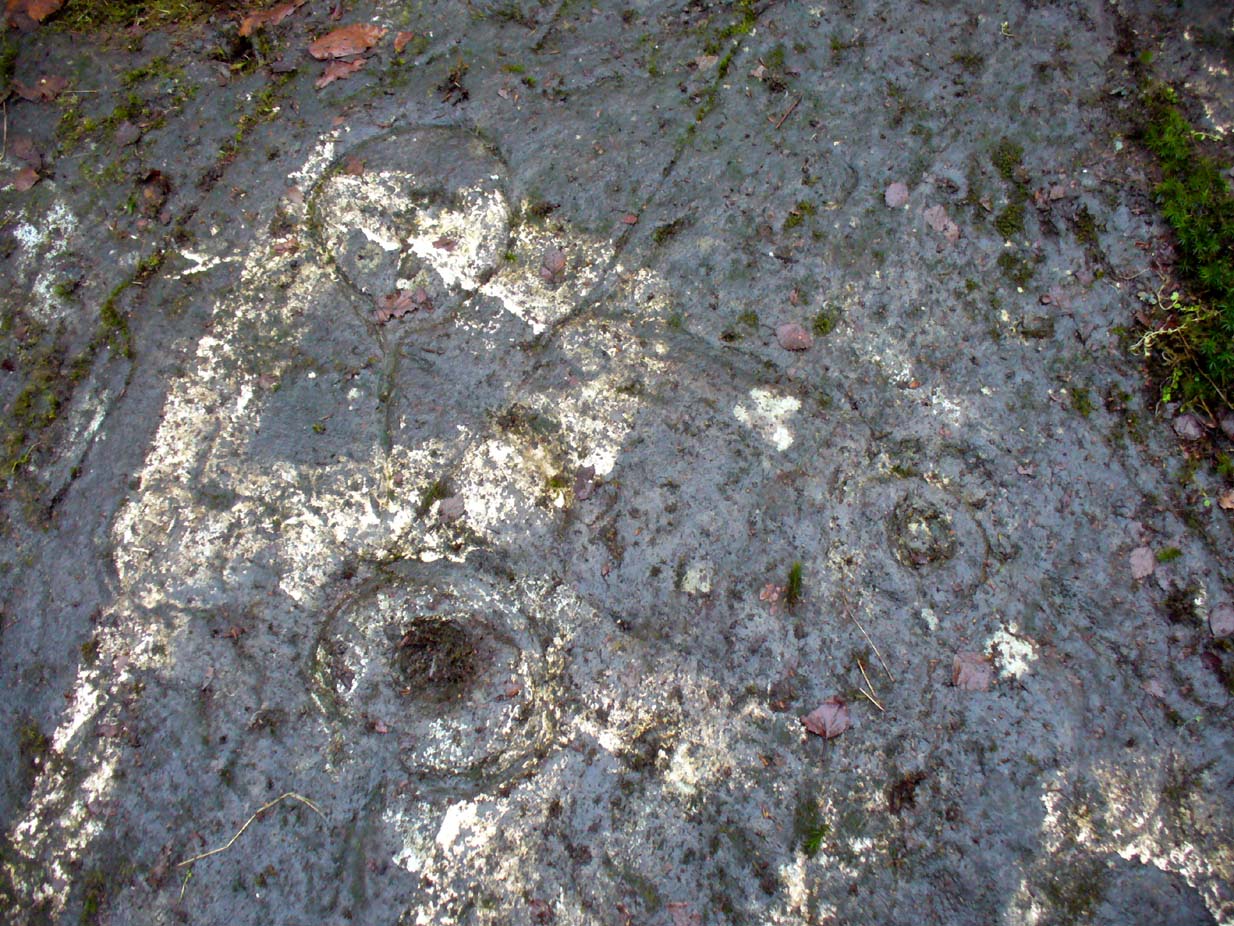
Cup-and-ring & carved lineOuter cup, ‘fan’ & CnRs
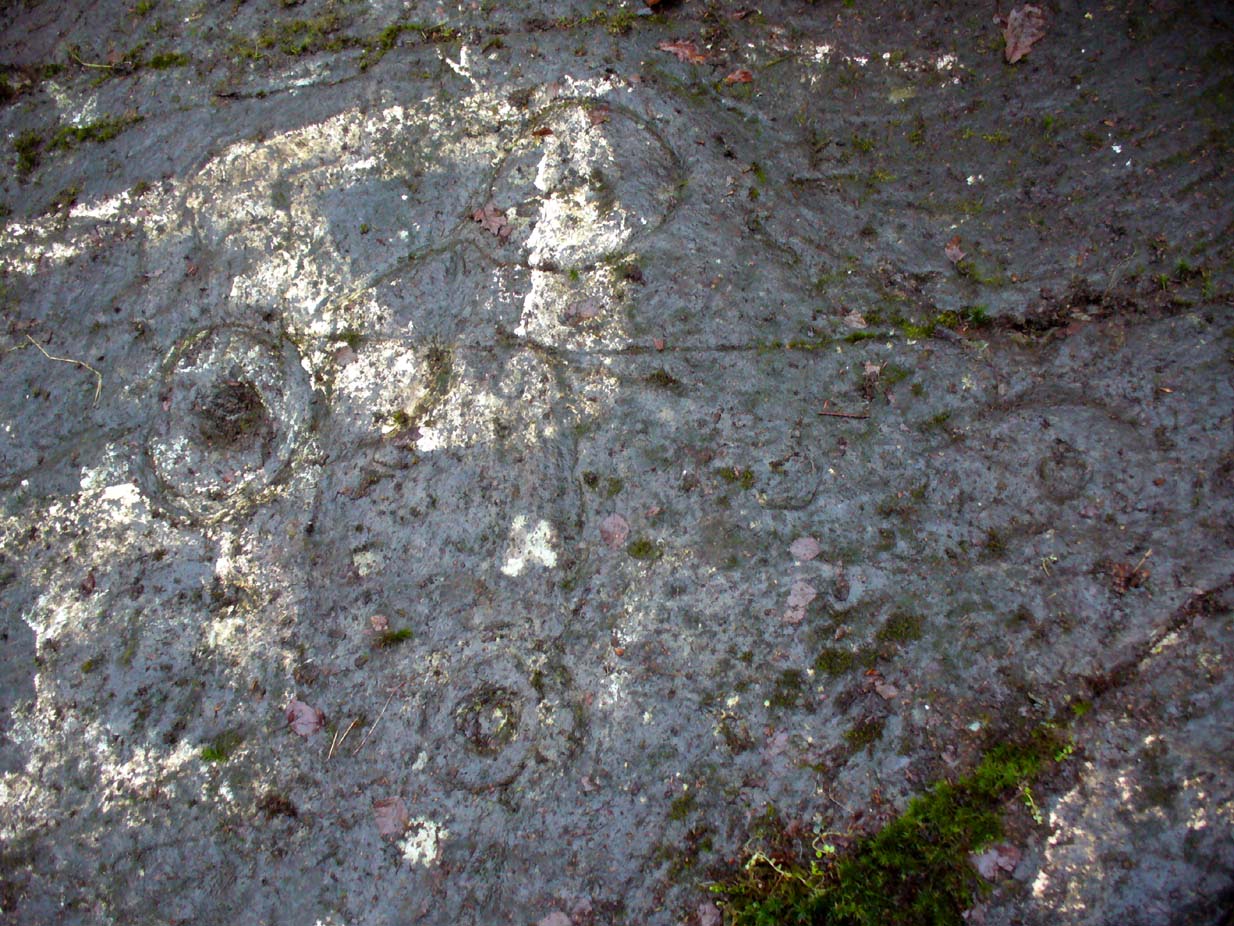
A number of possible cup-marks are overshadowed by the definite series of well eroded cup-and-rings (at least four of them) all close to each other, with lines connecting some to the others, including one which runs down to the tunnel hole. Some other lines on this part of the rock may or may not be geophysical (is there a geologist in the house!?). Close to the edge of the stone (where Fraser stands in the photo above) a singular cup-mark has been etched within a series of five lines, like an open fan, that all run to a point at the entrance of the natural tunnel in the stone. We were unsure as to whether these lines were natural or man-made (we need that geologist!); but it should be noted that an element very similar to this ‘fan’ of lines occurs in a carving near Killin, Perthshire, which we have yet to fully excavate—and in the Killin example the lines reach out from a central point like spokes on a bike wheel to an entire surrounding ring of cup-and-rings! Intriguing…
R.W.B. Morris early photo
One of the cup-and-rings in this cluster has clearly been either vandalized or else carved within the last century, as the erosion on it is wholly different to the rest, and the angle of the cuts into the stone shows clearly that a metal tool has made it. However, as Ron Morris stated above, this was apparently not the case with this ‘ring’ when he visited it in 1934 (it would be good to see the photo which he says shows its original state).
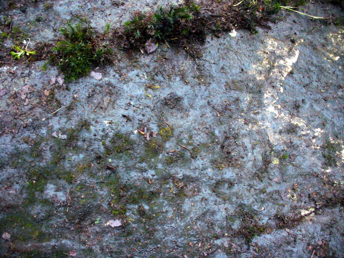
Faint cup-marks halfway up
Further up the slope of the rock we reach a near-parallel row of natural cracks across the stone. Inside this, about halfway along, a cluster of well eroded cup-marks exist—at least four of them. One of them has either a curved line arching out of it, or a semi-circular arc. Above the parallel cracks there is a large and very well eroded cup which, from differing angles, appeared to have faint sections of a ring around it, but we all agreed this was more a Rorschach response in our respective feeble minds!
We need to visit the site again in much better weather to gain a more accurate picture of the entire design. It appeared there were other elements to be seen here, but the lighting conditions were working against us that day…. That’s our excuse anyway!
References:
Kirkwood, James, “Notes on Cup and Ring Markings at Craigenfeoch, Renfrewshire”, in Transactions of Glasgow Archaeological Society, 9:2 (New Series), 1938.
Morris, Ronald W.B., “The Cup-and-Ring Marks and Similar Sculptures of South-West Scotland,” in Transactions of the Ancient Monuments Society, volume 14, 1967.
Morris, Ronald W.B., The Prehistoric Rock Art of Southern Scotland, BAR: Oxford 1981.
Acknowlegdments: With huge thanks to what Nina Harris called “the TNA rock art team” – Aisha Domleo (and Leo), Nina Harris, Frank Mercer, Lisa Samsonowicz & Fraser Harrick.
Holy Well (destroyed): OS Grid Reference – NS 6029 6547
Also Known as:
Minister’s Well
Archaeology & History
Site of the Priests Well in 1865
A ‘holy well’ with a bit of a difference when it was designated as such, however many centuries ago. Found on the southern slopes below Glasgow ‘s Cathedral, just a few yards west above the Molendinar Burn (upon which Wishart Street now sits), this was deemed to be a well only to be used by the christian ministers or priests from above. Local people were not supposed to drink here it seems! Instead, they were supposed to either drink from the burn, or walk a short distance down to the Lady Well (now badly polluted) 175 yards to the southeast. I don’t expect many Glasgow folk paid that much attention to such arrogant ministerial laws!
Shown on the earliest OS-map, simply as a ‘Well’, this is one of at least four water sources within a square mile of the Cathedral (including St. Mungo’s and Lady Well) that were deemed as ‘sacred’. It truly makes you wonder what on Earth was here before the christians came along and built their huge temple on the rocks above…. What animistic heathen rites and traditions were suppressed around this natural landscape before the toxic blanket of christianity was imposed upon us?
Healing Well (destroyed): Os Grid Reference – NS 5931 6500
Also Known as:
West Port Well
Archaeology & History
Once found near the old crossroads of Trongate, Arygle Street and Stockwell Street, the Trongate Well is another of old Glasgow’s lost sites, piped-off and added to the city’s water system sometime in the 19th century. A pity, as the fresh water from here was highly regarded (moreso than the modern stuff with its chlorine and other unnecessary additives). The well could be found where the Highland Gaelic Society built their own public house and, as a result, was very popular with local folk. It was,
“Opposite the old Black Bull in Trongate…afterwards covered in, which was famous in the palmy days of cold punch, and which is alluded to in Cyril Thornton as ‘the West Port Well.’” (MacGeorge 1880)
Old cattle markets were held here and MacGeorge (1880) wrote how it was a very popular and favourite place in its day, “surrounded by large numbers of the town’s people waiting a supply.”
The old Black Bull pub was much used by drovers and across from it was the old draw well, whose waters were of such renown that they were described in the verse, The Lament of Capt Paton, thus:
“Or if a bowl was mentioned,
The Captain he would ring,
And bid Nelly to the West Port,
And a stoup of water bring;
Then he would mix the genuine stuff,
As they made it long ago,
With limes that on his property
In Trinidad did grow.
O! we ne’er shall taste the like
Of Captain Pateon’s punch no mo’!”
Healing Well (destroyed): OS Grid Reference – NS 594 645
Archaeology & History
Mentioned briefly in James MacKinlay’s (1893) classic survey, this site was an ancient draw-well sunk near the old city centre but, like the ancient Moot Hill close by, has long since been destroyed. It is described amidst Andy MacGeorge’s (1880) historical survey of the ancient wells where he wrote:
“There was another…at the Barras Yet, near the port of that name at the foot of Saltmarket. It is mentioned in a minute of council in 1664, which ordains that ‘in respect of the heighting of the calsay at the Barrazet the well there be heightit twa stones higher round about, for preservation of childerin falling therein.’”
Although its exact whereabouts is not known, the proximity of the old fountain known as the Sir William Collins Memorial Fountain 100 yards east into the Glasgow Green Park at the bottom of the Saltmarket, might have robbed the Barrasyett Well of its water supply to gain existence.
One of the many public wells in Glasgow, all trace of this site disappeared long ago. Found at the ancient heart of the city, the name ‘Vennel’ comes from the old dialect meaning, “a narrow alley or lane between houses,” which is where it was once found, along the Old Vennel. An early account of it was outlined in MacGeorge’s (1880) classic text, where it was described as,
“a draw well, as there is a minute of council in 1656 arranging with John Scott, mill-wright, to ‘rewle and governe’ this well and ‘the new well in Trongait’, he undertaking to uphold them ‘in cogis and rungis, the toun vphalding all ganging greth quhan athir it weirs or breckis.’”
A few years after this in 1663, it seems the Vennel Well had been closed due to it becoming regularly polluted and further council minutes told:
“Recommendis to the deane of gild to caus open again the wall at the Stincking Vennell, and to remove the old wark therof, and caus mak it lyk the wall in Trongait for service of the inhabitantis.”
Around this time a door and lock was put around the well to prevent people dumping and polluting the waters. Further council minutes from April 1663 inform us that,
“The keyes of the well at the Vennell is delyvered to Robert Bell, tailyeour, and he is to have twa dollouris yeirlie for his attending thereupon.”
All healing virtues, folklore and traditions of this site have long since been forgotten.
Holy Well (destroyed?): OS Grid Reference – NS 553 658
Archaeology & History
This is the conjectural title conferred by T.C.F. Brotchie (1920) upon a Well uncovered during construction of the Pearce Institute in Govan in 1908. It was certainly an old site and very well made by the sound of it: being “a stone-built well some ten feet deep (and) some eight feet below the present surface of the ground.” Brotchie thought it to be medieval in age – and he may have been right.
On asking local people if they knew anything about the site, he was lucky to meet “a very old man, a Mr Rellie”, who told him that when he was a boy his granny spoke of a lost “guid well (that) was near the kirk.” He continued:
“I have no doubt that the well discovered in 1908 was the guid well, and judging from its proximity to the god’s acre, and also from adjective ‘guid’, that the well was at one time the holy well of St. Constantine, who in the 6th century founded a church in Govan. Of course, that is conjecture, but I venture to think that the conjecture is reasonably well founded.”
The church is immediately adjacent and is indeed dedicated to St. Constantine. Inside of it are a variety of fascinating archaeological relics: not least of which is what Sam Small (2008) called the ‘Pagan Sun Stone’ upon which is carved an ancient swastika! That – I’ve got to see!