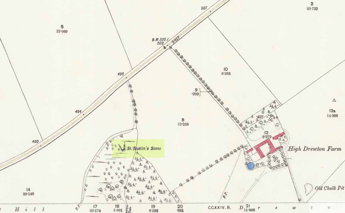
Legendary Rock: OS Grid Reference – SE 93360 34443
Also known as:
- St. Augustine’s Stone
- St Austin’s Rock
Folklore
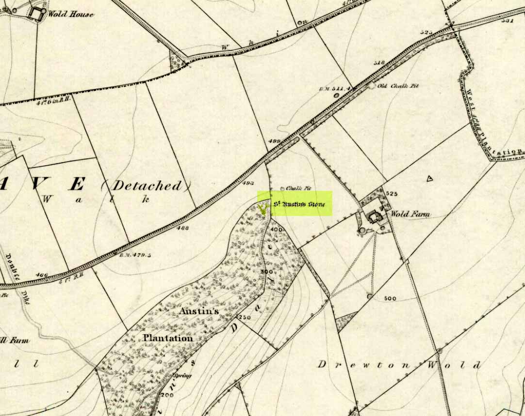
The folklorist John Nicholson (1890) wrote about this “block of natural concrete standing at the head of Drewton Dale, near South Cave” — which modern OS-maps call Austin Dale. Legend told how it “derived its name from St. Augustine, who used to preach from this stone to the heathen, before Britain became christian.” This obviously supplanted an earlier heathen site, but it’s difficult to work out what that may have been. It could have been the lost ‘Rud Stone’ immediately west; or perhaps had some traditional relationship with the healing well which emerges a short distance away further down the valley. Just above here as well, we find an ancient dragon’s lair at Drakes Hole, which could also hold a clue to this place.
A couple of years after Nicholson mentioned the site, John Hall (1892) published his excellent history of the township, in which he described St. Austin’s Stone thus:
“It’s a mass of rock projecting from the side of a hill and in its longest part, extending from the hillside to the face of the stone, measures about 60 feet. By some it is supposed to have formed a centre for druidical worship, and that the adjoining township took its name of Drewton (or Druid’s Town) from this fact. When St. Augustine came to England…he is said to have visited this part of the East Riding; and that this stone took its name from his visit.”
The site was also surmounted by a cross at some time in its recent history, but this has gone. The earth mystery writer Philip Heselton (1986) told that the nearby Well was indeed a place connected to St. Austin’s Stone, in an early article in Northern Earth Mysteries, saying:
“St. Austins Stone near South Cave is a rock outcrop where Saint Augustine is said to have made converts, baptizing them in a nearby well. The site is used for church services. Every seven years, part of the stone falls away, but it always grows again.”
The site should be examined for potential cup-and-ring markings; as well as reports on the status of the Well. Any photos of the present situation of the site would be most welcome.
References:
- Gutch, Mrs E., County Folk-Lore volume VI: Examples of Printed Folk-lore Concerning the East Riding of Yorkshire, David Nutt: London 1912.
- Hall, John George, A History of South Cave and other Parishes in the East Riding of Yorkshire, Edwin Ombler: Hull 1892.
- Nicholson, John, Folk Lore of East Yorkshire, Simpkin Marshall: London 1890.
- Thompson, Thomas, Researches into the History of Welton and its Neighbourhood, privately printed: Kingston-upon-Hull 1869.
Links:
© Paul Bennett, The Northern Antiquarian