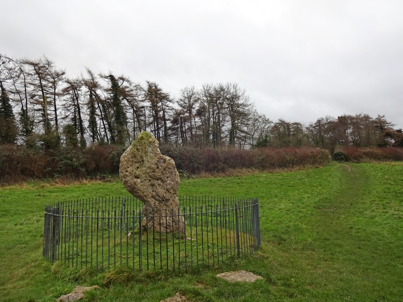
The King Stone of Rollright (photo by Sir Wilson III)
If you’ve reached the impressive Rollright Stone circle, simply cross the road, go through the gate and into the field, then up the gentle slope to your right. Y’ can’t miss it! If though, by any chance, you can’t find the Rollright Stones, get to Chipping Norton and ask a local!
Archaeology & History
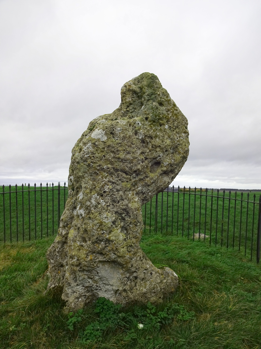
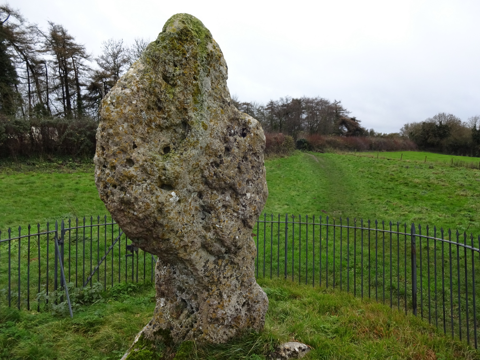
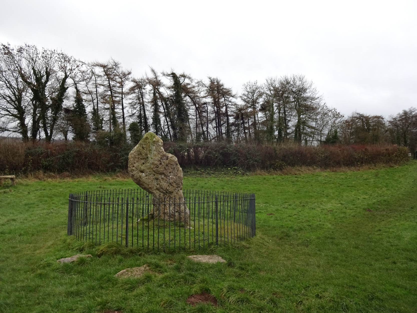
An integral part of the Rollright Stones complex, this gnarled almost moth-eaten-looking standing stone, whose edges were cut away for medicinal properties in earlier centuries, still awakes each morning beside the small rise in the field, long thought to have been the remains of an ancient tomb — much to the archaeologist’s opinionated disdain in bygone years. Yet they had to swallow their pride…
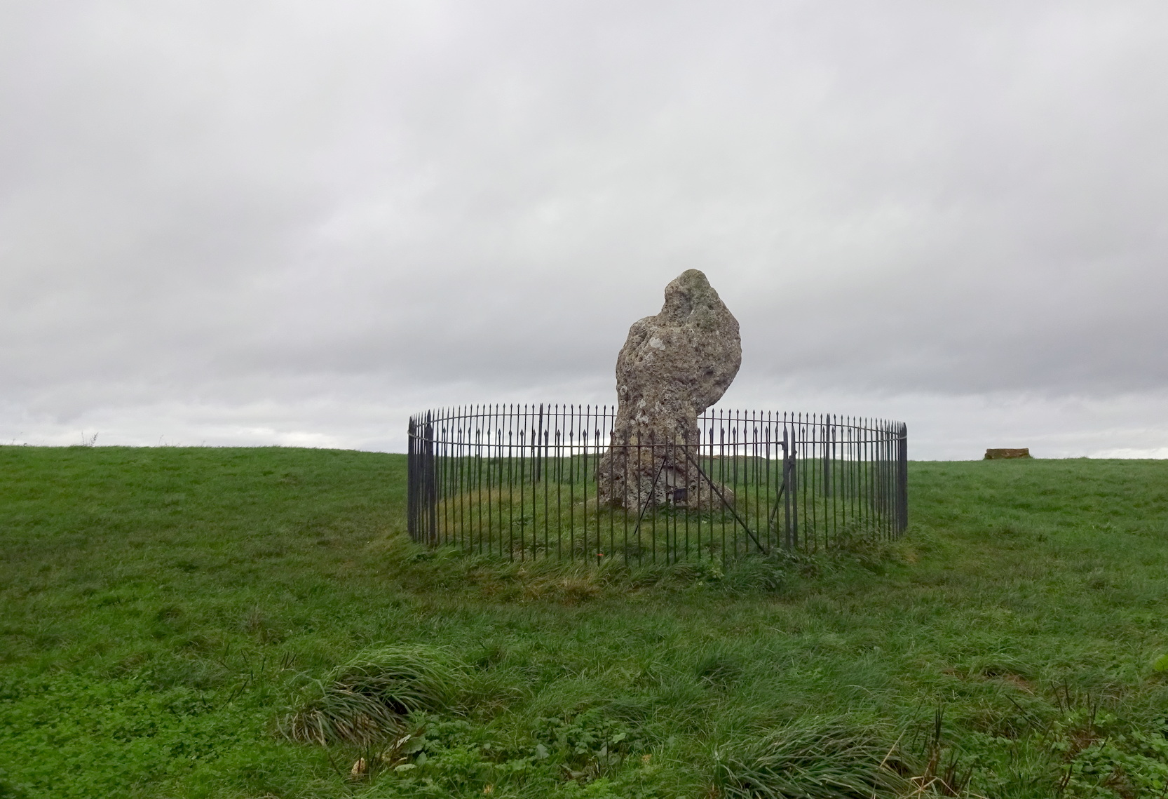
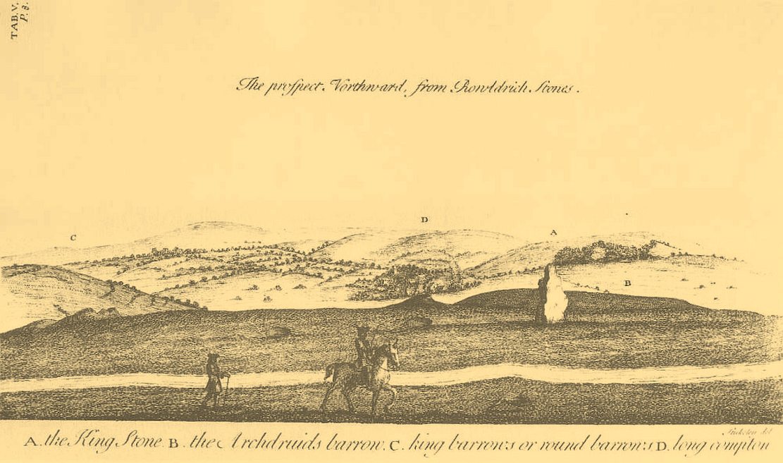
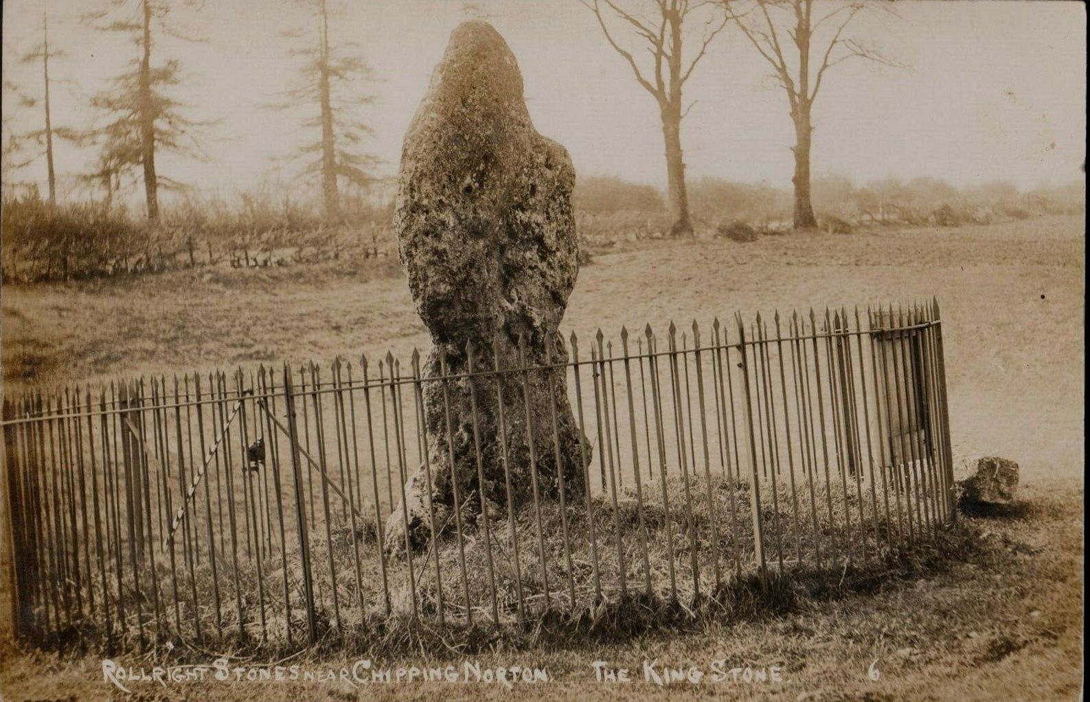
This is an eight-foot-tall standing stone made from the same local oolitic limestone as the King’s Men and overlooks the village of Long Compton on the northern side of the ridge. It actually stands besides an artificial mound which has been identified as a Bronze Age cairn—known in times past as the ‘Archdruid’s Barrow’— and suggested by Lambrick to date from around 1800 BCE. More recently however, the world’s leading authority on stone circles, Professor Aubrey Burl, has given the King Stone a more probable construction date of 3000 BCE. The date is consistent with other Neolithic finds in the adjacent fields. This old standing stone has suffered much down the centuries, with bits of it being chipped away to such an extent that it has been reduced to the novel shape we see today.
Looking up at the King (photo by Sir Wilson III)The King in dance
A little-known but important piece of megalithic history took place here in the 1970s and ’80s. It centred around an idea to investigation so-called “mysterious events” that are commonly reported at standing stones—and the King Stone has its own CV when it comes to such things. Curious stories have been described by people from all walks of life. Down the years, a number of people have told me of feeling some strange and powerful ‘energy’ at these places and stories of such things have filled many volumes, along with being the subject of many a folktale. So one evening in November, 1977, the then editor of The Ley Hunter, Paul Devereux, convened a meeting where twenty people from differing backgrounds gathered. At this first meeting were people from a variety of professional backgrounds: archaeologists, dowsers, chemists, biochemists, biologists, electronic engineers, geochemists, geophysicists, zoologists—and ley hunters of course. It was time, they thought, to address this issue of anomalous energies at stone circles and other ritual sites.
After some discussion about what they should call their investigations, “the long association of the dragon with some kind of earth force made it a fitting symbol.” And so, the Dragon Project (DP) was born…
On the misty morning of Saturday, 24 October, 1978, research scientist Don Robins—in the company of his dog and young son—drove the hundred miles from London to the Rollright Stones armed with a simple ultrasound detector. He didn’t know what he would find there, and his scientific training told him there shouldn’t really be anything untoward.
King Stone, looking W (photo by Sir Wilson III)Stukeley’s 1743 sketch showing the King Stone
Arriving around dawn, Robins took several background readings along some of the lanes a mile or so away and found the usual expected background levels (on a scale of 1-10, the background flickers between 0 and 1). When he eventually walked into the Rollright stone circle with his ultrasound monitor, no undue perturbations were found. He spent thirty minutes here, but at no time did he record anything other than background readings. So he crossed the road and tried the same at the King Stone—where a big surprise awaited him.
Switching on the detector he found an anomalously high reading, beating every minute or so, not unlike a heartbeat, more than five times above the background ultrasound!
“This was really peculiar,” he wrote, “in that the pattern was spread over about a minute and then commenced again after about 10 seconds, endlessly repeated.” Robins spent some time here and found that the strange ‘pulse’ wasn’t solely confined to the King Stone, but spread some distance around the old standing stone and onto the road itself.
Investigation of potential radiation anomalies was another avenue of enquiry explored by the Dragon Project, and although thousands of hours of monitoring were done at the three focal sites, there were few anomalies to write home about. Two however, were recorded in March and August, 1981, when radiation levels were twice the normal background rate for short periods of just a few minutes each. More puzzling was the finding—which can still be verified today—of radiation levels three and four times above background on the road between the circle and the King Stone.
Next on the list was an attempt to monitor the Rollright stones with infrared devices. This proved to be a potential goldmine, as there was the chance of photographic imagery. So early one morning in April, 1979, Paul Devereux readied himself at the King Stone. He took a number of photos at five minute intervals either side of sunrise. This time of day was chosen because of the repeated anomalous ultrasound emissions from the King and it was thought that this, if any, would be the best time to capture something on film.
“When the first roll of black-and-white IR film was professionally developed,” he wrote, “I was astonished to see a curious ‘glow’ effect around the King stone on the frame taken at sunrise.” His first account of it appeared in The Ley Hunter, where he described how “a hazy glow can be seen clinging to the sides and upper parts of the megalith. This glow becomes much stronger at the top of the stone where it looks like a cap of light.” Although the sun had risen, it was off to the left of picture and apparently no satisfactory explanation can be given to the effect on the plate. Research physicist Simon Hasler—who worked for Kodak—closely studied the negatives of this image and found the evidence for a simple explanation “weak.” A possible explanation of the mysterious glow was propounded by Don Robins, who suggested that an emission of microwaves from the stone may have been responsible, and although this sounds promising it has yet to be proven.
Folklore
(photo by Sir Wilson III)
Amidst the mass of modern lore, dowsed energy lines exceed here — although to be honest, most of them are little more than bullshit. Old school alignments in the form of leys that can be walked along are more credible, and one or two have been noted here. Dowser Laurence Main found a ley running between Broughton Church, “the old White Cross, the Victorian Cross and the old Bread Cross in Banbury. In the other direction the line led straight to the King Stone.” Although this line accurately links up these sites, other ‘ley points’ are utterly necessary between Broughton Church and the King Stone to give the alignment any real credibility. In a concise survey of the megalithic remains of this region made by Tom Wilson and myself, no other ley-points were found along the line.
In more traditional animist-based folklore, the creation myth here is well known. The famous, oft-repeated tale recites how a King and his men were marching across the land intent on conquering it when he came across an old hag, or witch near Rollright who offered the regal figure a magickal challenge. Some accounts name the witch as Mother Shipton—not the famous Yorkshire seer of the same name, but her less powerful (obviously!) southern counterpart. The old witch said to the King:
“Seven long strides thou shalt take, and
If Long Compton thou can’st see,
King of England thou shalt be.”
His majesty took this as a simple task and, with contempt, said to the old witch:
“Stick, stock, stone,
As King of England I shall be known.”
From where he was standing (which is never told, but presumed by most as the stone circle) the King then took seven long strides in the direction of Long Compton. As he was taking his seventh step the witch made the ground in front of him rise up, hence blocking his view of the village in the valley below. The old hag then said:
“As Long Compton thou canst not see,
King of England thou shalt not be.
Rise up, stick, and stand still, stone,
For King of England thou shalt be none;
Thou and thy men hoar stones shall be
And I myself an eldern tree.”
Thereupon, the King’s men who were waiting behind their master, the five knights in the field who were said to be conspiring against his majesty, and the King himself, were all turned into stone where they stood. The elder tree that the old witch turned herself into, was said to have grown along the old boundary close to the roadside, but this can no longer be verified. The folklorist Arthur Evans described several spots where the famed elder tree was said to have grown: one in the field close to the Whispering Knights, and another in the same field as the King Stone, close by another large stone that has long since gone.
When William Stukeley visited the area in the 18th century and heard about the legendary origin of these great monoliths, he told how “the country people for some miles round are very fond of, and take it very ill if anyone doubts it,” telling later, “The people who live at Chipping Norton and all the country round our first described temple of Rowldrich affirm most constantly, and as surely believe it, that the stones composing this work are a king, his nobles, and Commons turned into stones.
Another piece of animistic lore tells how the King Stone and the Whispering Knights venture, at midnight, less than half a mile south to drink from a spring in the small woodland at Little Rollright Spinney—although it is difficult to ascertain precisely which of the two springs the stones are supposed to visit. In some accounts, the stones reputedly drink from the well every night, but others tell that they only go there at certain times of the year, or on saint’s days. When Arthur Evans wrote of these tales he described there being a “gap in the bushes… through which they go down to the water,” but the terrain has altered since his day.
A variation of the same tale was told by T.H. Ravenhill, who wrote:
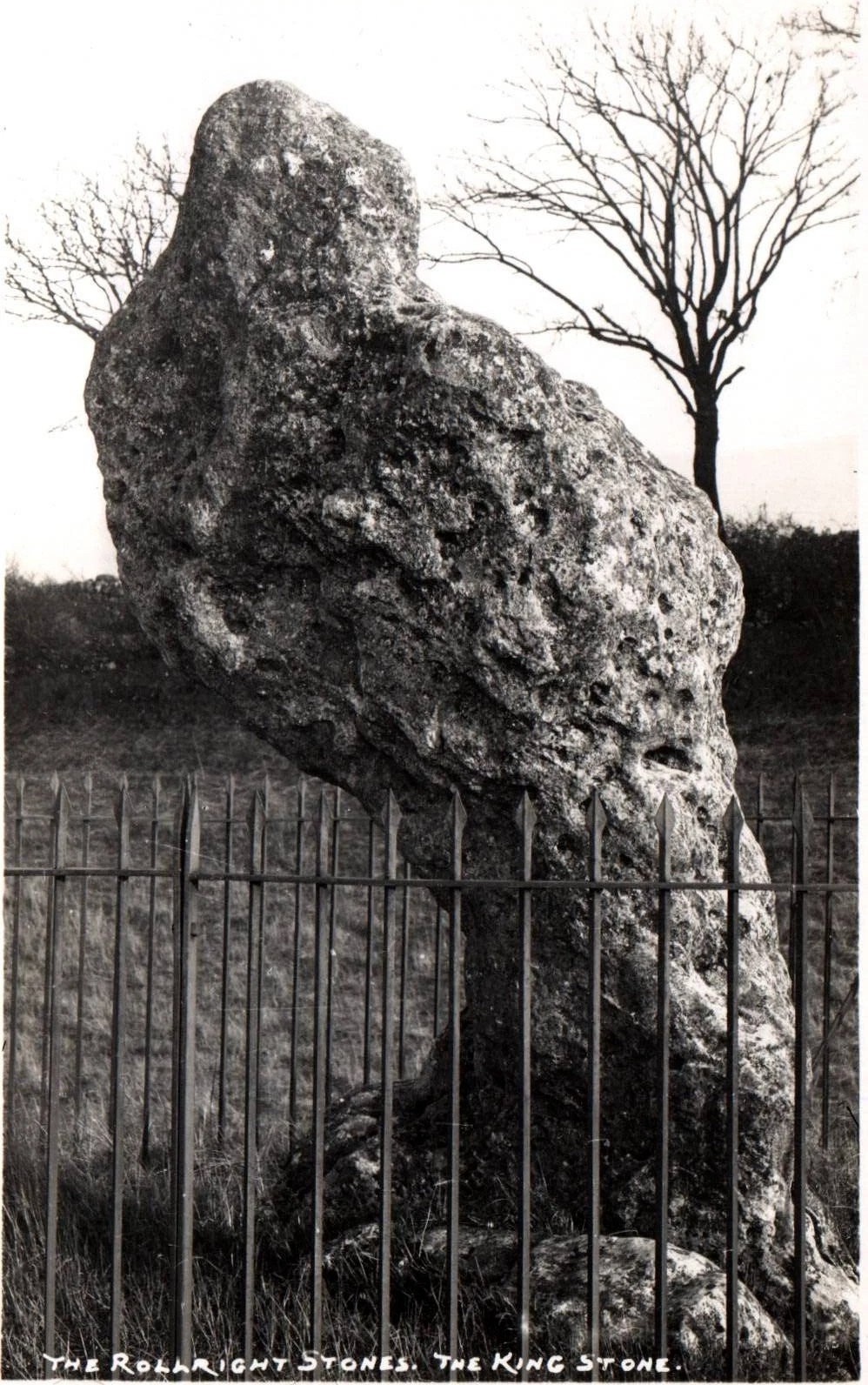
The old King c.1945King Stone, c.1920
“The Lord of the Manor of Little Rollright desired to possess the King’s Stone in order to bridge Little Rollright brook. So he dug it up and tried to cart it away, but found that he had not enough horses. He hitched on more, and yet more, and still he found that he could not move the stone. Finally he succeeded and hauled the stone away to the Manor House. The same night he was alarmed by strange sounds about the house, which he attributed to the presence of the King’s Stone, and decided, therefore, to replace it on its mound. No sooner had he harnessed the first horse to the cart than it galloped away up hill with ease, taking with it the stone, which leapt to position on reaching its resting place.”
Evans also wrote about an eighty-year-old local woman who told that her mother visited the King Stone on Midsummer’s Eve, along with many other locals, when the elder was in full bloom and they would stand in a full circle around the tall monolith. Ritual of a sort was performed then the elder tree was cut and, as it bled, “the King moved his head.” This annual rite was said to partially disempower the witch of her magickal hold over the King when her blood trickled from the tree. Some locals believed that if but a pin-prick of the witch’s blood was drawn, she would lose her power for all eternity.
Beneath both the Rollright stone circle and the King Stone, legend reputes there to be such a cavern where the little people live. In some accounts they are said to dance around the old King.
Arthur Evans told how one local man, Will Hughes, actually saw the faerie dancing round the King.
“They were little folk like girls to look at,” he said.
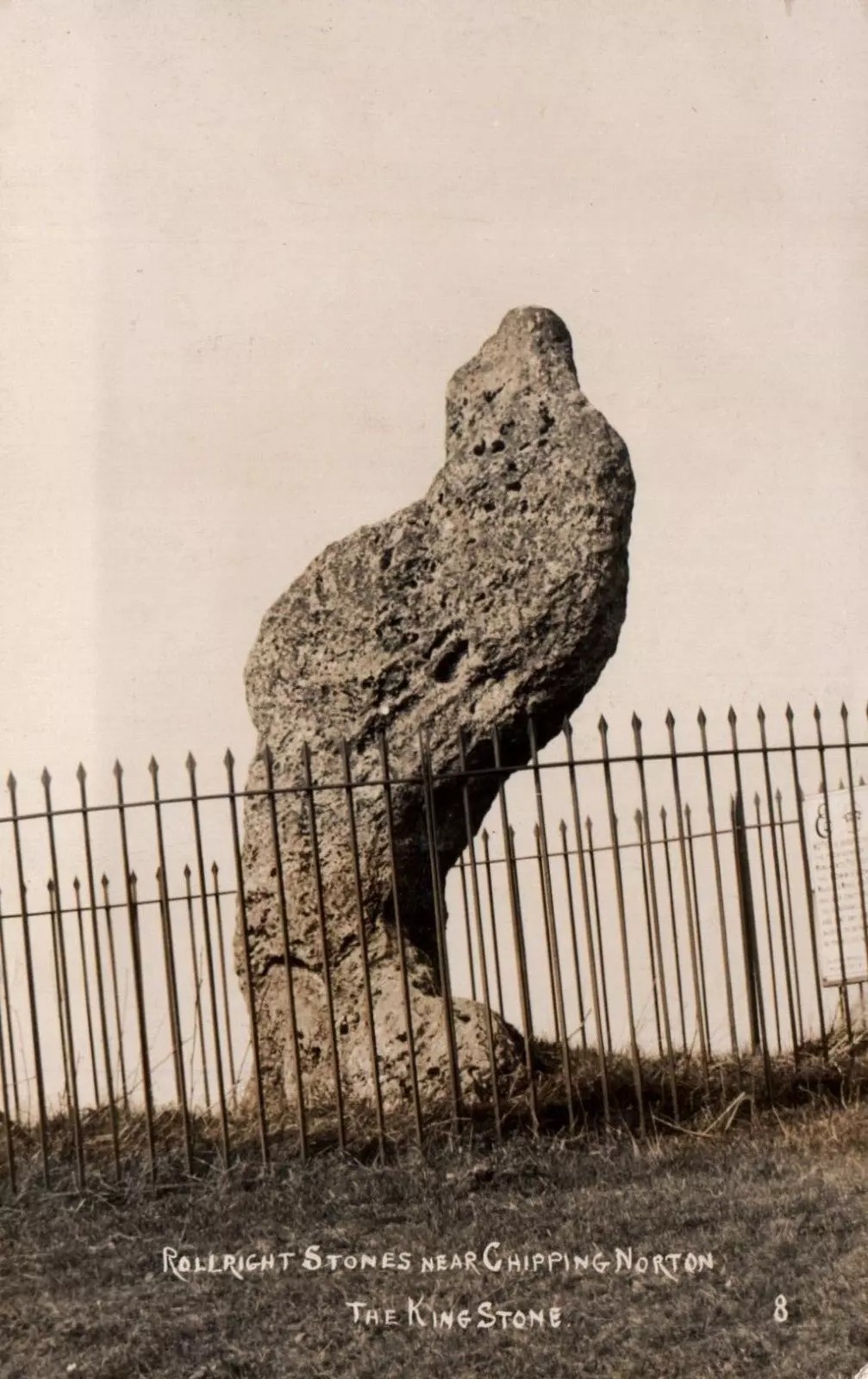
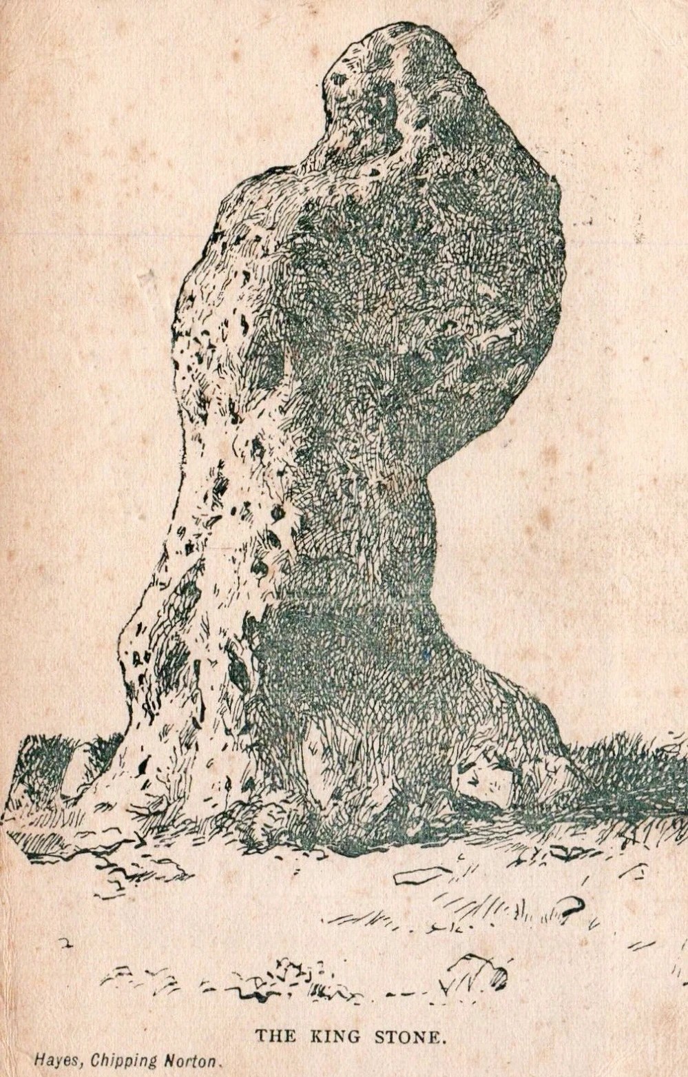
Old postcard, c.1910Sketch from 1904
Will’s widow, Betsy Hughes, told Evans that “when she was a girl and used to work in the hedgerows, she remembered a hole in the bank by the King Stone, from which it is said the fairies came out to dance at night. Many a time she and her playmates had placed a flat stone over the hole of an evening to keep the fairies in, but they always found it turned over next morning.” This curious entrance was a neolithic burial mound. Mark Turner described how the little people were “supposed to come out and dance around the stones by moonlight.”
As we have already seen, people used to take chippings off some of the old stones here—primarily the King—supposedly for luck, protection and good fortune. Local people used to blame Welsh workers more than anyone, but they wouldn’t be the only ones! Although those who took such chippings believed the pieces brought them luck, more often than not it was the opposite that happened. One local woman told Evans about her son who went to India as a soldier in the 19th century with a piece of the King Stone in his possession, but it did him no good whatsoever. He died of typhus! The Oxford archaeologist George Lambrick (1988) highlights in his book on the Rollright stones the extent of damage that has been done to the King Stone since 1607.
References:
Anonymous, The Rollright Stones: Theories and Legends, privately printed, n.d.
Bennett, Paul & Wilson, Tom, The Old Stones of Rollright and District, Cockley: London 1999.
Bloxham, Christine, Folklore of Oxfordshire, Tempus 2005.
Cowper, B.H., ‘Oxfordshire Legend in Stone,’ Notes & Queries (1st series), 7, January 15, 1853.
Devereux, Paul, ‘Is This the Image of the Earth Force?’ in The Ley Hunter 87, 1979.
Devereux, Paul, ‘Operation Merlin,’ in The Ley Hunter 88, 1980.
Devereux, Paul, ‘Operation Merlin 2,’ in The Ley Hunter 89, 1980.
Devereux, Paul, ‘The Third Merlin,’ in The Ley Hunter 92, 1981.
Devereux, Paul, Places of Power, Blandford: London 1990.
Devereux, Paul, The Sacred Place, Cassell: London 2000.
Evans, Arthur J., ‘The Rollright Stones,’ in Trans. Bristol & Glouc. Arch. Soc., 40, 1892.
Evans, Arthur J., ‘The Rollright Stones and their Folklore (3 parts),’ in Folklore Journal, 1895.
Lambrick, George, The Rollright Stones: The Archaeology and Folklore of the Stones and their Surroundings, Oxford Archaeology Review 1983. (Reprinted and updated in 1988.)
Michell, John, Megalithomania, Thames & Hudson: London 1982.
Pennick, Nigel & Devereux, Paul, Lines on the Landscape, Hale: London 1989.
Ravenhill, T.H., The Rollright Stones and the Men Who Erected Them, Little Rollright 1926.
The stone circle of Fingal’s Cauldron Seat, Machrie Moor, Arran (photo by Aisha Domleo)
By whichever way you come (be it from Brodick on the east, Lochranza to the north) ask any local the way to Machrie and they’ll point you the road onto the west side of the island, roughly halfway. You’re after the hamlets of Blackwaterfoot or Auchagallon. From either of these spots, take the road to Tormore. From here, the dirt-track east close to the Machrie Water is where you need to walk. About a mile along this well-defined track you’ll see the large barn ahead of you. Hereabouts you’ll begin to notice some very tall standing stones. Keep walking on the track, and the first double-ring of smaller stones to your right is the place yer after!
Archaeology & History
Approaching the ring (photo by Aisha Domleo)
This is one well-preserved stone circle in a superb setting with other large megalithic rings all close by—at least 12 of them!—set upon the flat open moorlands on the west side of Arran, with views in all directions sending the enquiring nose tasting for more wherever the eyes gaze…. It has been written about by many many writers over the last few centuries—which aint surprising! But it was in recent times that the place was said by Aubrey Burl (1981) to be “holy ground,” because although there are many prehistoric settlement sites and other remains scattered across this landscape,
“it is noticeable that the dozens of huts whose ruins litter the moor were built well away to the west, none of them near these powerful and lonely stones.”
1832 sketch of Fingal’s Cauldron by James Skene
It’s a fair point.
Fingal’s Cauldron was first defined in an archaeological context by James Bryce in 1863, who named it the ‘Machrie Moor 5’ stone circle (MM5)—and it was he and several others who dug into the ring, to see what it might be hiding!
“Excavating at the centre we found a small cist at less than a foot in depth, and lying about north-east. It was covered by a small lid, and the dimensions were 2 feet 2 inches in length, 10½ inches in depth, and 11 inches in width. Inside there were several bone fragments and black earth. A flint implement was found in the stony soil above, and three other flint fragments, but nothing of this kind in the cist itself. This was of much ruder structure than any we had seen before (Ed. – i.e., in the other Machrie circles); it was cut out of the sold sandstone rock, but with little care or exactness; the sides however, were nearly perpendicular. The difficulty of excavating without iron tools may account for the smaller size and ruder form of this cist. No other cist was found, nor remains of any kind, though a trial was made at several points around the centre. A deep opening was also made on both sides of the upright stone, but nothing was met with worthy of being recorded.”
A.E. Roy’s 1967 site-plan
Described thereafter a number of times by different historians and antiquarians, Fingal’s Cauldron (and its associates) was then recounted in the Machrie Moor survey of Mr Balfour (1910) in his magnum opus on the Isle of Arran. Although he gave more attention to the other stone circles in this multiple megalithic complex, he did thankfully make note that,
“upon higher ground free of peat, and immediately to the south of the farmhouse, is the celebrated double circle of granite blocks known popularly as Fingal’s Cauldron Seat. The inner ring consists of eight and the outer of fourteen blocks. The diameter of the inner circle is 36 feet and of the outer 57 feet. The largest stones are in the inner series; they are more or less round-topped blocks, about 4 feet high. One of the stones of the outer ring has a ledge which is perforated by a round hole, with the edges worn smooth.
“In the centre of the inner ring, only a foot from the surface, a ruined cist was laid bare. It had been previously disturbed, and was represented by two stones only, lying parallel to one another. There was no capstone, and no relics were discovered.”
More recently in the 1960s, another survey of Fingal’s Cauldron was undertaken by A.E. Roy and other archaeologists. They found nothing new of any value, but gave us the ground-plan we see here (sadly it seems that Alexander Thom didn’t bless this site with his theodolite and survey). Aubrey Burl re-examined the site again during his own survey in the 1980s.
An elemental called Lara sat seated on one of the uprights! (photo by Aisha Domleo)Small section of inner & outer rings (photo by Aisha Domleo)
There are other curious features to this ring that aint generally talked about amongst the archaeo-fraternity, out of fear of sounding inspiring perhaps… In the 1980s, a chap called Paul Devereux and a number of physicists organized volunteers from across the country to monitor electromagnetic anomalies at many megalithic rings, in order to explore the validity, or otherwise, of the idea that there were ‘energies’ at stone circles. The study was called The Dragon Project and went on for many years. The Machrie Moor complex was one of the places where examinations of electromagnetic fields were undertaken—Fingal’s Cauldron being one of them. Devereux (1990) tells us a small part of the story:
“In May 1983 Dave and Lynn Patrick monitored several of the Machrie Moor circles, including MM5, with a geiger counter for the Gaia Programme. They also took background control readings and monitored a non-megalithic ‘dummy site’ for comparisons.
“Five of the circles…gave average site readings 2 to 13 per cent higher than background, but MM5 gave a site average of 33 per cent above background. A non-megalithic ‘dummy site’ was 5 per cent above background. The Patricks had taken 20 readings within MM5—one hour of monitoring time—plotted onto the ground-plan. There was no mystery about why the site gave a higher average than anywhere else, and a third higher than background—the stones are radioactive granite, and there are 23 of them. But one stone, the tallest, and the most westerly of the upright stones in the inner ring, is particularly energetic, giving readings 16 per cent above the next most radioactive stone in the double ring, and more than that for the other 58 stones monitored in the Patrick’s study on Machrie Moor.
“I took measurements at the site myself in April 1988, using new equipment, and confirmed that the MM5 stone did indeed give a moderately high naturally radiation count (about 33 per cent above normal).”
This rather hot “Cauldron of Finn” certainly does throw off more heat than its compatriots nearby, as scientific analysis has shown! It turned out to be the type of stone which our ancestors used in constructing the site. Fascinating…
Folklore
1861 drawing of the site
Although this is one of the smallest of the megalithic rings on the moor, it’s the one that has the main legend. In line with its folk-title, twas said to have been the place where the Irish giant and hero-figure, Finn, “assigning to the encircling stones the purpose of supporting the cauldron of the giant,” with the inner ring being where it was placed and he cooked. Finn also used another part of the circle, as James Bryce (1863) said:
“A block on the southeast side of the outer circle has a ledge perforated by a round hole, which is well worn on the edges, and said to have been formed for the purpose of fastening the favourite dog Bran.”
Shortly after this, John McArthur (1873) wrote his work on the ancient remains of the island, giving additional elements to the myths of this ring; firstly telling that the perforated hole which Bran was tied to,
“was probably associated with some old superstition or religious ceremony, now forgotten. The hole is sufficiently large to admit the two fingers, and runs perpendicularly through the side of the column…
“The perforated column of “Fiongal’s Cauldron Seat,” on the Mauchrie Moor, was believed to contain a fairy or brownie, who could only be propitiated by the pouring of milk through the hole bored in the side of the stone.”
The animistic tradition of pouring milk into stones is more usually found at bullauns and some cup-and-ring carvings, so we need to look closely in good weather conditions at the uprights in the circle just to make sure we aint missed anything here… Carvings are found on some of the other Machrie stones.
Regarding the small hole through the stone which Bran was tied to, Gareth Weston (2007), in his otherwise terrible book, tells that,
“The middle of the perforated stone and the geometric centre (of the ring) are in line with the sharp summit of Goat Fell, Arran’s loftiest peak and the highest point in southeast Scotland.”
Geomancy anyone…?
Forteana
Over the years I have slept at many prehistoric sites in Britain—stone circles, chambered tombs and cup-and-ring stones all—hundreds of times, in all weathers. Sadly in recent years I’ve been neglecting this duty. However, during the winter of 1986 I spent a few nights in the snow on the Machrie plain, between this circle and the taller uprights a short distance away. On one dark freezing February night, shortly before we hit the sack,
“a bright orange glow was seen on the summit of the mountain (Ard Bheinn), three miles away. A second or two later a ball of light rose up from the snow-clad hills and into the clouds, a hundred feet above. A few minutes later we saw the same ball of light again; on both occasions the ball of light was visible for two seconds at the most.”
Several times when sleeping rough at Machrie I got talking with an old farmer who had grown up round here. He told that he’d “seen strange lights around the moors a few times” down the years. With the moorland scent and feel of the place round here, that surprises me not one bit!
McArthur, John, The Antiquities of Arran, Adam & Charles Black: Edinburgh 1873 (2nd edition).
MacLellan, Robert, The Ancient Monuments of Arran, HMSO: Edinburgh 1989.
Roy, A.E., “A New Survey of the Tormore Circles,” in Transactions of the Glasgow Archaeological Society, 51, 1963.
Weston, Garth, Monuments and Mountains, Ashridge Press: Bakewell 2007.
Acknowledgements: HUGE thanks to Aisha Domleo—and Her brilliant clan!—not only for kicking my arse to write this up, but for the photos of the site too! More to come.
All sorts of ways to get here – all via road I’m afraid. Those southern-types aint into walking over fields and ambling about like we can do ‘ere up North. Best way to get here really, is get to Chipping Norton (a good little town with many good folk there), and ask! Take the road out of the town to Over Norton, taking the first road left as you enter the village. Go along this country lane for a mile until you reach a crossroads at the top of the hill. Turn right at the crossroads and watch out for the parking space at the roadside a few hundred yards along. Stop there and walk through the gate to go round to the other side of the trees. (if there’s a Rollright Trust member there loitering in the entrance asking you for some money to walk or sit by the stone circle – don’t give ’em it! They’ve used the cash for poisoning the wildlife in the past (killing the moles, field mice and other indigenous creatures there) and then lied about what they did (reckoning it was nowt to do with them!), so I wouldn’t trust them).
Archaeology & History
Southern arc of stones
There’s masses to be said on this site, which can’t possibly be added all in one go (I’ve literally got a full unpublished book on the many aspects of this lovely site) — so this entry will be updated occasionally with additional bits and bats of info and images as time floats by.
This remarkable and quite atmospheric megalithic complex has so much to say for itself that entire books have been written on the place (see the extensive references below), dealing with its archaeology, folklore and ritual use. I was very fortunate around the turn of the 21st century, to be able to live in an old hut that used to stand in the copse of trees just outside the circle, where I had numerous weird and wonderful experiences with people, wildlife, and what some might call the more eosteric life of the place…
1920s Ground-planMr Taunt’s 1907 plan
The King’s Men is a near-perfect circle of oolitic limestone uprights. Thought for centuries to be the memorial site of some victory by the Danish King Rollo, they have been described by many historians, travellers and antiquarians from the 14th century upwards. Several early writers described a sort of “avenue” running from the circle, not unlike the one perceived at Stonehenge and elsewhere. Evidence for this cannot be fully disregarded, as there are some recumbent monoliths along the road beside the stone complex, known as the Jurassic Way. This was a prehistoric trade route and it is more likely than not that some other uprights would have been nearby.
The Rollright Stones were used as the prime base for what was known as the Dragon Project: an exploratory examination of potential electromagnetic anomalies that were recorded at the standing stones here by scientists, geomancers and archaeologists who were involved daily monitoring work over many years. Much of this was published in Paul Devereux’s book, Places of Power – required reading for everyone who pretends an interest in megalithic sciences.
Northern section of the ring
The Rollright complex today consists primarily of three sites: the Whispering Knight’s portal dolmen, the King’s Men stone circle, and the King Stone. Of these, it is the stone circle which draws most attention. Several alignments are connected with the complex. The original ritual use of the place would have, primarily, involved rites of passage and death rituals; though it seems obvious that menstrual rites were also an important social event here. After dark, this stone circle has distinctly ‘female’ spirit, sometimes manifesting in a quite wrathful form (please don’t confuse any of the modern witchcraft mythos with such things – they are fundamentally different in both social and ritual aspects). Women obviously played a large part in the ritual use and geomantic layout of the original complex. It also seems likely that the stone circle was used as a moot spot, which may have been in use until medieval times. The recent discovery of the carving of a family crest, at least 500 years old, implies this.
Until Tom Wilson and I lived in the hut at the circle in the 1990s, previous reports of ‘carvings’ at the stone circle were few and debatable. But two of the stones in the Rollright circle have quite distinct carvings on them. The most pronounced is etched on the tallest stone (stone 1 – Barnatt Survey) and comprises of a typical heraldic shield – although we cannot, as yet, ascertain the motif in the middle of the shield. This was first seen by a visiting tourist who wanted to remain anonymous, but the finding was written up in an article I wrote shortly afterwards. (Bennett 1999) The image below – reproduced courtesy of Alistair Carty’s Archaeoptics Limited laser scanning company – clearly shows the carving, which confirmed the initial discovery. The report of his findings can be read here.
Not unsurprisingly, since the discovery of the shield various screwy interpretations have been put forward to account for the design. My favourite has to be the one suggested by a pagan friend of the Rollright Trust, who, occult-like and all secret (y’ get the drift) reckoned it was all to do with King Arthur! Needless to say, my response of, “Y’ talking bollox mate!” was received somewhat nervously by pagan Karin Attwood and the twee little entourage who were discussing the shield, in the usual ‘secrecy – secrecy’ hush-hush tone of false witches and similar idiots!
A few months later I found another set of carvings on stone 62 (Barnatt survey), comprising a set of Ogham letters. These Ogham are very faint and are best observed before midday, when lighting conditions highlight them much clearer. If anyone can decipher them, it would be greatly appreciated. (though please don’t gimme some shit about King Arthur)
Folklore
Folklore ascribes that the number of stones in the complex cannot be counted (a motif found at other megalithic sites) and, intriguingly, of the surveys done here, no two are the same! One early illustration of the circle shows 30 stones, nother describes 46, and one survey describes just 22 stones! As the 20th century progressed the numbers increased dramatically, with surveys differing at 58, 60, 71, 72, 73, 77 and 105. The present-day ‘guesstimate’ is about 77. Weird!
Folklore tells that if you can count the stones three times in a row and get the same number, you may have any wish you choose. But recently this has become reversed and it is said to be a curse if you count three times the same. Intriguingly, modern visitors who allege no superstitious beliefs, will not count the stones a third time if the same number crops up twice.
The best-known folk tale of this place is of the King, his men and the knights, who “were once men who were changed into vast rocks and fossilised,” as Camden first put it in 1586. The King’s men sometimes go to drink at a well near Little Rollright, as does the king, but he only goes at certain times. At midnight however, on certain days, the King’s Men have sometimes been known to come to life, join hands and dance in a circle. This sounds more like a folk remnant of ritual use here.
Faerie folk are said to live beneath the circle, in great caverns, some of which are linked up to the single monolith across the road. Ravenhill [1926] described how local folk had sometimes seen the little people dancing around the circle by moonlight, but nobody has seen them of late.
References:
Anonymous, The Rollright Stones: Theories and Legends, privately printed, n.d.
Anonymous, ‘Oxfordshire Mysteries,’ in The Ley Hunter 86, 1979.
Aubrey, John, Monumenta Britannica, Milbourne Port 1980.
Barnatt, John, Stone Circles of Britain (2 volumes), BAR: Oxford 1989.
Bennett, Paul, ‘Remarkable Carving found at the King’s Men Stone Circle, Rollright, Oxfordshire,’ in Right Times 5, 1999.
Bennett, Paul & Wilson, Tom, The Old Stones of Rollright and District, Cockley Press: London 1999.
Bloxham, Christine, Folklore of Oxfordshire, Tempus 2005.
Bord, Janet & Colin, The Secret Country, Paul Elek: London 1976.
Bord, Janet & Colin, A Guide to Ancient Sites in Britain, Paladin 1979.
Brooker, Charles, ‘Magnetism and the Standing Stones,’ in New Scientist, January 1983.
Burl, Aubrey, A Guide to the Stone Circles of Britain, Ireland and Brittany, New Haven & London 1995.
Burl, Aubrey, Great Stone Circles, Yale University Press: New York & London 1999.
Burl, Aubrey, The Stone Circles of Britain, Ireland and Brittany, Yale University Press 2000.
Clayton, Peter, Archaeological Sites of Britain, Weidenfeld & Nicolson: London 1976.
Cooper, Roy, ‘Some Oxfordshire Leys,’ in The Ley Hunter 86, 1979.
Cowper, B.H., ‘Oxfordshire Legend in Stone,’ Notes & Queries (1st series), 7, January 15, 1853.
Crawford, O.G.S., Long Barrows of the Cotswolds, John Bellows: Oxford 1932.
D., A.J., ‘Rollwright or Rollright,’ in Notes & Queries, 2nd series, 7, 1859.
Devereux, Paul, ‘Is This the Image of the Earth Force?’ in The Ley Hunter 87, 1979.
Devereux, Paul, ‘Operation Merlin,’ in The Ley Hunter 88, 1980.
Devereux, Paul, ‘Operation Merlin 2,’ in The Ley Hunter 89, 1980.
Devereux, Paul, ‘The Third Merlin,’ in The Ley Hunter 92, 1981.
Devereux, Paul, Places of Power, Blandford: London 1990.
Devereux, Paul, The Sacred Place, Cassell: London 2000.
Devereux, Paul, Steele, John & Kubrin, David, Earthmind, Harper & Row: New York 1989.
Devereux, Paul & Thomson, Ian, The Ley Hunter’s Companion, Thames & Hudson: London 1979.
Dyer, James, Discovering Regional Archaeology: The Cotswolds and the Upper Thames, Shire: Tring 1970.
Evans, Arthur J., ‘The Rollright Stones,’ in Trans. Bristol & Glouc. Arch. Soc., 40, 1892.
Evans, Arthur J., ‘The Rollright Stones and their Folklore (3 parts),’ in Folklore Journal, 1895.
Graves, Tom, Dowsing, Techniques and Application, Turnstone: London 1976.
Graves, Tom, Needles of Stone, Granada: London 1980.
Graves, Tom (ed.), Dowsing and Archaeology, Turnstone: Wellingborough 1980.
Gray, William, The Rollright Ritual, Helios: Cheltenham 1975.
Grinsell, Leslie V., The Ancient Burial Mounds of England, Methuen: London 1936.
Grinsell, Leslie V., The Rollright Stones and their Folklore, Toucan Press: Guernsey 1977.
Hamper, W., ‘Observations on certain Ancient Pillars of Memorial, called Hoar Stones,’ in Archaeologia, 25, 1833.
Hawkes, Jacquetta, A Guide to the Prehistoric and Roman Monuments in England and Wales, BCA: London 1973.
Higgins, Geoffrey, The Celtic Druids, Rowland Hunter: London 1829.
Krupp, E.C., In Search of Ancient Astronomies, Chatto & Windus: London 1979.
Lambrick, George, The Rollright Stones: The Archaeology and Folklore of the Stones and their Surroundings, Oxford Archaeology Review 1983. (Reprinted and updated in 1988.)


")


")

")