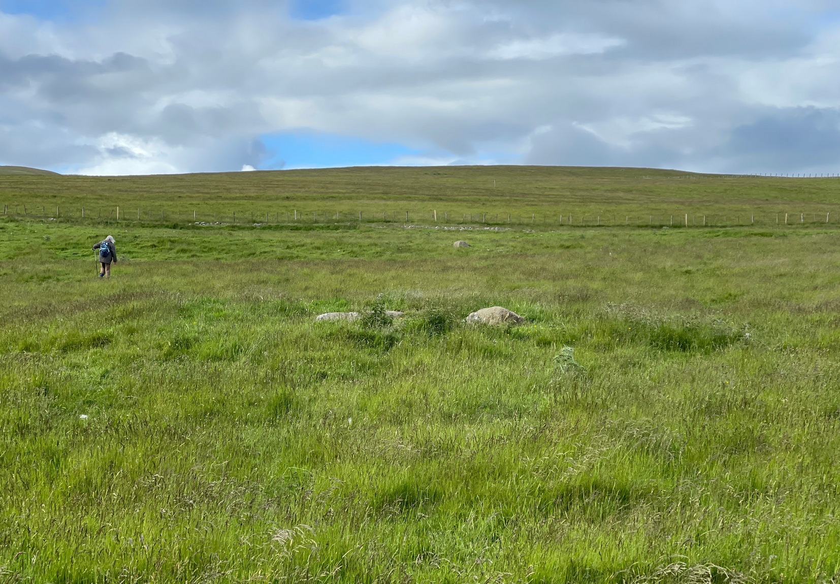
You need to hit the village of Fowlis Wester, which is easiest to approach from both east and west along the A85, between Crieff and Perth: nearly 3 miles east of Gilmerton and about 6½ mile west of Methven. Keep your eyes peeled and take the road up (north) where the large rounded tree-covered tumulus stands and up to the village. Go through the village and uphill for literally ½ a mile (veering sharp left at a junction) where a gate on your right leads into the fields. (a large parking spot is 300 yards further uphill) Walk ¼-mile east and through the other side of the small woodland, over the fence, you’ll see the mound of a typical tumulus. That’s it!
Archaeology & History
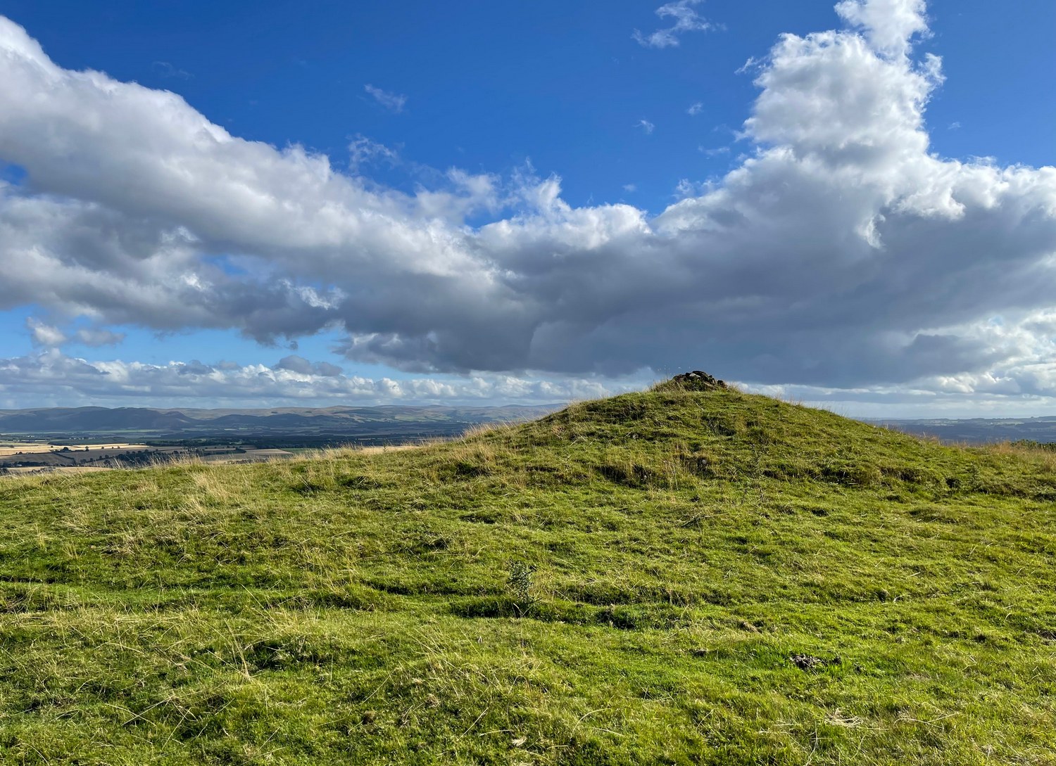
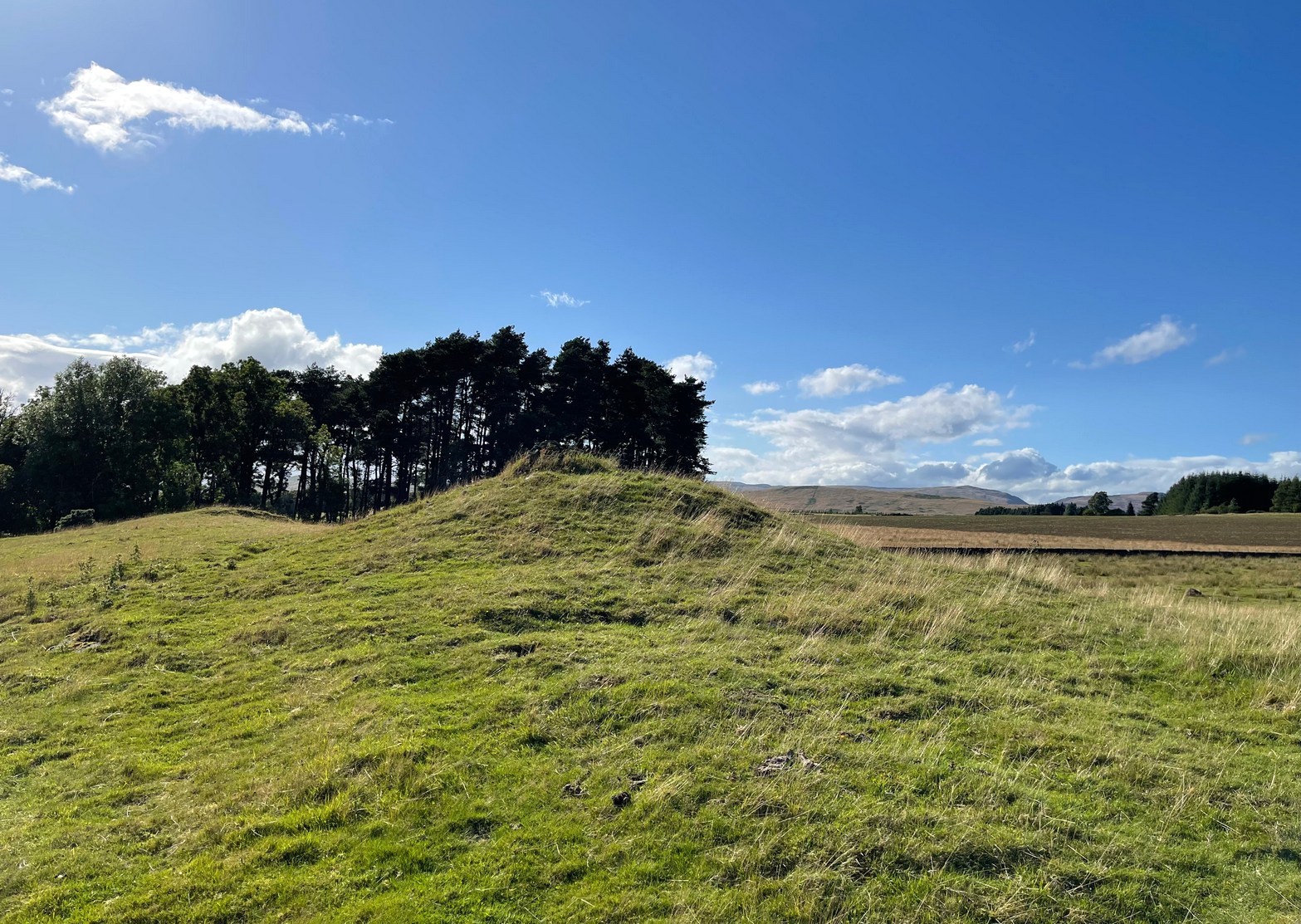
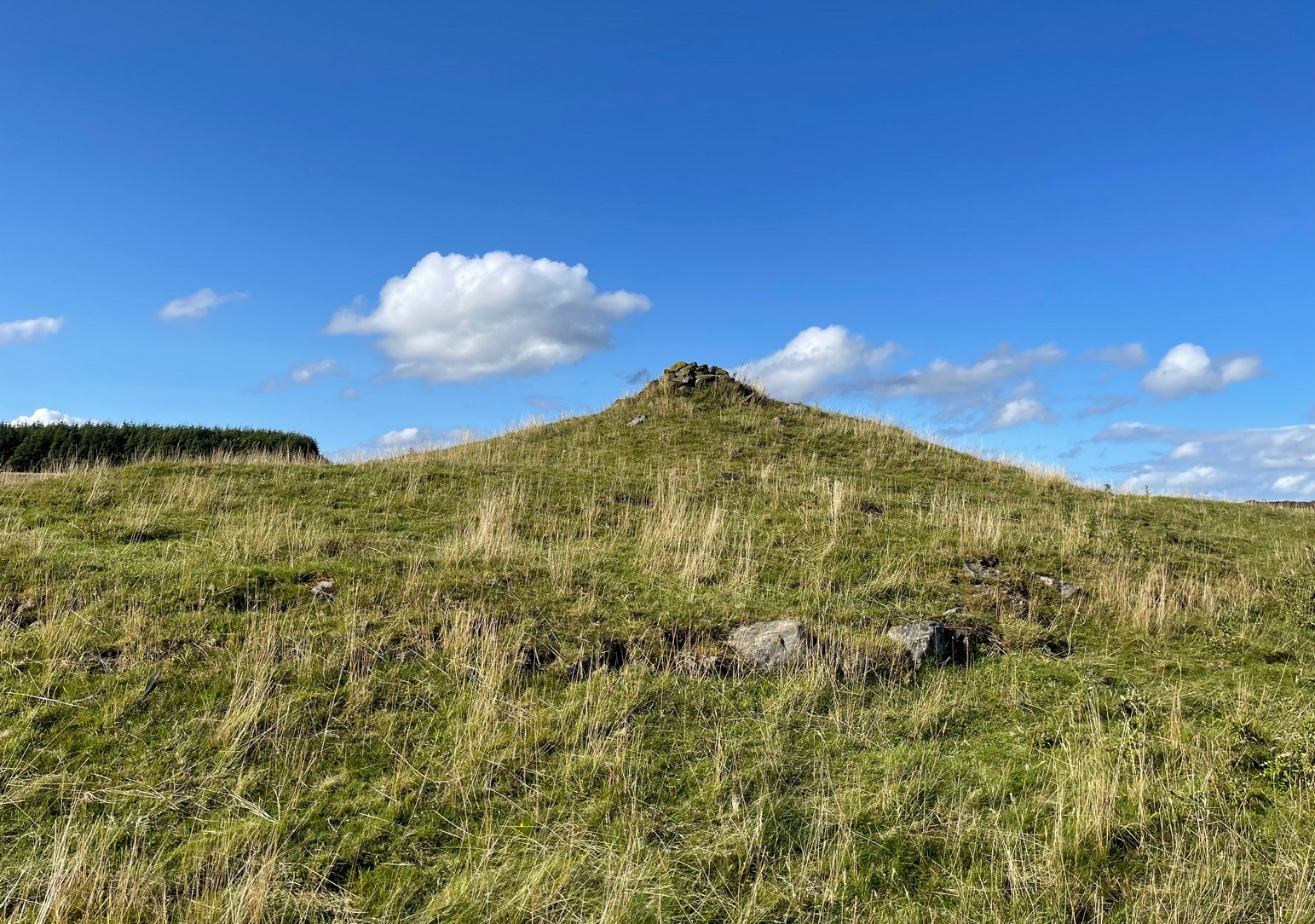
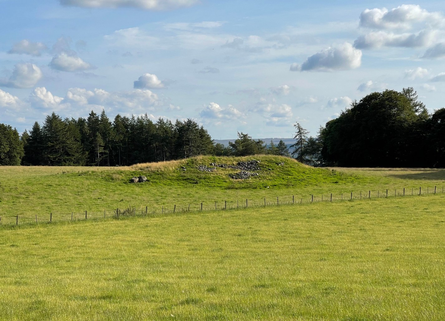
If you’re going to visit the megalithic remains of Fowlis Wester ¾-miles to the west, the antiquarians amongst you might as well give this old burial mound your attention too. It’s not grandiose by any means, but its position in the landscape is quite superb. It’s built upon a long geological promontory with extensive views that reach from south-east to south to south-west for many miles into the distance with the Ochils framing the majority of the southern horizon, but also with the notable pap of the West Lomond hill 20 miles to the south-east mimicking the shape of the tomb itself. It was obviously built here with the extended landscape having some ancestral importance. Visit it and see for yourself!
Despite being a notable mound, this tumulus-cum-cairn only seems to have been written about for the first time as recently as 1998, when archaeologist Ian Armit visited the site. Roughly circular in form, it’s about 12 yards across and more than six feet in height. A small pile of stones crowns the very top, placed here in much more recent times. At ground level on its northern side, an arc of low lying stones define the edge of the tomb. The stones probably continue all the way round the entire structure, but it’s overgrown by centuries of soil and vegetation and we lose sight of it as we walk round. When Mr Armit (1998) wrote about the site, he and colleague wrote:
Seat Knowe, looking NWSeat Knowe, looking north
“A grassed-over stony cairn lies on the highest point of Seat Knowe, a ridge commanding extensive views to the south. The cairn has a diameter of c.10m and is up to 2m high. A modern cairn occupies it summit. The low turf foundations of a rectilinear structure, some 6 x 8m, occupy its south flank, and thee are extensive cultivation and field system remains in the vicinity.”
Check it out! You won’t be disappointed.
Folklore
An interesting piece of relatively recent folklore about Seat Knowe, described in the Perthshire Name Book around 1862, told that,
“One of the Earls of Strathearn, desirous of having a church in the vicinity of his Castle, stood on an eminence, on which he had a summer seat, and resolved to erect it where the sun first shone, which was on the spot where it now stands.”
References:
Armit, Ian & Hall, M., “Seat Knowe (Fowlis Wester parish): Cairn,” in Discovery & Excavation Scotland, 1998.
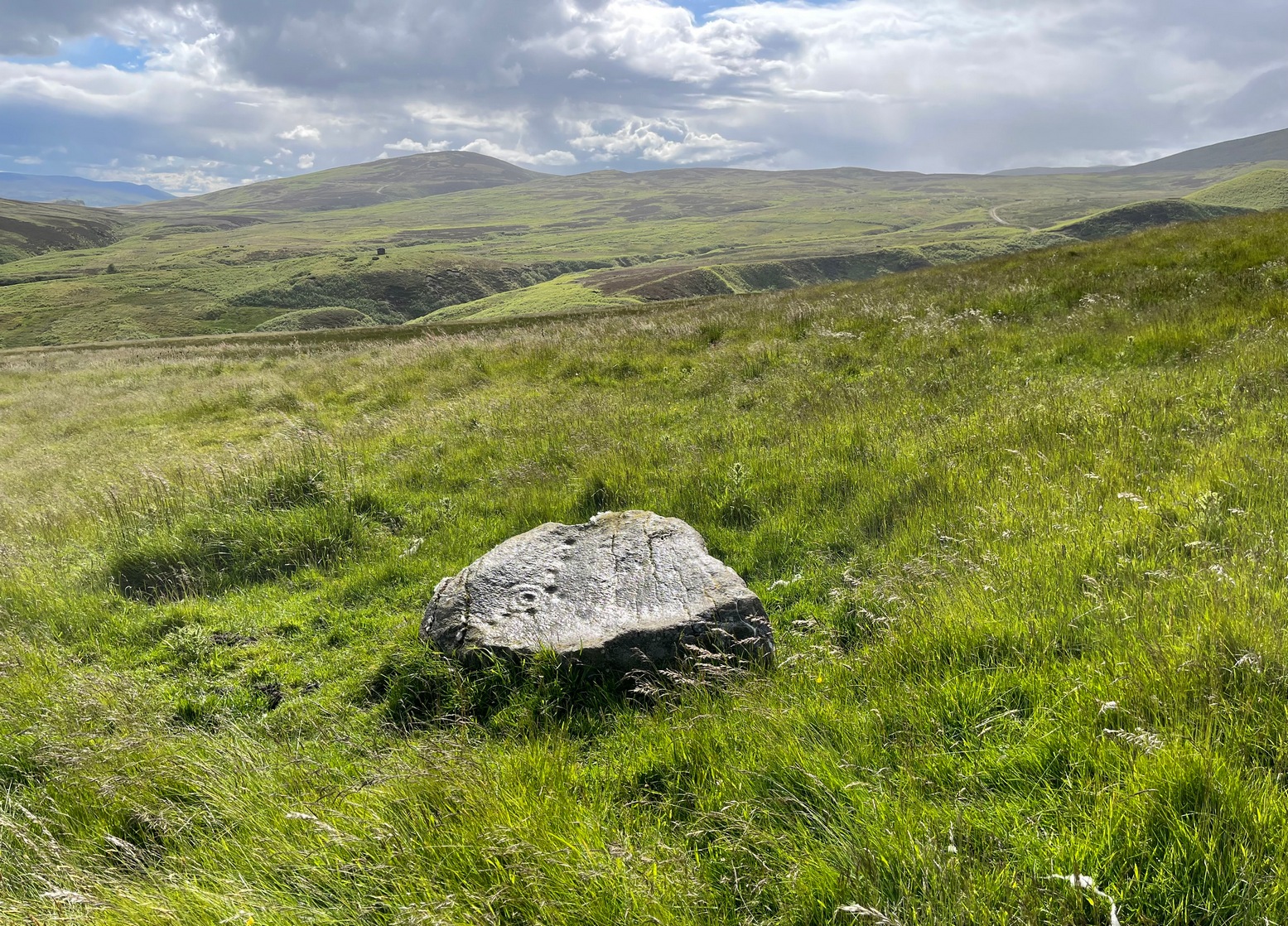
It’s a helluva zigzag to get here. Just out of Crieff along the A85 road to Comrie, turn right up the minor road to Hosh and Glenturret Distillery. Just past the distillery, over the small river bridge, turn left and go up the tiny road for literally ⅔-mile (1.1km) and park up just before the cattle-grid. Naathen, up the slope into the trees at a diagonal behind where you’re parked, walk up and up for half-a-mile where the land levels out and you reach a gate (and my bath, in the undergrowth to your right). A track goes up above the gate (not the one through it) and bends round where, 100 yards up, you reach a gate. Go over it and look at one of the stones in front of you!
Archaeology & History
Very faint cups
This is another one of those petroglyphs that only the purists amongst you will want to see. On the lower section of this typically smooth female stone, you’ll see a singular cup-mark, half-natural half-carved, a couple of inches across, with a less discernible cup-mark of similar dimensions further up the rock, but entirely man-made. When we visited here yesterday, the shadows of the trees above made it very difficult to get any decent photos of the cups. Give it your eye on the journey up to the impressive standing stone of Stonefield a few hundred yards further up the hill; and if you manage to get any good photos, stick ’em on our Facebook group.
Cup-Marked Stone: OS Grid Reference – NN 8515 2484
Archaeology & History
Site of supposed cupmark
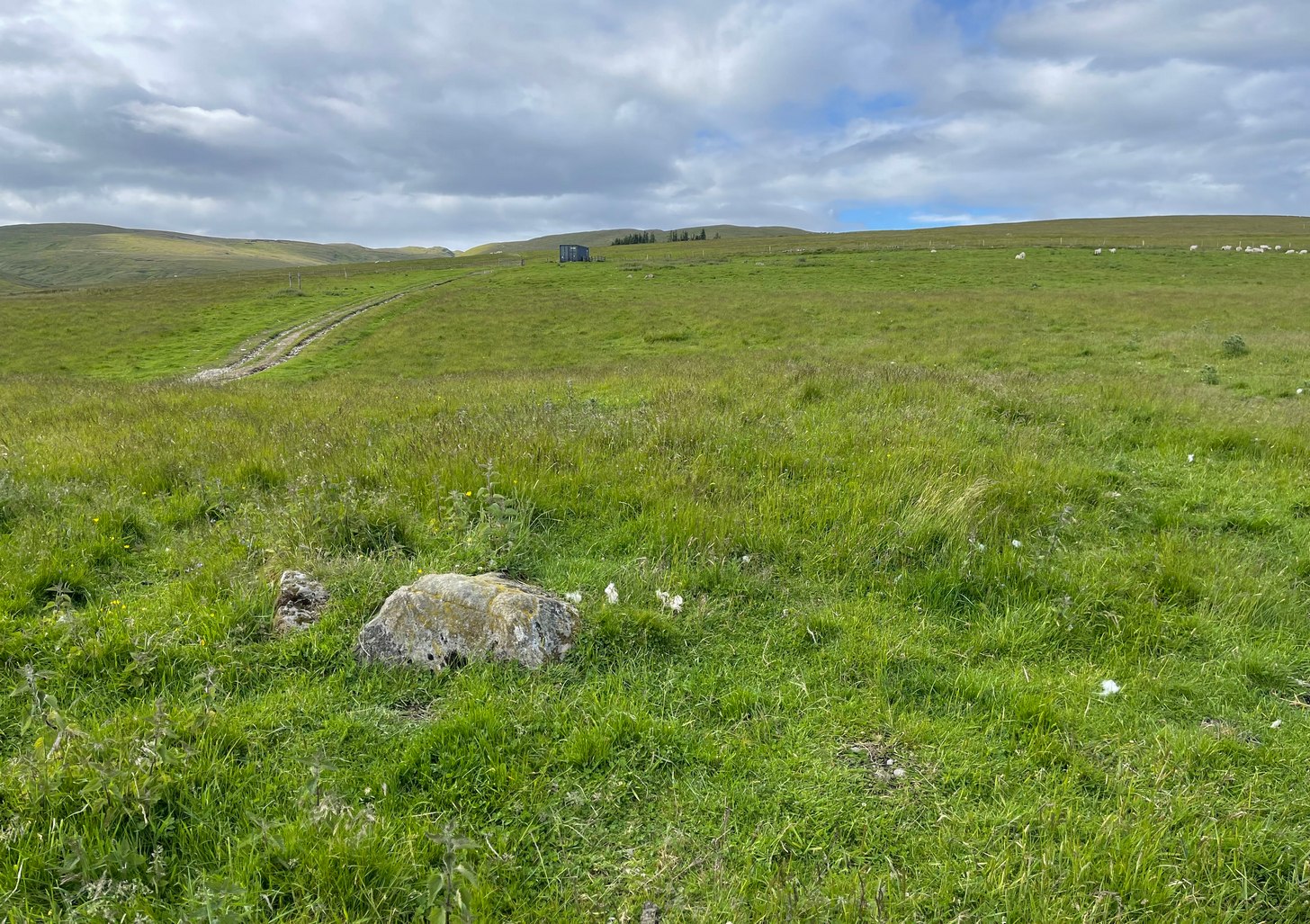
There’s little to see here. In the 1990s, students from the Royal Commission found what they described as “a single cupmark”, 3 inches across by 1 inch deep, on a rock measuring 2-feet by 1½ feet, on the north side of this large (seemingly) natural mound with large scatters of field clearance stones all over its northern face. When I visited the place yesterday (on my way to see the impressive Stonefield monolith 260 yards to the north-east), I zigzagged back and forth over the rocky mound and was unable to find it, although it may have been beneath the summer vegetation. A winter visit may prove more fruitful.
You’re going from Crieff, up the A822 road from the Gilmerton junction and head up towards the Sma’ Glen. And if you’re visiting this stone, you’ve already walked past the carvings of Connachan (2), (4), (5) and (6). So just another 100 yards or so up the dirt-track past Connachan (4), (5) and (6), just where there’s a bend in the track, the land just about levels out (if you’ve reached the gate and fence you’ve gone too far). At this point walk onto the grassland on your right for barely 50 yards, just where the land sweeps back downhill. Look around for a small stone at the edge of some very low indistinct walling. You’ll find it!
Archaeology & History
Cluster of cups
A site that’s shown on the modern OS-map as a “cairn” but which is, by the look of things, actually a hut circle — and a somewhat indistinct hut circle at that! You could very easily walk right through it without even noticing you’d done so. However, the cup-marked stone on the outer edge of its southern wall does grab your attention! Once you’ve found the stone, if you pace round a few times you’ll begin to see the vague outline of this prehistoric, probably Bronze Age abode.
at a slightly different angle
The carving was probably placed here after the hut circle had been built; or perhaps even built deliberately upon the petroglyph itself—but only an excavation would give us the answer. Its incorporation in the hut circle was probably functional, somewhat like the Man Stone carving in North Yorkshire, which is found at the doorway there. But this site is in such a state of neglect (and is somewhat overgrown) that I couldn’t ascertain whether it was at the entrance or not. If it was, then most likely there was a mythic relationship between the design of the cups and the person who lived therein. This relationship was probably a long standing traditional one attached to a particular family, or tribal leader, or even a shaman figure which no doubt stretched over many centuries. (as seems likely with the aforementioned Man Stone)
The carving itself is somewhat basic, as you can see, comprising of a small irregular cluster of between 18 and 20 tightly packed cups on a small stone. The hut circle is about 14 yards across. About 100 yards to the east is a severely robbed-out cairn.
References:
Stewart, Margaret E.C., “Connachan, Crieff – Cup Marks and Hut Circle,” in Discovery & Excavation, Scotland, 1967.
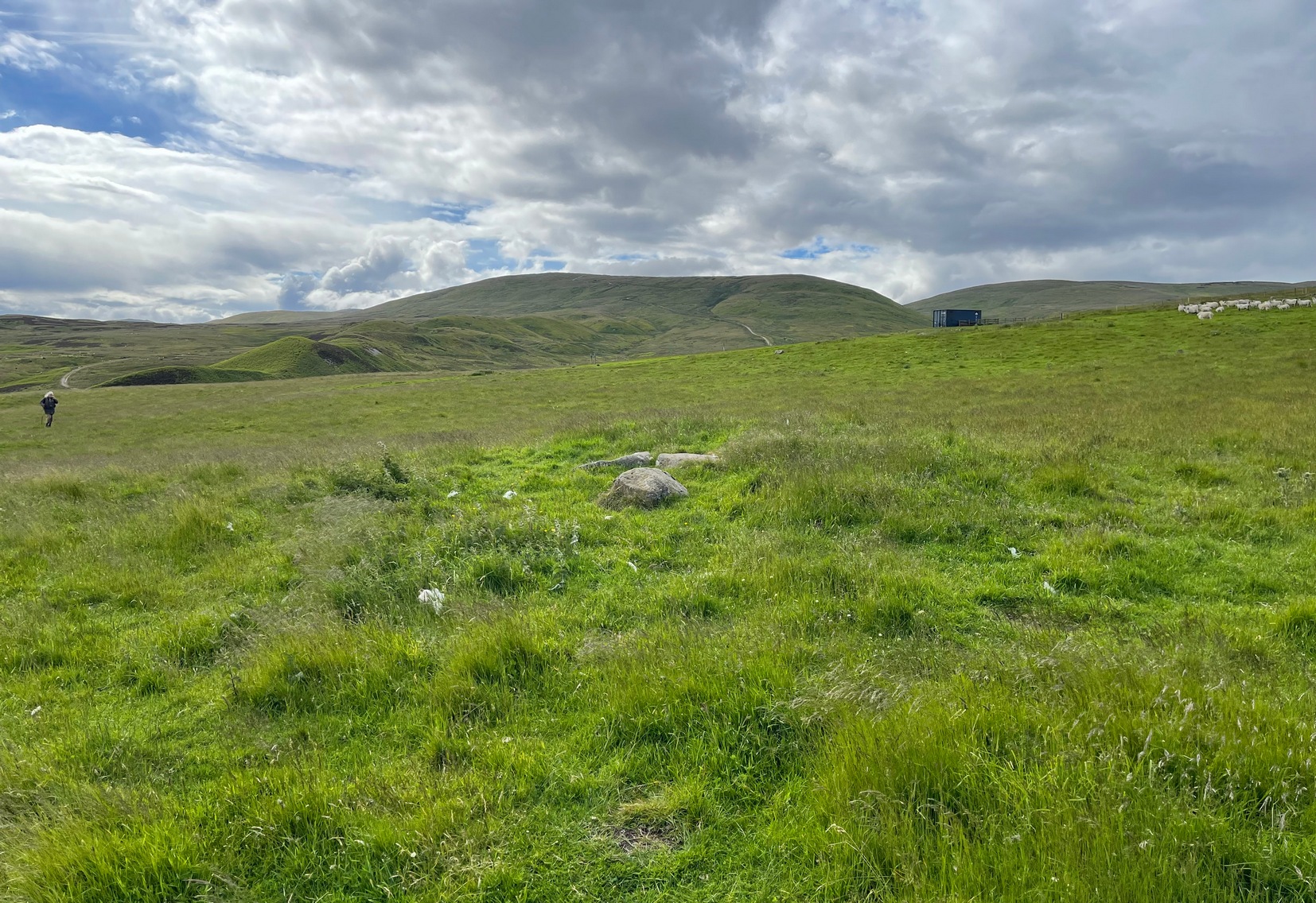
A couple of miles east of Crieff, take the A822 road from the Gilmerton junction and head up towards the Sma’ Glen. After literally 1¾ miles (2.8km), on the right-side of the road, you can park-up right opposite the dirt-track that leads up to Connachan Farm a half-mile away. Walking up and then past the farm, go past the Connachan (2) petroglyph, keeping on the same track uphill and just past the (Connachan 4) carving the land levels out where the track curves. From here, walk to your right, into the grasses, and about 90 yards along you’ll see a small rise in the ground with two or three fallen stones in the middle.
Archaeology & History
The cairn, looking N
There’s nothing truly notable about this much-overgrown cairn and you could very easily walk past it without noticing it was even there! Much of its original mass has been removed and, no doubt, its stones reused in the old walling a few yards to the north (a long section of that walling appears to have a prehistoric provenance). It measures roughly 10 yards across and its outer edges are clearly visible as a raised grass-covered mound all round, just one or two feet high at the most. Obviously it was much larger when first built, but all that we see now are its final ruins, four or five thousand years after its birth… The one thing of great note here is the view: you’re looking from east to south to west across an awesome landscape for many many miles. Check it out!
References:
Stewart, Margaret E.C., “Connachan, Crieff – Cup Marks and Hut Circle,” in Discovery & Excavation, Scotland, 1967.
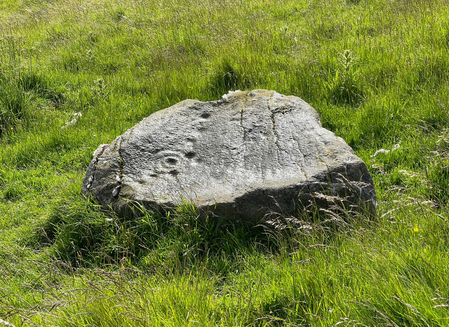
A couple of miles east of Crieff, take the A822 road from the Gilmerton junction and head up towards the Sma’ Glen. After literally 1¾ miles (2.8km), on the right-side of the road, you can park-up right opposite the dirt-track that leads up to Connachan Farm a half-mile away. Keep walking up past the farm to the Connachan (2) petroglyph, and keep to the track uphill for another 600 yards keeping your eyes peeled for a notable singular rock on your left, about 10 yards into the heather. It’s pretty easy to see. If the track’s levelled out, you’ve gone too far!
Archaeology & History
Perhaps the most attractive of the Connachan petroglyphs is this curvaceous stone with its archetypal double-ringed motif. It seems to have been described firstly by Margaret Stewart (1967), whose description (to me at least) doesn’t quite do it justice; but then, they are somewhat troublesome abstract creations most of the time. She told it to it be,
“a boulder 4’10” x 3’10 x 2′ in height with 6 cups and a grooved circle, which incorporates two more cup marks on its outline. The grooved circle encloses a gapped circle with another cup mark at its centre.”
Connachan (4), looking NMain face of the carving
So, nine cups in all: one with the double-ring around it, and two of the cups touching the outer ring. The cup-marks are ostensibly as Stewart described them, but there are another two or three which I was unable to capture in the photos, as the daylight wasn’t good when we came here. They’re shallow but very distinct when you see and feel them in the flesh, so to speak, and are closer to the top- and bottom-centre of the stone in the photos here. Well worth checking out if you’re in the area!
References:
Stewart, Margaret E.C., “Connachan, Crieff – Cup Marks and Hut Circle,” in Discovery & Excavation, Scotland, 1967.
Acknowledgements:Huge thanks for use of the Ordnance Survey map in this site profile, reproduced with the kind permission of the National Library of Scotland.
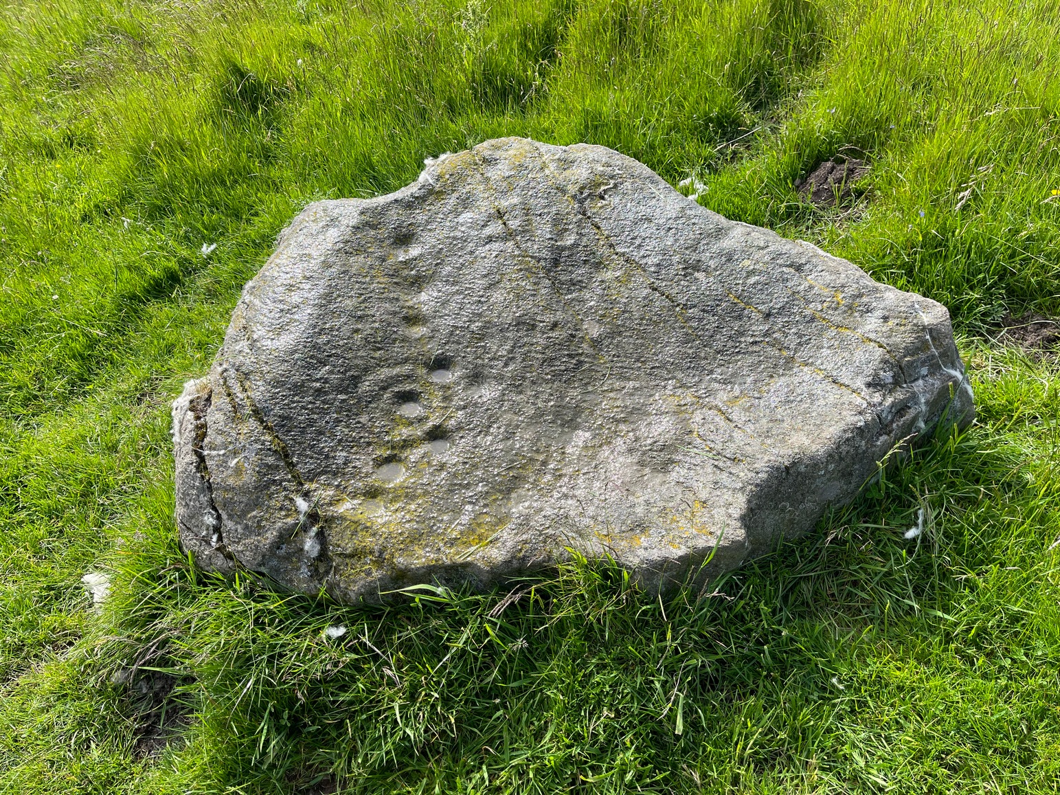
A couple of miles east of Crieff, take the A822 road from the Gilmerton junction and head up towards the Sma’ Glen. After literally 1¾ miles (2.8km), on the right-side of the road, you can park-up right opposite the dirt-track that leads up to Connachan Farm a half-mile away. Keep walking up the track, past the farm and the cottages, and about 300 yards further along, right by the track-side, you’ll see a large stone. Y’ can’t really miss it!
Archaeology & History
This carving was seemingly rediscovered by J.H. Maxwell of Crieff in the 1960s, but not in the position it presently occupies by the trackside. A large body of field clearance rocks lies scattered 60 yards to the west, which is where it was reportedly first seen; which means that, even then, it wasn’t in its original spot. But at least we can be assured that it came from somewhere very close to its present location, by the trackside.
Close-up of cups & linesThe carving, looking SW
It’s not overly impressive in terms of its design, comprising almost entirely of cup-markings: at least thirty, perhaps as many as thirty-four. When we visited here recently, Nature wasn’t overly concerned about giving us decent daylight, so we couldn’t see the carving clearly, but it did seem that a carved broken “ring” swerves around at least one of the cups near the middle of the stone. You can make it out in the photos here (centre-left). There are what seems to be several other carved lines on different parts of the stone but, again, without decent daylight, we could neither get decent photos, nor do a decent sketch of them. The Scottish Rock Art Project, who got themselves nigh on a million quid to survey all our carvings up here, neither sketched, photographed or visited this or the others in this Connachan petroglyph cluster, so we’re none the wiser as to its original form. If you happen to visit this carving when the daylight is being nice, see if you can catch us a good photo or two and stick ’em on our Facebook group.
References:
Stewart, Margaret E.C., “Connachan, Crieff – Cup Marks and Hut Circle,” in Discovery & Excavation, Scotland, 1967.
Cup-and-Ring Stone (lost): OS Grid Reference – NN 880 252
Archaeology & History
A long lost carving, probably quite impressive in design, was recorded by John Laurie, schoolmaster in Monzie. He told us that,
“a large Druid stone with rude carving upon it lies on the side of the public road between the villages of Monzie and Keppoch. This stone was one of a Circle which Mr Monroe, the then minister, caused to be broken and dispersed.”
When Fred Coles looked for the remains of this “circle” at the beginning of the 20th century, he questioned Laurie’s location of the site, but found remains of one in an adjacent field consisting of two stones, but told that “on neither of them could we discern any carving of any sort.” It’s likely that the carving has been completely destroyed, or if we’re lucky it may be hiding in some nearby walling.
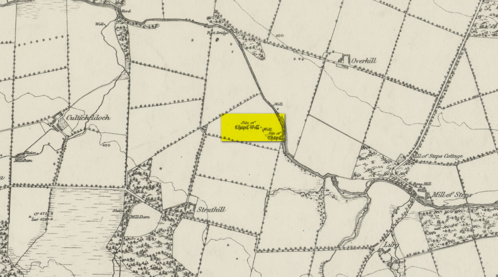
From Muthill, go up Thornhill Street out of the village for nearly 1½ miles. You’ll have just passed the double hairpin bend, crossed the rivulet, then reached the large old farmhouse of Lurgs. From here, turn right and after just over half-a-mile you reach Struthill where, running by the side of the house, is a small trackway. Ask the folks at the house, who are most helpful, and walk down the track for nearly 400 yards and go through the first gate on your right, crossing the field until it dips down to the burn. The boggy marshy mass running from near the top of the slope is what you’re looking for!
Archaeology & History
Shown on the 1863 map as the Chapel Well, the dedication of the waters to St. Patrick coincided with a chapel that once stood here, also in his name. Very low faint remains of the chapel, completely overgrown, can still be made out amidst the rushes. It’s one of two holy wells in Muthill parish that are dedicated to St. Patrick.
Very little of any real spring of water can be seen nowadays. Indeed, the site today is merely a much overgrown bog-of-a-well whose water oozes down the slope into the Juncus rushes, trickling into the adjacent burn. I had a drink of the water from the slopes, which tasted OK and did me no harm whatsoever.
Folklore
The most important aspects of this site was its use by local people and the attributes it was given. We know not how far back such folklore goes, but it would have been many many centuries, if not millenia. Water worship (if that’s the right word) is the most archaic of all traditional forms of veneration. This place was no exception. In John Shearer’s (1883) excellent local history work, he gave the following account of the site:
“About a quarter of a mile west from the Mill of Steps, upon a height on the right bank of the Machany, are to be seen the ruins of a small chapel. When other places of Popish worship were thrown down after the Reformation, the Presbytery of Auchterarder ordered it to be demolished about 1650 to repress the superstitions practised at this place of resort. West from the chapel is an excellent spring which was held in great veneration in those dark ages of superstition, when the ignorant and credulous populace were deceived by the crafty priests who stood below the spreading branches of an ancient ash which grew near the fount, pronouncing a benediction on the weary pilgrims as they drank of the waters. And as it was celebrated for its healing qualities in many different distempers, numbers yearly visited it from a great distance to benefit by its virtues with as much devotedness as the Mahometan pilgrims visit the tomb of their Prophet. Insanity was also cured here. Several persons testified before the Presbytery of Stirling, in 1668, that having carried a woman thither, they staid two nights at a house hard by the well. The first night they bound her twice to a stone at the well, but she came into the house to them being loosed without any help. The second night they bound her again to the same stone and she returned loosed. And they also declared that “she was mad before they took her to the well, but since that time she is working and sober in wits.”
“This well was still celebrated in the year 1723 and votive offerings were left, but no one then surviving appeared to appreciate the virtues of the stone. Small offerings were given in coin and thrown into the well and those who had no coin brought white stones which were laid in regular order along the declivity where the water runs to the river. Coins have been of late found in the well and the white stones are still to be seen. The officiating priest generally resided at Drummond Castle. Within the last sixty years, several of the gentry have come in their carriages to inspect these relics which were held in so great reputation in ancient times. The chapel and well are about one mile south west from Muthill.”
References:
MacKinlay, James M., Folklore of Scottish Lochs and Springs, William Hodge: Glasgow 1893.
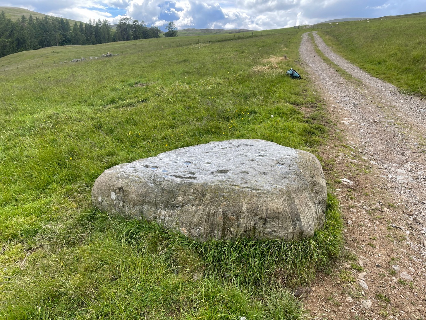
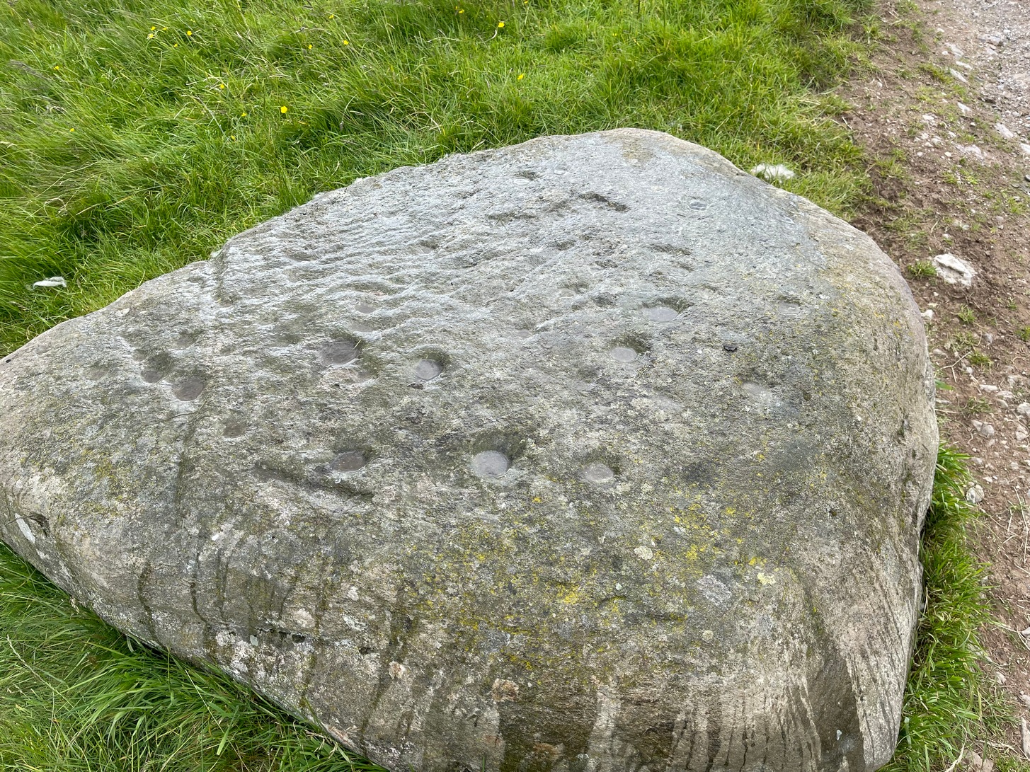
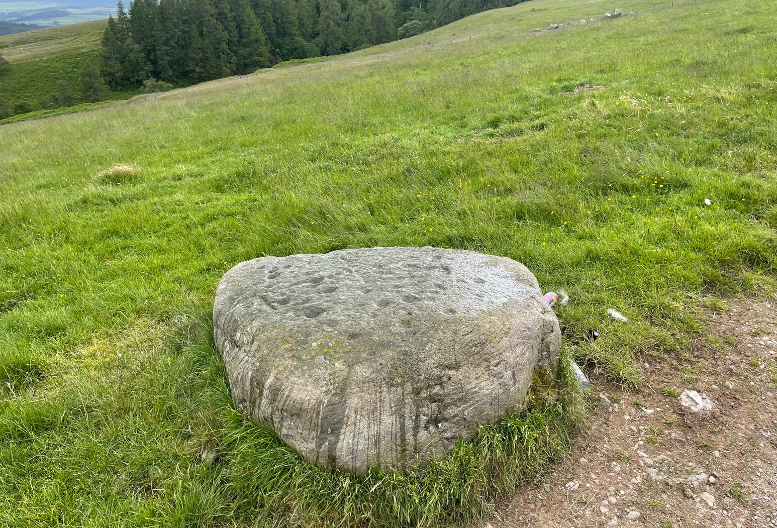
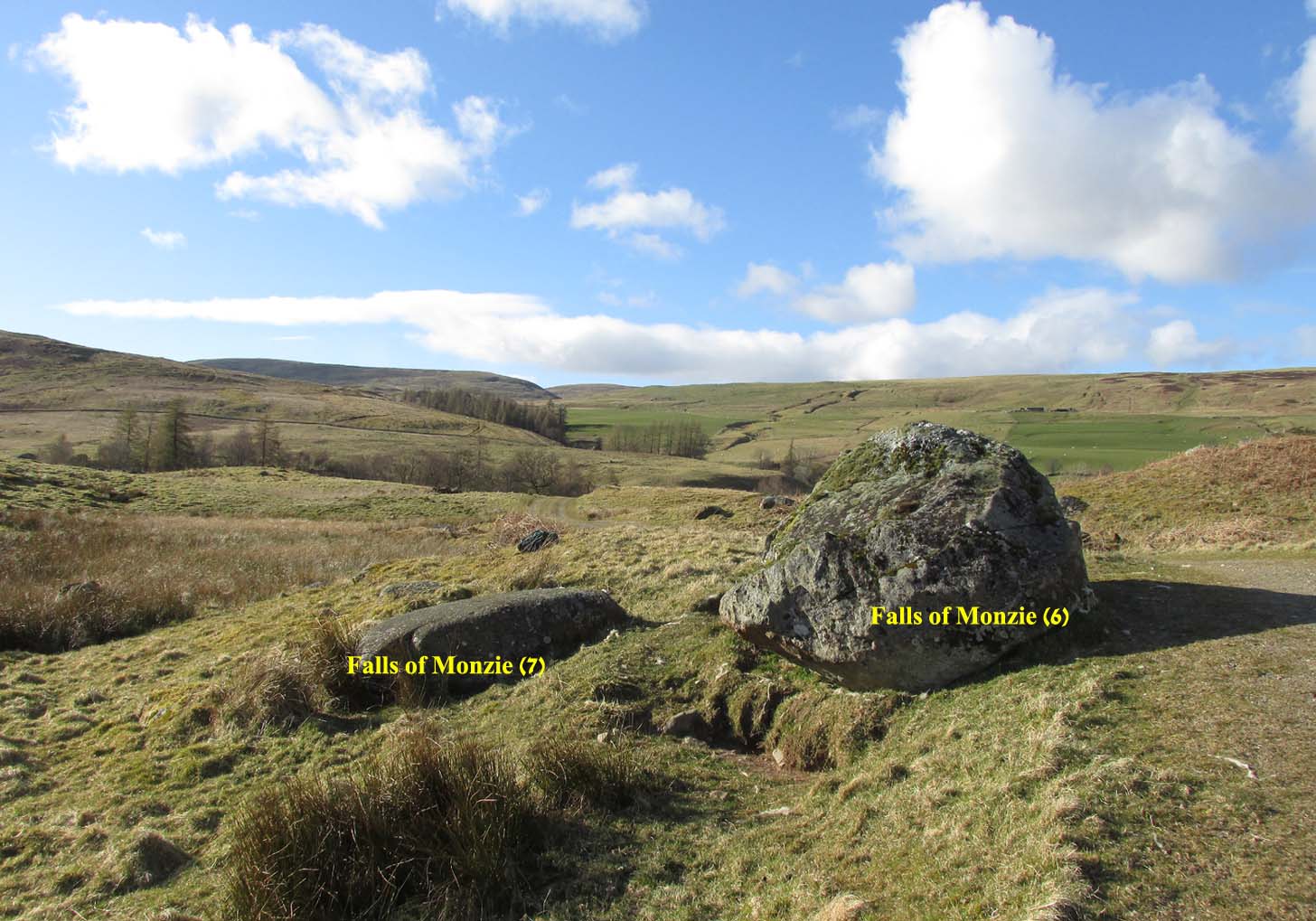
A couple of miles east of Crieff, take the A822 road from the Gilmerton junction towards the Sma’ Glen. After literally 1¾ miles (2.8km)—just 100 yards before the track up to Connachan Farm—you’ll reach a dirt-track on your left that leads into the hills. Go on here and after an easy walk of 400 yards or so, you’ll reach the conspicuous boulder known as the Falls of Monzie (6) stone. Two or three yards to its side is a large flat stone. That’s it!
Archaeology & History
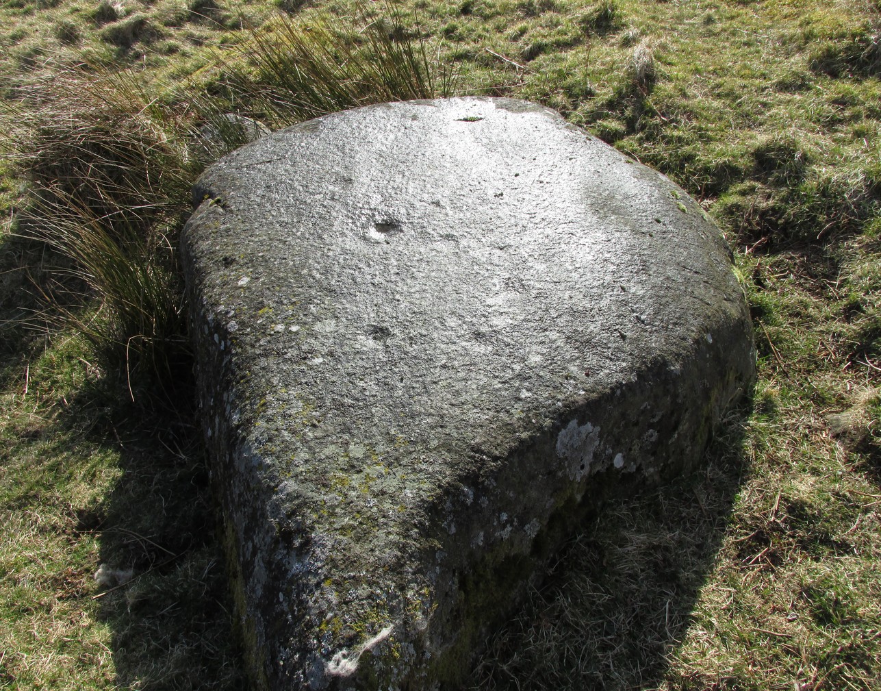
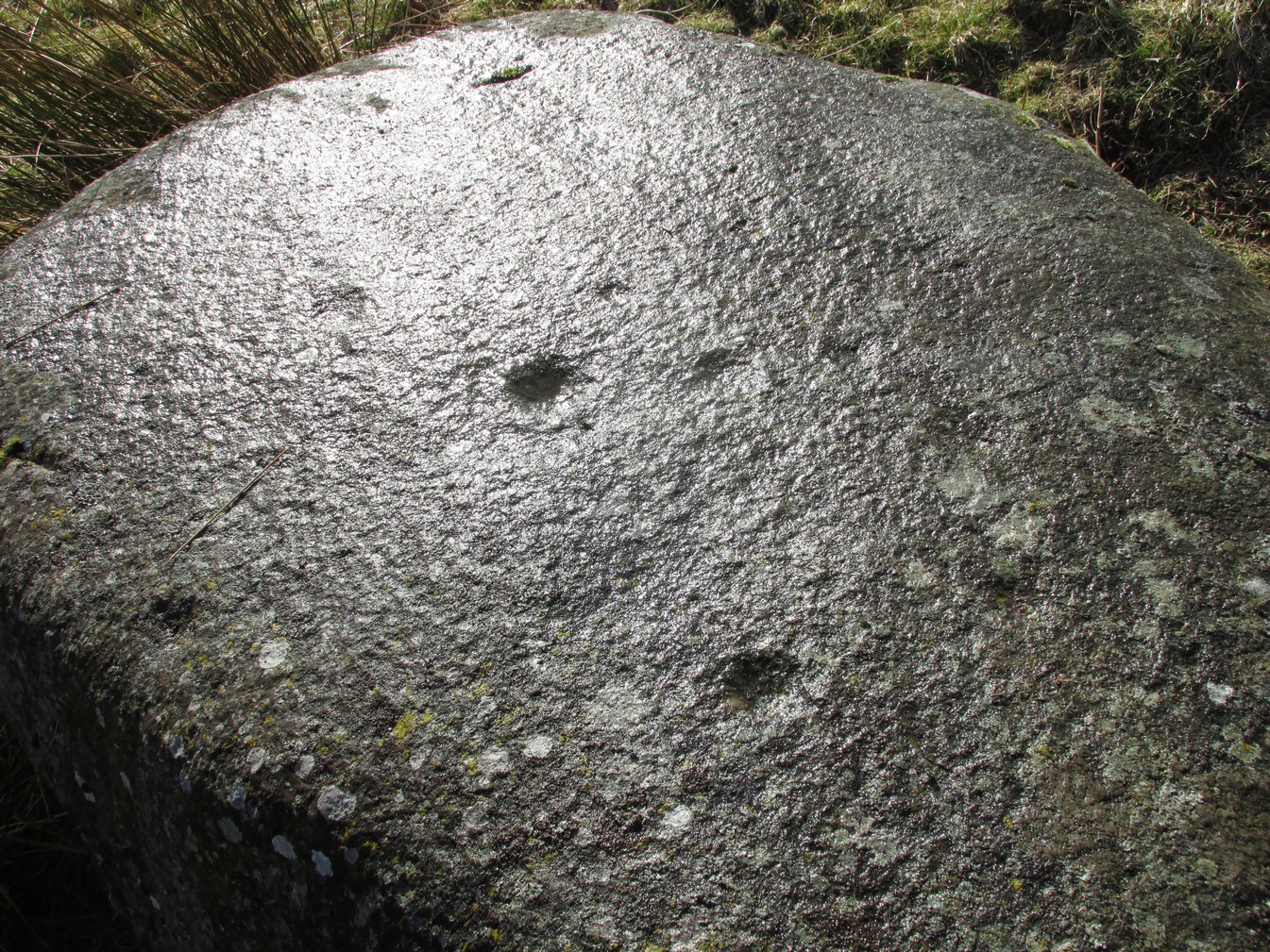
This large flat smooth earthfast rock, is possessed of a number of very faint cup-marks. Altogether there are at least nine cup-marks, most of which are closing in to the middle of the stone, with other single cups near the western and southern edges.
The faint cupmarksClose-up of cups
Near the middle of the rock, one cup has an equally faint semi-circular arc, just visible on the photos here. Close-up photos of this semi-circle seem to suggest it was more complete in ages gone by, but the erosion is such that it’s difficult to say with any certainty. (possibly the computer-tech kids could give us a bit more certainty). The nearest other carving with more definite cup-and-rings can be found on the Falls of Monzie (8) stone, about 200 yards to the west.