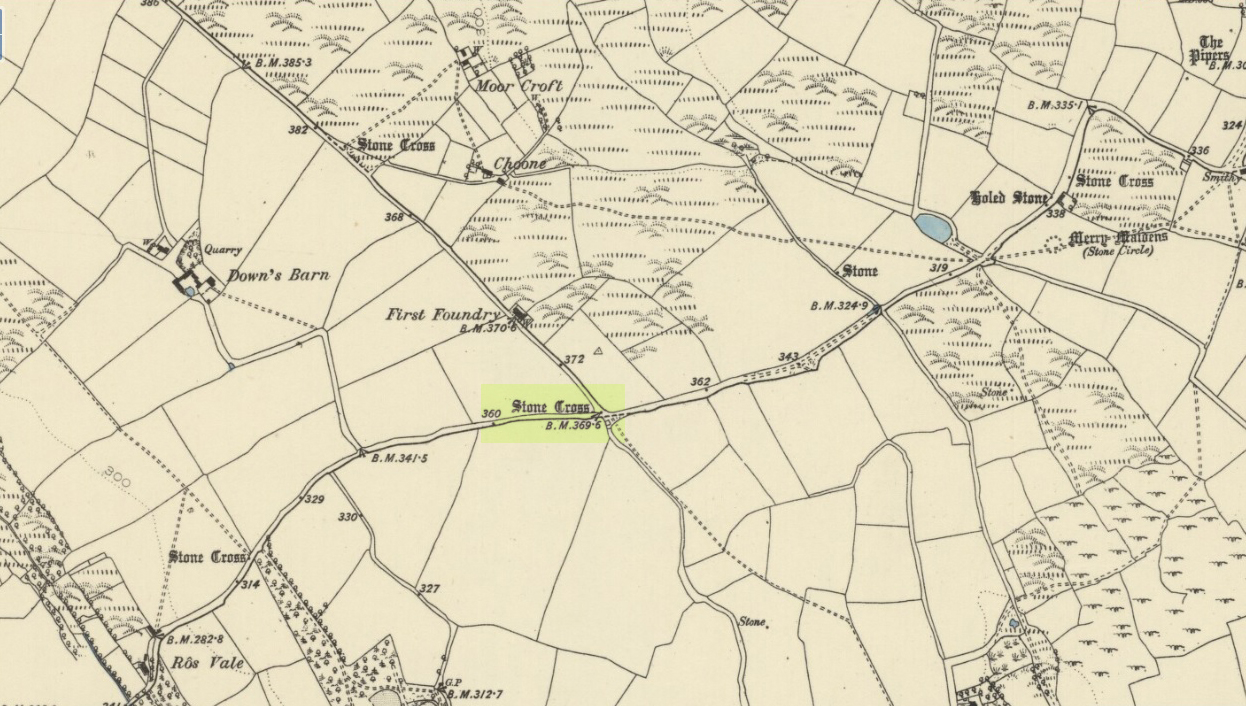
Wayside Cross: OS Grid Reference – SW 42579 24266
Also Known as:
- Historic England Grade II Listed Building No. 1007955
Boskenna Cross on 1887 map
Getting Here
Travelling along the B3315 from Penzance to Lands End, the Cross is on the south side of the road at the junction with the minor road to St Buryan, past the Merry Maidens stone circle.
Archaeology & History
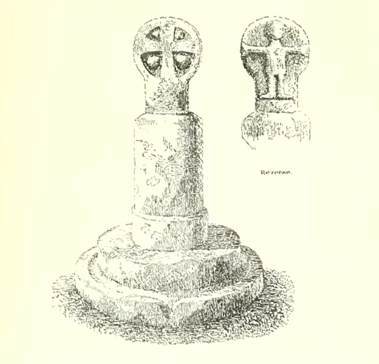
Arthur Langdon (1896), in his magnum opus on Cornish Crosses, describes this wheel-headed wayside cross:

Sketch from Langdon’s 1896 book
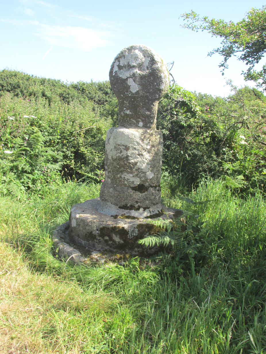
‘The only ancient part of the monument is the little cross at the top, which is mounted on a base made up of an extraordinary collection of apparently disused circular granite stones. Immediately beneath the cross is a cylindrical piece, the upper edge of which is roughly rounded off. Beneath this comes a short drum, about two inches wider than the piece above and nine inches deep. The next two stones are much wider but not so deep as the last, the bottom one consisting of the lower portion of an old cider-press, with its surrounding channel and lip !
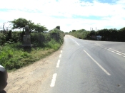
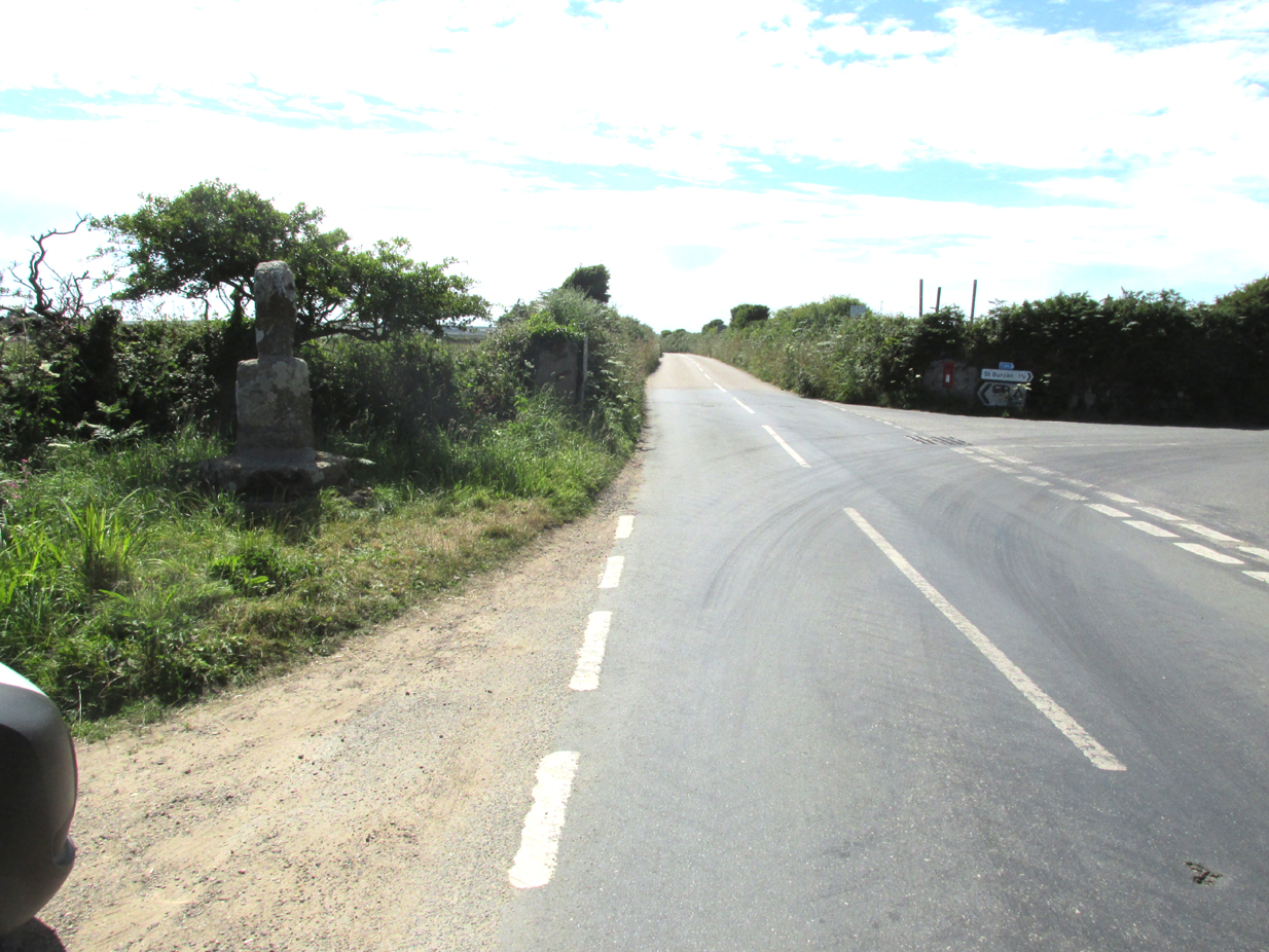
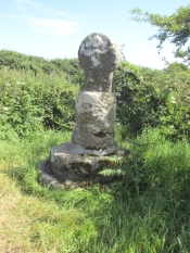
Its roadside position.
There is a good deal to admire in the feeling which prompted this effort to once and for all preserve so ancient a relic, and the care bestowed in the erection of this curious substructure goes far to remove its incongruity.
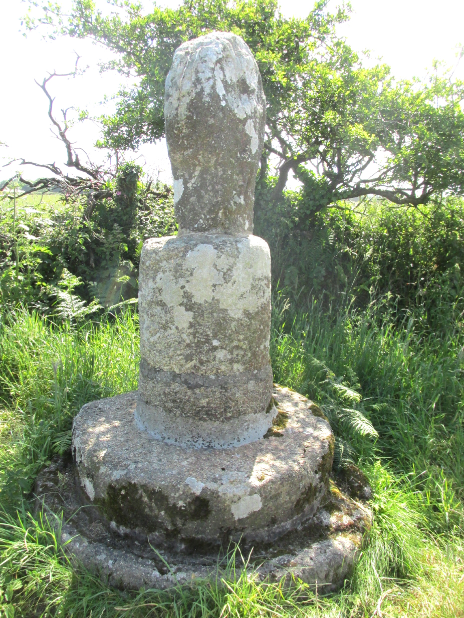
Front — The figure of our Lord here sculptured is quite the best example in which He is represented wearing the tunic; the expanded sleeves are especially apparent, as well as the outline of the garment above the knees. The feet are very large, and turn outwards at right angles.
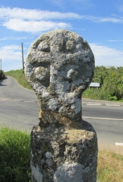
The Crucifixion face
Back — On the head is a cross with expanded limbs, flush with the surface of the stone. The four triangular sinkings, or recesses, which form the background are not of uniform size, the lower being considerably larger than those above, thus making the lower limb the longest. The inner portion of each sinking is raised, forming bosses in low relief.
Dimensions — Total height of the monument, 6 ft. 10 in; height of the cross, 2 ft. 4 in; width of head, 1 ft. 8 in; width of shaft, 12½ in.‘
The cross has had a chequered history. It is not known when it was demolished. Langdon, once more, takes up the story:
The opposite face.
‘Mr. J. H. Johns, landlord of the “King’s Arms”, St. Buryan, informed me of the circumstances connected with the discovery of this cross. It appears that formerly one of the angles at the intersection of these roads was so sharp and awkward for traffic that, in 1869, the local authorities decided to ease this corner by rounding off the hedge, which was then about ten feet thick. Mr. Johns’ father was one of the men employed on this work, and shortly after commencing he found the cross buried in the hedge. By the advice of His Honour Charles Dacres Bevan, County Court Judge of Cornwall, and then residing at Boskenna Mansion House, the cross was erected on the triangular piece of grass in the middle of the roads, a spot on which it is extremely likely it originally stood.‘
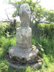
Side view from the east.
In 1941 and 1942, the Cross was demolished by road vehicles, whereupon the council removed it to its present roadside position. It was again hit by a vehicle in 1992. And in 2002 there was another incident, reported by Meyn Mamvro:
‘..In February the top of the cross was found lying by the roadside. It is not known whether this was the result of deliberate vandalism or a road traffic accident, but local village witch Cassandra Latham acted quickly in alerting Cornwall Archaeological Unit, who took it away for repair and restoration…‘
References:
- Langdon, Arthur G., Old Cornish Crosses, Truro, Joseph Pollard, 1896.
- Langdon, Andrew, Stone Crosses in West Penwith, The Federation of Old Cornwall Societies, 1997.
- Meyn Mamvro, No 49, Autumn 2002, p. 4
© Paul T. Hornby 2018