Dun Riaskidh, Torrisdale Bay, Sutherland

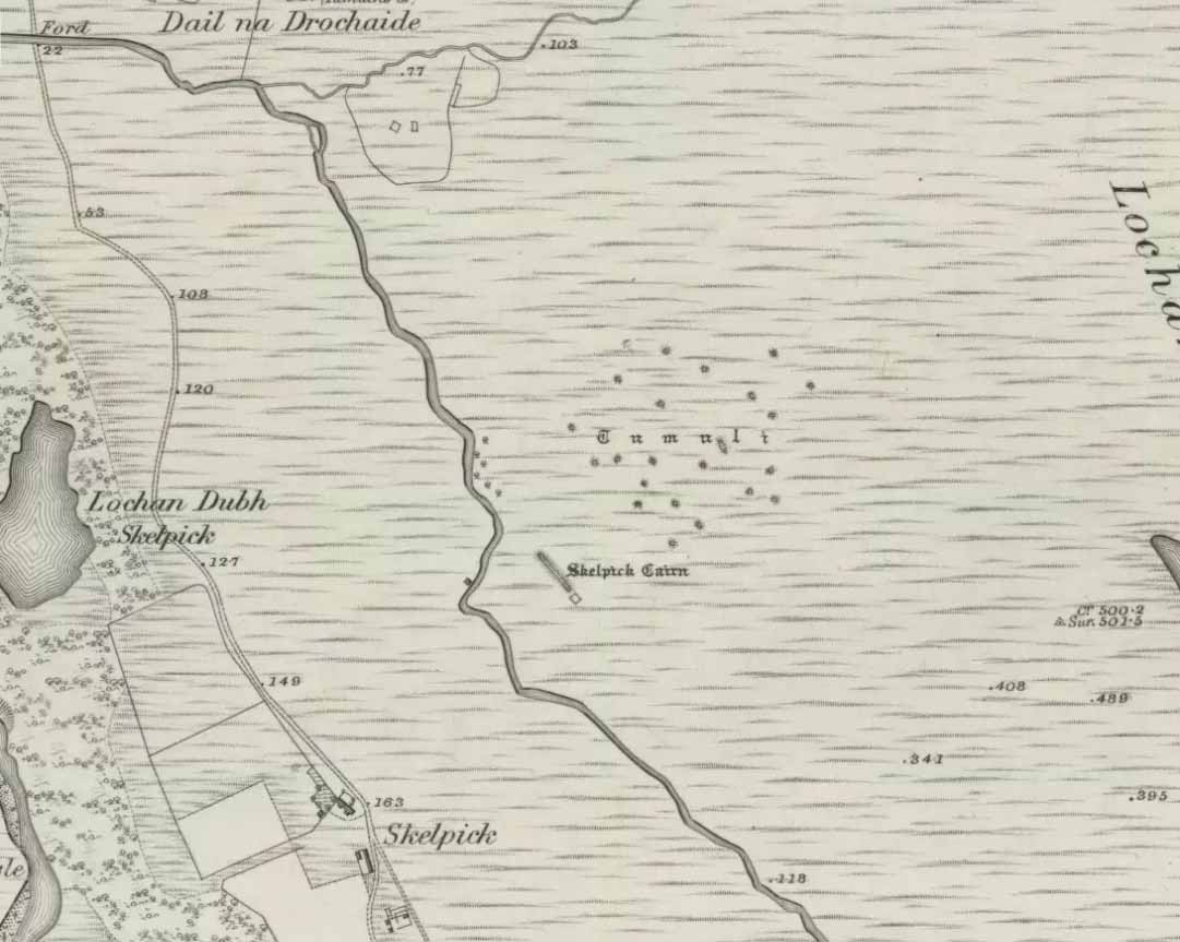
Chambered Cairn:  OS Grid Reference – NC 68763 61406

Also Known as:

  1. Canmore ID 5775
  2. Dun Richard

Getting Here

Approaching Dun Riaskidh

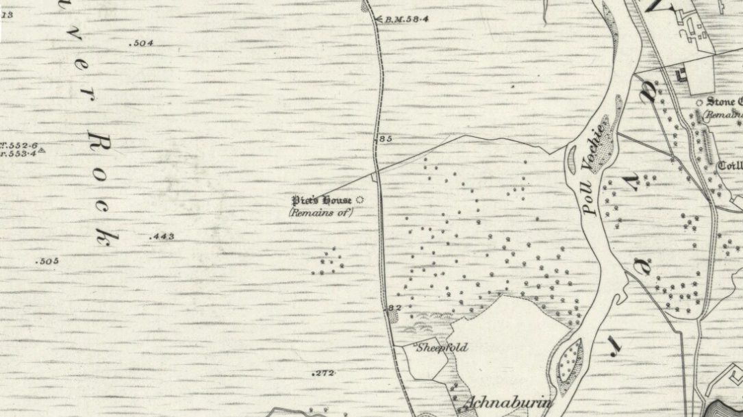
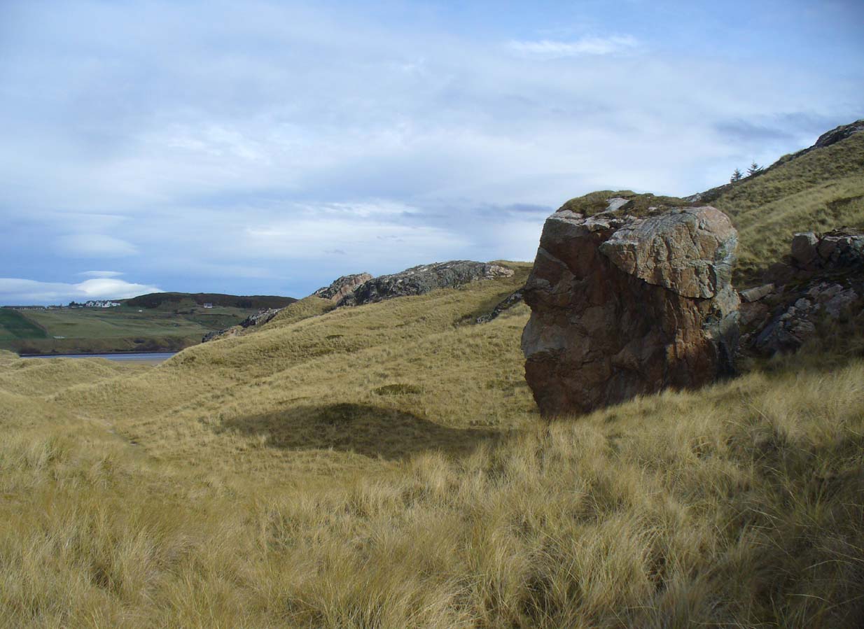
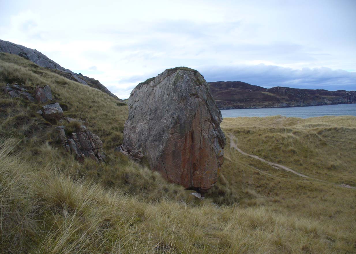
Along the A836 road between Bettyhill and Tongue, keep your eyes peeled for the turning down to Borgie and Skerray.  Go along here for 1.8 miles (2.9km) until, just past a tiny road on your left, a small parking spot with a tourist board is by the roadside. Walk down hill and over the River Borgie below and follow the footpath round until your reach the edge of Torrisdale Beach. From here, walk right, uphill, across overgrown sand-dunes to the stone escarpment 400 yards or so to the east.  A large scattered mass of rocks on top of one of the first rocky knolls is what you’re looking for.  You can’t really miss it.

Archaeology & History

Dun Riaskidh, looking north

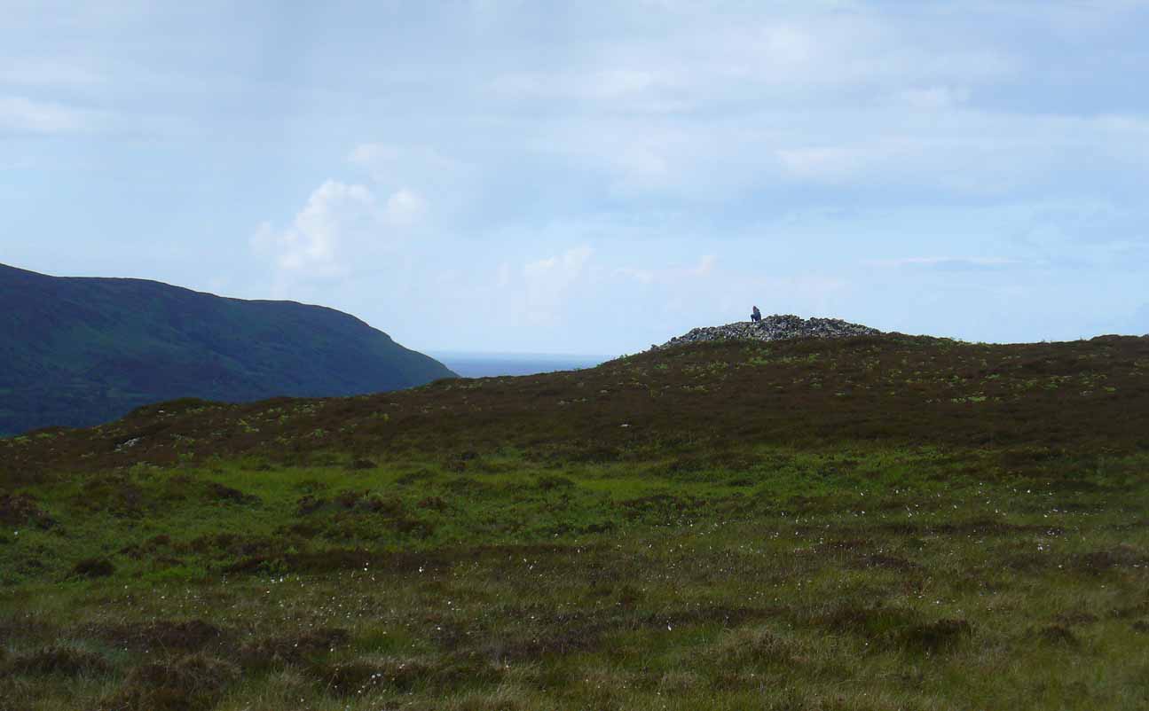
This is worth the journey for the scenery of Torrisdale Bay alone: one of the most beautiful places in all Scotland. …Not far from the legendary Ringstone and the carving above, this collapsed mass of scattered rocks was said, in local lore, to have been the remains of an old broch—or that’s what Hew Morrison told the Royal Commission (1911) lads about it when they surveyed the area more than a century back.  Their description was short:

“About ½-mile E of the footbridge across the River Borgie, near Torrisdail, and on the W. side of Druim a’ Chleibh, are the remains of a broch. No outlines of walls are visible. The site is indicated by a structureless heap of stones.”

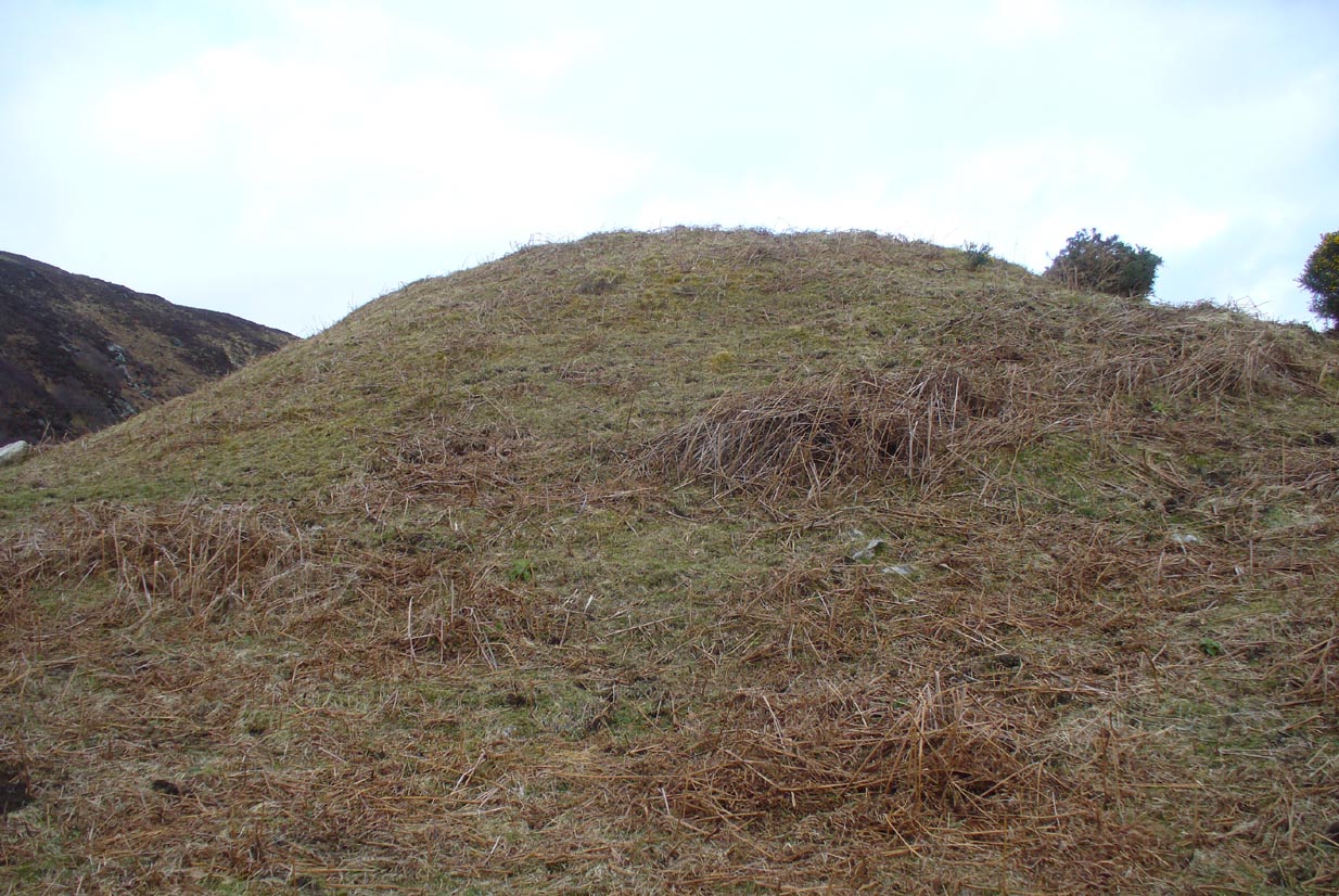
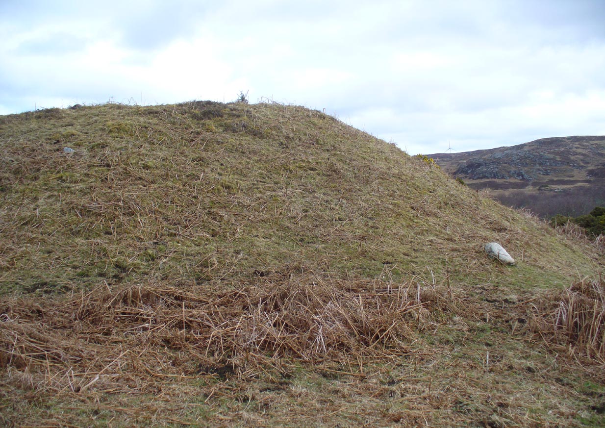
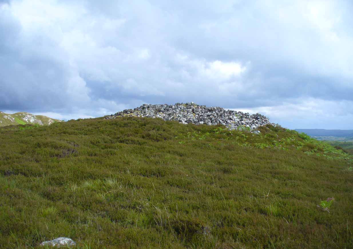
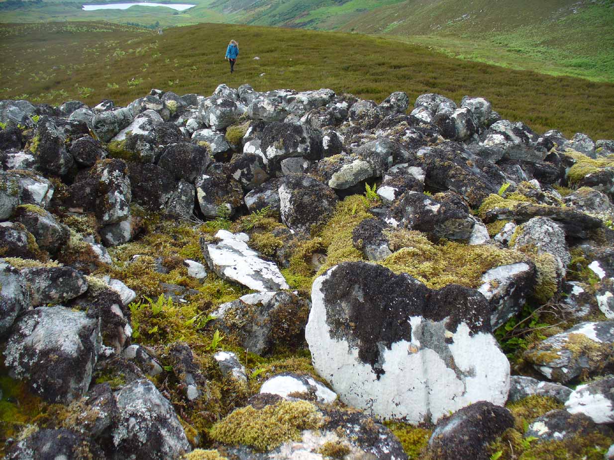
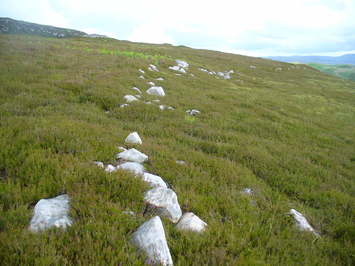
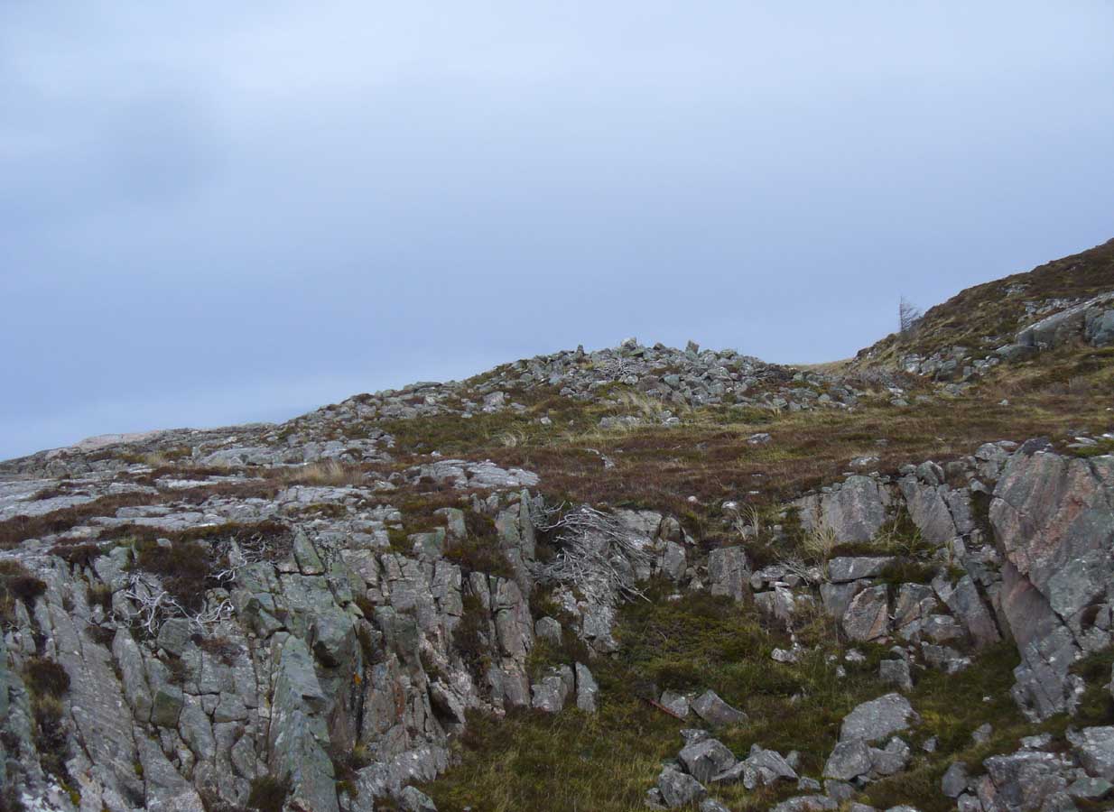
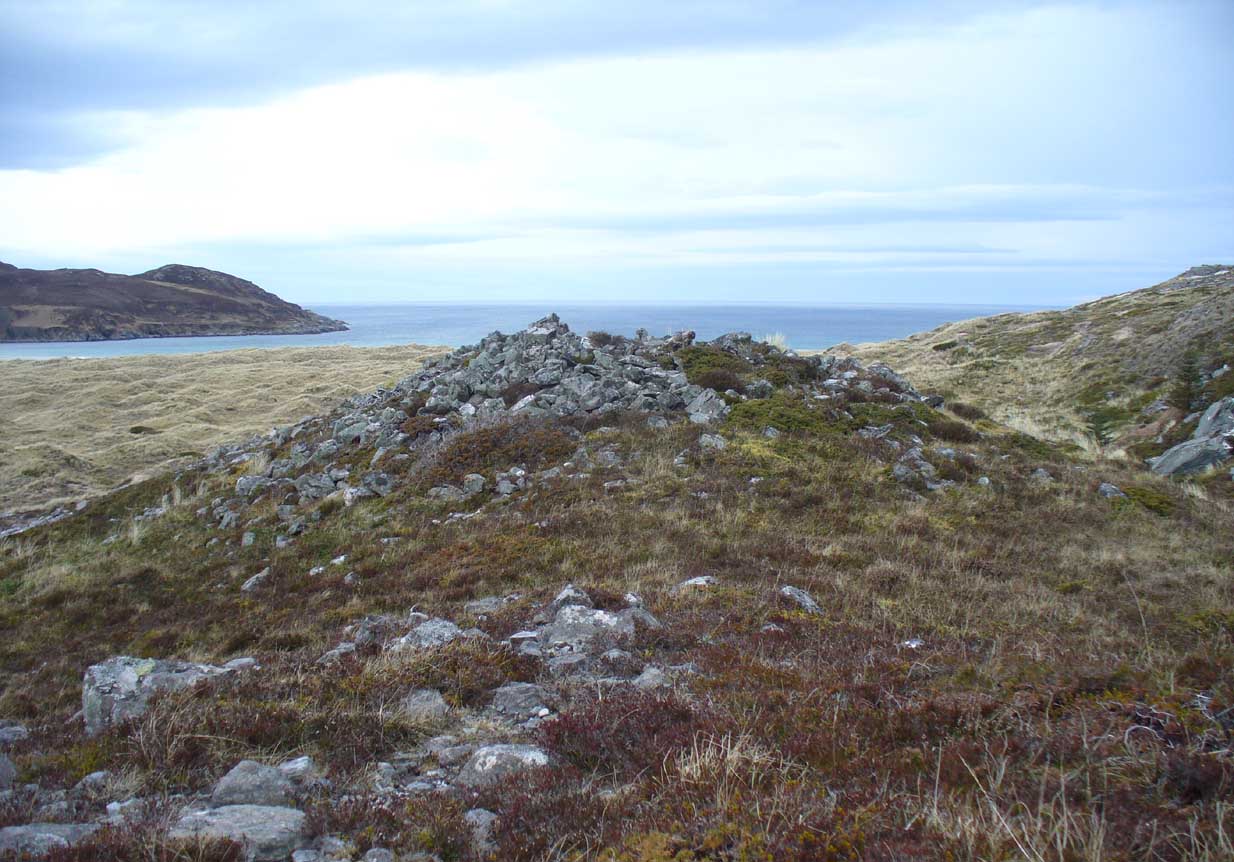
It seems at first to be in an unusual position for a chambered cairn: built onto solid rock instead of soil.  Yet we find this geocentric structuralism echoed at the Borgie chambered tomb 1½ miles to the southeast.  When you reach the place, a large mass of stones—hundreds of them piled-up several feet high—is strewn across the rocky surface and reaching onto more typical moorland ground.  On top are a number of large stones, some laid down, some half-upright appearing, perhaps, to have played some part in an internal cist or chamber.  On the eastern side the rocky mass falls down a natural steep slope, with many of the fallen stones covered by centuries of vegetation.  As you walk around it, cairn-scatter seems to extend southwards towards another natural rocky knoll 20 yards to the south, giving the impression of a second cairn (much like the Fiscary 1 and 2 cairns 2.8 miles to the east), but this is improbable.

The first detailed archaeological account of the site was by Audrey Henshall (1972), who told us:

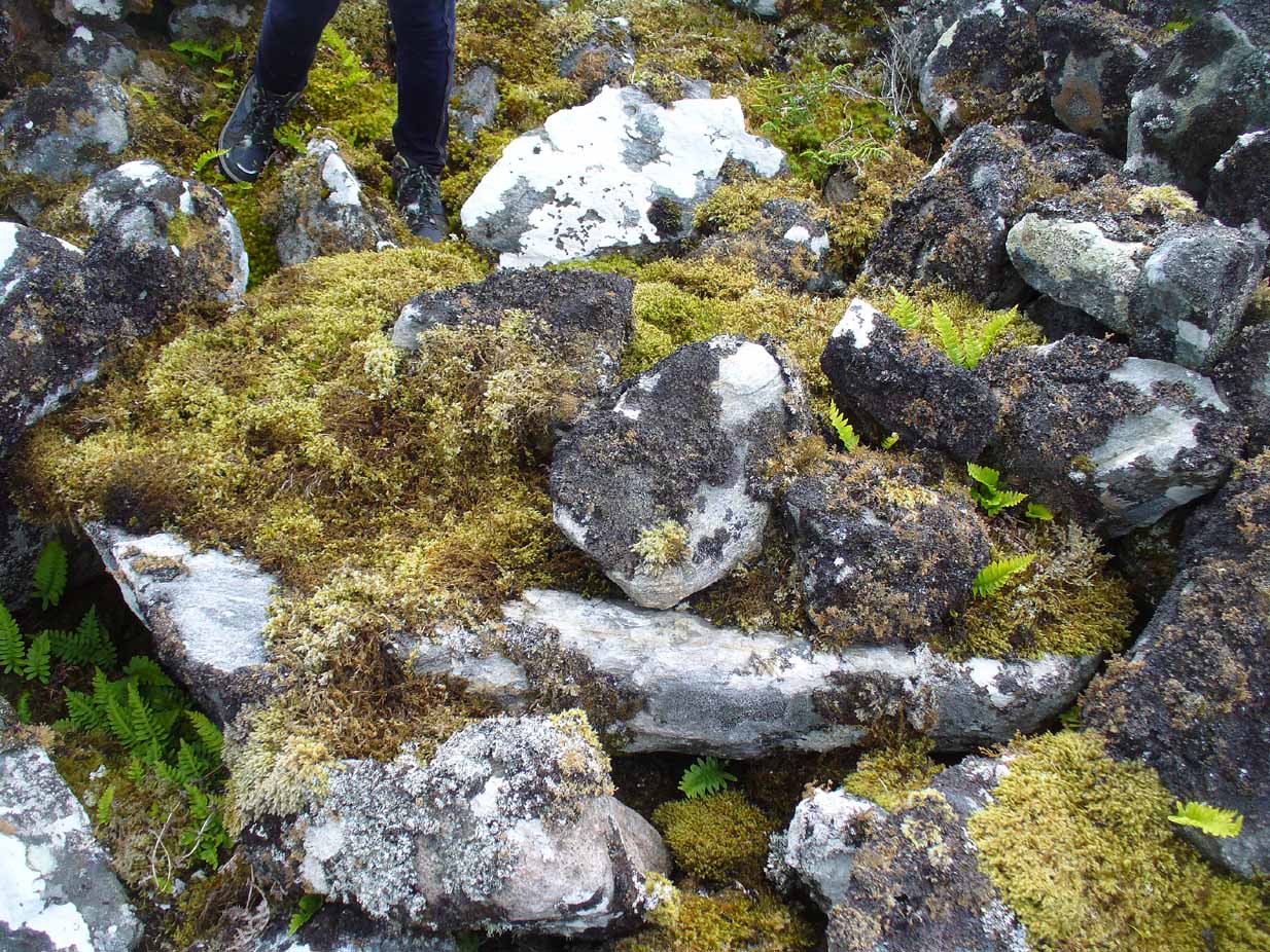
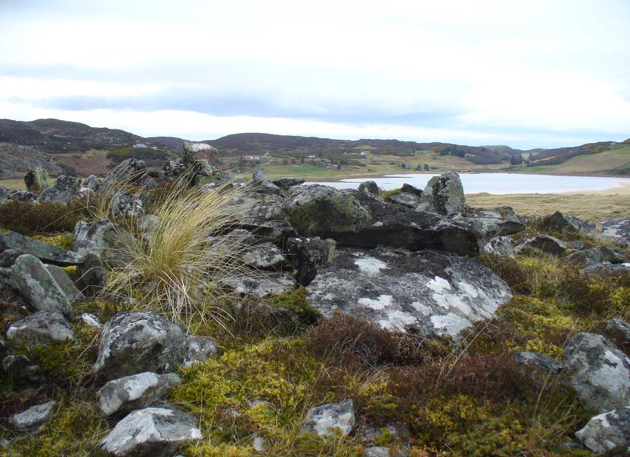
“…The cairn is about 4ft high, consisting of a mass of angular stones.  On the S side the edge can be traced, and the indications are that the diameter was about 57ft.  The edge on the N side is rather vague and may have been flattened in plan.  On the E and W sides, where there are steep drops, the stones have evidently spread downhill, though on the E side parts of a roughly built edging can be seen.

“Many large slabs lie about the site, probably mainly displaced corbels and roofing stones.  Much of the chamber structure probably exists, and a few visible orthostats are probably in situ.  The entrance has probably been from the N or seaward side.  A slab towards the S side, aligned E-W, projects 1ft 6in, and is likely to be the back-slab.  The E side of the chamber is represented by a slab 4ft 6in to the N, aligned N-S, which is just visible.  On the W side of the chamber there are a number of large slabs, one over the other wide their E edges aligned vertically, and laid declining to the W, which appear to be corbel stones only slightly displaced.  To the N of them, a stone set transversely to the axis of the chamber, 10ft 3in N of the back-slab, might be a portal stone.  Another upright stone seemingly firmly set but obstructing the probable position of the entry into the chamber, is presumably displaced.”

More than twenty years later however, Miss Henshall (1995) revisited Dun Riaskidh and altered her initial diagnosis of it as a chambered cairn, suggesting it to be something completely different, telling:

“The cairn-like structure…has an overall spread of about 17m including stone displaced downhill, and a height of 1.6m on the S side.  On the summit a group of upright slabs protrudes up to 0.35m, and forms a rough oval 5.5m E to W, by 4.5m N to S.  They seem to be on the inner side of a ring of stony material  about 2.5m thick.  In the interior is a disorganised mass of lintel slabs and three earthfast upright slabs.  The structure appears to be a house with spaced uprights in the inner face of the wall, and with a series of uprights which helped to support a partly lintelled roof.  A hollow on the N or seaward side probably indicates the position of the entrance.”

Top of the cairn, looking W

Now woe am I to go against the words of a giant like Miss Henshall, but having slept in numerous derelict houses and seen countless numbers of them in the hills, this structure does not seem to have such properties.  The category that is continued by Canmore and Ordnance Survey re Dun Riaskidh is still a “chambered cairn”; but, perhaps, if Miss Henshall is correct in saying that it is not a cairn, then maybe the words of local tradition may have been right all along (again!) and this is a collapsed broch?  Who knows for sure…?

Whatever its original nature and function, this vestige of antiquity is enveloped within another one of Nature’s incredible domains…

References:

  1. Henshall, Audrey S., The Chambered Tombs of Scotland – volume 2, Edinburgh University Press 1972.
  2. Henshall, Audrey S. & Ritchie, J.N.G., The Chambered Cairns of Sutherland, Edinburgh University Press 1995.
  3. Horsburgh, James, Notes of Cromlechs, Duns, Hut-circles, Chambered Cairns and other Remains, in the County of Sutherland“, in Proceedings Society of Antiquaries, Scotland, volume 7, 1870
  4. Mercer, R.J. & Howell, J.M., Archaeological Field Survey in Northern Scotland – volume 2, University of Edinburgh 1981.
  5. Royal Commission on Ancient & Historical Monuments, Scotland, Inventory of Monuments and Constructions in the County of Sutherland. HMSO: Edinburgh 1911.

Acknowledgments:  Huge thanks to Donna Murray, for putting me up in this part of Paradise.  Cheers Donna.

© Paul Bennett, The Northern Antiquarian 

Borgie, Tongue, Sutherland

Chambered Cairn:  OS Grid Reference – NC 6737 5940

Also Known as:

  1. Canmore ID 5743

Getting Here

Borgie Cairn under gorse, right

Very difficult to find under the herbage, but – along the A836 road between Tongue and Bettyhill, turn down at Borgie Bridge towards Skerray.  A few hundred yards along, past the third house on y’ right, a path through the gate on the left takes you up the slope. Once you meet the deep-cut dike, follow it north-ish for 200 yards, over the fence; then walk 150 yards towards the eastern edges where the mass of gorse meets with the rocky escarpment.  You’re damn close!

Archaeology & History

These days, much of the remains of this neolithic chambered cairn are inaccessible, as it is covered with the spindly-killer-bushes that are the yellow gorse (Ulex eurapæus).  A pity.  …Just like its fellow chambered tomb of Dun Riaskidh precisely 1½ miles NW, this was also built upon the edge of a natural rocky escarpment with some of the rocks making up the tomb falling to the edges (I nearly fell in and spined misself meandering around its edges!).

Little has been written about it in archaeo-tomes, despite it being first listed in 1947. Presumably neolithic in age, it was first classed as a ’round cairn’ and has subsequently been described by Canmore as,

“a severely robbed, chambered cairn. It is about 15.0m in diameter, with a maximum height of 0.6m in the centre; elsewhere the cairn is reduced to a stony rim and scattered stones. In the centre a chamber is indicated by two opposing earthfast boulders 1.1m apart and protruding up to 0.6m through the cairn material.”

References:

  1. Gourley, Robert, Sutherland: An Archaeological Guide, Birlinn: Edinburgh 1996.

Acknowledgments:  Huge thanks to Donna Murray, for putting me up in this part of Paradise.  Cheers Donna.

© Paul Bennett, The Northern Antiquarian

Achnaburin, Bettyhill, Farr, Sutherland

‘Hut Circle’:  OS Grid Reference – NC 7082 5891

Also Known as:

  1. Achnabourin
  2. Canmore ID 6210

Getting Here

Site as ‘Picts House’, 1873 map

From Bettyhill village, take the A836 road as if you’re going to visit Tongue, crossing the metal bridge across the River Naver a mile south of Bettyhill.  Keep going past here for nearly a mile, beyond the houses and then into the small trees, making sure that you keep your eyes peeled to the right where a small but notable bracken-covered mound rises 10-20 yards in the rough field. Go through the gate and you’re there!

Archaeology & History

Low stone wall along S side

A site which, from the nearby roadside, has all the hallmarks of being yet another Sutherland broch (there are tons of them up here!)—but apparently it isn’t!  Despite being shown on the earliest OS-map of the region as a ‘Pict’s House’ (which are usually brochs), the site has subsequently been designated by modern archaeologists as a simple ‘hut circle’.  I have my doubts over this, as it’s a most unusual one with little logic over its positioning—unless it was either a look-out point, or an odd ritual spot.

South side of the mound

As you can see from the poor photos I got of the place, a large angled tumulus-like hillock (it’s akin to a mini-Silbury Hill at first sight) rises up from the ground with a reasonably uniform angle around much of it, to a height of between 16-20 feet.  Scattered rocks and stones adorn the mound as you walk up its embankments and onto the top where, around the edges, a notable man-made ring of walling shows it to have been artificially created.  Unfortunately most of the top of the mound was completely covered in thick decayed bracken when I visited, so it was difficult to get any good photos of this topmost walling.

The SE side of the mound

From the top of the mound, the walling is between 1-3 feet high, in a roughly circular setting, measuring 36-40 feet across.  The most distinct section of it was visible on the west-to-south-to-east section; with the lowest and depleted section occurring on its northern edges.  The entrance to the ‘hut circle’ is apparently on its eastern side.  Although it is assumed to be Iron Age in nature, its real age is unknown.

References:

  1. Mercer, R.J. & Howell, J.M., Archaeological Field Survey in Northern Scotland – volume 2, University of Edinburgh 1976-1983.

© Paul Bennett, The Northern Antiquarian

Ringstone, Torrisdale Bay, Farr, Sutherland

Legendary Rock:  OS Grid Reference – NC 69128 61741

Getting Here

The Ringstone, Torrisdale Bay

Along the A836 road between Tongue and Bettyhill, turn down towards Skerray at Borgie Bridge for 1.8 miles (2.87km) until you reach the little information sign at the roadside. Walk downhill and cross the little bridge and wander onto the west side of the beach.  You’re likely to end up daydreaming… so once you’ve re-focussed, head into the middle of the beach and walk up the steep-ish sand-banks to your right (south).  Once at the top, you’ll see a gigantic rock—the Ringstone—nearly as big as a house.

Folklore

This gigantic boulder is part of one of Sutherland’s archaic Creation Myths as they’re known: ancient stories recounted by archaic societies about the nature and origins of the world.  Such tales tend to be peopled by giants, gods, huge supernatural creatures, borne of chaos, eggs, darkness and primal oceans.  Thankfully we still find some examples of these tales in the northern and northwestern mountainous regions of Britain, as the Church and Industrialism never quite destroyed the hardcore communities—despite what they might like to tell you…

The face of the Ringstone
The Ringstone, gazing east

The following folktale was written by the local headmaster, Alan Temperley (1977), who wrote down many of the oral traditions in Scotland’s far north before they disappeared forever from the tongues of local people (as is sadly happening in these mountains) as they’re slowly, sadly, being erased by the influx of incomers with no connection nor sincere love of old tales and ways.  It is typical of stories found other large geological formations from aboriginal Australia, to Skye, to everywhere on Earth where people have settled.  Mr Temperley wrote:

“Many years ago there were two giants, the Naver giant from the river at Bettyhill, and the Aird giant from the hill above Skerray.  Normally they got on quite well, but one afternoon they became involved in a heated argument about some sheep and cattle, and both grew very angry.  The Aird giant was standing on top of the hill above Torrisdale bay with the animals grazing around him, and the Naver giant stormed across the river to the beach below.

“Those are my sheep,” he roared up the hill.

“No they’re not,” the Aird giant said. “At least not all of them.”

“You stole them. You’re a thief!”

“No I didn’t. They came up here themselves. Anyway, you owe me fifty sheep from last year.”

“You’re not only as thief, you’re a liar!” shouted the Naver giant.  If you don’t send them down this minute, I’ll come up and see to it myself.”

At this the Aird giant gave a disparaging laugh and made a rude face, and picking up a great boulder flung it down the hill at his friend.

The Naver giant was speechless with fury, and picking the stone up himself, hurled it back up the hillside, making a great hole in the ground.

The Aird giant saw things had gone far enough.

“I’ll send them back if you give me that silver ring you’re always wearing,” he said.

“Never!” roared his friend, his face all red and angry.

“Suit yourself then,” said the Aird giant, and picking the stone up again he tossed it back down the hill.

For long enough the rock kept flying between them, and in time the giant from Naver grew tired, because he was throwing it uphill all the time.

“Will you give me the ring now?” said the Aird giant.

For answer the Naver giant tried one more time to throw the stone up the hill, but it only got halfway, and rolled back down to the shore.

“Come on,” said the giant from Aird, for he wanted to be friends again. “Give me the ring, and I’ll let you have it back later.”

“No!” said the Naver giant from the bottom of the hill.  “I’ll never give it to you!” His eyes began to fill with tears.

“Oh, come on, please!” coaxed the Aird giant. “Just for a week.”

“Never, never, never!” shouted the giant from Naver, and pulling the ring from his finger he threw it on the ground and jammed the great boulder down on top of it.  Then he sat down on top of the stone and stared out to sea.  Every so often he sniffed, and his friend, looking down at his broad back, saw him lift the back of a hand to his eyes.

They never made friends again, and after a long time they both died.

The ring is still buried under the stone, and so far nobody has ever been able to shift it.”

The giant’s face, in profile

When I got back from visiting this immense rock a few weeks ago, a local lady Donna Murray asked me if I’d seen the face of the giant in the rock.  I hadn’t—as I was looking to see if the name ‘Ringstone’ related to any possible cup-and-rings on its surface, which it didn’t (although I didn’t clamber onto the top).  But in the many photos I took from all angles, Donna pointed out the blatant simulacra of the giant’s face when looking at it from the east.

However, on top of the slope above the Ringstone (not the Aird side), I did find a faint but distinct ‘Ringstone’ carving (without a central cupmark).  Whether this ever had any mythic relationship to the tale or the stone, we might never know.  The rocky terrain above Aird now needs to be looked at…

References:

  1. Eliade, Mircea, Patterns in Comparative Religion, Sheed & Ward: London 1958.
  2. Long, Charles H., “Cosmogony,” in Eliade, M., Encyclopedia of Religion – volume 4, MacMillan: New York 1987.
  3. MacLagan, David, Creation Myths: Man’s Introduction to the World, Thames & Hudson: London 1977.
  4. Temperley, Alan, Tales of the North Coast, Research Publishing Company: London 1977.

Acknowledgments:  Massive thanks again to Donna Murray, for her help and for putting up with me amidst my wanderings up in Torrisdale and district.

© Paul BennettThe Northern Antiquarian 2017

Queen’s Cairn, Farr, Strathnaver, Sutherland

Chambered Cairn:  OS Grid Reference – NC 7247 5687

Also Known as:

  1. Canmore ID 6212
  2. Skelpick

Getting Here

The great Queen's Cairn
The great Queen’s Cairn

From Bettyhill village, take the road east towards Tongue and Durness.  A half-mile out of the village, at the bottom of the hill, just before you cross the small metal bridge across the River Naver, a very minor road, left, takes you to Skelpick. Go down here and follow the directions to reach the giant long cairn of Skelpick Long.  Once there, walk east up the moorland hill (there are no footpaths) for about 150 yards.  Once on top of the rise, the moorland levels out a little and there, before you, amidst the small overgrown undulations of many old cairns, a giant one rises up to greet you about 100 yards away.  Y’ can’t really miss it!

Archaeology & History

Neolithic in nature, this giant circular cairn, standing on the ridge above the hugely impressive chambered long cairn of Long Skelpick, isn’t quite as grandiose as its neighbour below, but it’s still an impressive feature in this beautiful moorland landscape.  Comprised of tens of thousands of small stones raised to a height of 10 feet above the moorland peat, several ‘pits’ have been dug into the top of this undoubted tomb of regal nature; but whether it was originally the burial-place of a single person, to which were later added members of the same family, is simply unknown.

queens-cairn35
Moss-covered capstone
Depression atop of the cairn
Depression atop of cairn

On the top of the cairn, at least one of the so-called ‘pits’ that drop into the centre is covered by a large heavy tombstone with a small upright monolith at its side.  Although the late great Miss Henshall (2005) thought no ‘chamber’ was here, it is quite possible that a chamber might be found beneath this large moss-covered flat rock (see photo).  When we visited here, it looked as if there was a hollow beneath it, but only an excavation would tell us for sure.

Mass of cairns on 1878 map
Mass of sites on 1878 map

Highlighted on the earliest Ordnance Survey map, it was shown to be just one cairn amidst the mass of other smaller surrounding tombs—most of which were probably built for people from the same tribal group.  None of these small cairns have been excavated, but they were probably built after the construction of the major Queen’s Cairn.

The Royal Commission lads visited the site in 1909, but said very little of the place (probably over-awed by Long Skelpick, Coillie na Borgie and other nearby giants!), merely that this large circular cairn has

“a diameter of about 54′.  It is about 8′ high, and though the stones have been pulled about here and there on the top, it does not appear to have been excavated.”

Queen's Cairn, looking north
Queen’s Cairn, looking N

And so it remains to this day—although the cairn is slightly larger than the dimensions given by the Commission boys.  Beneath the encroaching heather, the cairn is closer to 67 feet (10.23m) across, with a circumference of 210 feet (64.25m).

Line of ancient walling nearby
Line of ancient wall nearby

The monument sits on a plateau immediately above the giant Long Skelpick cairn—although neither can be seen from each other.  But if you walk only a short distance from the Queen’s Cairn towards the long cairn below, a very notable and extensive line of ancient walling runs along the edge of the geological ridge separating the two tombs, as if deliberately keeping them apart.  Other lines of ancient walling run closer to the cairn, seeming to indicate that a settlement of some form was also apparent on this ridge, in close connection with the group of smaller burial cairns.

It’s a gorgeous arena with many prehistoric sites and puzzles to behold, and plenty of unrecorded ones nestling quietly in the heather.  It’s bloody superb to be honest!

References:

  1. Gourlay, Robert, Sutherland: An Archaeological Guide, Birlinn: Edinburgh 1996.
  2. Henshall, Audrey S. & Ritchie, J.N.G., The Chambered Cairns of Sutherland, Edinburgh University Press 2005.
  3. Royal Commission Ancient & Historical Monuments, Scotland, Inventory of Monuments and Constructions in the County of Sutherland, HMSO: Edinburgh 1911.
  4. Stuart, John, “Report to the Committe of the Society of Antiquaries of Scotland, Appointed to Arrange for the Application of a Fund left by the Late Mr A. Henry Rhind, for Excavating Early Remains,” in Proceedings of the Society of Antiquaries, Scotland, volume 7, 1868.

Acknowledgements:  Big thanks to the awesome Aisha Domleo & her frobbling Lara for our meandering day out to this olde place… Gorgeous! x

© Paul Bennett, The Northern Antiquarian