In terms of getting here, follow the directions given by H.C. Collins (1946), who reached here from Healey, north of Rochdale. “Once past Lousy Hillock the track continues in front of Brown House Reservoir… The track climbs Faffelty Brow under the lea of Man Stone Edge on the left”, above the Rossendale Way footpath. You can of course come straight up from Whitworth, heading up the eastern hill over Lobden golf course. The site’s to the northeast edge of the course.
Folklore
I first read of this a couple of decades back, in Jessica Lofthouse’s (1976) folklore book, but her pronunciation of the site — which I sought and sought, without success — made finding the place really troublesome. Thankfully, the local guidebook of Harold Collins (1946) has brought this site into focus once more and, it would seem, the probable site of prehistoric archaeological remains. But until we get over here and have a good look round, that aspect of the Man Stone will have to await assessment.
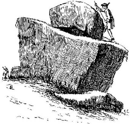
Collins (1946) described the “huge stone on the moortop on the left of the track” he’d been walking along, telling how “according to legend it bears the imprint of a human hand and was thrown (here) from Blackstone Edge by Robin Hood.”
Lofthouse (1976) told similarly when she was describing the folklore of Robin Hood’s Bed, about six miles east of here, by the Yorkshire-Lancashire border, saying,
“Robin was a mighty hurler as well as a bowman without peer. To while away waiting time in the Bed he took a large boulder from the giant’s overspill at hand, threw it and watched its course. Six miles away on Monstone Edge that boulder dropped, a feat amazing , and has been called Robin Hood’s Quoit ever after!”
But the “quoit”, said Lofthouse, was there centuries before any legendary Robin Hood — as it would have been. As far as I can find though, no such prehistoric relic ‘officially’ exists upon this hill. But as those of us who’ve been into seeking these old sites know, that doesn’t necessarily mean a thing. Henry Fishwick’s (1889) notes about the markings on the rock — “and certain impressions on its surface are said to be the marks of the fingers and thumb of the thrower” —may also prove fruitful.
Adding fuel to an authentic animistic history is the existence, once, of the Old Man’s consort: his Old Woman, or Cailleach, whose well and other landscape features existed to the north. Much of our peasant history is clearly just beneath the surface in this unexplored archaeomythic region…
References:
Collins, H.C., Rambles round Rochdale, Thomas Yates: Rochdale 1946.
Fishwick, Henry, History of the Parish of Rochdale, James Clegg: London 1889.
Lofthouse, Jessica, North Country Folklore, Robert Hale: London 1976.
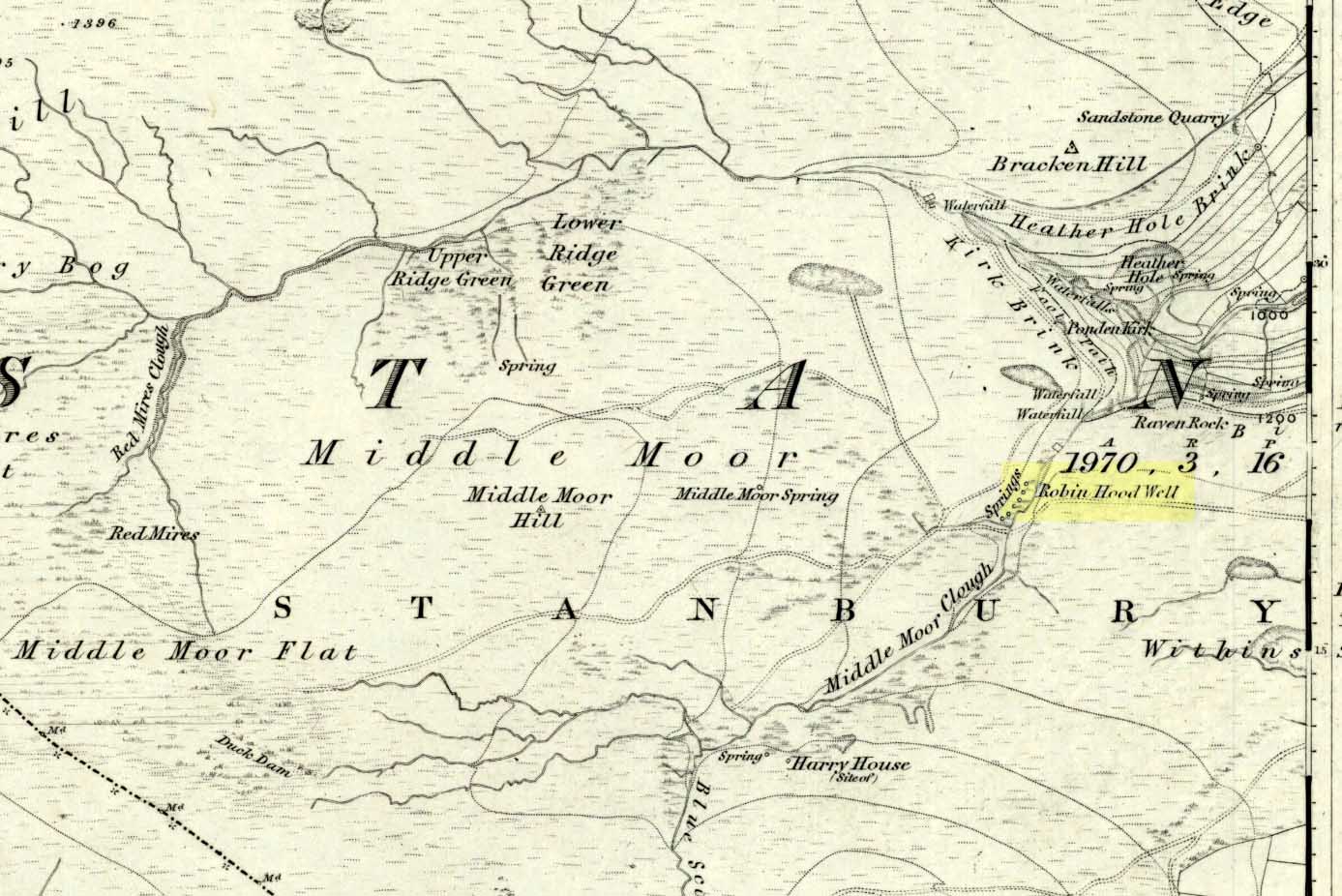
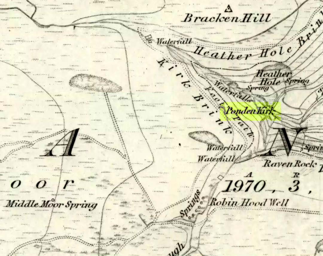
Follow the same directions to get to the nearby Ponden Kirk and, once on top of the rocks, overlooking the valley, walk on the footpath to your right. It bends round and follows the stream up onto the moors. About 100 yards along, walk up the heathery slope to the right and you’ll find several boggy watering holes on the top of the ridge. In looking at the first OS-map of the area in 1853, it seems that the northernmost of six boggy springs is the Robin Hood’s Well – although we don’t know this for certain. It’s one of them though!
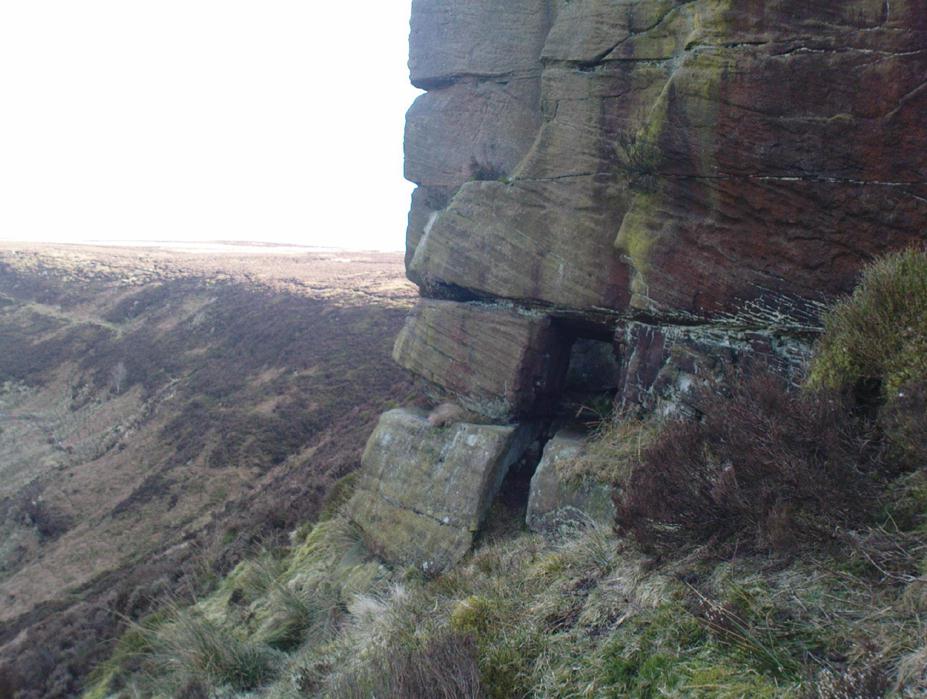
Archaeology & History
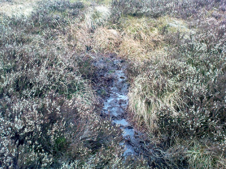
Robin Hood’s Spring, above Ponden Kirk
There’s little to see here really: it’s little more than a small boggy spring of water emerging from the edge of the ridge, as the photo shows. Curiously, descriptions of the site (and its neighbouring compatriots, Will Scarlett’s Well and Little John’s Well) are sparse aswell. It was noted by the Ordnance Survey lads in 1848 and subsequently posted on the first OS-map of the area in 1851. Both Horsfall Turner (1879) and Johnnie Gray (1891) mention the site passing, saying nothing of the place. However, several years after Gray’s work, Halliwell Sutcliffe (1899) ventured here and gave us the first real description of the place, telling:
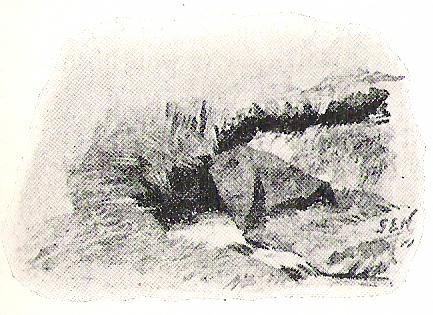
“Half-hidden underground, and fringed with fern and bog-weed, lie the three wells which go by the names of Robin Hood, Little John and Will Scarlett. One may stop to ask how they came by their birth-names, to wonder why a man should have troubled to fashion them in this out-of-the-way spot; but neither speculation nor questioning of the moor folk brings one nearer to an answer.”
Folklore
Halliwell Sutcliffe’s scruffy quick sketch, circa 1898
Apart from this site being a spot where the legendary outlaw stopped and drank in ages past, the healing attributes of these waters have long since been forgotten. Considering the proximity of the Ponden Kirk and its legendary association with fertility and marriage rites, I’d guess that such lore wold have centred around Beltane, or Mayday; and Robin Hood is very well known in folklore to have close associations with the same period. So — and I’m guessing here — it’s likely that whatever might have occurred at this well, would have taken place around Beltane aswell.
References:
Gray, Johnnie, Through Airedale from Goole to Malham, Walker & Laycock: Leeds 1891.
Sutcliffe, Halliwell, By Moor and Fell in West Yorkshire, T. Fisher Unwin: London 1899.
Turner, J. Horsfall, Haworth, Past and Present, Hendon Mill: Nelson 1879.
Go west through Stanbury village towards Lancashire for a mile till you reach the end of Ponden Reservoir. Where the water ends, follow the small track up to, and past, Whitestone Farm, till you reach the stream. Follow the valley up…
Archaeology & History
As the great Yorkshire historian J. Horsfall Turner (1879) told, “Ponden Kirk consists of a ledge of high rocks, dry in summer, but forming a stupendous cataract after heavy rain. It was here that Mrs Nicholls (Currer Bell) caught a severe cold shortly before her death.” The site is a fine one – not to be attempted from the base by unfit doods, unless you’re really serious about your climbing! But to those of us who like clambering up rocks and wholesome scenery, walk to the site via the stream (Ponden Clough Beck) and get to the cleft in the rock face. Tis a truly fine place!
Ponden Kirk from below
In 1913, one writer posited the notion that the opening in the rocks through which local folk crawl (see Folklore, below) “is seemingly artificial” – which aint quite true, sadly.
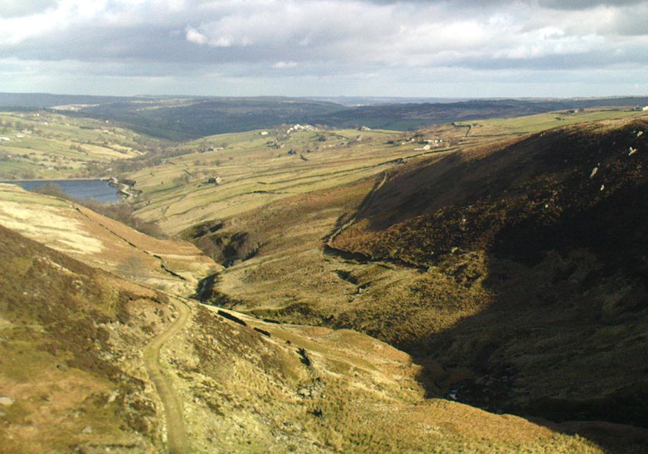
Once on the tops above the Kirk, you’ve one helluva decent view, be it raining or sunny. On the far northeastern horizon arises the great omphalos of Almscliffe Crags; and next to that is the elongated top of Baildon Hill; and a little further northeast is Otley Chevin. It would be good to visit here on a few of the old heathen days and watch the sunrise, just to see if there are any intriguing solar observations to be made! (take a tent though – or p’raps, if you’re like us, don’t bother, but you’ll be bloody cold for the night!) The only potential sunrises of heathen significance appear to be midsummer and Beltane….
Ponden Kirk on 1851 map
For me at least, one of the things which gives this site an intriguing form of sanctity is the fact that the Kirk itself forms the head at the end of the valley. It is a very fine ritual site and would obviously have had much more to be said of it than just the heathen marriage rites which are left today. The forces of wind and rain scream from its height, and in the valley beneath the chime of the gentlest echoes resonate, giving an altogether different ‘spirit’ amidst the same land. Those old cherubs of ‘male’ and ‘female’ spirit commune potently here – no doubt being the ingredients which gave form to the marriage customs… Those of you into feng-shui (the real stuff, not the modern bollox) and genius loci should spend time with the water and rocks here and you’ll see what I mean. Archaeologists amongst you, if you dare, should amble aimlessly here for sometime…for many hours, a few times, and give yourselves a notion of the ‘ritual landscapes’ you like to write about from the safety of your textbooks, to get a bittova better notion of what ‘experiencing the land’ is actually about.
Ponden Kirk’s opening
This rocky outcrop was also said to be the place that Emily Bronte used in her Wuthering Heights novel as the place called Penistone Crags. A couple of other local writers have also added this legendary place in their tales aswell.
Folklore
Alleged by Elizabeth Southwart (1923) “to be of druidical origin,” the first literary note of this great rock outcrop appears to come from the reverend James Whalley (1869) of Todmorden, who in his romantic amblings over the moorlands here, told that if any gentleman wants to get married,
“he must by all means pay a visit to Ponden Kirk… Here ‘they marry single ones!’ Any lady or gentleman who can successfully ‘go through one part of the rock’ (which is quite possible) is declared to all intents and purposes duly married according to the forms and ceremonies of Ponden Kirk.”
The view from the top
His wording here seems to imply that the event of passing through the rocky opening, is in itself a confirmation of the ceremony of marriage, not needing the blessing of some strange christian rites. If so, this tradition would be a very ancient one indeed, making the stone the witness to the marriage event. This would be a rite witnessed by the stones themselves: a universal heathen attribute found in most of the ancient traditional cultures. But this curious unwritten history was to be echoed a decade later by that great Yorkshire historian, J. Horsfall Turner (1879), who told us that,
“at Ponden Kirk, as at Ripon Minster, a curious wedding ceremony is frequently observed. It consists in dragging one’s-self through a crevice in the rock, the successful performance of which betokens a speedy nuptial… The place is now frequently called ‘Wuthering Heights. Apart from the association of such names as Crimlesworth and Oakden (see the Alcomden Stones), fancy easily ascribes a druidical settlement at the Kirk.”
A not unreasonable assumption – though nothing of this nature, of yet, has been found.
That other great Yorkshire writer, Harry Speight — aka Johnnie Gray (1891) — echoed the same folklore telling how,
“The natives of these parts have a saying, ‘Let’s go to Ponden Kirk where they wed odd ‘uns,’ which has its origin in an old custom of passing through an enormous boulder… The belief is that if you pass through it, you will never die single. No one knows how the rock acquired its name, but the Saxon kirk suggests a temple of worship, possibly extending back to the druidical times.”
Ponden Kirk – by T. MacKenzie, c.1923
A few years later, Mr Whiteley Turner came here and he too affirmed the old wedding rites, also telling that “according to tradition, maidens (some say bachelors too) who successfully creep through the aperture will be married within the year.” This bit of info also shows that the rocks also had oracular properties – a function known at countless other sites.
The proximity of Robin’s Hood Well, just a couple of hundred yards away, beckons for association with the Ponden Kirk – which it obviously had… But that’s a tale to be told elsewhere…
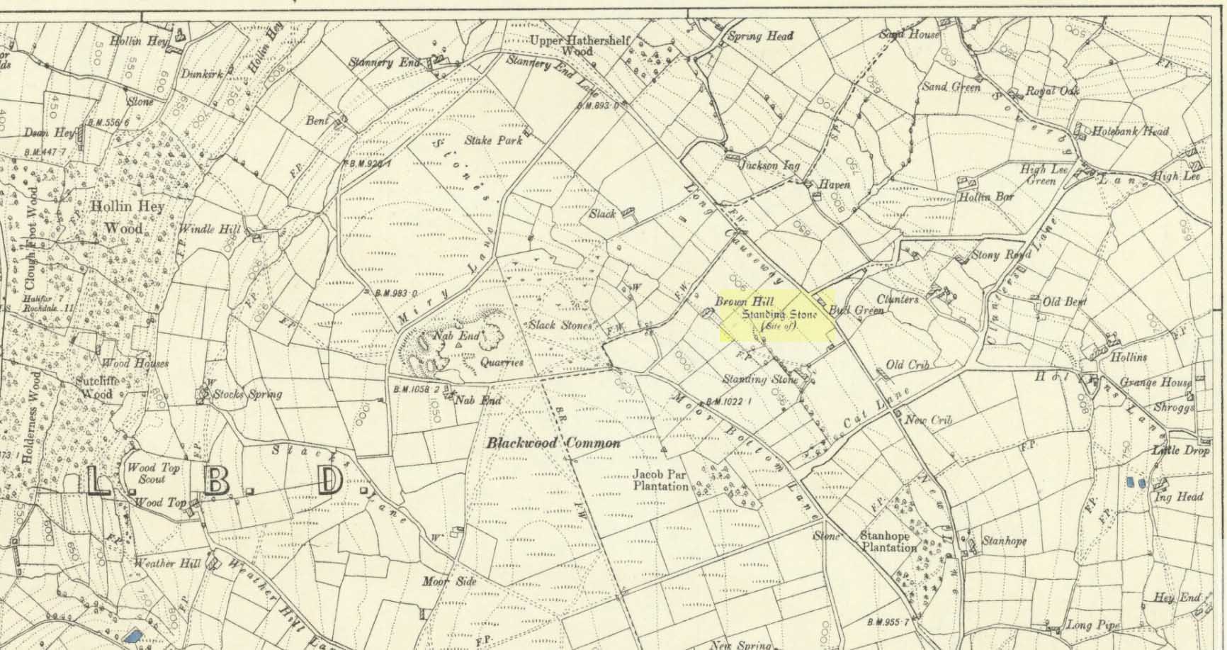
Standing Stone (destroyed): OS Grid Reference – SE 024 244
Archaeology & History
Standing stone on 1894 map
Also known as the Field House Standing Stone, this monolith seems to have gone. It was first described in local Minister’s Accounts of 1403, and then again in the Wakefield court-rolls of 1515. By the time John Watson (1775) wrote about the place there had been several other references describing this old “standyngstone”. It was still upright in 1852, but Ordnance Survey showed it as “Site of – ” at the beginning of the 20th century, and the stone had been moved a short distance away, further down from its original position to a spot at the side of the old trackway — but all trace of it has since vanished.
Folklore
This is thought to have been the standing stone which Robin Hood threw here, from the appropriately called Robin Hood’s Penny Stone at Wainstalls. The tale tells how he dug it out of the ground with a spade and threw it three-and-half miles across the valley until it landed here. Ooh, what a strong boy!
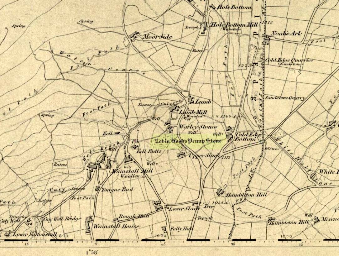
Stone Circle (destroyed): OS Grid Reference – SE 046 288
Archaeology & History
The Pennystone on 1852 map
All remains of this site, first mentioned as a stone circle in 1836, have gone. The place could be found by the appropriately named Stone Farm at the top end of Wainstalls and was first mentioned by John Watson (1775), who strangely said nothing about any circle here. However, this changed when John Crabtree (1836) arrived and described a ring of stones surrounding a large boulder in the centre (illustrated here). The boulder itself was actually called the Robin Hood Penny Stone.
Folklore
Watson’s 1775 drawing
This was one of the many legendary sites from where our legendary outlaw practiced shooting his arrows. He was also said to have picked up and thrown a large standing stone from this spot, until it landed three-and-a-half miles away on the hillside on the other side of the Calder Valley. (this was known as the Field House, or Sowerby Lad Standing Stone)
Crabtree, John, Concise History of the Parish and Vicarage of Halifax, Hartley & Walker: Halifax 1836.
Dobson, R.B. & Taylor, J., Rymes of Robyn Hood, Alan Sutton: Gloucester 1989.
Faull, M.L. & Moorhouse, S.A., West Yorkshire: An Archaeological Guide (4 volumes), WYMCC: Wakefield 1981.
Varley, Raymond, “A Stone-Axe Hammer, Robin Hood’s Penny Stone and Stone Circle at Wainstalls, Warley, near Halifax,” in Yorks. Arch. Journal 69, 1997.
Watson, John, The History and Antiquities of the Parish of Halifax, T. Lowndes: London 1775.
From Kilburn village, take the north road up past the church for about 300 yards, bearing up the track on your left and walk up into the wooded hill a mile ahead of you. It’s in there!
Folklore
In this region there’s a teeming cluster of druid, fairy, devil and spook-lore, along with numerous prehistoric remains. Not sure this site has such an archaic pedigree, though the creation myth told of this rock (marked on the 1st edition OS-map as an antiquity) seems to imply as such. Our old devil disguised himself as a druid many moons ago in an attempt to gain favour with the old priests, but was discovered in his plans and so, in anger, flew out across the hills carrying a great stone with him which he dropped from the skies and it landed where the Hood Hill Stone still remains. Also in anger he jumped down and stood on the great rock, and in doing so left his footprint impressed upon the stone. (There’s the possibility this is an unrecognised cup-marking – having not been here I can’t say misself). Edmund Bogg (1906) also tells us that,
“The monk’s hood-like configuration of the crest is said to have originated its name. The busy tongue of tradition, however, says that the name commemorated Robin Hood who, with his merry men, affected the hill-fastnesses hereabouts; but the hill was named ‘Hode’ long, long before the famous Robin came this way at all.”
The same writer also told how,
“legend, too, has it that the happy valley just north of Hood Hill…was a secluded and sacred retreat of the druids, and at the introduction of christianity into these parts, a great assembly gathered to consider which of the two religions should in future be adopted.”
Yet another legend – and an old one, says Bogg – is “that when the dinner-bell rang at Osgodby Hall the stone rolled down for its repast, and regularly returned to the crest after the meal.”
It’s blatantly obvious that something of antiquity this way hides. The “enclosure” shown on the modern OS-maps here could do with being looked at little closer.
References:
Bogg, Edmund, Richmondshire and the Vale of Mowbray (volume 1), James Miles: Leeds 1906.