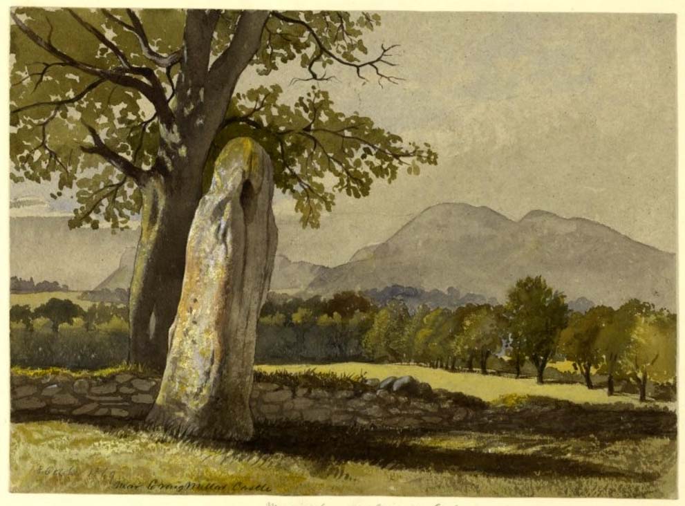
Take the A7 road south from Edinburgh central (off Princes Street) for several miles. It becomes known as the Old Dalkeith Road eventually, just as it passes the huge wooded ground of Craigmillar Castle on your left (east) and the Inch estate on your right. Walk along here, keeping your eyes peeled for the small path that takes you onto Ravenswood Avenue. Barely 30-40 yards from the main A7 road, the standing stone is there surrounded by railings.
Archaeology & History
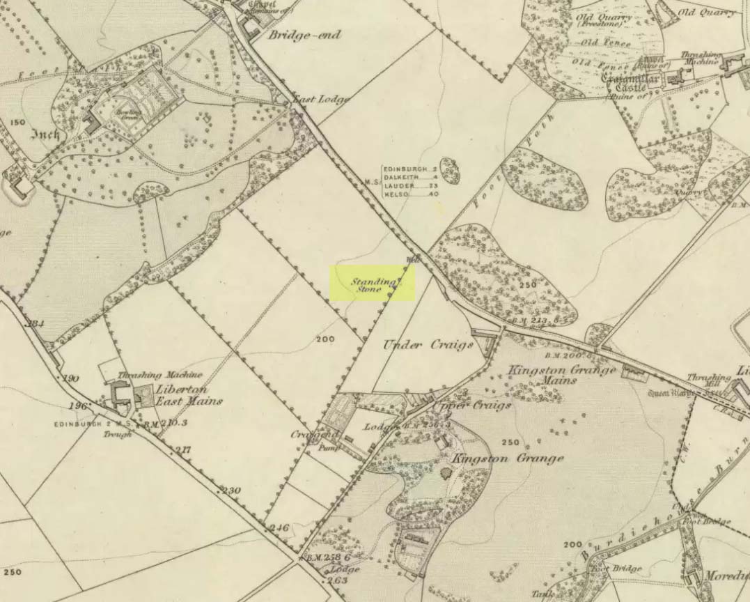
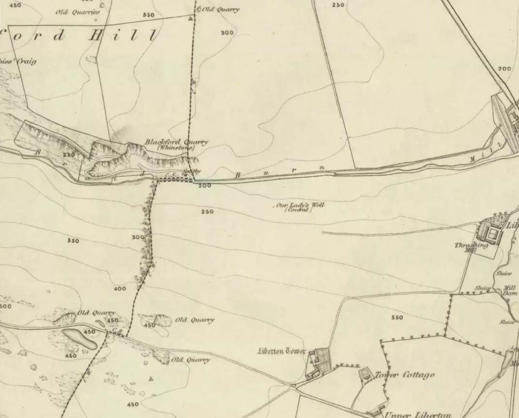
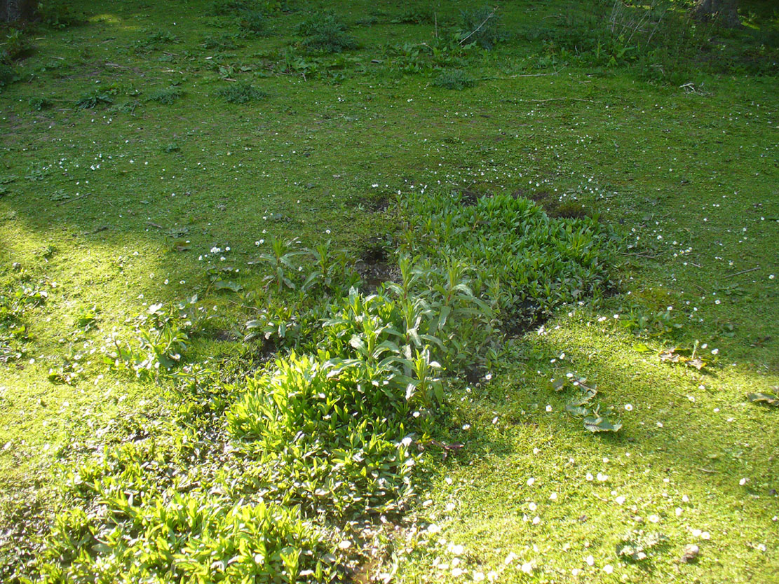
A curious place to find a standing stone – especially one that’s still alive! But that’s what we find on the Inch housing estate, thankfully. Highlighted on the 1855 Ordnance Survey map, it was one of a number of standing stones described in George Good’s (1893) fine survey on Liberton parish, which he thought commemorated ancient battles. When he wrote about it, the monolith was “built into the wall on the public road to Greenend”, just as shown on the OS-map. He told how the
“stone was taken down in the beginning of the present century (c.1801), when the road was widened, and it long lay in the field opposite, but was restored to its original place in 1891.”
When the Royal Commission (1929) lads came here many years later, they gave their own archaeocentric description, telling:
Site shown on 1855 mapThe old stone in its cage
“About 40 yards from the main road near Little France…is a standing stone, which is set up without packing, with its main axis almost due north and south, but with a slight inclination towards the east. It stands 6¾ feet above ground, and has a girth of 6 feet 5 inches at 3 feet from the base. It is of grey sandstone, badly weathered on two sides and without traces of any artificial markings or design.”
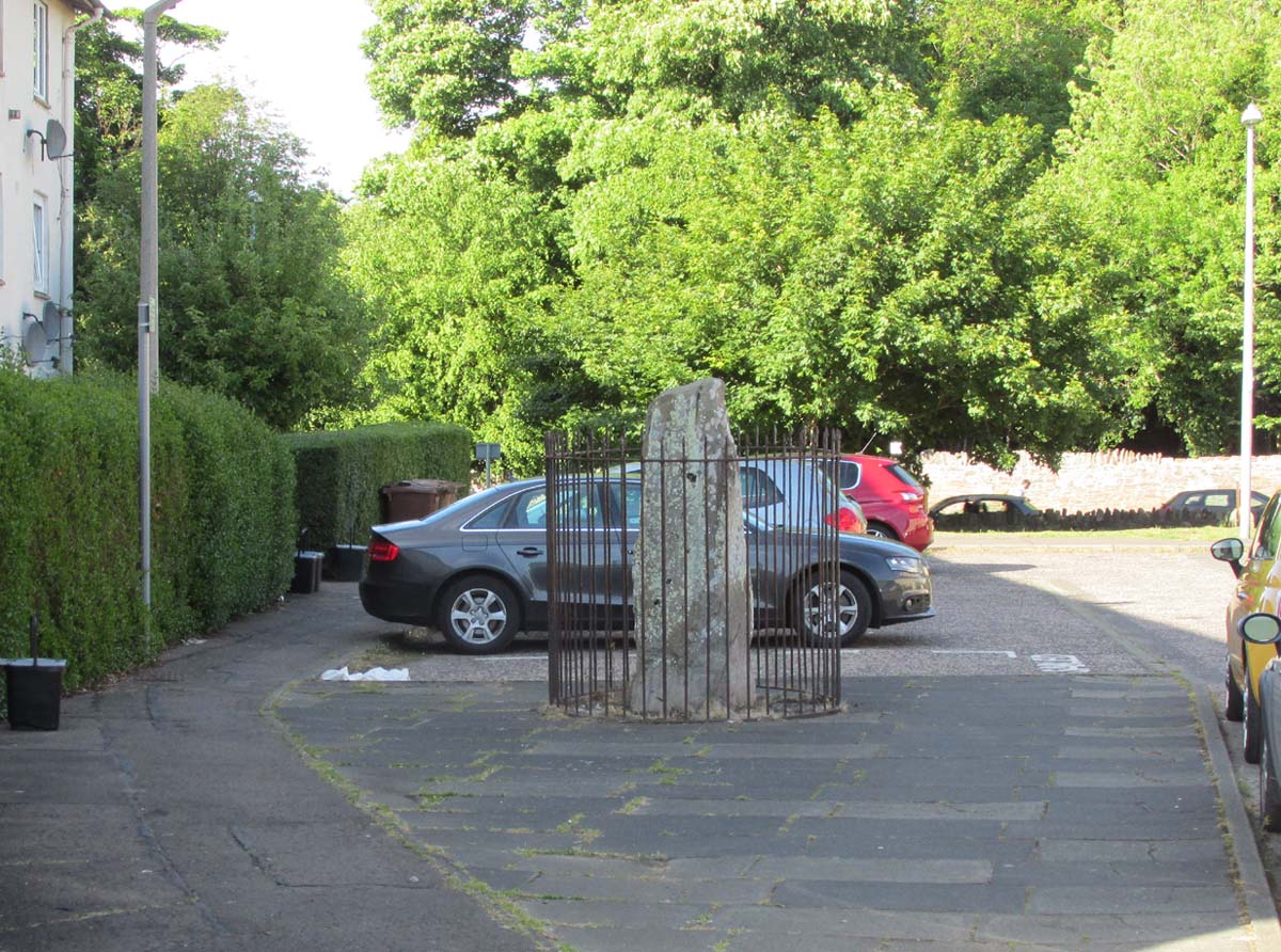
The monolith was included in Adam McLean’s (1977) megalithic survey of the area, where he rightly said how the iron fence that surrounds the stone destroys any atmosphere that might once be had here. Still, at least it’s still standing and is worth checking out if you’re in the area.
Folklore
The Ravenswood Stone
An old footpath that runs dead straight from Craigmillar Castle towards the stone was long ago said to be the pathway taken by the ghost of a white lady.
In days prior to the housing estate being built, local folk had annual bonfires here between Samhain (Halloween) and Guy Fawkes Night (Oct 31 – Nov 5).
References:
Good, George, Liberton in Ancient and Modern Times, Andrew Elliot: Edinburgh 1893.
McLean, Adam, The Standing Stones of the Lothians, Megalithic Research Publications: Edinburgh 1977.
Royal Commission on the Ancient & Historical Monuments of Scotland, Inventory of Monuments and Constructions in the Counties of Midlothianand West Lothian, HMSO: Edinburgh 1929.
Holy Well (destroyed): OS Grid Reference – NT 2728 6669
Archaeology & History
Our Ladys ‘Well’ on 1855 map
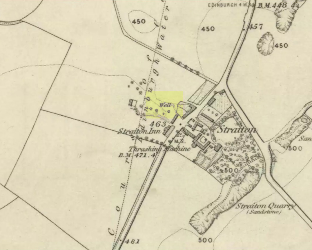
This is another all-but-forgotten holy well once dedicated to the Virgin Mary, close to the south-side of Edinburgh’s outer ring-road. It would seem to have been one in a cluster of sacred wells not far from each other (with the two Jacob’s Wells and St. Margaret’s Well at nearby Pentland), whose traditional stories have fallen prey to the incredulity of ‘progress’. I can find very little about the site, other than the note given it in George Good’s (1893) Liberton survey where, in stepping south towards the old hamlets of Broomhill and Straiton, he told:
“A little to the west of the hamlet, and near what was called Straiton Green, is an old draw-well dedicated to the Virgin, and known by the name of Our Lady’s Well. There may possibly have been a cell or chapel near this well, but no tradition or history regarding it is extant.”
We can only presume that the ‘Well’ which is highlighted on the first OS-map in 1855, maybe 20-30 yards west of the old road on what looks like a small park or ‘Green’, would be the ‘Lady Well’ in question. (another ‘Well’ is shown at Broomhill Cottage, which is unlikely to be the contender)
In Thomas Whyte’s (1792) lengthy survey of Liberton village, as it was in the 1790s, we come across what seems to be the earliest description of this long-lost sacrede site on the northwest side of the parish. In writing of the beauty of the countryside hereby in those times, he told how,
“on the north by the rivulet called Braid’s-burn, near which there is a well which has the appellation…of the Lady’s or Virgin Mary’s well, famous for its large current, and the salubrity and lightness of its waters.”
Site of Our Lady’s Well
Our Ladys Well on 1855 map
Mr Whyte believed that its dedication to Our Lady went way back, probably before Liberton parish was given to St. Cuthbert in the 11th or 12th century (whose own holy well could once be found several miles north, near Leith). Generally, wells that are dedicated to ‘Our Lady’, refer to the Virgin Mary; but prior to any christian affectation, the animistic genius loci of the waters would have been a local spirit.
It was visited and described by the Ordnance Survey lads in the Name Book of 1851, in which they said that Our Lady’s Well was,
“The site of a celebrated well situated in a hollow on the farm of Liberton Tower Mains, and dedicated to St. Mary, as it and the field is well known to be called to this day, “The lady’s Field” & Well”. This well however about 50 years ago underwent a drainage during some improvements that were making on the land. In its covered condition it takes a S.E. course till its Confluence with the Braid Burn where it is shown to this day as the water coming from the Lady’s Well, and from which a body of crystalized water flows copiously. It was supposed that a chapel was somewhere Convenient which gave rise to the name, but all traces have long since disappeared….”
“There is no tradition recorded among the County people as to whether this was a holy well, or resorted to for superstitious purposes. But it is well ascertained to have been once a remarkable well & an object well known and though now covered-in, the place is still well known, as is also the name.”
Although this holy well was shown on early and late 19th century OS-maps as ‘covered’, trying to find its exact position today has proven difficult. When Paul Hornby and I visited the site after some heavy rains in June, 2017, we found a large pool of water in the field exactly as shown on the old map. This was, however, misleading, as the owner of the land and the Blackford Glen Western Riding school—a Mr John Fyfe—told us that they had, for years, always wondered about its exact position, but been unable to ascertain it with any certainty. The pool in the field always appeared after the rains, he said. He did tell us however, that many years ago when he was digging in order that the Braid Burn stopped flooding his property, he came upon a length of ancient piping running in the direction of the burn, some 5 or 6 feet down, whose use he could not ascertain—but which might have once conducted the waters from the Lady Well away. No water was running through it though.
Near the middle of Liberton village a century or so ago, another holy well of the same name could once be seen less than a mile to the east.
Tumulus (destroyed): OS Grid Reference – NT 3076 7177
Archaeology & History
Long since gone, this little-known burial mound could once be seen not far from the old mansion of Niddrie House. The only reference I’ve found of it is in Thomas Whyte’s (1792) early essay on the parish of Liberton, where he told:
“East from the house and plantations, and on the north side of the public road, is a rising ground, or tumulus, called the Law Know, where, in more early times, judgment was dispensed, and where, probably, certain acknowledgments were made, by those who held of the baron or family. It is of a circular form. And this is the cafe with all places of the same kind. For they were considered as emblems of the sun, that great object of Druidical worship.”
The site appears to have been destroyed when the Industrialists blasted their quarry here and, as historians well know, quarrymen are dreadful when it comes to making notes of anything! Any additional info on this place would be good….
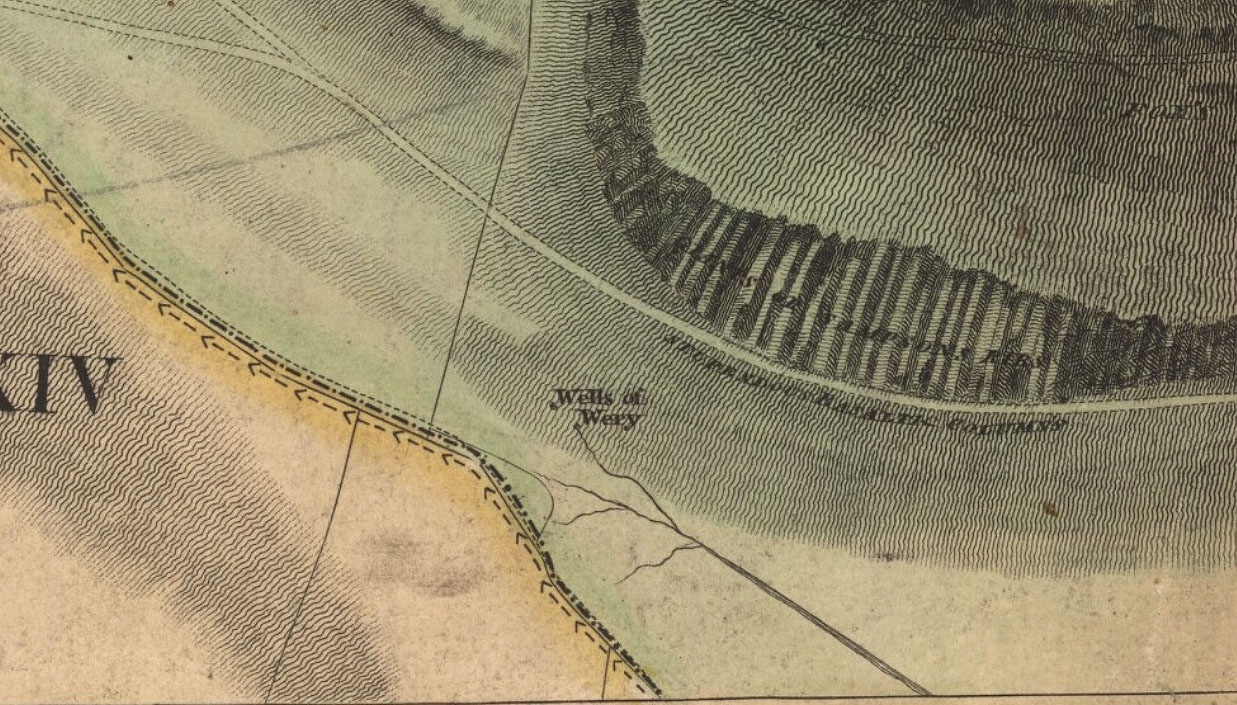
Sacred Wells (destroyed): OS Grid Reference – NT 2741 7241
Also Known as:
Wells o’ Weary
Well of Wery
Archaeology & History
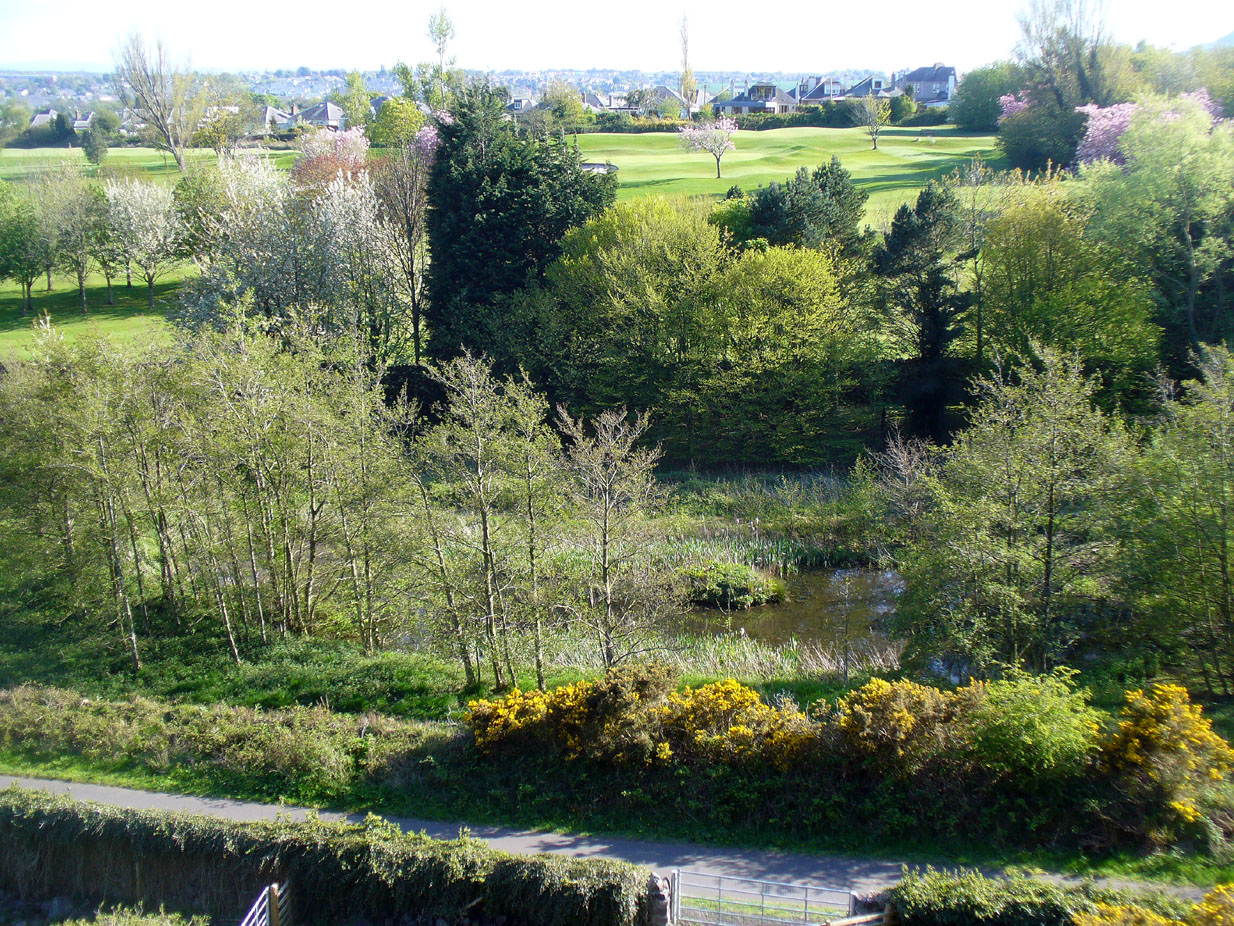
The precise spot for these “wells” is difficult to say today with any certainty, which is unfortunate as it was a renowned spot for a variety of reasons. The wells were apparently disrupted and fell back into the Earth when the Industrialists dug their train-line into the south-side of Arthur’s Seat. On the early maps, we can see several ‘troughs’, ‘pumps’ and ‘wells’—one or more of which are said to be the site (and which we base the OS grid-reference on, above).
Site on 1821 Kirkwood mapWells o’ Wearie ponds
The Wells of Wearie were one of nearly a dozen sacred and healing wells surrounding legendary Arthur’s Seat at the edge of Edinburgh, and whose waters were also said to have supernatural properties. Shown on James Kirkwood’s 1821 map of Edinburgh (left) as the ‘Well of Wery’, this curiously named site was renowned in earlier centuries as an excellent water supply for the local people — “to cure the weary traveller” for one. Today, all we have left of them are the small ponds immediately below the road, next to the converted railway line path, just as you come out of the long tunnel.
Folklore
In Henderson & Cowan’s (2007) fine work on Scottish fairy lore, they outline the witchcraft trial of a local woman, Janet Boyman, who was said to have performed ritual magick at the Wells of Wearie. They told:
“Jonet Boyman of Canongate, Edinburgh, accused in 1572 of witchcraft and diabolic incantation, the first Scottish trial for which a detailed indictment has so far been found. Indeed, it is one of the richest accounts hitherto uncovered for both fairy belief and charming, suggesting an intriguing tradition which associated, in some way, the fairies with the legendary King Arthur. At an ‘elrich well’ on the south side of Arthur’s Seat, Jonet uttered incantations and invocations of the ‘evill spreits quhome she callit upon for to come to show and declair’ what would happen to a sick man named Allan Anderson, her patient. She allegedly first conjured ‘ane grit blast’ like a whirlwind, and thereafter appeared the shape of a man who stood on the other side of the well, and interesting hint of liminality. She charged this conjured presence, in the name of the father, the son, King Arthur and Queen Elspeth, to cure Anderson. She then received elaborate instructions about washing the ill man’s shirt, which were communicated to Allan’s wife. That night the patient’s house shook in the midst of a huge and incomprehensible ruckus involving winds, horses and hammering, apparently because the man’s wife did not follow the instructions to the letter. On the following night the house was plagued by a mighty din again, caused, this time, by a great company of women.’”
The Wells were, in earlier centuries, a site where lovers and wanderers came to relax and dream. It was a traditional gathering spot — not just for witches! — and poetry was written of them – including this by A.A. Ritchie:
“The Wells o’ Wearie —
Sweetly shines the sun on auld Edinbro’ toun.
And mak’s her look young and cheerie;
Yet I maun awa’ to spend the afternoon
At the lanesome Wells o’ Wearie.
And you maun gang wi’ me, my winsome Mary Grieve,
There’s nought in the world to fear ye;
For I hae ask’d your minnie, and she has gien ye leave
To gang to the Wells o’ Wearie.
O the sun w-inna blink in thy bonny blue een.
Nor tinge the white brow o’ my dearie.
For I’ll shade a bower wi’ rashes lang and green,
By the lanesome Wells o’ Wearie.
But Mary, my love, beware ye dinna glower
At your form in the water sae clearly,
Or the fairy will change ye into a wee wee flower,
And you’ll grow by the Wells o’ Wearie.
Yestreen, as I wander’d there a’ alane,
I felt unco douf and drearie,
For wanting my Mary a’ around me was but pain
At the lanesome Wells o’ Wearie.
Let fortune or fame their minions deceive,
Let fate look gruesome and eerie ;
True glory and wealth are mine wi’ Mary Grieve,
When we meet by the Wells o’ Wearie.
Then gang wi’ me, my bonny Mary Grieve,
Nae danger will daur to come near ye.
For I hae ask’d your minnie, and she has gien ye leave
To gang to the Wells o’ Wearie.”
References:
Baird, William, Annals of Duddingston and Portobello, Andrew Elliot: Edinburgh 1898.
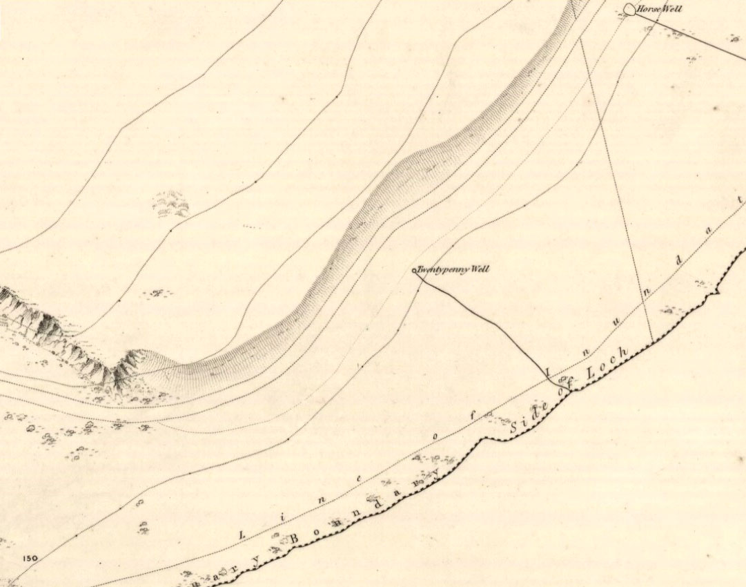
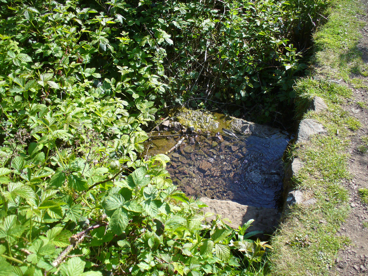
From Duddingston, head along the Old Church Lane to the Delf Well, and from then to the Horse Well and, from here, walk along the small footpath that runs along the northwest side of Duddingston Loch. Less than 100 yards past the Horse Well you’ll notice, on the left-hand side of the path, a stone trough with a fast flow of water running into it. That’s the spot!
Archaeology & History
Another little-known and all but forgotten healing well, illustrated on the 1852 Ordnance Survey map of the area, but all history and traditions relating to the site are seemingly forgotten (surely not?).
The well at the path-sideThe clear drinking water runs into the stone trough
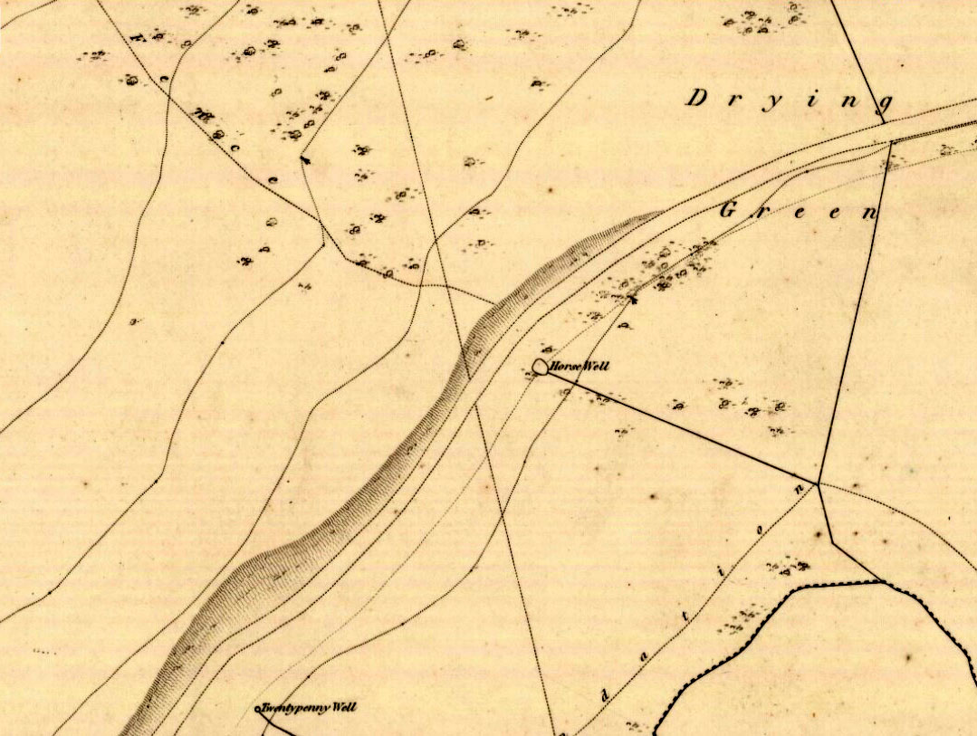
The well originally appeared a little further up the slope, closer to the road in the brambles, but Time has brought the waters lower. The name “twentypenny” is a curious one. We know of many Penny Wells across the country: some (like the trees) are sites where coins were given to the spirits of the place as an offering for goodness or to heal a given affliction; others were so-named as the price of one penny was given for a draught of the waters. Twenty pennies is something of an anomaly. Somebody somewhere must surely know something?
Healing Well (destroyed): OS Grid Reference – NT 239 692
Also Known as:
Three Foxes Well
Archaeology & History
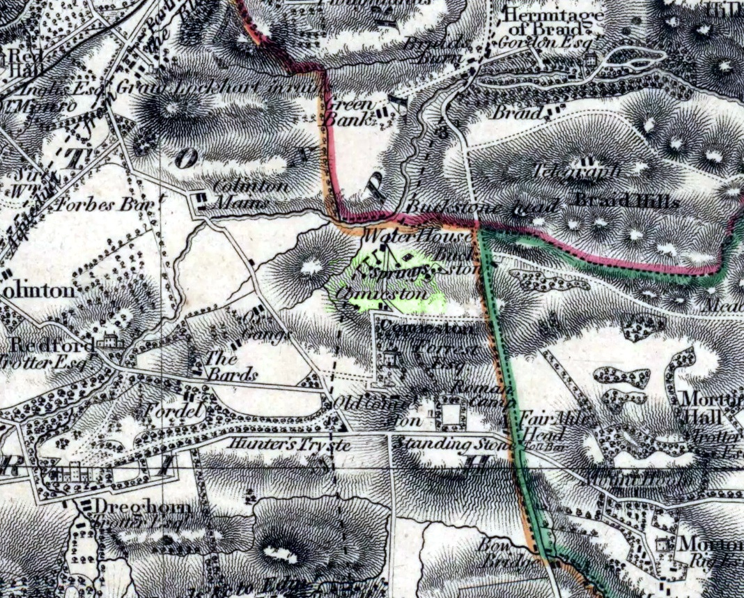
Springs at Comiston, 1832 map
A renowned site of once clear running water, the Tod’s Well got its name from being the abode of foxes many centuries ago. It was one of the five well-known ‘Comiston Springs’ as they were known—each dedicated to a certain animal—but the eternally present water in this venerable landscape was corrupted from Nature’s course by the usual Industrialists as early as 1681, so as to feed the polluting edifice of Edinburgh city. James Colston (1890) told how,
“The Town Council entered into a contract with a Dutchman, named Peter Bruschi (aka Peter Brauss) for the sum of £2,900, “to bring the water of Tod’s Well (Anglice fox) at Comiston to Edinburgh, in a leaden-pipe of a three-inch bore, to be laid one foot deep in the ground.””
When the local council upgraded the water supplies in 1820, this piping was replaced to feed the ever-needy merchants and marketeers. In Hope & Telford’s (1813) survey, the water from here was described as “constantly pure” and “excellent.”
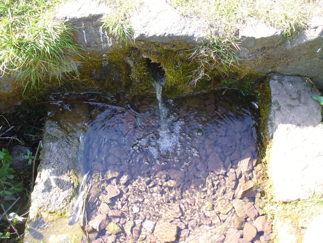
Get to the Delf Well from Duddingston and keep walking along the lochside road for 60-70 yards, where you go through the black metal gate in the fence on your left. Walk down the slope just a few yards and (drought dependent!) you’ll see an initial damp patch where the well used to arise 150 years ago; just a few yards further down the slope is the more notable spring water of the Horse Well below you.
Archaeology & History
The site is shown on the 1852 map of the area where it was later “capped” and used by the old local water authority. Thankfully the water has managed to escape and is once more feeding the birds and the land, running into the loch below. When we arrived here, a crow was drinking from the waters.
Horse Well & its herbs
Although you’d expect that this was once a watering-place for horses, the name of the well may relate to the Scottish folk-name of the herb Veronica beccabunga, generally known as Brooklime or European Speedwell, but locally called Horse-well grass—some of which seemed to be growing in the watery spring amidst the other plants. As a herb it was used in the treatment of scurvy. The history of the well however, seems all but forgotten…
Standing Stones (destroyed): OS Grid Reference – c. NT 178 655
Archaeology & History
We are uncertain about the nature and form of what was once known to be “a group of five standing stones” near the destroyed giant cairn of Harlaw, west of Balerno (which was probably built near the old trig-point at NT 1783 6594). This cluster of standing stones may have been the remains of a stone circle or a possible megalithic stone row, and it’s even been postulated as a line of possible boundary stones—but this is most unlikely.
The only known reference of the site comes from the New Statistical Account in 1845 which told:
“About a quarter of a mile to the south of the large cairn were five very tall and large stones set perpendicularly in the Earth.”
They were destroyed around the same time as the cairn in the early 1800s. Until we find further information, its exact status remains unknown. (Kaledon Naddair – are you out there?)
References:
Baldwin, John & Drummond, Peter, Pentland Place-Names, FotP: Edinburgh 2011.
Get onto the Royal Mile road (which comprises Lawn Market, High Street and Canongate) which runs down from the castle; and near the bottom of the High Street section (between North Bridge and St. Mary’s Street), on the left side of the road you’ll see a large upright monument which was formerly a stone drinking fountain. You can’t really miss it!
Archaeology & History
Found just yards away from the house of the religious lunatic, John Knox, this is one of several wells that could once be found along the old High Street, or Royal Mile, near the middle of the city. A fast-flowing spring of water was contained within this solid stone monument first built around 1675 by the King’s mason, Robert Mylne. The fountainhead was rebuilt at a later date and it supplied water for the inhabitants of the old town.
Fountain Well, Edinburgh
Fountain Well, early 19th C
It has a small semi-circular water trough at its western base and is ornamented on this and its eastern side with small mythical fauns, out of which water emerged. The local council should ensure to make the well work again, giving people clean drinking water when they need it.
The local historian Stuart Harris (1996) puzzled over the origin of the name ‘Fountain Well’, wondering whether it related to a nearby mansion, but he wasn’t too clear in his description for those who live outside of the city, where this mansion was. He wrote:
“It is…reasonable to suppose that the present well got its name from being in the general vicinity of the mansion, and that the mansion and the (Fountain) Close must have been named for another well, now lost, in the close or at its head. It is suggested in Wilson (1891), but scarcely proved, that it was the Endmyleis Well…which is mentioned in…1567.”
Bereft of natural animism, the site is more likely to be of interest to architects than the usual hydromancers and their exploratory ilk…