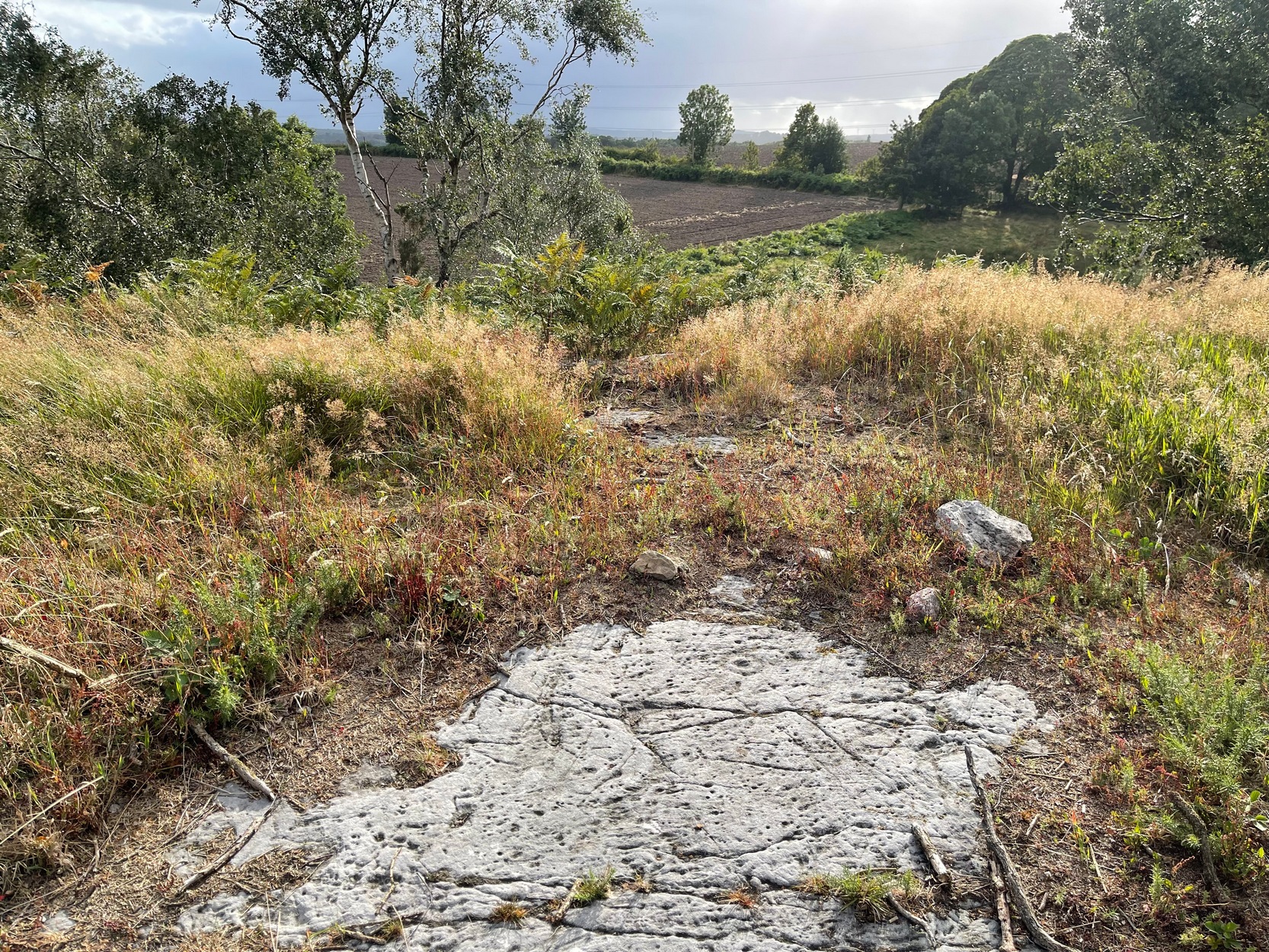
If you start from the Castleton (2) carving, in the first small birch copse closest to the road, walk to its southeast side where there’s a small break before the next small birch copse begins which runs along the raised rocky crag to the southeast. Walk along the back lower east-side of these birches for about 100 yards until you reach a break in the copse (the next lot of trees are another 30-40 yards further on) and from here walk up the slope onto the first flat piece of rock on the crag itself. Zigzag hereabouts until you’re about two or three yards from the edge.
Archaeology & History
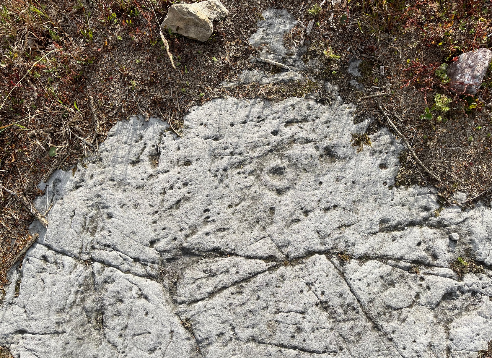
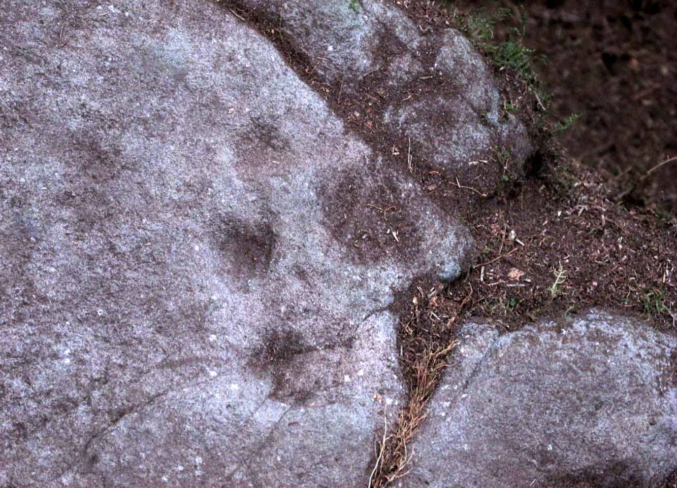
Single cup-and-ring
Once this rock surface is covered again by Nature’s carpet, you’ll struggle to find it. Unlike many of its more ornate neighbours, this seems to be a lonely solitary cup-and-ring design, cut near the edge of a large level piece of otherwise blank rock. Numerous geological nicks and scratches scatter the same surface, but the carved element is easy enough to see, as the photos here show. It was rediscovered in the 1980s by Morris & van Hoek (1986) who described it simply as “a single cup and one ring, 8cm in diameter on horizontal rock.” There may well be additional elements to this design beneath the soil.
References:
Morris, Ronald W.B. & van Hoek, Maarten, “Stirling District: Castleton 4d; Castleton 5e,” in Discovery & Excavation, Scotland, 1986.
Acknowledgments: Massive thanks to Thomas Cleland for helping to make this site visible again.
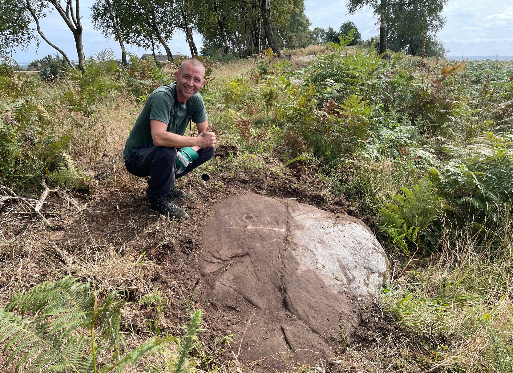
Start from the Castleton (2) carving, in the first small birch copse closest to the road and walk to its southeast side where there’s a small break in the trees before the next small birch copse begins, which runs along the raised rocky crag to the southeast. Walk to the front or western side of the trees there and along the very edge of the low crag. About thirty yards along, right on the edge of where the rocks begin, look for the smooth sloping earthfast boulder (about 20 yards before the mighty nine-ringer of Castleton 7). Rummage around and you’ll find it.
Archaeology & History
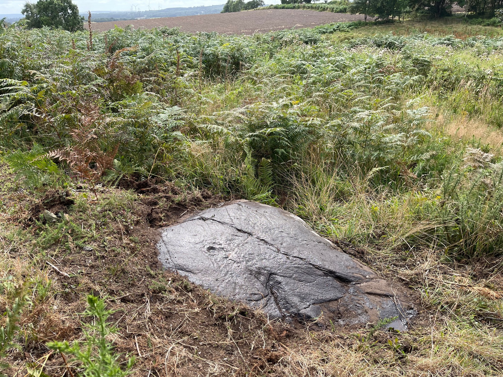
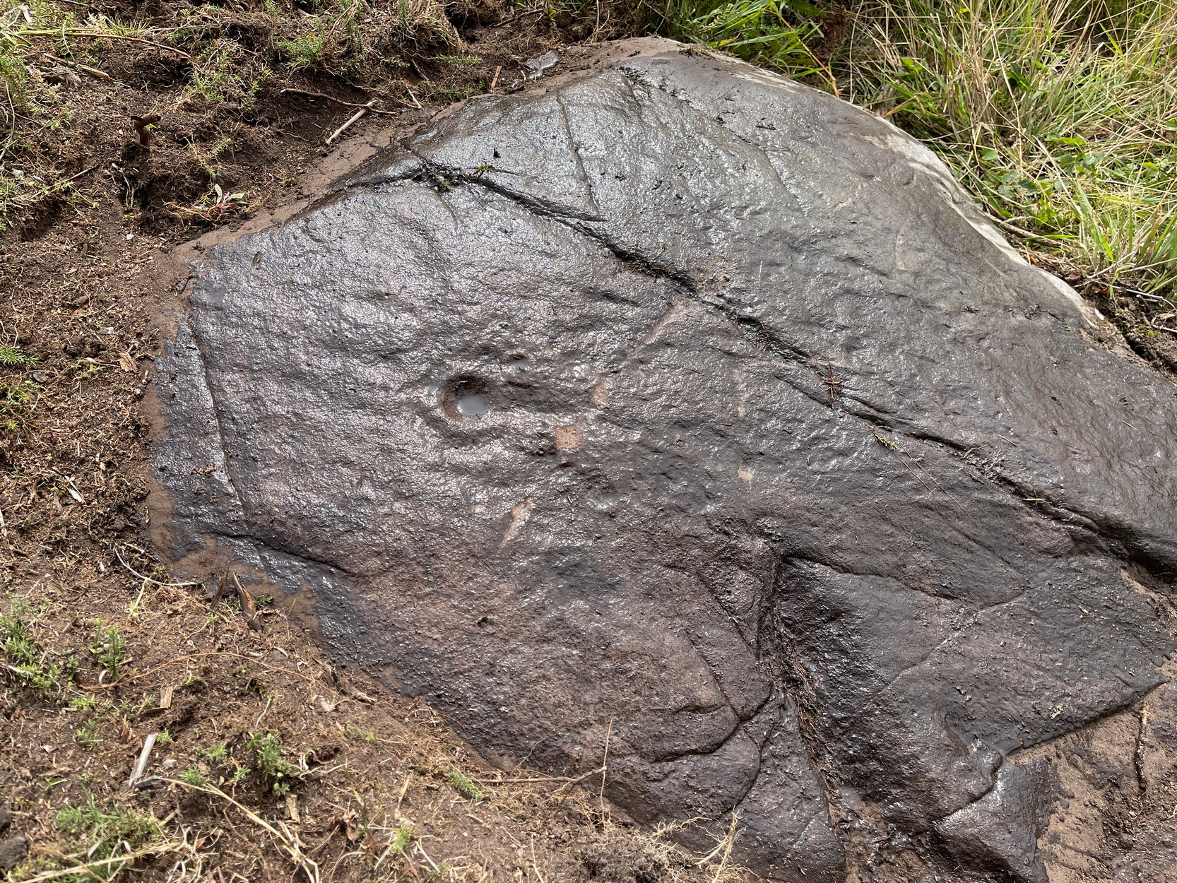
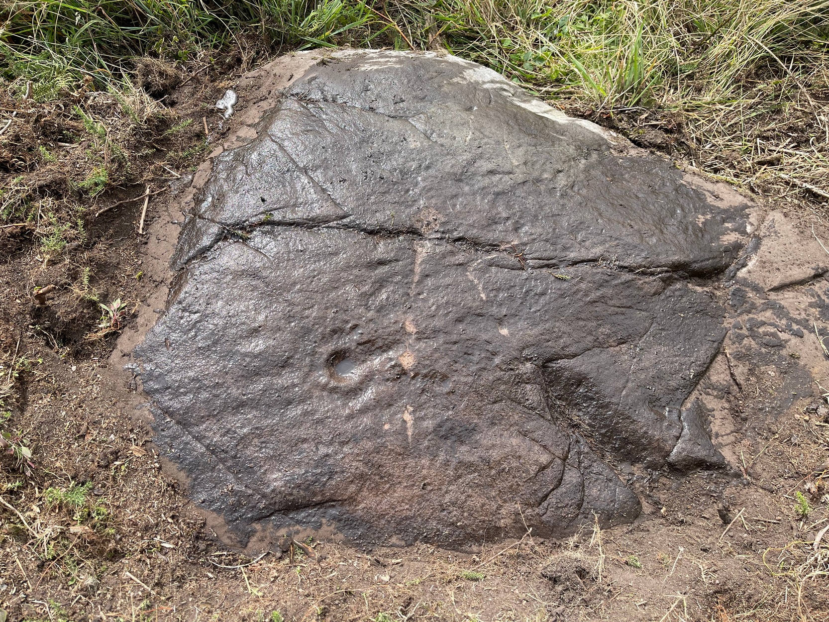
Castleton (7e) carving
This newly recorded petroglyph was rediscovered by Thomas Cleland on August 6, 2025. Initially it was thought to consist of just a single cup-and-ring with an opening from which a carved line ran outwards; but, once wet, there seemed to be the beginning of an outer second-ring on its left-side. You can see it clearly in the photos. And, the more we looked, the more it seemed there were one or two other very faded elements.
Above the main cup-and-ring is a faint, shallow cup-marking and surrounding this appears to be an incomplete dumb-bell-shaped ‘ring’ that you can only just make out in the photos. It’s very faded and would seem to pre-date the primary design by some considerable time (unless, of course, it was merely ‘outlined’, so to speak and never completed).
Cup & ring & faint ‘bell’Cup & ring & faint ‘bell’
Both Tom and I are convinced that there’s more to this carving than is presently visible. The rock is covered in deeply compacted soil and it would require a lot of work to uncover the rest of it. A job for the future maybe…..
Note to self: This carving and all the others in the Castleton complex need to be fully re-catalogued as their indexing is haphazard through various academic tomes and websites.
Acknowledgements: Massive thanks to Thomas Cleland for locating this carving, for the first time in millenia. 🙂
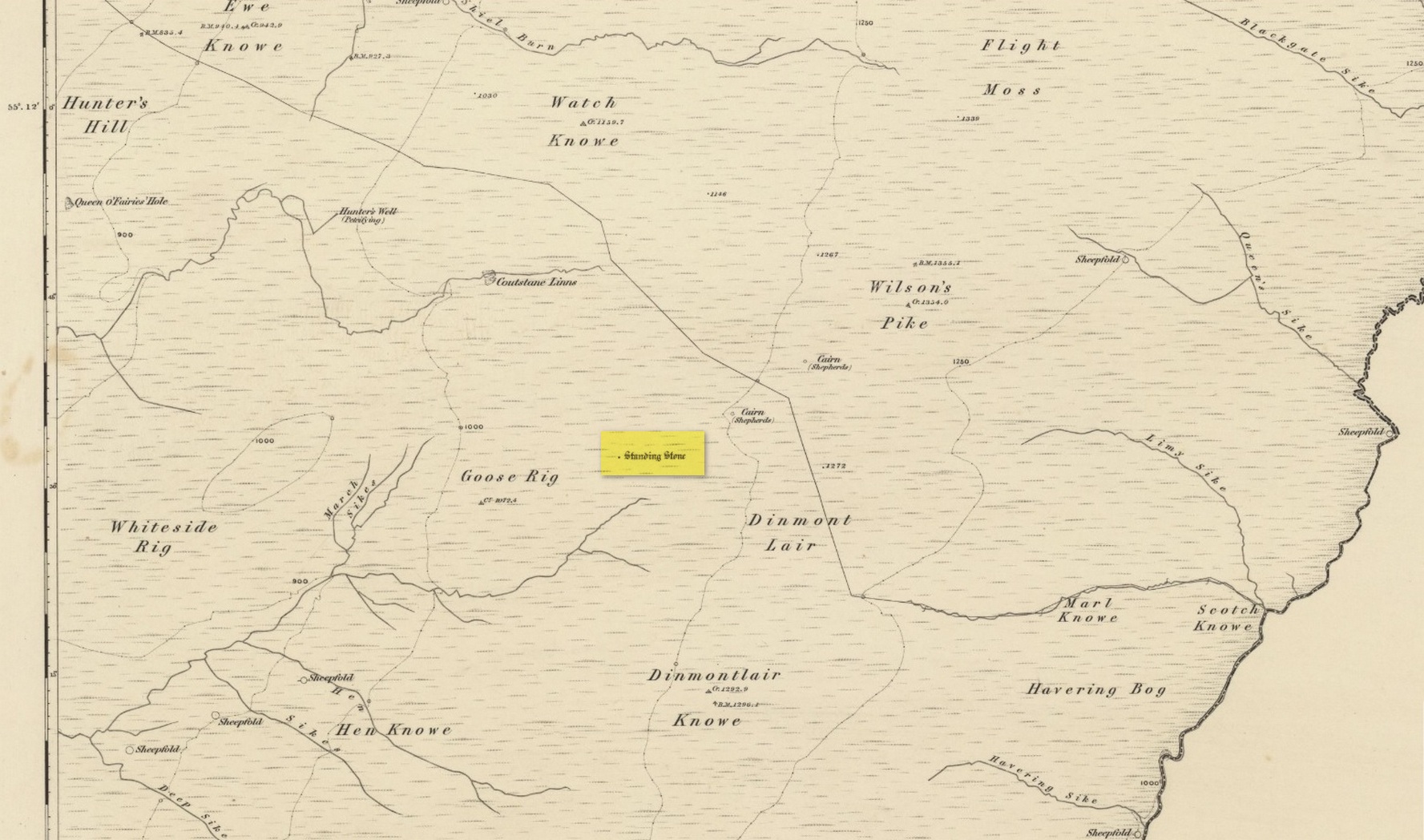
Standing Stone (destroyed): OS Grid Reference – NY 546 889
Archaeology & History
Stone shown on 1863 map
Once found living on the high moors four miles to the east of Newcastleton, close to the English border, all trace of the stone has gone. Highlighted on the 1863 OS-map, the stone was three feet high and was located at the highest end of Goose Rig. It was deemed by local people “to be of ancient origin,” but we know little else about it. A place immediately to the northwest is known as the Queen o’ Fairies Hole, whose history and folklore has also been forgotten…
References:
Royal Commission on the Ancient & Historical Monuments of Scotland, Roxburghshire – volume 1, HMSO: Edinburgh 1956, p.95
Cup-and-Ring Stone: OS Grid Reference – NS 8551 8819
Archaeology & History
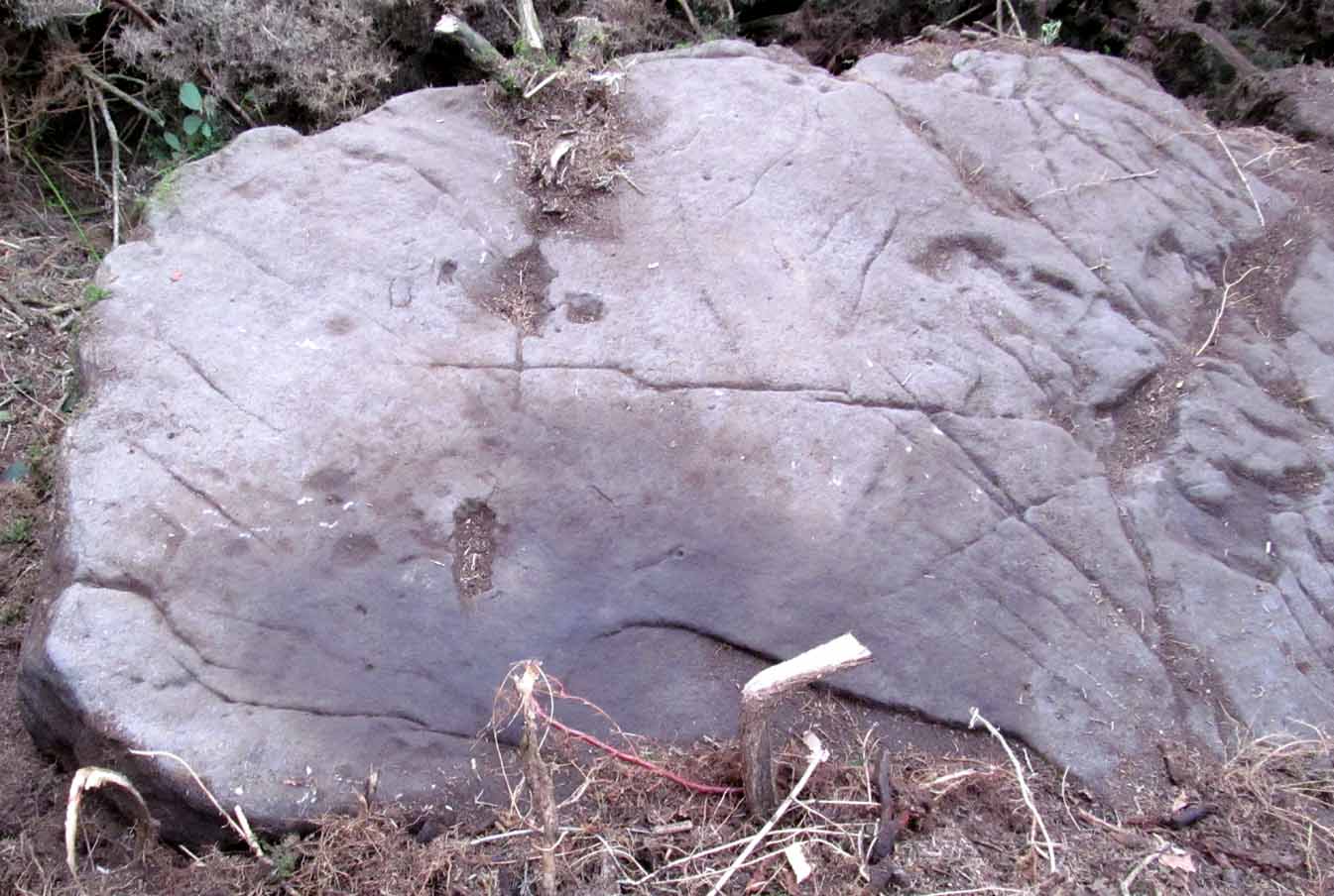
Looking down on C-7c
Near the northwestern end of the small geological ridge that runs to the west of Castleton farmhouse, close to an awesome nine-ringed carving, we find this more simplified triple-ringed petroglyph. And although the carving is easy enough to describe, its labelling (as ‘Castleton 7c’) is rather troublesome. As with other carvings in this locale, the name of the stone is based on a survey done by Maarten van Hoek in the mid-1990s. But van Hoek’s sketch of Castleton 7c and the one shown in our photos, whilst very similar, possess attributes that aren’t on van Hoek’s drawing. Now this isn’t too odd, as many petroglyphs look different when lighting conditions change; to the point where some features you can see one day are almost invisible the next. But this carving has attributes that are very difficult to miss – and van Hoek’s detailing tended to be good. But, all this aside: until we can verify with certainty one way or the other and despite my suspicions that this isn’t what van Hoek described, I’m still entering this carving as Castleton 7c. So – now that bit’s out of the way…!
When we visited the site two years ago the day was dark and overcast, so we didn’t really have good conditions for seeing any faint carvings. But this wasn’t faint, thankfully. It was completely buried beneath soil and gorse bushes, but thankfully Paul Hornby managed to unearth the one you can see in the photos. If it is the Castleton 7c petroglyph, it was rediscovered by van Hoek on one of his ventures here in 1985.
Carving showing wavy lines on right…and from another angle
When we visited the site we only managed to uncover a small section of the stone, as the roots of the surrounding gorse prevented us from seeing more. (it’s tough stuff unless you’ve got the right gardening equipment!) The section we uncovered consisted of a cup-and-triple-ring. This is consistent with van Hoek’s sketch and description; but we also found there were two very notable ‘arcs’ on the outer edge of the rings—nearly opposite each other—as if another, fourth ring had been started. You can’t really miss these elements – and even in the poor lighting conditions we had, these outer arcs are very evident on a number of photos – especially when they are expanded to full-scale. However, as I mentioned, we were unable to uncover all the rock; but when van Hoek was here there was far less herbage. What he saw on this carving was as follows:
“Deturfing part of this ridge revealed a fine cup with three rings with a broadly pecked tail; one solo cup; one large oval ring with small central cup; and a faint cup with two rings, the outer one incomplete. The rock slopes 12º ENE.”
Crap drawing done in crap lightingvan Hoek’s 1996 sketch
The “broadly pecked tail” he mentions is also not really clear in any of the 60 photos we took. There is a faint line that runs through the three rings, into the central cup and out the other side: a single curving line no less. It’s certainly visible, but it’s far from broad. But there are a number of other lines coming out of the rings. These maybe just natural scratch marks, or even scratches acquired from farming activity. It’s difficult to say. In the poor light that we had, there as looked to be a single cupmark a few inches away from the rings, but this isn’t consistent with the position of the cupmark on van Hoek’s sketch.
There’s a simple solution to all this: we need to revisit the site and expose more of the rock. At least that will tell us once and for all whether this is the same as van Hoek’s stone, or whether we’ve found yet another new carving. Watch this space, as they say! 😉
References:
van Hoek, Martin A.M., “Prehistoric Rock Art around Castleton Farm, Airth, Central Scotland,” in Forth Naturalist & Historian, volume 19, 1996.
As with other carvings in this locale, the name of the stone is based on a survey done by Maarten van Hoek. (1996) It’s a pretty simplistic design within the impressive Castleton complex, found at the southeastern end of the gorse-covered rocky ridge, about 70-80 yards west of the farmhouse. It was uncovered on a visit here by Nina Harris, Paul Hornby, Frank Mercer and Lisa Samson on Sunday 19 November, 2018.
The cup-marked stoneLarge cup & arc of 3
Unlike the others in the Castleton complex, this carving is probably of interest only to the hardcore petroglyph hunters. The design consists of at least ten cup-marks on the uncovered section of the rock, one of which appears to have a broken circle with two ‘entrances’ either side of it, so to speak. The most notable element in the design is close to the edge, where an arc of three cups almost corners a larger cup right at the edge. There may be more carved elements to be found on the westerly side of the stone, which was covered in deep vegetation when we came here.
References:
van Hoek, Martin A.M., “Prehistoric Rock Art around Castleton Farm, Airth, Central Scotland,” in Forth Naturalist & Historian, volume 19, 1996.