Enclosure: OS Grid Reference – NS 8618 8848
Also Known as:
- Castleton (north)
- Darnbog
Archaeology & History
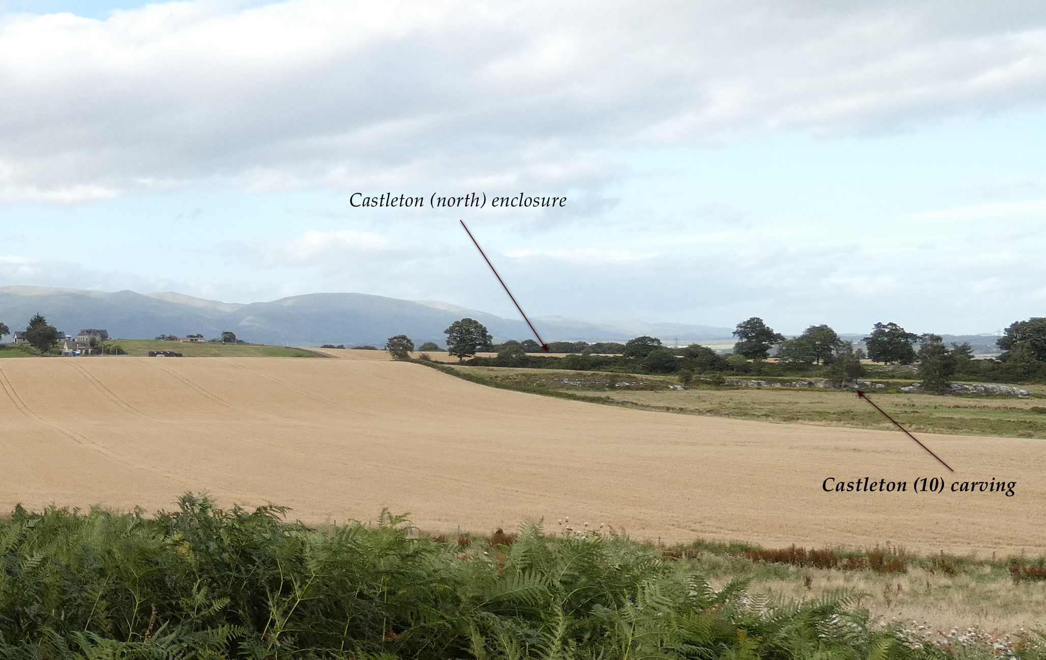
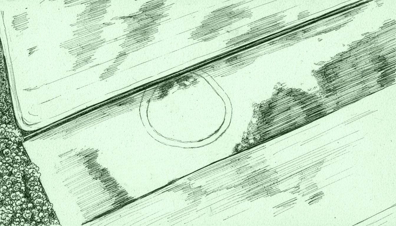
In the fields immediately above the northernmost of the Castleton petroglyphs, there was, in bygone times, a prehistoric settlement, forgotten and cast even from folk memory until very recently, when aerial photography revealed the ghostly outline of its former existence. Similar in design, but somewhat smaller than the prehistoric Gallamuir enclosure a half-mile southwest of the Castleton carvings, this double-ringed oval enclosure—thought by archaeologists to have been defined all round with large wooden stakes, or palisaded—measures, from outer edge to outer edge, 65 yards (SE to NW) across its longer axis, by 55 yards (SW to NE). The gap between the trenches that define the inner and outer wooden ‘walls’ is between five and six yards apart all round it. The entrance to the enclosure seems to have been on its southeastern side—although an excavation is needed to be sure about this. Sadly, almost nothing can be seen of the site at ground level. An archaeo-dig would be a good idea. 🙂
‘Palisade enclosures’ tend to be neolithic in origin and were in use for many centuries, sweeping into the Bronze Age. I highlight this long period in time due to the proximity of the extensive and very ornate cup-and-ring carvings that start just 300 yards southwest of the settlement on the first rock outcrop that you meet. It’s a good one too! Petroglyphs were also created mainly during the neolithic and Bronze Age periods; and as the enclosure here is on the slight rise in the land overlooking the various small rocky ridges below, many of which are decorated in ornate cup-and-rings, it’s likely that some of the people who lived here were probably the people who did them…
© Paul Bennett, The Northern Antiquarian