Standing Stones / Stone Row: OS Grid Reference – NN 83259 02293
Also Known as:
- Lairhill Stones
Follow the same directions as to reach the cup-marked Sheriffmuir Carving, which is just a coupla hundred yards away to the southwest. On a clear day you can see this standing stone from the pub by the roadside, a few hundred yards away!
Archaeology & History
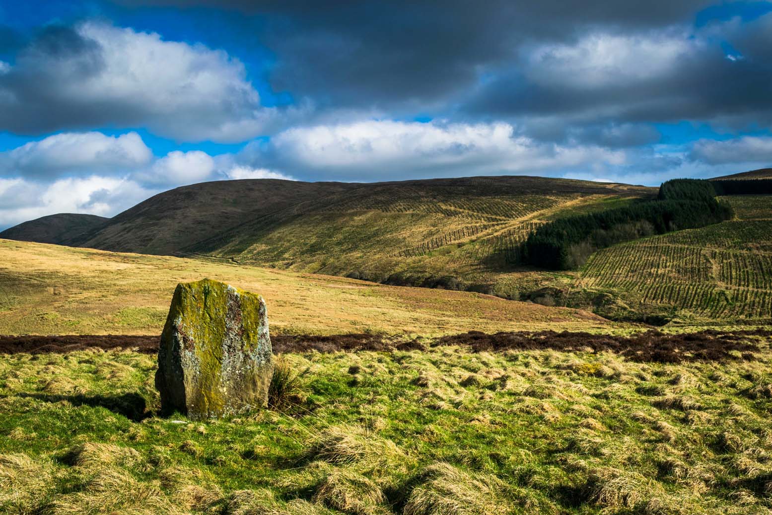
This is alleged to be just one standing stone in a straight line of five once-upright monoliths. Starting at the southwestern end of this row we have the 7ft-long cup-marked Sheriffmuir Carved stone — which certainly looks as if it stood upright in the not-too-distant past — and as we move up the line we pass another that’s been split in half. Another earthfast-looking rock is the next contender, before we reach our famous Wallace Stone, standing upright and proud on this moorland ridge. It’s about 6ft tall and 3ft across at its widest and certainly acts as a marker for the line of stones that allegedly stood upright here. And if we walk just a bit further up we have another big stone laid on the ground which is alleged to be a part of the same alignment.
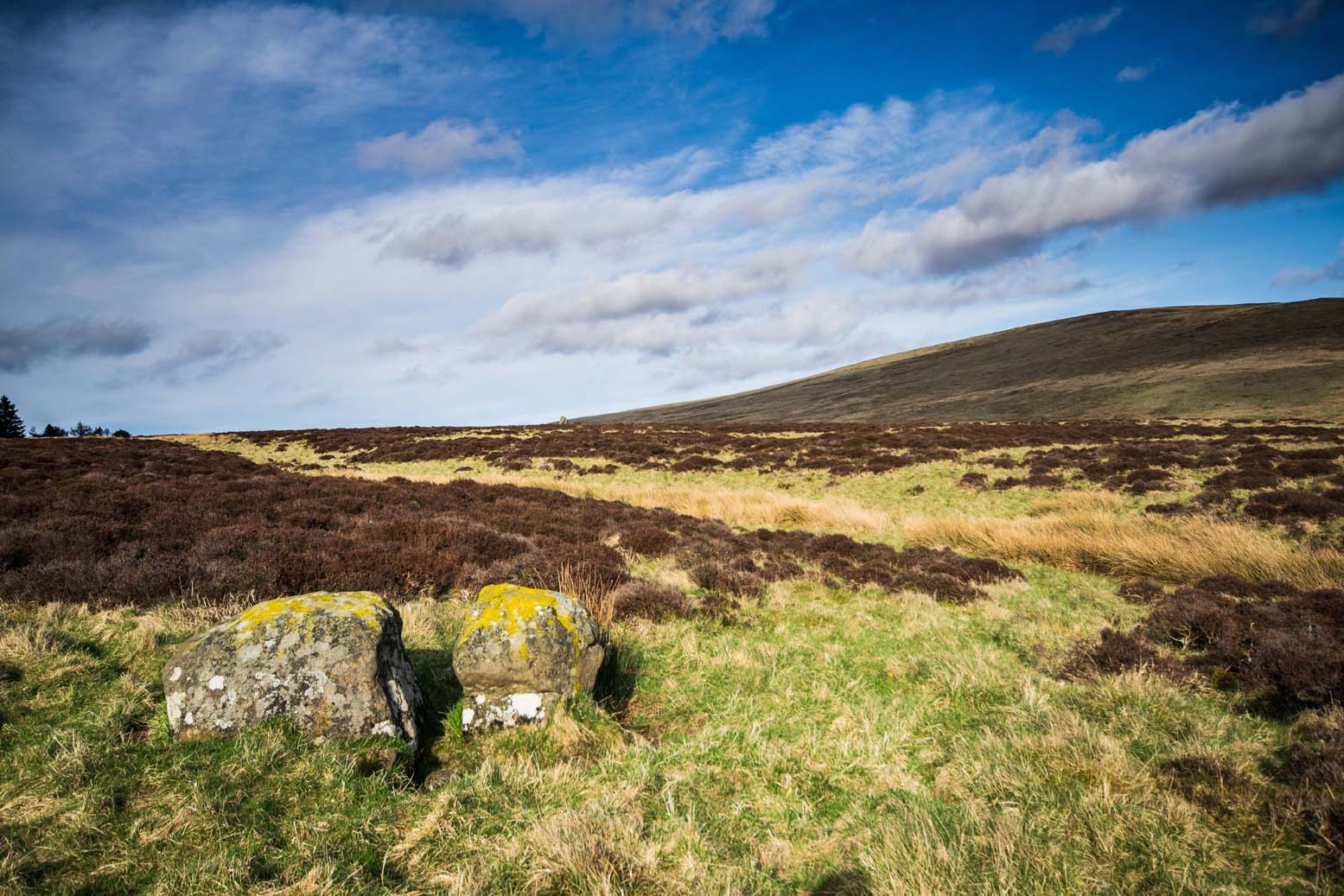
If it is an authentic megalithic row, it’s not included in either the Thoms’ (1990) two-volume work on the subject, nor Aubrey Burl’s (1996) compendium a few years later. And though the alignment looks good, I’ve found ones just like this in the Pennines where we have just one upright left and then a line of other seemingly prostrate stones running dead straight either side of the singular upright (and have kept mi gob shut about ’em for sensible reasons), so I’m not too sure what to think.
But, alignment aside, the Wallace Stone itself is a damn good standing stone and well worth checking out. It’s highly probable that other prehistoric remains still lurk, undiscovered, amidst these heaths…like the lost stone circle to be found nearby…
Folklore
A slight variation on a theme about this spot: in both accounts the stone was named after the legendary Scottish independence fighter, Sir William Wallace. The folklore tells that he and his fighting clans gathered here in 1297 preceeding the Battle of Stirling Bridge; whilst the variation tells that the stone here was actually erected around that time to commemorate the event. This tale was first narrated by a local story-teller called Blind Harry and was found by local historian A.F. Hutchinson (1893) to be a case of mistaken identity!
References:
- Burl, Aubrey, From Carnac to Callanish: The Prehistoric Stone Rows and Avenues of Britain, Ireland and Brittany, Yale University Press 1993.
- Heggie, Douglas C., Megalithic science: ancient mathematics and astronomy in north-west Europe, Thames & Hudson: London 1981.
- Hutchinson, A.F., “The Standing Stones and other Rude Monuments of Stirling District,” in Transactions of the Stirling Natural History and Antiquarian Society, 1893.
- Royal Commission on the Ancient & Historical Monuments of Scotland, Archaeological Sites and Monuments of Stirling District, Central Region, Society of Antiquaries of Scotland 1979.
- Thom, A., Thom, A.S. & Burl, Aubrey, Stone Rows and Standing Stones – 2 volumes, B.A.R.: Oxford 1990.
Acknowledgements: Big thanks as always to James Elkington for use of his photos in this site profile – prints of which are available from the man himself!
© Paul Bennett, The Northern Antiquarian


