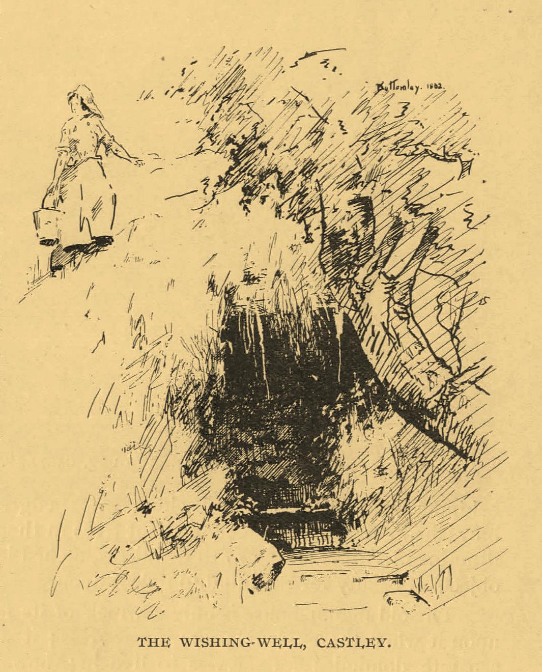
An important water source for local folk in Castley hamlet in previous centuries, this was one of several so-called ‘Wishing Wells’ above the higher banks of the River Wharfe a few miles from each other. It’s a title which, to be honest, was afforded the place when its original local name was removed. It was quite obviously a sacred well in earlier times, as it’s found beneath the slope of Chapel Hill, looking eastwards towards the rising sun, when the waters here (as at countless others) had their greatest remedial or magickal powers. Tradition told there was once a small chapel above the well itself. The spring was highlighted on early Ordnance Survey maps, but all that seems left here today is an occasional boggy mass in the trees at the bottom of the sloping hill.
The old folklorist and antiquarian Edmund Bogg (1904) wrote the following about it:
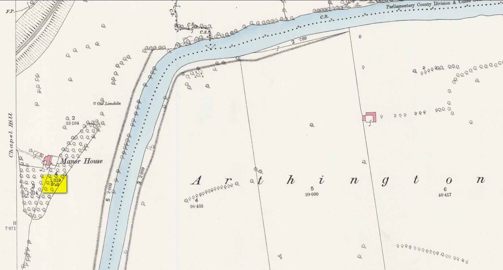
‘Wishing’ Well on 1888 map
“On the terraced bank near the garden, ’neath an overhanging hawthorn, is a beautiful spring of clear sparkling water, which is locally known as Castley ‘wishing-well.’ More than once we have heard the women-folk declare how, in their maidenhood, they loitered down the bank to the well, usually at eventide, when the birds were warbling their vesper song, and placed their offerings there in silence, yet breathing, as it were, the mute longing of their heart’s desire. It is a natural grotto fit habitation of fairies or the traditional elves. The bank, in which the well is situated, is known as ‘Snake Bank.’”
References:
Edmund Bogg, Higher Wharfeland, James Miles: Leeds 1904.
Acknowledgements:Huge thanks for use of the Ordnance Survey map in this site profile, reproduced with the kind permission of the National Library of Scotland.
Cup-Marked Stone (lost): OS Grid Reference – SE 2556 4687
Also Known as:
Carving no.556 (Boughey & Vickerman)
Archaeology & History
We know very little about this carving, which was first highlighted on Eric Cowling’s (1940) map of Wharfedale petroglyphs. Described simply as one of the “cup-marked rocks”, he mentioned it briefly in Rombald’s Way (1946) as being “the most easterly carving” in mid-Wharfedale—which it was at the time (a very recent find by Benn Potts of a cup-marked stone at Weeton has pushed the boundary further eastwards). Oddly for Cowling, he left no further notes nor sketch of the carving and when Stuart Feather (1961) came to write of it, he merely copied Cowling’s earlier words. It’s not been seen since. In Boughey & Vickerman’s (2003) survey, they could find no cup-marked stone in the wood but thought instead that,
“this may be due more to confusion than to loss of the carving. Riffa Wood does contain a carving: of a Native American on a conspicuous rock alongside one of the many woodland paths. Furthermore, one or two local residents recall a German prisoner carving something on a rock in Riffa Wood during the Second World War. Presumably, this is the origin of the Native American carving. Could it be that this man added something of his own to what was already a carved rock, in which case the Native American as he now appears is the site noted by Cowling before the War?”
No cup-marks exist on this Native American carving, and it’s highly unlikely that Cowling would have made such an elementary mistake. The carving no doubt lies covered in woodland vegetation waiting, once more, for the day that someone comes along and exposes its visage to the world again. Let us know if you manage to find it…
References:
Boughey, Keith & Vickerman, E.A., Prehistoric Rock Art of the West Riding, WYAS: Wakefield 2003.
Cowling, E.T., ‘A Classification of West Yorkshire Cup and Ring Stones,’ in Archaeological Journal, volume 97, 1940.
Cowling, E.T., Rombald’s Way: A Prehistory of Mid-Wharfedale, William Walker: Otley 1946.
Feather, Stuart, “Mid-Wharfedale Cup-and-Ring Markings,” in Cartwright Hall Archaeology Group Bulletin, volume 6, no.3, March 1961.
Acknowledgements:Huge thanks for use of the Ordnance Survey map in this site profile, reproduced with the kind permission of the National Library of Scotland.