Balnakeilly Stone, Moulin, Pitlochry, Perthshire

Standing Stone:  OS Grid Reference – NN 9463 5943

Getting Here

As you go through Pitlochry’s main street, watch out for the right-turn up the A924 road.  Go up here for perhaps a mile.  You’ll know you’re getting close as you pass the Moulin pub and the seeming avenue of trees opens on either side of the road.  A coupla hundred yards up into the trees, there’s the left-turn up the Balnakeilly driveway.  Stop! It’s on your left.

Archaeology & History

The Balnakeilly Monolith

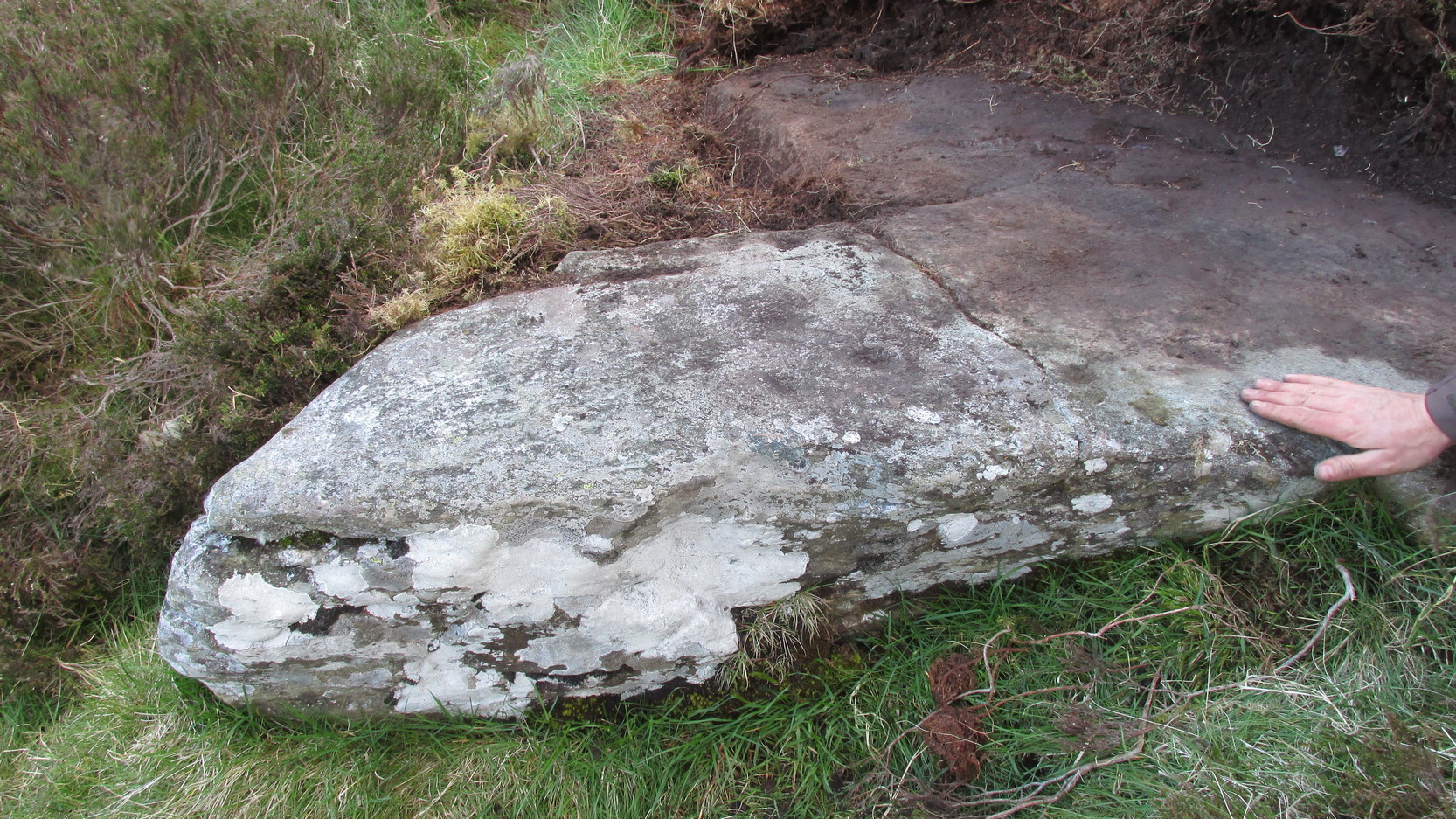
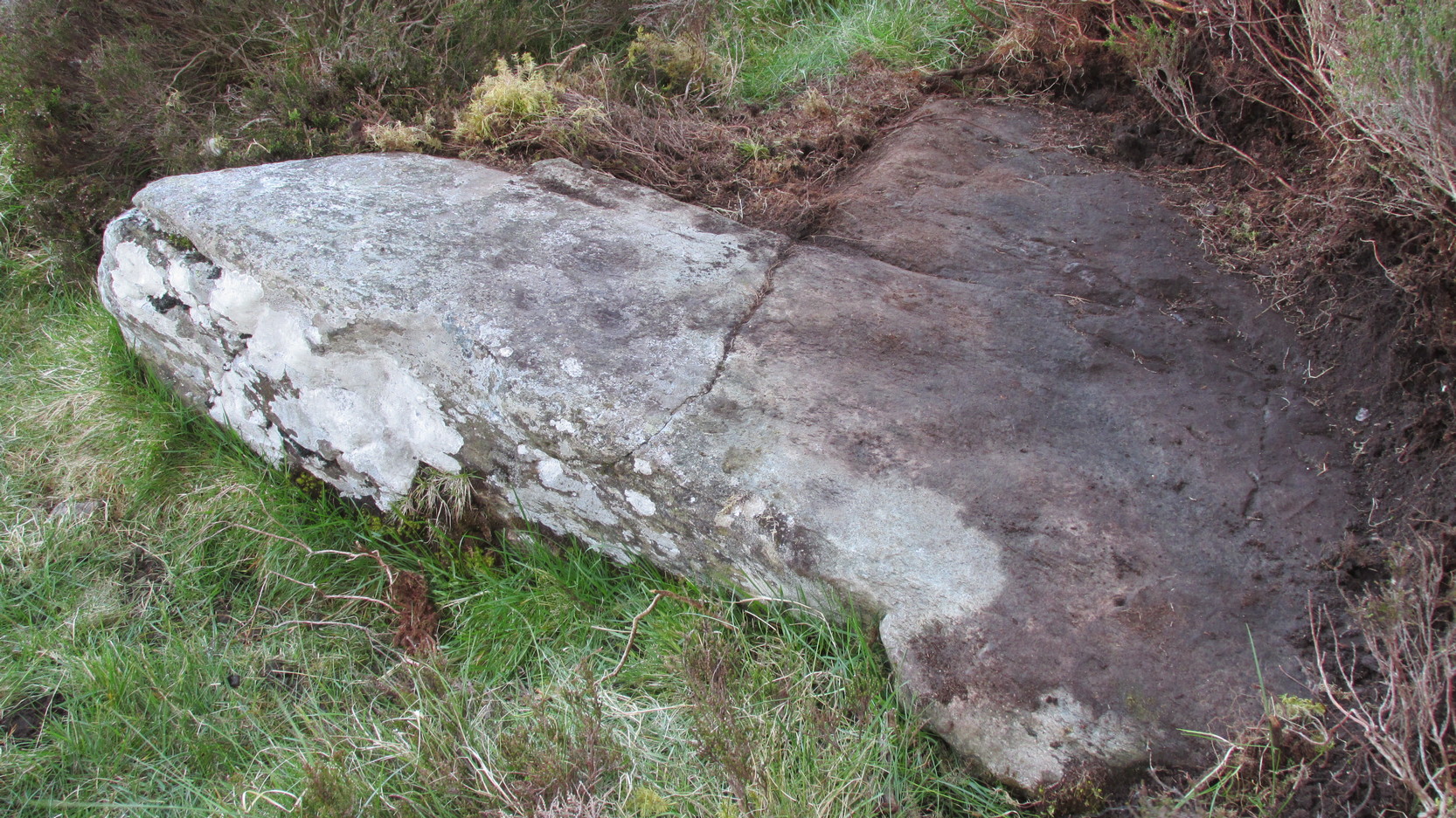
Knocking on for nine-feet tall, there’s some debate as to the archaic authenticity on this standing stone.  Ian Armit and his mate (1998) certainly wondered whether this was an ancient stone or not and, gotta say, when I came up here a coupla weeks back, I got the same impression.  It doesn’t have that feel about it which comes from the real olde ones; but this could be due to it having been moved in the not-too-distant past.  Though when Alan Reid wrote about it in 1911 he told us that,

“it bears marks of having been…worked slightly into shape by some pointed tool whose traces are plainly seen on several of its angles.”

Not something you’d find on monoliths that are a few thousand years old!  But if this stone was moved when the entrance to Balnakeilly drive was done, or the road widened, this could account for such markings.  We could do with digging into any archives that may exist about Balnakeilly or the Pitlochry roads to see if there’s any record of this stone to end the debate once and for all.  Tis a good site to visit though – check it out!

References:

  1. Armit, I. & Johnson, M., ‘Balnakeilly (Moulin parish), ‘modern standing stone’,’ in Discovery and Excavation in Scotland, 1998.
  2. Reid, Alan, ‘Monumental Remains in Pitlochry District,’ in PSAS 46, 1911-12.

© Paul BennettThe Northern Antiquarian


Balloch, Alyth, Perthshire

Cairn (destroyed):  OS Grid Reference – NO 2738 4885

Archaeology & History

Unfortunately we can no longer see the large prehistoric tomb that was once visible in the fields here, close to the bottom corner of the field below the old Bridge of Ruim, a couple of hundred yards north of the A926 road to Ruthven. The site was destroyed around 1863, but records show that there were several burials found here containing human bones, along with an urn.  Described in an early PSAS article, the Scottish Royal Commission chaps seemed to think that “its position may be indicated by a low swelling in the field”, about 30 yards southeast of the position shown on the first OS-map.  Anyone know owt more about this place?

References:

  1. Royal Commission on the Ancient & Historical Monuments of Scotland, North-East Perth: An Archaeological Landscape, HMSO: Edinburgh 1990.

© Paul BennettThe Northern Antiquarian


Drumderg (3), Tullymurdoch, Perthshire

Cup-Maked Stone:  OS Grid Reference – NO 18488 55054

Getting Here

Drumderg (3) petroglyph

Go up the A93 road from Blairgowrie, after 5 miles turn right at the Bridge of Cally and up Glen Shee.  After another 3½ miles, keep your eyes peeled for the iny road on the right signposted to the Drumturk Cheese farmshop.  Go up this long tiny winding road, a mile up past the cheese place (which are gorgeous btw!) and onto the open moors.  Keep on this road for another 2¼ miles where you can park up near the entrance to the huge wind-farm.  Walk up the track to the windmills, bearing right at the first junction, then right again at the next one.  From here, walk to the second windmill and from its base walk down, east, into the heather for about 80 yards. You’re damn close!

Archaeology & History

Drumderg (3) carving

On this T-square-shaped earthfast stone, a hundred-and-twenty yards north of the impressive Drumberg (2) petroglyph and just 10 yards below the remains of an impressive hut circle, we find this somewhat plain cup-marked design.  It was covered pretty deeply beneath the heather when we came here and it took some time before we could see what we were looking at.  The grey skies and poor daylight didn’t help matters either, as the cups were difficult to make out at first, but, thankfully, you can just about see them in the photos.

There are between five and seven shallow but distinct cup-markings on the flat surface, one of which may have a faint ring around it.  In truth, this carving’s only gonna be for the real geeks amongst you.

© Paul BennettThe Northern Antiquarian

Machuim, Lawers, Loch Tay, Perthshire

Stone Circle:  OS Grid Reference – NN 68201 40156

Also Known as:

  • Lawer’s Mill

Getting Here

From the north-end of Loch Tay at Kenmore, follow the road (A827) round down the lochside, through the village of Fearnan and then another 4 miles down.  If you park up at the pub at Lawers, walk back up the road for ½-mile, keeping your eyes peeled up the slope on the left where you’ll see the circle visible from the road.

Archaeology & History

Much has been said of this fine old place – also known as Lawer’s Mill – which seems to have been first described by Thomas Pennant in his rambling Tour in Scotland (1772).  The local writer William A. Gillies (1938) told that after

“a recent examination of the ground around the circle…suggests that at one time there was an outer circle of stones concentric with the existing one. Most of the stones were removed in order to make more of the field available for cultivation, but there are still large stones buried within a few inches of the surface.”

Folklore

In J. McDiarmid’s Folklore of Breadalbane (1910) he tells of a man from Killin who, on passing by this old circle, heard haunting fairy music.  Being inquisitive, he walked up to see what was going on and walked into the circle where the little people were playing.  He was obviously lucky and the faerie-folk enjoyed his company, for when he left he was given the gift of a strong, fast, white steed.

Solar folklore may be…?

References:

  1. Gillies, William A., In Famed Breadalbane, Munro Press: Perth 1938.

© Paul Bennett, The Northern Antiquarian