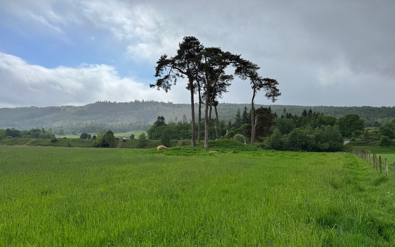
Along the main A924 Atholl Road in Pitlochry, head west towards the Perth Road, under the railway bridge and, another 200 yards along, take the right-turn and walk over the river bridge. Once on the other side of the River Tummel, about 150 yards on turn left and walk along the minor road for 400 yards where, just past some houses, a path takes you on the left into the fields. You’ll be able to see a large tree-topped mound in the next field ahead of you. Follow the line of fencing and you’ll reach the site.
Archaeology & History
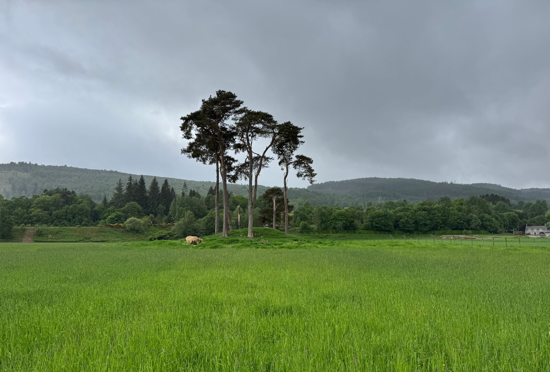
Dunfallandy, looking N
This is a gorgeous site in a beautiful setting, close to where the River Tummel meets with the River Tay. It has that archetypal fairy mound look to it and, if the folklore is right, the association would seem to be a real one! The old school ley-hunters that follow Alfie Watkin’s original notions of straight tracks would also be intrigued by this notable tomb.
An early description of it by the local writer Hugh Mitchell (1921) told that, around the middle of the 19th century, this large mound of rock and earth, “was surrounded by upright stones, but these were carted away about eighty years ago to repair a breach in the embankment of the River Tummel.” In Mitchell’s (1923) later work on the antiquities of the Pitlochry district he expanded on his earlier notes, pointing out, again, the notable clump of trees on the grassland plain where it lives:
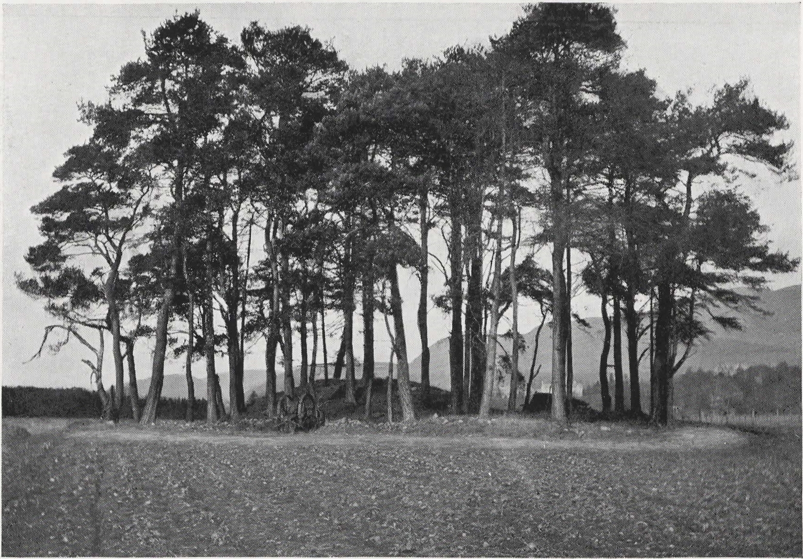
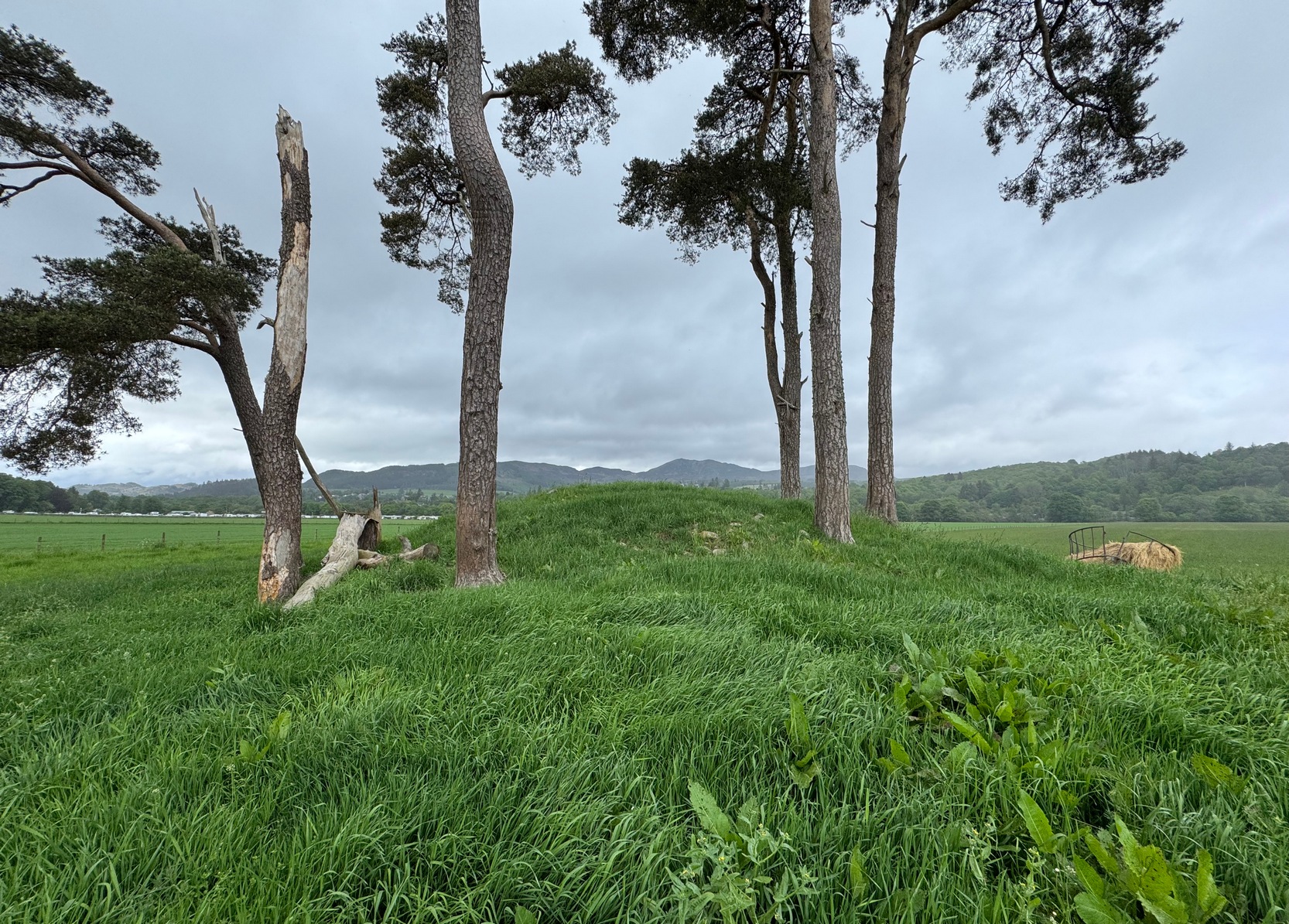
The fairy mound in 1925Top of the mound
“The trees are growing on a Neolithic burial mound,” he wrote, “which is composed of small stones and earth, and is circular, having a height of about 8 feet and a diameter of about 50 feet. It is surrounded by a shallow ditch about 6 feet wide and 18 inches deep and having a raised margin round it. There was a row of standing stones round the mound which were carted away about 80 years ago… This mound has been partially excavated and any graves near the surface have been destroyed, but some of the old people say they remember seeing small stone cists, which appear to have been of the usual Neolithic type. The surrounding ditch is unusual, and in that respect the mound differs from any other in the district.”
When John Dixon (1925) came to describe the site a few years later, he merely echoed what Mitchell had written, although said that the “row of standing stones” Mitchell described was a “circle of standing stones.” Without a modern excavation, we may never know which is the more accurate. The closest it seems we’ve got to archaeologists looking at the site is when the old-school dudes Childe & Graham (1943) came here, but they just told us what we already knew, saying how it,
“is constructed of large rounded stones and earth and measures 60 feet by 48 feet on plan; its sides rise steeply to a flattened top the surface of which, though disturbed, shows no trace of any cist.”
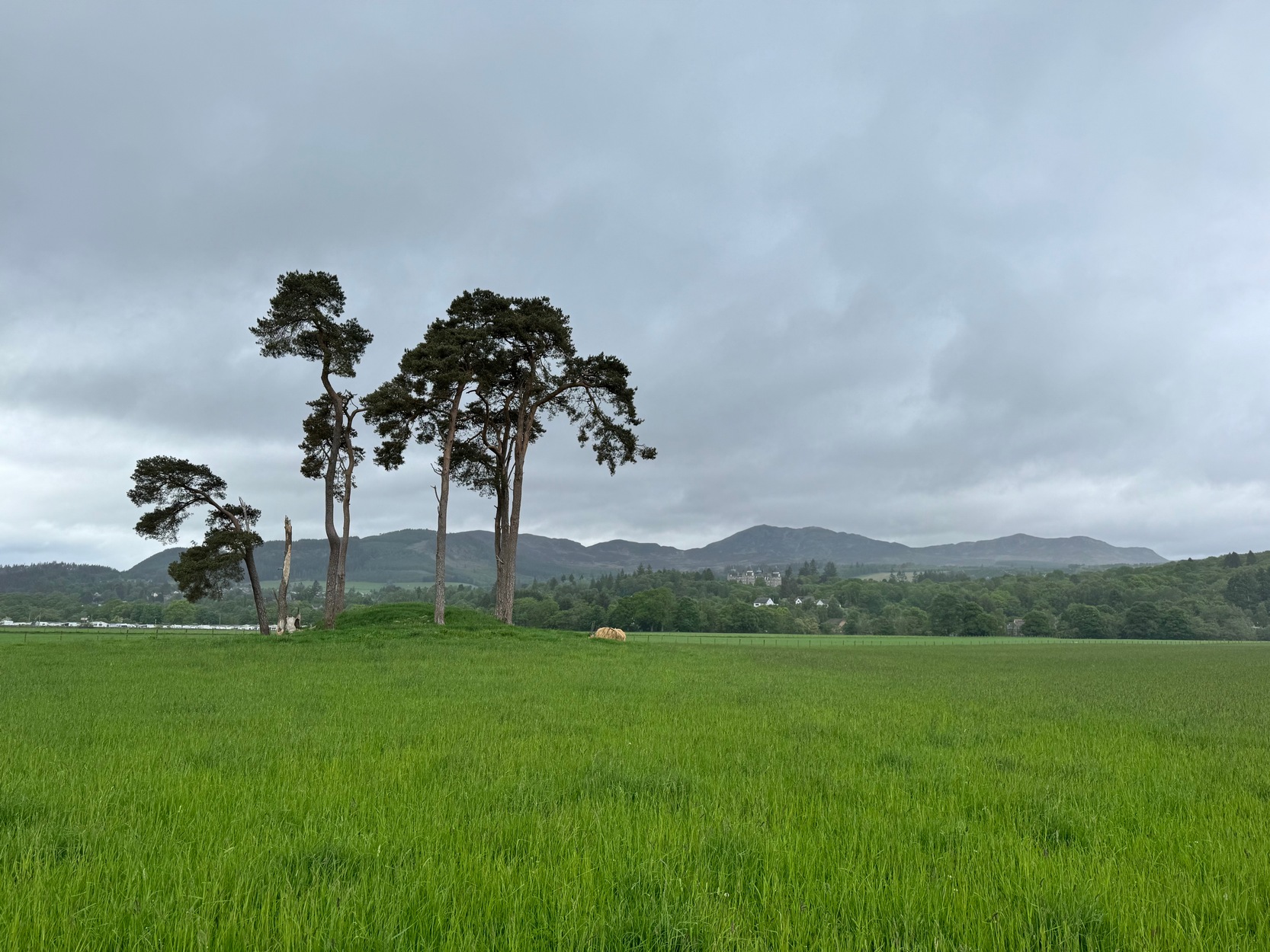
Dunfallandy, looking SW
The cists, of course, had been shifted a century earlier. And when Colin Lidell (1994) included the site in his recent history of Pitlochry, he too could add no more than what the old antiquarians had given us…
It’s not changed much over the last century. The mound has got slightly smaller, in both height and width, and the ditch that surrounded the tomb wasn’t apparent on my recent visit—although the crops were high. My own personal thought is that we’re looking at a Bronze Age tomb, not a neolithic one—but I’d love to be wrong! The older the better in my opinion! It’s worth checking out when you’re in the area. I loved the place!
Folklore
On the east-side of the River Tummel, a few hundred yards from the tomb, there are several place-names of Dalshian, meaning “the flat or field of the peaceful folk, or fairies”, which the local writer Hugh Mitchell (1921) thought also related to the ground on which our tomb resides:
“There seems little doubt,” he wrote, “that this burial mound is the Sithean (Shian) which at one time gave its name to the whole flat.”
Traditions of the sith (fairies) and similar creatures are rampant in this neck o’ the woods.
References:
Childe, V.G. & Graham, Angus, “Some Notable Prehistoric and Medieval Monuments”, in Proceedings Society Antiquaries Scotland, volume 77, 1943.
Dixon, John H., Pitlochry, Past and Present, L. Mackay: Pitlochry 1925.
Feacham, Richard, Guide to Prehistoric Scotland, Batsford: London 1977.
Lidell, Colin, Pitlochry — Heritage of a Highland District, Perth & Kinross District Library 1994.
Mitchell, Hugh, “The Picts in Athol”, in Transactions Inverness Scientific Society Field Club, volume 8, 1921.
Mitchell, Hugh, Pitlochry District: Its Topography, Archaeology and History, L. Mackay: Pitlochry 1923.
Acknowledgements: Huge thanks for use of the Ordnance Survey map in this site profile, reproduced with the kind permission of the National Library of Scotland.