Cup-and-Ring Stone: OS Grid Reference – NS 85538 88150
Getting Here
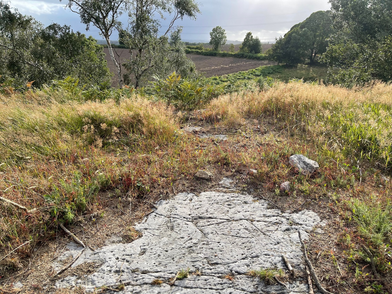
If you start from the Castleton (2) carving, in the first small birch copse closest to the road, walk to its southeast side where there’s a small break before the next small birch copse begins which runs along the raised rocky crag to the southeast. Walk along the back lower east-side of these birches for about 100 yards until you reach a break in the copse (the next lot of trees are another 30-40 yards further on) and from here walk up the slope onto the first flat piece of rock on the crag itself. Zigzag hereabouts until you’re about two or three yards from the edge.
Archaeology & History
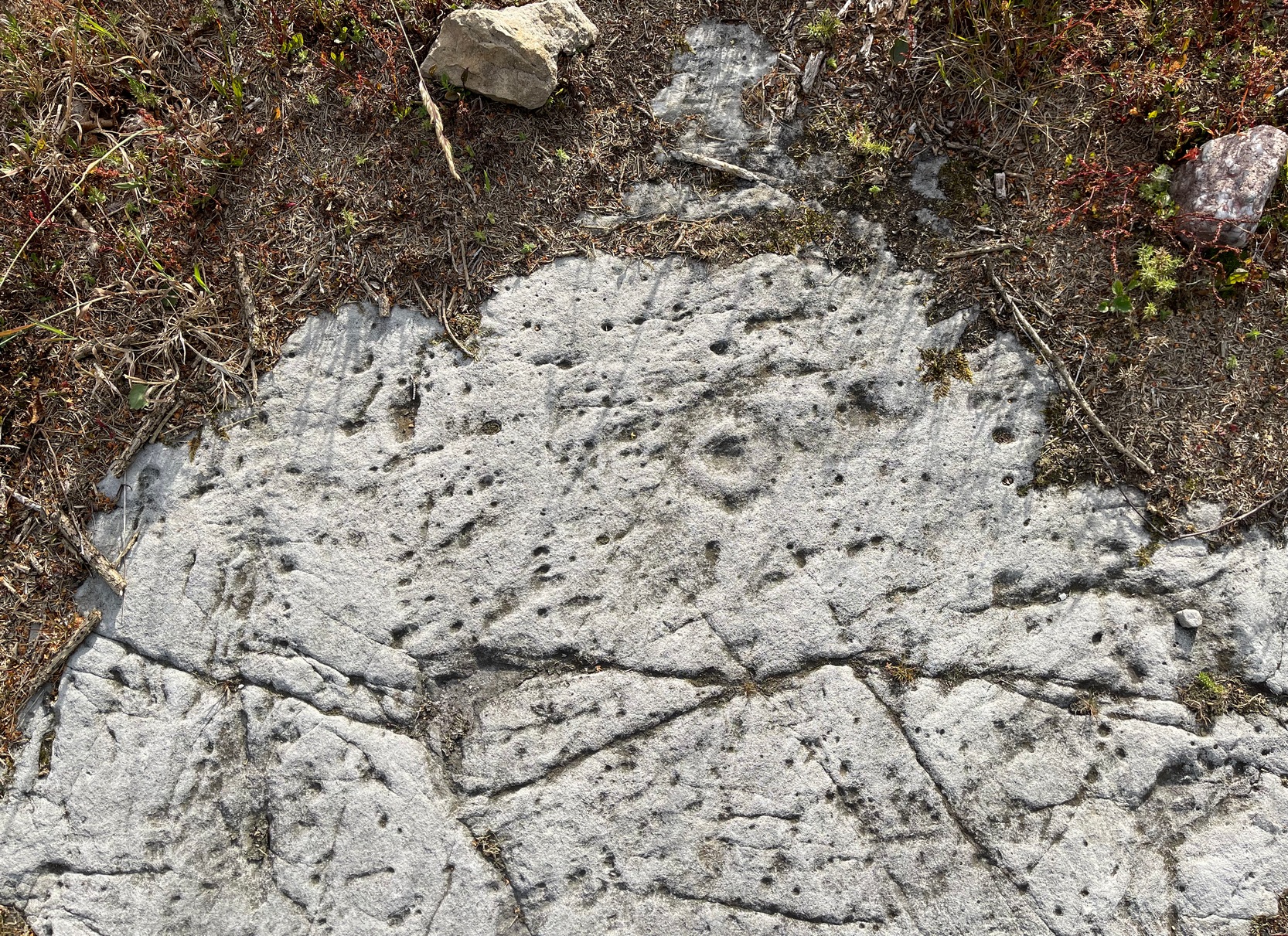
Once this rock surface is covered again by Nature’s carpet, you’ll struggle to find it. Unlike many of its more ornate neighbours, this seems to be a lonely solitary cup-and-ring design, cut near the edge of a large level piece of otherwise blank rock. Numerous geological nicks and scratches scatter the same surface, but the carved element is easy enough to see, as the photos here show. It was rediscovered in the 1980s by Morris & van Hoek (1986) who described it simply as “a single cup and one ring, 8cm in diameter on horizontal rock.” There may well be additional elements to this design beneath the soil.
References:
- Morris, Ronald W.B. & van Hoek, Maarten, “Stirling District: Castleton 4d; Castleton 5e,” in Discovery & Excavation, Scotland, 1986.
Acknowledgments: Massive thanks to Thomas Cleland for helping to make this site visible again.
© Paul Bennett, The Northern Antiquarian