Sacred Well (lost): OS Grid Reference – SJ 68 87?
Archaeology & History
We are unsure of the precise location of this site, described in some detail by the early Victorian naturalist Leo Grindon (1882) during one his many botanical rambles in and around Manchester nearly 150 years ago. He described it to be along a little valley known as Ridding’s Brook, located near “the water at Lymm” which he described as,
“a vast reservoir, brought into existence by the construction of the viaduct at the foot. The site now occupied by the water was originally a little vale, down which flowed a streamlet called the Dane. Becoming very narrow where the roadway now is, to throw a barricade across was easy. The construction of this gave distinctiveness also to the “dell,” the pretty hollow, full of trees, into which, when the water is high, the overplus, creeping under the road by a concealed channel, springs so cheerily.”
This is undoubtedly the Lymm Dam as it’s known today. From here, he told, “visitors should continue along the hillside, opposite the church, and as far as the grove of trees” and then “cross by the rustic bridge, and, turning to the left, ascend the little valley called Ridding’s Brook.” It is here where a magickal well whose waters turned plants into stone could be found. Grindon said of it:
“The special interest of the valley lies, after all, in its curious dropping and petrifying spring. At the further extremity, upon the right, the steep clay bank, instead of receding, is hollowed underneath for the length of a hundred yards or so, the upper edge projecting to a considerable distance beyond the base, so as to overhang the stream, and form a sloping roof to it. The surface is completely covered with luxuriant moss, and from the land overhead comes an incessant filter of water, which at once nourishing the moss and entangled in it, causes it to hang down in long vegetable ringlets. At a distance they seem soft, but examination shows that every drop has brought along with it a particle of earth, which being deposited in the very substance of the moss, is gradually converting it into stone. Every cluster, externally so green and living, is in its heart a petrifaction.”
Waters that turn objects into stone were obviously seen as possessing a somewhat supernatural propensity in many cultures—and although I can find nothing in the local records of the myths or medicinal properties of this site (early animistic folklore records were sadly neglected by the many Industrial historians in Lancashire, meaning we lost masses of valuable village traditions), there’s little doubt it would have possessed a mythic history of its own in the local area.
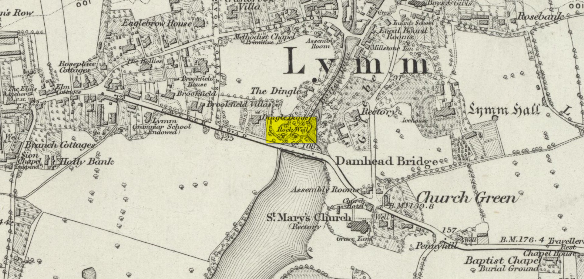
It’s possible that a Well shown on the 19th century Ordnance Survey maps as a ‘Rock Well’ could be the petrifying waters in question, but until site gains the attention of a diligent local student of occult history, we’ll not know for sure… Does anyone know if it still exists…?
References:
- Grindon, L.H., Country Rambles and Manchester Walks and Wild Flowers, Palmer & Howe: Manchester 1882.
Acknowledgements: Huge thanks for use of the Ordnance Survey map in this site profile, reproduced with the kind permission of the National Library of Scotland.
© Paul Bennett, The Northern Antiquarian