Lister Well, White Moor, Barnoldswick

Healing Well:  OS Grid Reference – SD 8695 4412

Getting Here

Lister Well on 1853 map

You’re a bit spoilt for choice in terms of how your reach this spot, high upon White Moor – which is south of Barnoldswick, west of Salterforth, northwest of Foulridge, north of Barrowford, or northeast of Blacko.  Whichever route you end up taking, you’re going uphill onto the heights near Weets Hill – and find the old trackway which bisects White Moor and has the rather tell-tale name of Lister Well Road!  It’s roughly halfway along the route, right by the trackside.

Archaeology & History

Lister Well, White Moor

History and folklore here have long been silent (though I aint checked the Annals of Barrowford, which may prove useful).  A local land-owner told us that the original trough had been uprooted a few decades back when the gas- or electricity-board (he can’t remember which) did some work hereabouts and uprooted the stone trough into which the waters ran and, for sometime, caused the complete destruction of the supply.  But its waters eventually re-emerged from the Earth, trickling into the grassy drainage line on the southern-edge of the track before going under the wall and down the moorland slope.

If you like a good walkabout with good views to behold, get y’self up here and have an amble.  Tis a damn fine place, with a lot of forgotten history embedded in the landscape.

© Paul Bennett, The Northern Antiquarian

Standing Stone, Foulridge, Lancashire

Standing Stone:  OS grid reference – SD 8803 4316

Also Known as:

  1. Lark Hill Stone
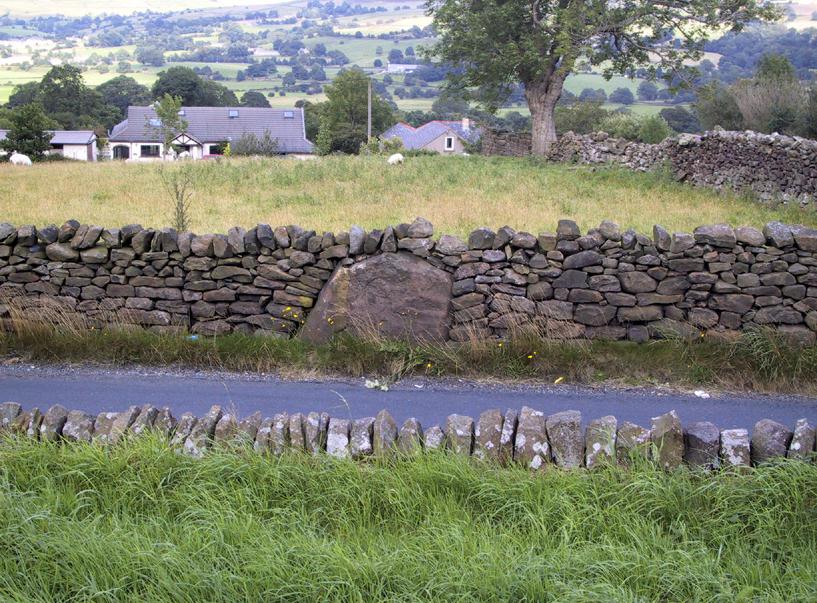
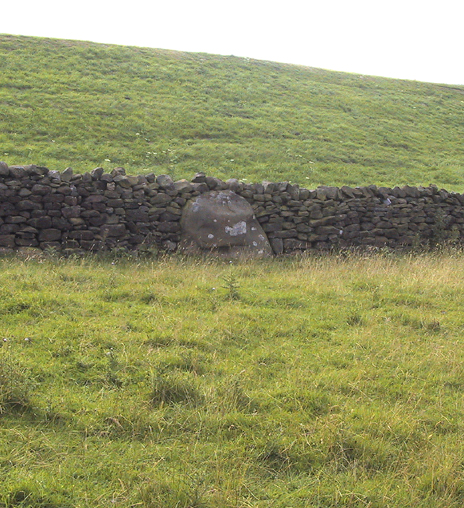
Possible Standing Stone in walling close to Standing Stone Road crossroads
‘Standing Stone Road’ monolith

Getting Here

From Foulridge go west up the long windy road (B6251) till you hit the old crossroads near the top.  Turn right and go on till you hit the modernised farmhouse on your right, where you’ll notice a modern upright stone in the entrance.  You need to go back about 70 yards and you’ll see this old stone in the wall.

Archaeology & History

"Standing Stone Road' stone!
“Standing Stone Road’ stone!

Less than a mile northwest of Foulridge along the southern stretch of the Whitemoor Reservoir, on the northern outskirts of Colne, we find the intriguingly-named ‘Standing Stone Lane’ — which seems to indicate that at some time in the not-too-distant past, an old monolith could be found hereabouts.  The old maps show the boundary line turning at right angles just near the crossroads, which is where I thought we might locate some remains of an old standing stone.  But it wasn’t to be.  Instead, we need to travel about 100 yards west along the single-track road, just below the reservoir — and there, in the walling, plain for all to see, is what may be the old standing stone which gave the road its name.  I found this site in early July 2008, and although we can’t be 100% certain, it’s not too bad a good contender as the monolith which first gave the road its name.  Does anyone know anymore about it?

More probably though (and this is what ‘feels’ right): the original stone which gave the road its name was much bigger than this little thing, but was probably destroyed when the reservoir here was constructed.  How much d’ y’ wanna bet!?

© Paul Bennett, The Northern Antiquarian