Legendary Rocks (destroyed): OS Grid Reference – SE 0886 4479
Archaeology & History
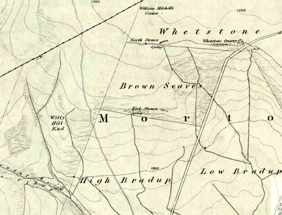
Kirk Stones on 1851 map
A place-name that is still recognised on modern Ordnance Survey maps, even though the original site giving rise to it was all but destroyed some one hundred-and-fifty years ago. Derived from the old word kirk, meaning a church or sacred site, no christian remains of any kind have ever existed here and so we must presume an earlier, more heathen site of sanctity (an abundance of prehistoric petroglyphs exist very close by). The singular reference detailing the nature of these Kirk Stones is in J.A. Busfield’s (1875) rare tract on the history of Upwood, in the parish of Bingley. Upwood Hall was built by the Busfield family and, as the author tells,
“one of the most striking features in the vicinity at this age [c.1800, PB] was the fine range of magnificent rocks called Kirkstones, which had existed for countless ages. These grand rocks, towering one above another, extended along the whole southern boundary of the [Whetstone] Allotment on the left of the road to Ilkley, and were really a fine object, but alas!, through the ignorance or stupidity of the agent Colonel Bence, the “Crags of Kirkstone” were broken up and disposed of in the construction of the Bradford Water Works about the year 1854.”
Sadly we have neither illustrations nor other references to these fine sounding sentinels.
Undoubtedly the Kirkstones were a natural feature, despite their venerated title. It would have been their very appearance that gave rise to their revered title, as in the great and contorted rock masses seen at Brimham Rocks which, from Bensons’s description, these Kirk Stones seem reminiscent. The only piece of extant lore to these stones is that the uprights that went into making the recently destroyed Bradup stone circle a short distance south of here, came from this sacred outcrop. It seems reasonable to assume that they played an important role in the magickal history of these hills when they were scattered with forest.
The Kirk Stones aligned along the equinox axis to the Black Knoll standing stone less than a mile [1.4km] due east.
References:
- Bennett, Paul, The Old Stones of Elmet, Capall Bann: Milverton 2001.
- Busfield, Johnson Atkinson, Fragments Relating to a History of Bingley Parish, Bradford 1875.
- Smith, A.H., English Place-Name Elements – Part 2, Cambridge University Press 1956.
© Paul Bennett, The Northern Antiquarian