Along the A85 road between Comrie and St Fillans, just over a mile out of Comrie, on the right-hand side (north) of the road is the small farm-track into the fields where the ruined stone circle of Tullybannocher lives. Walk up this track (known as Maam Road), past the stones, and keep going uphill for more than a mile (literally 1 mile up, another track turns sheer right, but ignore it) where the track eventually levels-out; keep walking for another 600 yards, slightly downhill, until you reach a distinct fork in the track where you need to veer right, uphill, and keep walking up the track for ⅔-mile (1km) where you’ll see a cottage ahead of you. About 50 yards before the house, down the slope on your left, a large rounded mass covered in bracken is the site you’re after.
Archaeology & History
This is an odd site, in more ways than one. In the 18th and 19th century, local people told that it was “a very ancient churchyard, so old, indeed, that the grave-stones among the rank grass are scarcely discernible.” (Carment 1882) This lore was reinforced by the fact that, as James Gow (1888) put it,
“within living memory that a burial took place here, and the tradition is that people came to bury the “wee unchristened bairns” from long distances, such as Loch Tayside, Glendochart, Balquhidder, and Strathyre.”
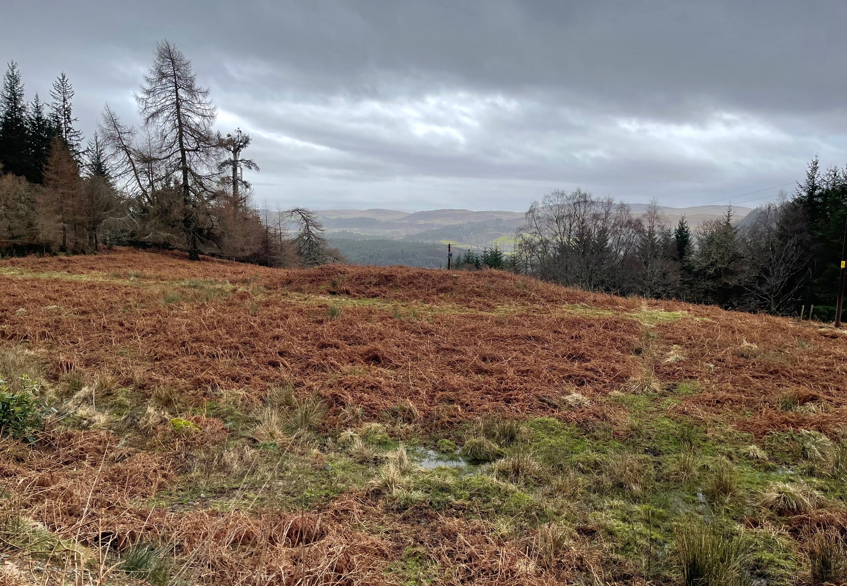
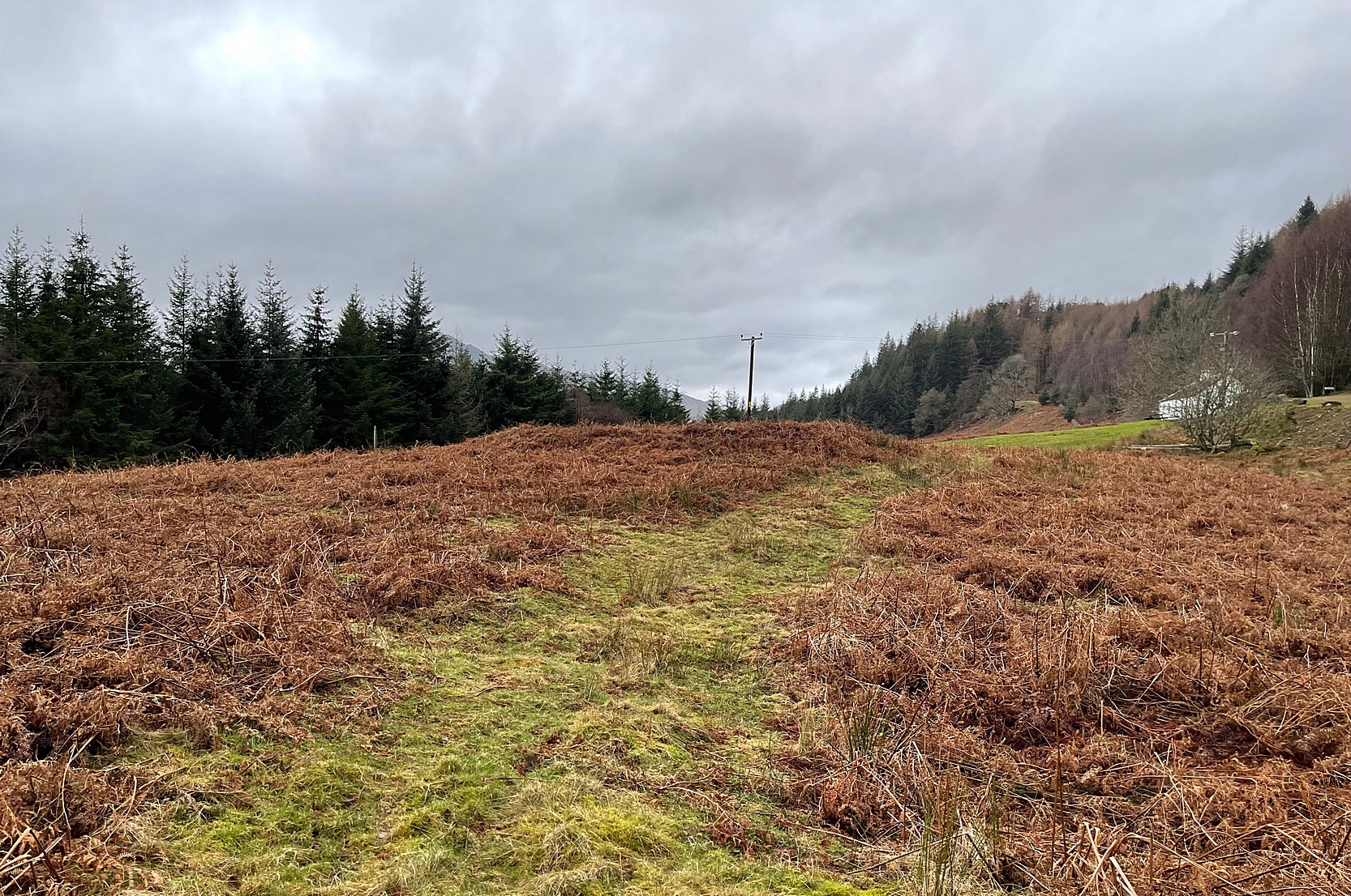
Looking W, at the circleThe old mound, looking SE
That’s a lot of effort and a considerable distance for some people to travel! But the age and nature of this site is curious. It very name, Drum-na-kill derives from either “ridge of the burial ground” or “hill of the chapel” (and variants thereof)—yet there are no records of any such early church or religious cell. That doesn’t mean, of course, that there never was one. A wandering Culdee priest may have set up camp here more than a thousand years ago after doing his service with the fading druids of Dull, less than 20 miles to the north. Such things, never written down, will obviously have happened in these mountains and cannot be discounted merely due to a lack of scripts. But we simply don’t know. When Mr Gow described the place—as “a raised enclosure 25 to 30 feet in diameter, with, a turf-covered wall or rampart 3 or 4 feet high surrounding it”—he emphasized that “in former times (it) was used as a burying ground for unbaptised infants.” (large numbers of Highlanders weren’t in the slightest bit interested in the ways of the Church) So how far back in time did this tradition go…?
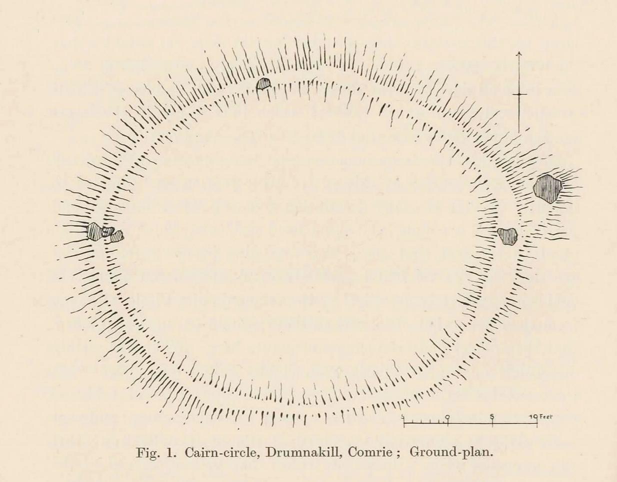
Well, Gow thought the place to be an early christian site. But when Fred Coles came here more than thirty years later, during his massive survey of the Perthshire stone circles, he deemed it to be a much earlier construction. A “cairn circle” no less—which would give it a more Bronze Age footprint. And this definition has stuck. Coles (1911) told that,
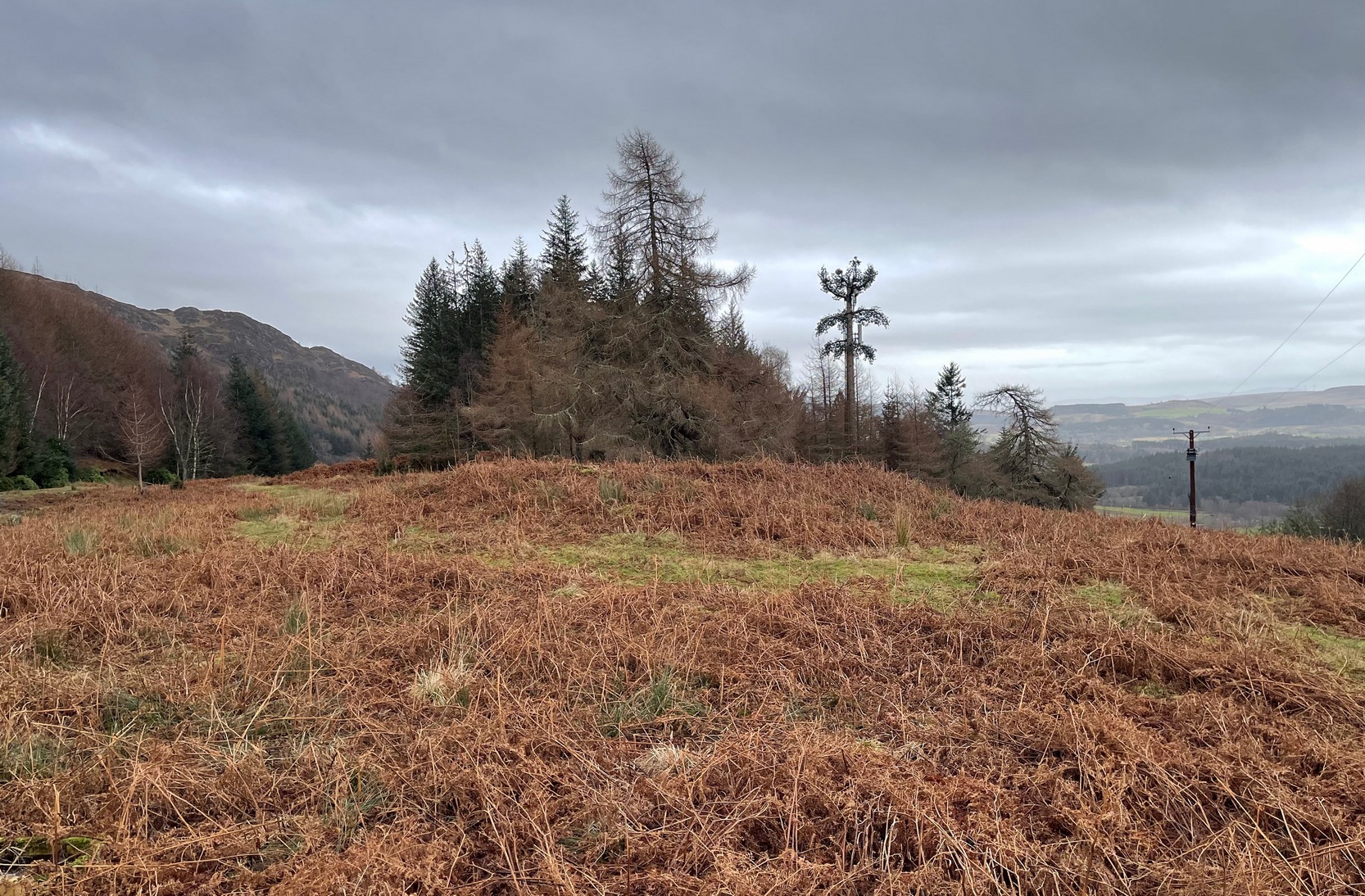
Coles’ 1911 diagramRaised ‘walling’ highlighted
“This Cairn-circle is about seventy yards east of the shepherd’s cottage, and it slightly resembles others already noticed in Perthshire. It measures from crest to crest of its circular ridge 44 feet 3 inches east and west by 37 feet 10 inches north and south. Several large blocks of stone lie exposed on the crest, and many others can be felt as one walks along it. The ridge is completely oval-circular, having no break or passage-way, and encloses a flattish, rather uneven space measuring about 34 feet in diameter. The height above the outside ground at the best-preserved portions is fully 4 feet.”
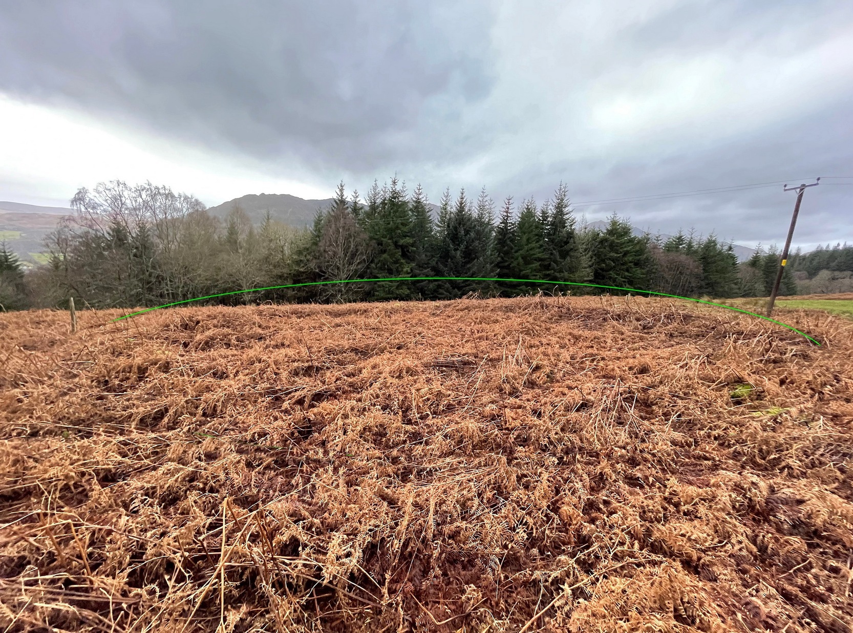
More than a century later, its not changed much—although if you were to believe the updated Trove website, “the cairn has been destroyed in the process of land improvement.” Which is untrue. As the albeit darkened photos here show (we visited it on a truly dark grey day), the raised cairn, despite being covered in a mass of deep bracken, is clearly in a condition similar to what Coles described. It looks like a typical example of this type of monument, of considerable size, with reasonably well-defined edges and comprising the usual scattered mass of stones in and around it. The large boulders that Coles described don’t seem to be in evidence, but these were apparently shifted a few decades back and added to the enclosure walling to the east. To honest, only the untrained eye would miss the place! Check it out when you’re looking at the cup-marked stone, less than a hundred yards to the east…
References:
Carment, Samuel, Scenes and Legends of Comrie, James P. Mathew: Dundee 1882.