Healing Well (destroyed): OS Grid-Reference – NT 2547 7337
Archaeology & History
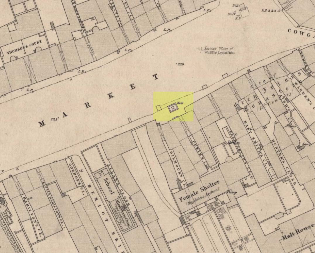
We have the historical detective work of Stuart Harris (1996) to thank for the location and probable meaning behind the name of this long-lost well, that could once be seen along Haymarket, near the heart of the old city. Shown on the 1852 OS map, without name, the site was recorded as a public well “from 1502 onwards,” he wrote — and its name was variably written as muse, muss, meus and mwse, which led him to surmise that it was from the old Scots word “meuse”, or the “well by the stables”; although I cannot find this validated in the established dialect dictionaries and glossaries of William Grant (1934-76) or Simon Taylor (2012). Their relative definitions tell it to be of a mouse, or a small trackway left by rabbits, hares or rodents, running between hedgeways. This would mean the ‘Muse Well’ was a variant around a “well by an animal track”, which in earlier centuries were very important to note, as wild animals were indicators of food (amongst other things).
This aside, “the King’s Stables, dating from the 1340s, were of course over 200 yards further west,” he wrote,
“but the convent of the Greyfriars, founded in 1471 in the Cowgatehead only about fifty yards east of the Muse Well, certainly gave lodging to travellers of the more distinguished sort, and although no early record of stables here has come to light, it may be no accident that the only stables recorded in the Valuation Roll of 1635 as being on the south side of Grassmarket were in McIntyre’s Close, which had its entry ten yards east of the Well.”
References:
- Grant, William (ed.), The Scottish National Dictionary – 10 volumes, SNDA: Edinburgh 1934-76.
- Harris, Stuart, The Place-Names of Edinburgh: Their Origins and History, Gordon Wright: Edinburgh 1996.
- Taylor, Simon & Gilbert, Markus, “Elements Glossary”, in The Place-Names of Fife – volume 5, Shaun Tyas: Donington 2012.
© Paul Bennett, The Northern Antiquarian