Legendary Stone: OS Grid Reference – SD 66972 66292
Also Known as:
- Big Stone
- Four Stones

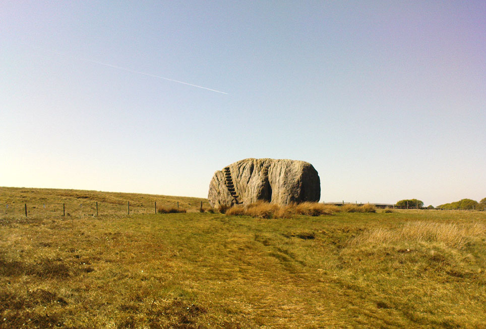
From near the middle of the large village (or small town!) of High Bentham, go down Station Road, over the river — where the road becomes known as Thickrash Brow! — and keep going for about a mile. The landscape opens up into the hills and there, on the left-hand side of the road, is a car-parking spot with a footpath taking you straight up to the large boulder a 100 yards on: that’s our Great Stone! You can’t really miss it.
Archaeology & History

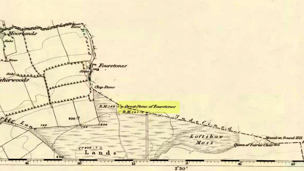
A meeting place of local tribes in more ancient days, the moorland plain upon which the Great Stone sits, beckons to a vast landscape on all quarters (north, south, east and west) calling the elders from their lands for annual rites and decisions to befit the health of the land and the people. The stone rests on the ancient boundary of Yorkshire and Lancashire, just on the Yorkshire side, and was visited annually in more later centuries during the beating of the bounds, to define the edges of the local township.

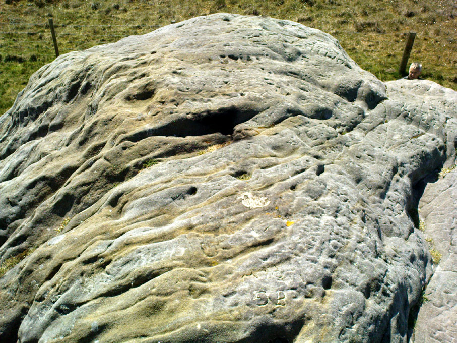
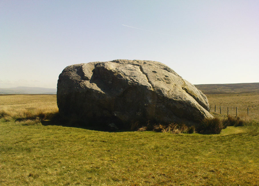
First described in a Yorkshire inquisition account from 1307, this Big Stone was visited by Harry Speight (1892) who described it as measuring 30 feet round and 12 feet high. I came here for the first time in the 1980s when I was hitch-hiking into the Scottish mountains, but a good old “local” (from the Yorkshire side) took a detour to show me the place! Once here, I climbed up the very worn “steps” which were carved into the side of the boulder several centuries back and it didn’t surprise me to find a number of cup-markings (no discernible rings) on its top surface. When I came here again with Michala Potts and Paul Hornby yesterday, I couldn’t believe how many people had carved their names on top of the Great Stone in the intervening years — it’s almost covered in modern graffiti and the old cup-markings were much harder to see. Taylor (1906) mentions them briefly in his holy wells survey, saying how,
“This great boulder is ascended on its eastern side by fourteen steps, and on the top are two circular holes about two inches deep and two inches in diameter.”
There used to be three others boulders very close to this one (hence its title), making a natural stone circle, but they were “broken up for sharpening scythes” a couple of hundred years back. A much wider archaeological survey of this region is long overdue.
Folklore

Harry Speight (1892) told how the (original) Four Stones were the creation of our old friend the Devil, long ago, who dropped them in one his many megalithic travels across our land. The stones were also the meeting place of ancient councils, from the tribes either side of the Yorkshire-Lancashire border. Their presence here also had mythic relationship with the Queen of the Fairies Chair, about a mile southeast, along the same boundary line.
Weird how folklore changes. Whilst old Mr Speight told how the devil created the once great four stones that were here, many years later Jessica Lofthouse (1976) told how the three missing stones – which had been here “since the world began” – were actually taken from here by Old Nick. Carrying them over the land,
“His load he dropped on Casterton Fell, where the rocks he discarded, the Devil’s Apronful, are still lying around. He selected the most suitable, dressed them and carried them in panniers down to the (River) Lune”
— and built the legendary Devil’s Bridge at Kirkby Lonsdale – which itself has strange tales to tell. Another creation myth about the Great Stone is told on the plaque near the stone, alongside the footpath, which tells:
“Legend has it that it is a small part of the debris hurled by the giant Finn McCool across the Irish Sea in a fit of anger.”
It’s very obvious that a lotta mythic landscape material has been neglected and overlooked around this site. Something we need to remedy, if we can, in the coming years…
References:
- Lofthouse, J., North Country Folklore, Hale: London 1976.
- Speight, Harry, The Craven and Northwest Yorkshire Highlands, Elliott Stock: London 1892.
- Taylor, Henry, The Ancient Crosses and Holy Wells of Lancashire, Sherratt & Hughes: Manchester 1906.
© Paul Bennett, The Northern Antiquarian
Nice info. Had a look for the Henry Taylor book. Quite valuable. Not on Project Gutenberg yet either.
I lived very close to “T’big stoan” up to 2000…I had Thornes Cottage just on the right before you cross the River Wenning. I often walked up there when I needed a bit of peace. Wondrful spot!
Zoom in using Bing’s aerial view and you will see, close to the big stone, a big enough boggy hole in the ground to the North, and one at 1 o’clock, and another at 2 o’clock. I’ll dare to suggest that they might indicate where the missing three stones once stood.
Interesting too is the track immediately on the west side of the Great Stone. To the south it becomes one track which seems to continue on across Aikengill Road, then swing west to join that same road c. 200m away, and to swing east then south to continue generally towards the farm known as Sea View on Ringstones Lane (and there’s a name to ponder on!). North of the Great Stone the “dual carriageway” of tracks spreads like fingers through the boggy ground, but the walker here will find that generally the path curves towards Fourstones Barn and continues north-ish from there. It seems quite possible that the track(s) described in this paragraph were the forerunners of the modern Slaidburn Road.