Sacred Well: OS Grid Reference – SD 81755 35151
Archaeology & History
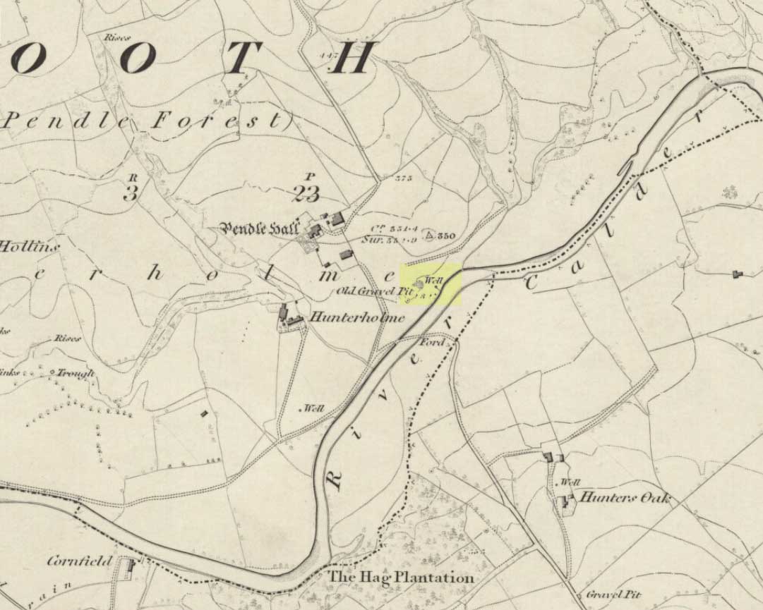
On the north-side of the River Calder, a short distance above the riverbank below Pendle Hall—as shown on the earliest OS-map of the area, but without a name—the local history writer, Joe Bates (1926), told us about this “spring of icy cold water”, which, in bygone years, “used to be called Robin Hood’s Well.” (Having moved out of the area, I’m not able to say whether this site is still visible. Can any local folk illuminate us on the matter?)
Folklore
Like many other sacred and healing wells across Britain, Bates (1926) said that the waters from Robin Hood’s Well,
“was at one time considered a specific for certain ailments of the eyes.”
References:
- Bates, Joe, Rambles twixt Pendle and Holme, Nelson 1926.
© Paul Bennett, The Northern Antiquarian
I live reasonably close to this site in Padiham, and I seem to remember that round about the map reference for the well is a tiny, squat brick building which from the “ting, ting, ting…” sounds emanating from it I assume to contain a ram pump. A small but steady stream of water also exits this building towards the river.
I will go back to this site at some point (tonight, weather permitting) and check the exact grid reference for it. Certainly I think I remember a couple of springs in that area, and the Coal Authority maps indicate it hasn’t been open-cast mined in the past, which disrupts surface ground water.
I therefore think the spring still exists, and is actively being used as a water supply, whether that be as a supply for Pendle Hall to the north-west or merely for the local farmer’s sheep.
You good man Dan! Let us know what you find. 😉
OK then, I have just returned from visiting this well. Just a little ways down from the coordinates given there is a large (80cm by 120 cm approx) metal lid surrounded by low fencing which contains something that is going “ding… ding… ding…”; this is certainly a hydraulic ram pump. There is also the unmistakeable sound of running water, audible over and above the sound of the river nearby; this spring is definitely still there, and flowing quite strongly.
A few metres down slope from the metal lid is a small, square, brick construction which I think is or was another ram pump, which I did not investigate, not wishing to get my feet wet. It was at this point also that I discovered that my hand torch had given up the ghost, although my phone, GPS and all bike lights were perfectly OK, so nothing supernatural there.
My GPS coordinates for the point just up-slope of the upper hydraulic ram pump are: N53.81239 W002.27858
Plotted on Google Earth, these show exactly the right spot.
According to the Coal Authority maps, no open cast mining has taken place at the well site, although it most certainly has closer in to Padiham. There was certainly a lot of older mining in this general area as the open cast mine yielded far less than expected since much older pillar and stall workings had stolen much of the expected shallow coal. Gravel working has taken place near the well, so I rather think that any well structure will have long gone.
If you wish to visit, then the well is right on a footpath and the road from Padiham to it is both a bridle path and a designated cycleway. You have, in other words, every right to be there but if you visit at night as I did, being as well illuminated as a Christmas tree and wearing hi-vis clothing helps immensely.