Cairn: OS Grid Reference – NS 68789 91880
Also Known as:
- Caerlatheran
- Canmore ID 45381
The quickest way here is still a long one. From Gargunnock village, take the road west towards the A811, turning left just before the bend down to the main road, and up through what looks like private estate gates. Walk all the way along this road as if you’re visiting the Leckie broch and its carvings, but keep going, until it becomes a track. Continue into the woods, uphill and out the other side until you have the Gargunnock cliffs rising a few hundred yards ahead of you. On your right a few yards up is a long straight length of walling running to the first set of cliffs. Go up it and up the next rise and the next. When you’re on top of the moors, look for the highest spot close by. You can’t miss it!
Archaeology & History
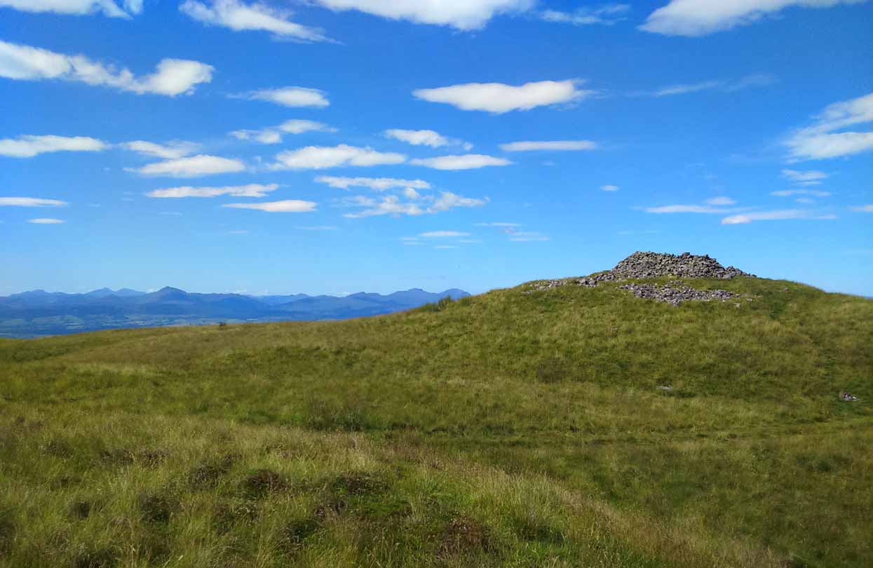
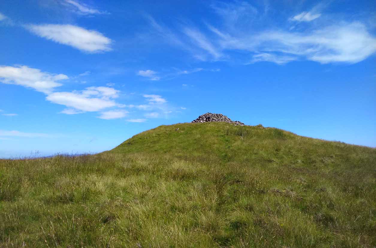
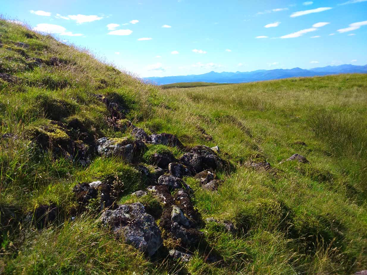
Nearly 1600 feet above sea level, this seemingly isolated giant cairn sits on the highest point of the Gargunnock Hills, giving a truly fantastic 360º view, looking across a diameter of perhaps 100 miles on a clear day—which is what I was greeted with when I visited. Giant cairns scatter hilltops all across the British Isles, many of them peopled with creation myths of giants, devils and thoroughly animistic creatures! But I can find no such tales here… Equal lackings are in the archaeological texts which, it seems, only catalogued the site in recent years.

The name of the site is intriguing. The element caer is a fort, but no such ‘fort’ seems to be here. But we’ll come back to that shortly. The element latheron and its variants apparently relates to a mire or swamp (Watson 1926), whose existence to the immediate south and west is considerable (a small loch was once hereby, but its size has decreased over the last 150 years), and it is very boggy across the tops here. When I visited, it was a scorching day (I was fucked by the time I got here!), but in many places the ground was very dangerous to walk over. It was superb! So it seems that the place-name indicates Caerlatheron was ‘the fort by the swamp’. It works perfectly, except that this is listed as a cairn – and it’s a large one at that!
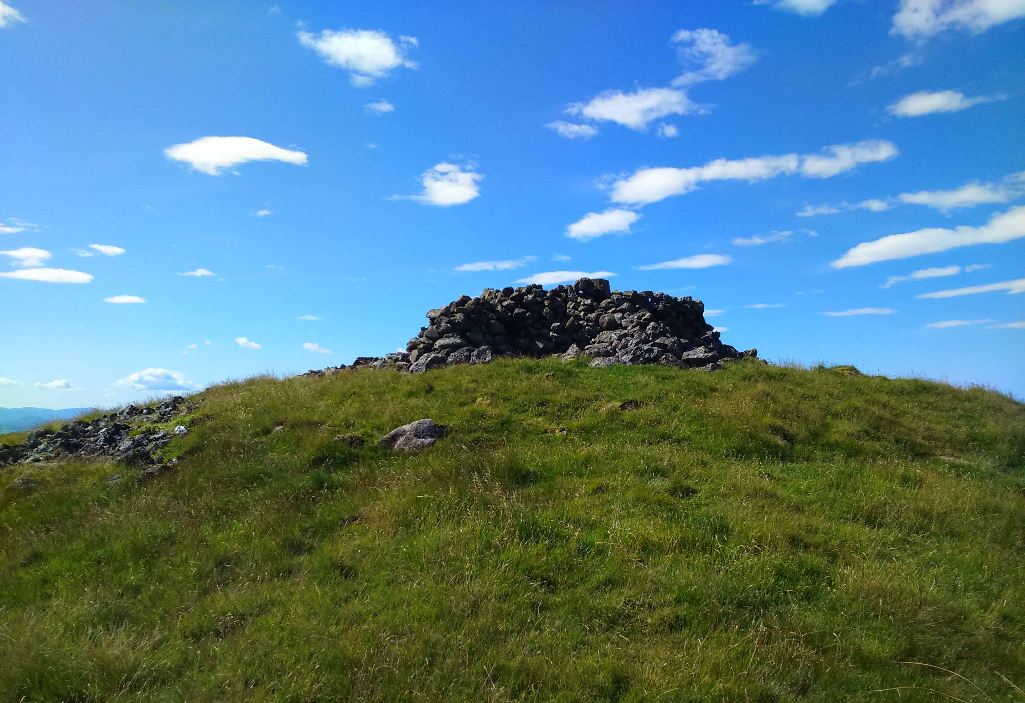
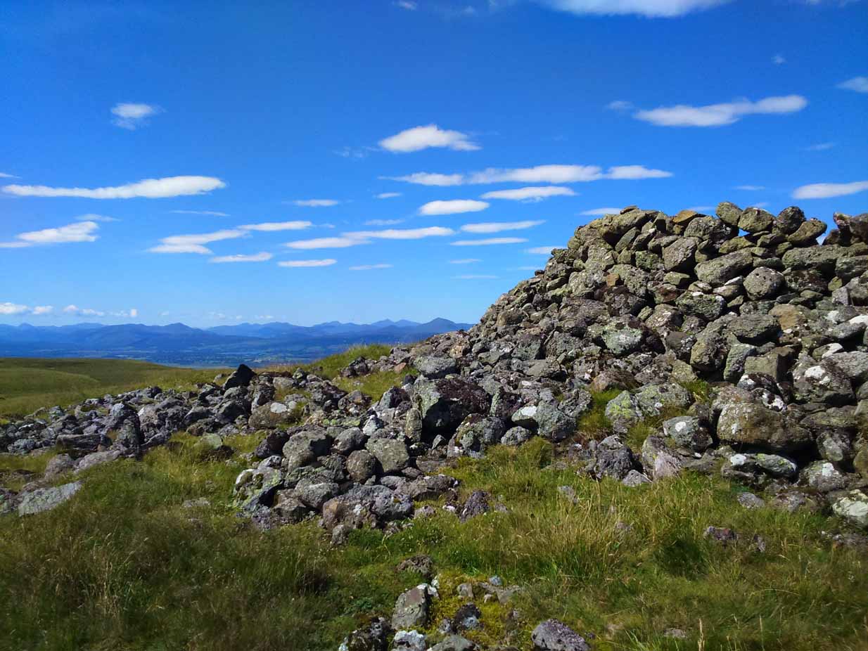
The cairn sites on top of a large mound. This mound seems to be artificial and is between 10-12 feet high. The cairn and mass of rocks on top of the mound (within which is a triangulation pillar) is itself 4-5 feet high—although much of this relates to Ordnance Survey and walkers piling up many of the loose stones to create an enclosure or wind-break to protect any traveller up here in stormy weather. The cairn-pile is 20 yards across at the top, and as you walk around it you become aware that this appears to be slightly raised on top of its parent mound with an evident ’embankment’, particularly on the eastern side. As you follow this round, you lose sight of it completely on the southern edges, which is covered by the extended cairn-mass; but some of it seems in evidence on the northwest and northern side. A number of stones marking this out would seeeem to be in evidence. A few larger flat stones on the south and western top of the cairn might suggest that it was once a chambered cairn – but this is highly speculative. The late great Audrey Henshall never got here; and I don’t know whether the great local archaeologist, Miss Christian MacLagan, ever got her fingers here either, so we don’t have their expertise to help us out.
The mound upon which the ‘cairn’ sits is also intriguing. When walking round and around the bottom of it, you note the unmistakable substantial mass of overgrown rocks, particularly around from the northwest, to north, to northeast, both on the slopes and at the bottom, seeming to imply that the entire mound is artificial. I kept walking up and down and around it, to see if these had simply fallen from the top, but wasn’t 100% sure and wished there was a geologist at hand to tell me, one way or the other. In truth, the shape of the mound from the bottom, from most angles, reminded me of an overgrown broch and not a cairn. And there are a few brochs nearby—the closest of which is just at the bottom of the hill from here: the Leckie broch (I aint done the site profile for it yet, soz….). It was only when I got home and looked for the meaning of Caerlatheron that the ‘broch’ idea came back to me with a little more fortitude, perhaps making sense of it as a ‘fortified structure by the bogs and swamps’. Perhaps… Without an excavation, we may never know for sure.

About 350 yards northwest, across truly dodgy swampy ground (walk up here at night and it’ll probably be the last thing you ever do!) is another small singular cairn, made up of quite large rocks, with a few smaller ones filling it up. It looks to be either a shepherd’s cairn, or one for his sheepdog perhaps, a few centuries old. I can find nothing about it in any local history or record-books.
The place is well worth visiting—but it’s a full day out and you’ll be knackered when you get back. However, from here Nature grants us a stunning view of these tiny parts of Her body. It’s well worth the effort!
References:
- Watson, W.J., Celtic Placenames of Scotland, William Blackwood 1926.
© Paul Bennett, The Northern Antiquarian