Stone Circle (destroyed): OS Grid Reference – NO 18873 08865

Also known as:
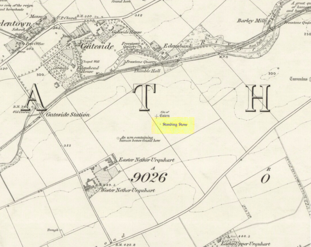
Turn off the A91 road at Gateside and go down Station Road, crossing the old railway line at the bottom. From here, cross the fields to your left and the site of the circle will be found in the field to the north east of Easter Nether Urquhart Farm.
Archaeology & History

Marked on the 1856 6″ Ordnance Survey map as a “standing stone,” earlier references record this as being the survivor of a stone circle. Not listed in Aubrey Burl’s (2000) magnum opus, this circle was on the edge of the site of a major battle between the Romans and the native defenders, and large amounts of human remains have been found in the vicinity. Referring to an adjacent cairn, Lieutenant-Colonel Miller wrote in 1829:
“A very fine Druid’s Temple stood on the south side of it, consisting of seven very large stones. All these were blasted with powder and removed, except half the one of them, which still marks the spot.”
Of the same cairn, the Reverend Andrew Small wrote in 1823:
“This cairn stood a little north of an ancient Druids’ temple, only one stone now remaining, out of ten of which it formerly consisted.”
The Ordnance Survey Name Book for 1853-55 imparts the following:
“This standing Stone is about 13 chains on the South side of the River Eden opposite Edensbank but whether it is the remains of a druid’s temple or set up to mark something relative to the battle contested between the Romans and Caledonians according to Messrs. Miller & Small, it is difficult to determine. It stands about 4 feet 10 inches high and its sides are about 2 feet broad…many of the inhabitants consider it to have been a druid’s temple…”

J.S.Baird of Nether Urquhart informed an Ordnance Survey officer in 1956 that the remaining stone was broken up and removed around 1952, and measured 5 feet high with a girth of 9 feet at the base. Near the top of the stone, on the south-side were two slight cracks weathered to suggest a simple incised cross.
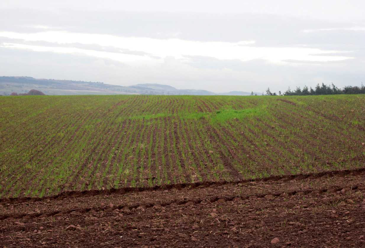
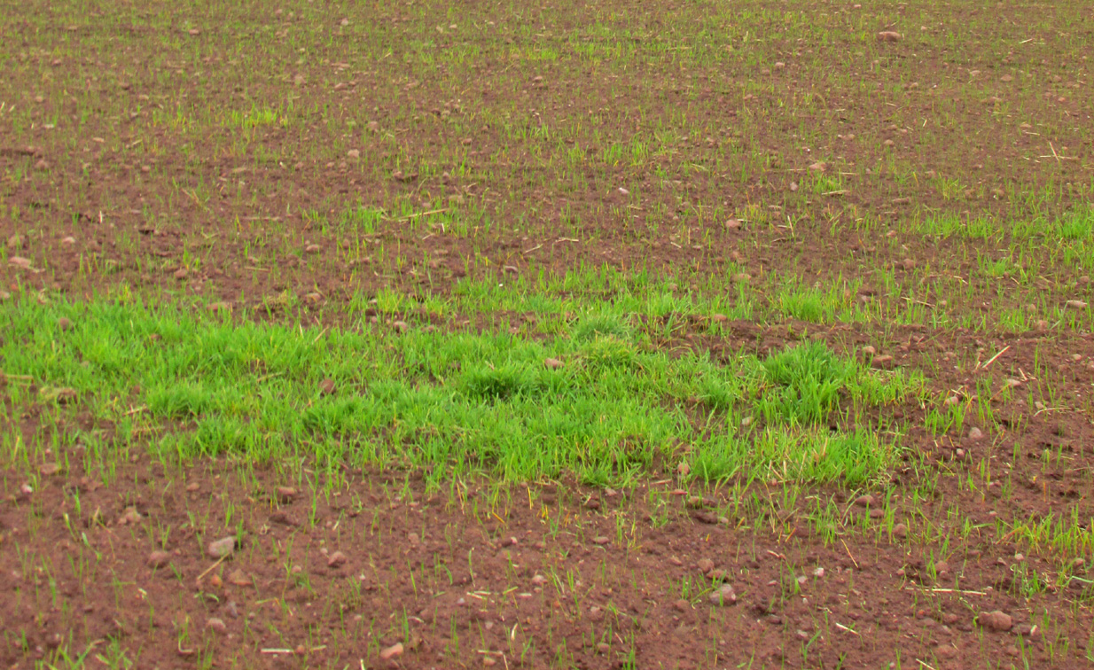
On the day of my November field-visit the winter barley was sprouting and it was interesting to see how much better it was growing at the place where the remaining stone had stood.
A standing stone at Wester Nether Urquhart, rediscovered by Maggie Overett in July 2020, can be seen a half-mile southwest.
References:
- Burl, Aubrey, The Stone Circles of Britain, Ireland and Brittany, Yale University Press 2000.
- Miller, Lieutenant-Colonel, “An Inquiry respecting the site of the battle of Mons Grampius (Read 27th April 1829 and 25th January 1830),” in Proceedings of the Society of Antiquaries of Scotland, Volume IV, 1857.
- Small, Reverend Andrew, Interesting Roman Antiquities Recently Discovered in Fife Ascertaining the site of the Great Battle fought betwixt Agricola and Galgacus, John Anderson & Co: Edinburgh 1823.
© Paul T. Hornby 2016 – The Northern Antiquarian