Cross (destroyed): OS Grid Reference – SK 2612 9417
Also Known as:
- Hanson Cross
Archaeology & History
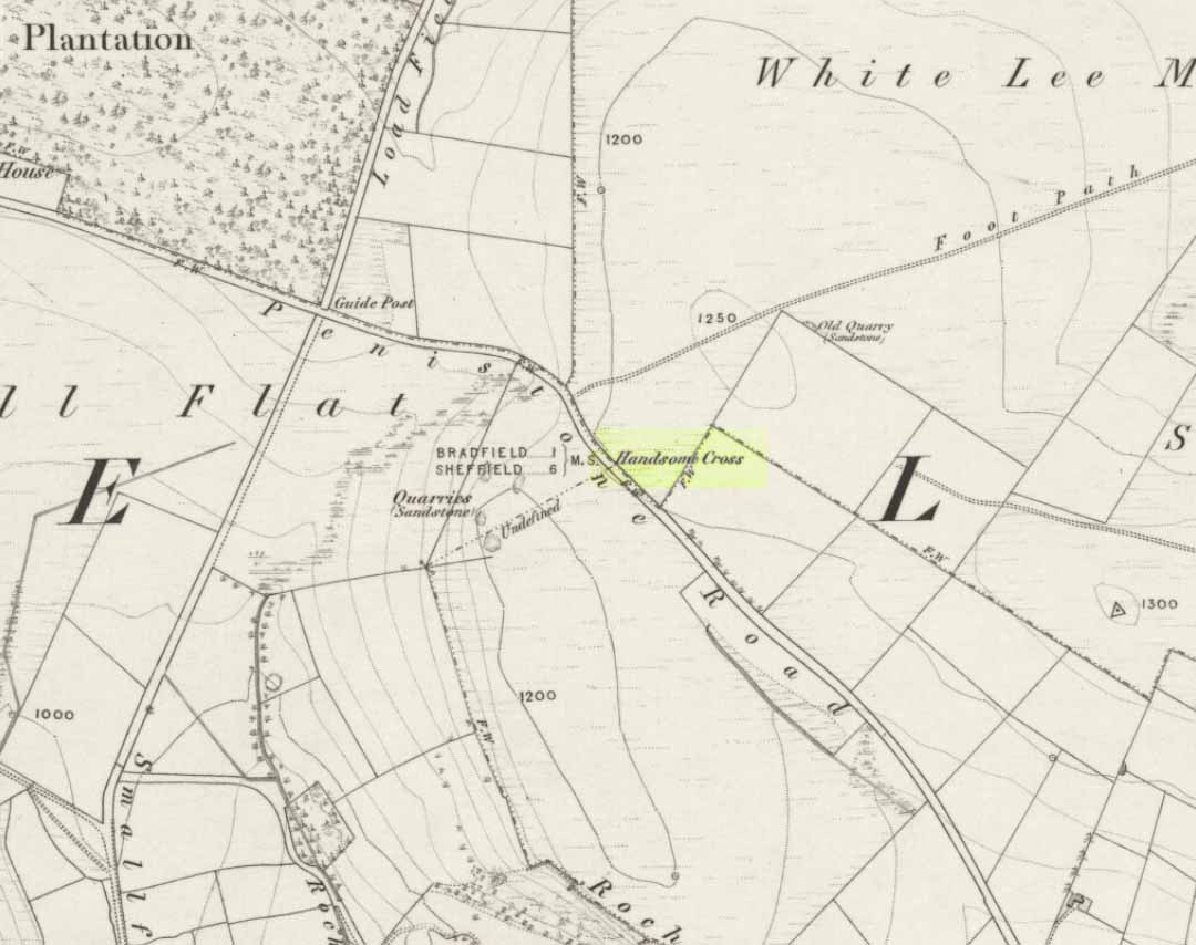
Described in Joseph Hunter’s (1819) rare work as being close to a now-lost stone circle, this wayside cross is shown on the earliest Ordnance Survey map of 1855 as being at the side of the old Penistone road, across from the guide-stoop which can still be seen. The cross stood at a peak on the roadside which allowed it to be visible from either direction and probably stood on the ancient township boundary line.
In Neville Sharpe’s (2002) fine survey he found an early account of this lost relic from writings ascribed to one John Wilson, who lived between 1719 and 1783, which told that,
“Ann Hawley, an old woman who lived at Broomhead in 1700, says she remembers Hanson Cross having a head and arms. The head is still there, but the arms I do not remember.”
References:
- Hunter, Joseph, Hallamshire: The History and Topography of the Parish of Sheffield, Lackington: London 1819.
- Sharpe, Neville T., Crosses of the Peak District, Landmark: Ashbourne 2002.
- Smith, A.H., The Place-Names of the West Riding of Yorkshire – volume 1, Cambridge University Press 1961.
© Paul Bennett, The Northern Antiquarian